

1. The Blue Dot That Knows Where You Are
It was a rainy evening in a city I did not know, and my phone was the only thing standing between me and a missed train. I typed the station name, and a small blue dot appeared on the map, pulsing gently on the exact street corner where I stood. I turned left, the dot turned with me. I walked the wrong way for ten seconds, and the dot told me so before I had even reached the end of the block. That moment felt ordinary, and that is exactly what makes it extraordinary. A machine in my pocket had just asked clocks in space what time it was, measured signals travelling at the speed of light, and worked out my position on a planet 12,742 kilometres across — all in less than a second, without me noticing any of it.
Understanding how GPS works means understanding that the blue dot is not magic and it is not a single invention. It is a chain of ideas, each one solving a problem the previous idea created. A satellite must know where it is. A clock must tick at exactly the right rate. A receiver must turn tiny delays in radio signals into a distance, and then turn distances into a place. And Einstein, of all people, had to be right about time itself, or the whole system would drift off by kilometres every day.
GPS stands for the Global Positioning System. It is a satellite navigation system built by the United States, and it gives any receiver on or near Earth its position, its velocity, and the time — day or night, in any weather, anywhere on the planet. The system is free to use. It runs on a constellation of satellites, a network of ground stations, and the receivers in our phones, cars, planes, and tractors. When people ask how GPS works, they usually expect a short answer about satellites in space. The real answer is longer and far more interesting, because GPS is really a timing system that happens to tell you where you are.
I first started paying close attention to GPS not as a traveller but as someone who kept getting lost in the same forest on weekend walks. Paper maps had taught me to read contours and compass bearings, and I was proud of that skill. Then one afternoon, deep under tree cover, my phone placed me on a trail I knew was a hundred metres away, and I felt a flash of irritation at the machine. That irritation turned into curiosity. Why was it wrong there and right everywhere else? The answer took me from atomic physics to Einstein to the ionosphere, and it changed how I think about every blue dot I have seen since.
In this article, we will follow the signal from space to your pocket, step by step, so that by the end you will understand how GPS works from the satellite down to the screen. We will meet the three segments that make GPS possible, learn why distance is really a question about time, see how three spheres and a fourth satellite pin down a position, and find out why the clocks in orbit have to be deliberately set wrong before launch. We will look at what limits accuracy, why your phone sometimes places you on the wrong side of the road, and how GPS compares with its sister systems — Galileo, GLONASS, and BeiDou. By the end, that blue dot will look less like a trick and more like one of the most elegant pieces of engineering humans have ever built.
2. What GPS Actually Is
2.1 A positioning, navigation, and timing service
The official description from the United States government is refreshingly plain: GPS is a U.S.-owned utility that provides users with positioning, navigation, and timing services, and it consists of three segments — the space segment, the control segment, and the user segment. That sentence, from GPS.gov, the official U.S. government site for GPS, is the skeleton of everything that follows. Positioning tells you where you are. Navigation tells you how to get somewhere else. Timing tells you what time it is, with a precision that banks, power grids, and mobile phone networks depend on every second.
Most of us only notice the first two. The third is quietly the most important. When your phone asks a satellite for the time, it gets an answer accurate to billionths of a second. That precision is the whole trick. GPS does not measure your position directly. It measures how long radio signals took to reach you, and it turns those travel times into distances. Distance divided by the speed of light is time, and time, measured well enough, becomes place.
2.2 A short history: from Sputnik's beep to a global utility
The story starts with a beep. In October 1957, the Soviet satellite Sputnik 1 circled Earth broadcasting a simple radio pulse, and scientists at Johns Hopkins University noticed something useful: as the satellite passed overhead, the frequency of its signal shifted, rising as it approached and falling as it receded. That Doppler shift let them work out the satellite's orbit from the ground. Then someone asked the question in reverse. If you know where the satellite is, and you can measure that shift, can you work out where you are? The answer was yes, and the U.S. Navy's Transit system, the first satellite navigation system, was born from that insight in the 1960s. Transit worked, but slowly — a fix could take many minutes, and a submarine had to wait for a satellite to pass overhead.
The modern system came later, and it came from the military. In the 1970s, the U.S. Department of Defense began building NAVSTAR GPS, a system designed to give a position fix anywhere, at any time, in seconds rather than minutes. The first test satellite launched in 1978. The constellation reached full operational capability in the mid-1990s, with 24 satellites in orbit. For years, civilian signals were deliberately degraded by a policy called Selective Availability, which limited ordinary users to roughly 100 metres of accuracy. On 1 May 2000, that degradation was switched off, and civilian accuracy improved tenfold overnight. I remember the change the way sailors remember a lighthouse being lit: suddenly the handheld receivers that had been a rough guide became a precise tool, and within a decade they had shrunk into every phone.
That history matters because it explains the shape of the system. GPS was built for soldiers, pilots, and ships first, and for the rest of us second. Its signals are one-way broadcasts — the satellites talk, the receivers listen, and the satellites never know you exist. That is why GPS cannot be overloaded by too many users, why it works in a war zone and a wheat field alike, and why your phone can find you without sending anything to space at all.
2.3 GPS, GNSS, and the family of systems
You will often see the term GNSS, which stands for Global Navigation Satellite System. GPS is one GNSS — the American one, and the first. Europe's Galileo, Russia's GLONASS, and China's BeiDou are the others, and most modern phones listen to several of them at once. When this article says GPS, it usually means the American system specifically, and when it says GNSS, it means the whole family. The principles are the same across all of them: satellites, atomic clocks, and trilateration. The details — frequencies, orbits, and signal designs — differ, and we will compare them in Section 12.
3. The Three Segments: Space, Control, and User
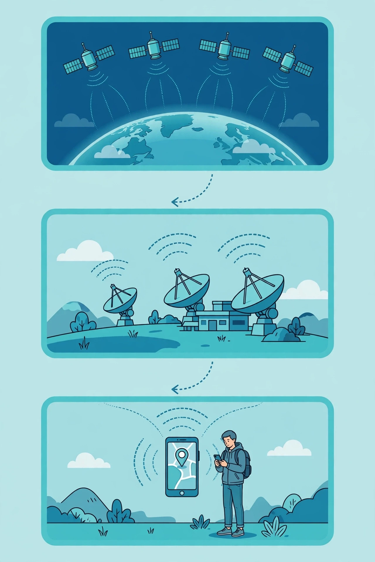
Every explanation of how GPS works starts here, because the system is not one machine. It is three cooperating parts, and if any one of them stopped, the blue dot would vanish within hours. The space segment is the satellites. The control segment is the ground stations that watch over them. The user segment is every receiver, from a surveyor's tripod to the phone in your hand.
3.1 The space segment: a constellation of clocks
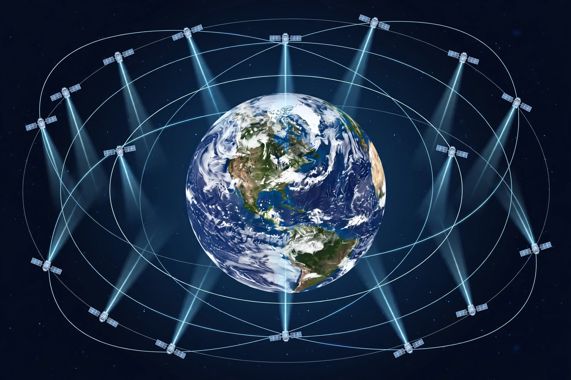
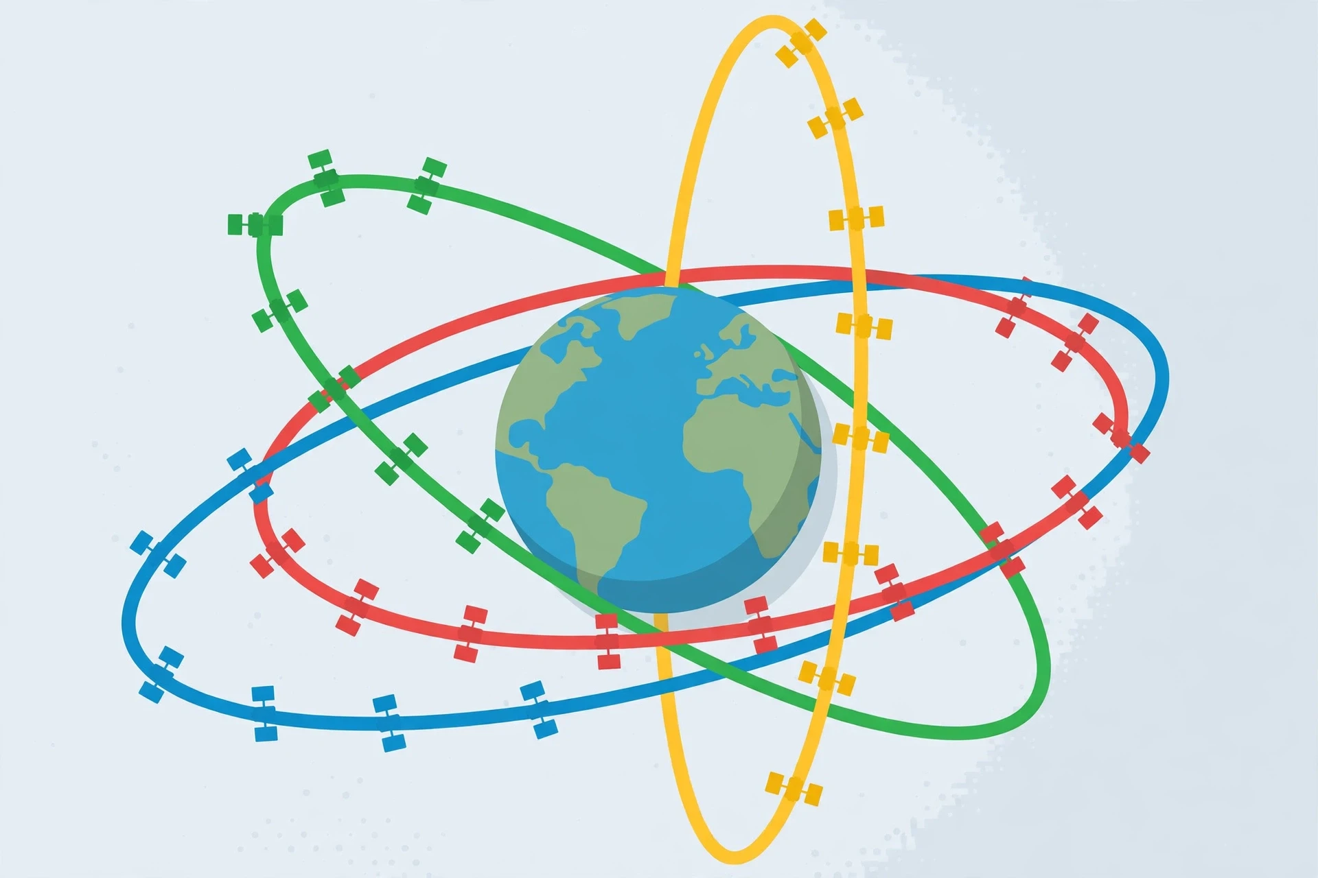
The space segment is a nominal constellation of 24 operating satellites, arranged in six orbital planes, each tilted 55 degrees to the equator, at an altitude of about 20,200 kilometres. Each satellite circles Earth twice per sidereal day — roughly every 11 hours and 58 minutes — so the pattern of satellites overhead repeats almost exactly from one day to the next. In practice, more than 24 satellites are usually in service, often around 31, because spares are kept in orbit and older satellites keep working past their design life.
Each satellite is, at heart, a flying clock with a radio transmitter attached. It carries several atomic clocks — typically rubidium and cesium standards — plus solar panels, a navigation payload, and antennas that broadcast its signals toward Earth. The satellites do not talk to each other about your position. They simply broadcast, continuously, two pieces of information: where they are, and what time it is according to their clock. A receiver that can hear four of them can work out where it is. A receiver that can hear more can do it better.
I once watched a satellite pass overhead on a clear night, a steady point of light moving too fast for a star and too slow for a shooting star, and I found myself thinking about what was inside it. No crew, no windows, no one to steer. Just a clock, a radio, and a set of instructions uploaded from the ground, falling around Earth in a curve so precise that it returns to the same place in the sky four minutes earlier each day. There is something quietly moving about that — a machine keeping perfect time in the dark so that the rest of us can find our way home.
3.2 The control segment: the ground crew
The control segment is a worldwide network of monitor stations, ground antennas, and master control stations that track the satellites, work out their exact orbits and clock errors, and upload corrections. The U.S. Space Force develops, maintains, and operates the space and control segments, and the master control station sits at Schriever Space Force Base in Colorado, with an alternate at Vandenberg in California. Monitor stations around the world — on islands and remote sites chosen for their spread across the globe — listen to every satellite as it passes, measure its signals against their own extremely accurate clocks, and send the data back for analysis.
Think of the control segment as the system's quality-control department. Satellites drift. Their orbits are nudged by the Moon's gravity, by sunlight pressing on their solar panels, and by the faint wisps of atmosphere even at 20,000 kilometres. Their clocks drift too, by tiny amounts that matter enormously when a nanosecond equals 30 centimetres of position error. The ground stations measure all of this, compute fresh orbit and clock data, and upload it to the satellites, which then broadcast the corrected information to users. Without those uploads, the broadcast orbits would go stale in hours, and positions would degrade from metres to hundreds of metres within a day.
3.3 The user segment: the receiver in your pocket
The user segment is the part you own. A GPS receiver is an antenna, a radio, a modest processor, and — crucially — a cheap quartz clock. It does not transmit to the satellites. It listens, and it calculates. That one-way design is why a billion receivers can share the same satellites without interfering with each other, and why GPS keeps working when mobile networks fail.
Your phone's receiver is doing something remarkable with very modest hardware. Its clock is an ordinary quartz crystal, the same kind that keeps time in a wristwatch, and it drifts by microseconds in seconds. The satellites carry atomic clocks worth more than a house. The receiver bridges that gap not by owning a better clock but by treating its own clock error as one more unknown to solve for — a trick we will meet in Section 6, and the reason four satellites are needed instead of three.
Segment | What it is | Who runs it | What it does |
|---|---|---|---|
Space | 24+ satellites at about 20,200 km altitude | U.S. Space Force | Broadcasts position and time signals |
Control | Monitor stations, ground antennas, master control stations | U.S. Space Force | Tracks satellites, corrects orbits and clocks, uploads data |
User | Receivers in phones, cars, aircraft, and survey equipment | Billions of users worldwide | Listens to signals and calculates position, velocity, and time |
4. The Signal: How a Satellite Tells You Where It Is
4.1 A radio message travelling at light speed
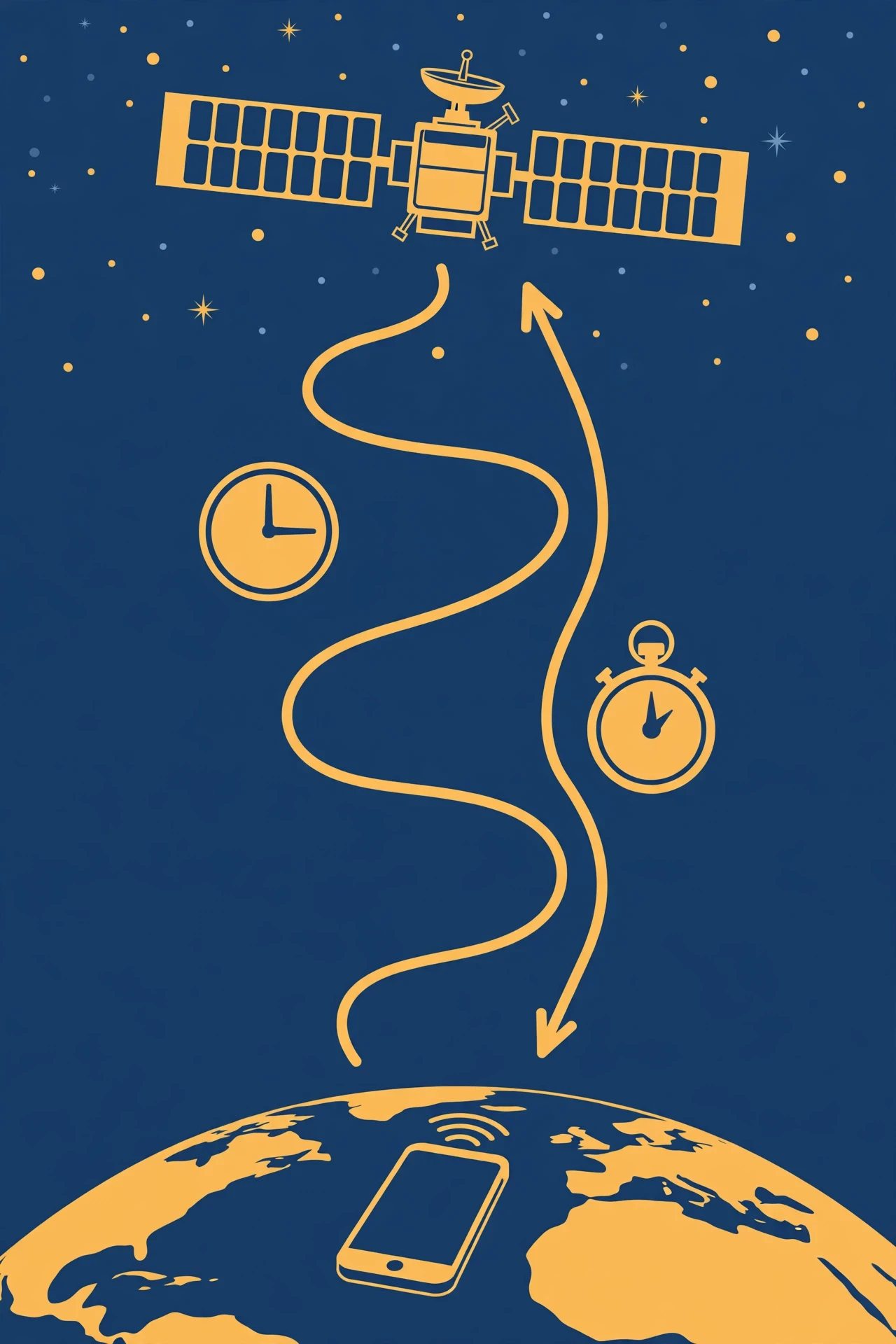
Each GPS satellite broadcasts a radio signal that carries three things: a unique code that identifies the satellite, the satellite's position at the moment the signal was sent, and the time the signal was sent, stamped by the satellite's atomic clock. To understand how GPS works at the level of the signal, start here: the signal travels at the speed of light — 299,792 kilometres per second — and it takes about 67 milliseconds to reach the ground from 20,200 kilometres up. Your receiver measures the arrival time, compares it with the sent time, and multiplies the difference by the speed of light to get the distance to that satellite. That distance is called a pseudorange, and the "pseudo" matters: it is the true distance plus the error from the receiver's imperfect clock.
The numbers involved are humbling. Light travels about 30 centimetres in a single nanosecond — a billionth of a second. So if your receiver's timing is off by one microsecond, a millionth of a second, your position is off by about 300 metres. If it is off by one millisecond, your position is off by 300 kilometres. GPS works because it measures time to within a few billionths of a second, using clocks in space and a clever piece of mathematics in your pocket. Everything else in this article is a consequence of that one fact.
4.2 Codes, carriers, and frequencies
The signal itself is a marvel of engineering. Each satellite transmits on radio frequencies in the L-band, and the civilian signals most receivers use live on L1 at 1575.42 MHz, with newer civil signals on L2 at 1227.60 MHz and L5 at 1176.45 MHz. Riding on those carrier waves are two things: a navigation message, broadcast at a slow 50 bits per second, which carries the satellite's orbit data and clock corrections; and a pseudorandom code — a long, apparently random sequence of ones and zeros that is unique to each satellite and repeats in a known pattern.
That code is the key to the timing measurement. Your receiver generates an identical copy of the satellite's code locally. When the satellite's signal arrives, the receiver slides its local copy back and forth in time until the two codes line up. The amount of sliding is the travel time. It is like recognising a familiar song starting a fraction of a second late: you know the tune, so you can tell exactly how late it began. Because each satellite uses a different code, the receiver can separate the signals of a dozen satellites sharing the same frequency, the way you can pick out one voice in a crowded room if you know what it sounds like.
I find the pseudorandom code quietly beautiful. It looks like noise, and in a sense it is noise — but it is noise with a pattern, known in advance, shared between the satellite and every receiver on Earth. That shared pattern is what lets a phone with a ten-pound antenna lock onto signals so faint that they arrive weaker than the background radio noise of the universe itself. The signal from a GPS satellite reaches your phone at a power of roughly a tenth of a millionth of a billionth of a watt. Your receiver still finds it, because it knows exactly what to look for.
4.3 What the receiver actually measures
Strip away the engineering, and the heart of how GPS works is this: the receiver measures one thing per satellite: how long the signal took to arrive. From that, it computes a pseudorange. It also reads the navigation message, which tells it where the satellite was when it sent the signal. So after listening for a few seconds, the receiver holds a small table: satellite A was at this position and its signal took this long; satellite B was at that position and its signal took that long; and so on. The rest is geometry — and geometry is where the story gets elegant.
5. Trilateration: Finding Yourself from Distances
5.1 Not triangulation — trilateration
Most people assume GPS uses triangulation, but a key part of how GPS works is that it actually uses trilateration, and the difference matters. Triangulation works out a position from angles. Trilateration works it out from distances. The distinction is not pedantry: GPS never measures an angle. It measures distances, and it finds you at the intersection of spheres.
The idea is simple enough to try with a piece of string. Imagine you are standing somewhere in a large field, and a friend tells you that you are exactly 100 metres from a flagpole. You could be anywhere on a circle of radius 100 metres around that pole. Now a second friend tells you that you are 80 metres from a tree. You are now on the circle where the two circles cross — which is two points. A third friend tells you that you are 60 metres from a bench, and the three circles meet at a single point. That point is where you are standing.
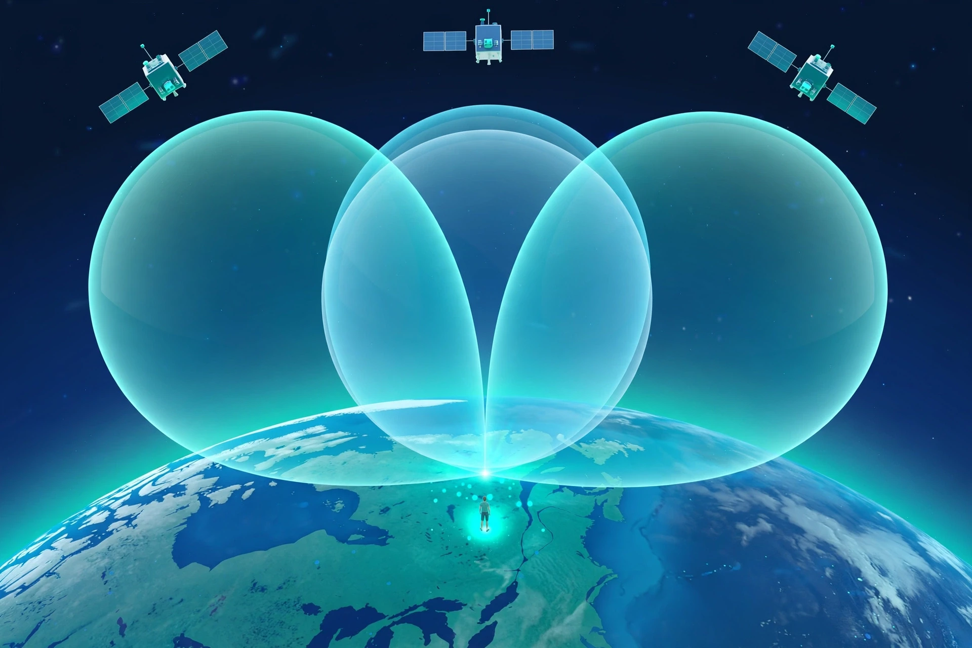
In three dimensions, the circles become spheres. One satellite tells you that you are somewhere on the surface of a sphere centred on that satellite, with a radius equal to your distance from it. A second satellite gives you a second sphere, and the two spheres intersect in a circle. A third satellite gives you a third sphere, and that circle meets the third sphere at two points. One of those points is usually far out in space, moving at thousands of kilometres per hour, and the other is on or near Earth's surface. The receiver picks the sensible one — and there you are.
Trilateration is not about angles. It is about distances. One distance puts you on a sphere, two put you on a circle, and three put you at a point — with the fourth satellite there to fix your clock, not your geometry.
5.2 A worked example in your head
Try it with numbers. Suppose three satellites tell you that you are 20,200 kilometres from the first, 20,500 kilometres from the second, and 20,100 kilometres from the third. Each distance defines a sphere. The spheres are enormous — their radii are about three times Earth's diameter — but they still intersect in a precise way, because the satellites are in different parts of the sky. The intersection of the first two spheres is a circle, tilted in space. The third sphere cuts that circle at two points, one near Earth's surface and one far away in space. Your receiver discards the space point without a second thought. The remaining point is your position, in three dimensions: latitude, longitude, and altitude.
The precision is startling. With good signals, the spheres intersect cleanly, and the point is defined to within a few metres. With poor geometry — say, all the satellites bunched together in one part of the sky — the spheres meet at a shallow angle, and a small error in any distance becomes a large error in position. Surveyors call this dilution of precision, and it is one reason your phone's accuracy varies from place to place and hour to hour, even when nothing else has changed.
5.3 Why the spheres are never perfect
In the real world, the spheres are fuzzy. The signal slows slightly as it passes through the ionosphere, the electrically charged layer of the atmosphere high above us, and through the troposphere, the wet lower air where our weather lives. It bounces off buildings and cliffs, arriving by a longer path. The satellite's broadcast position is a prediction, not a measurement, and predictions have errors. The receiver's own electronics add noise. Each of these effects smudges the sphere's surface by a little, and the intersection becomes a small volume of uncertainty rather than a perfect point. The art of GPS engineering is shrinking that volume — and the rest of this article is about how.
6. Why Four Satellites? The Clock You Do Not Have
6.1 The fourth unknown
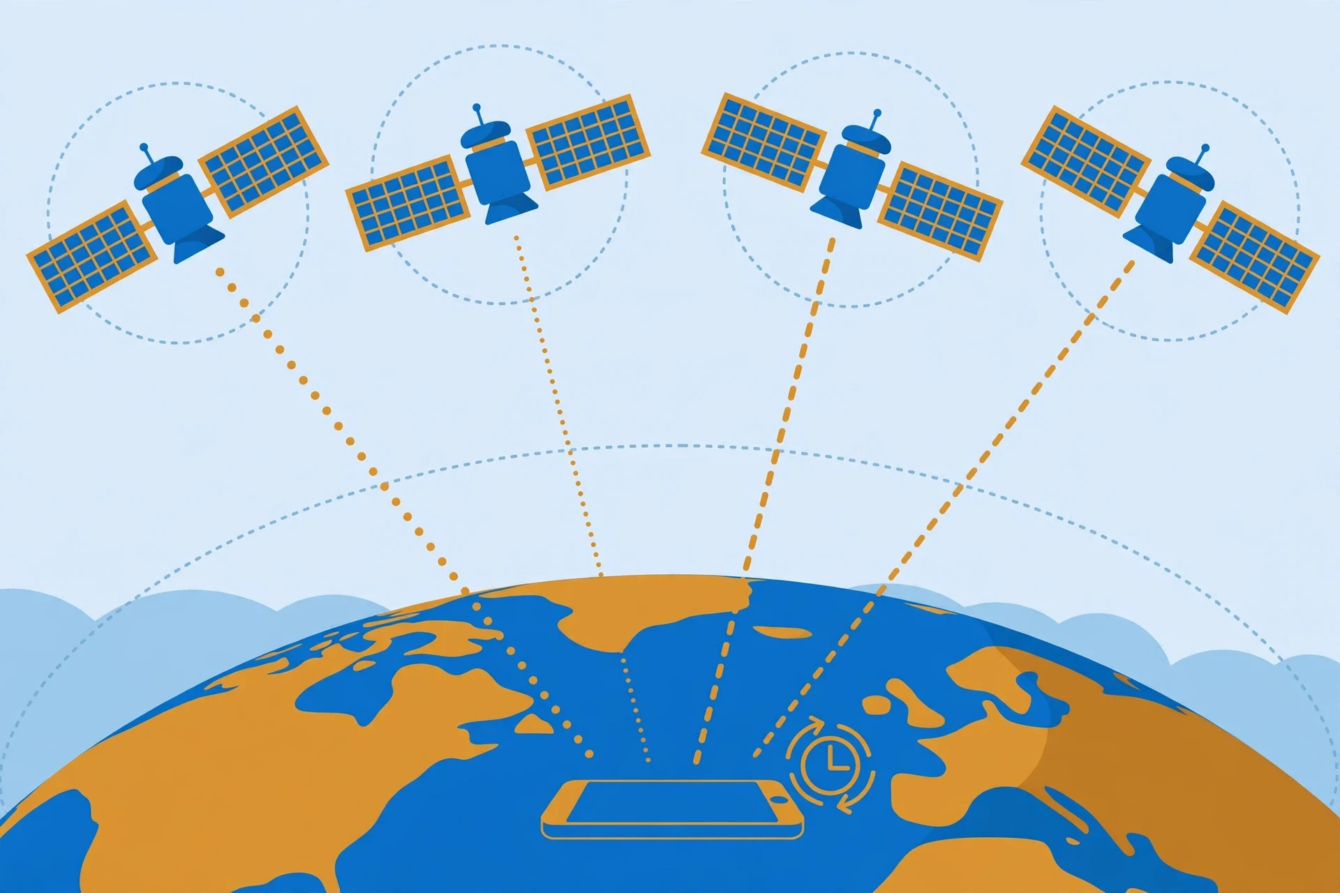
Here is the problem the textbook version of how GPS works quietly skips: it assumes the receiver knows exactly what time it is. Your phone does not. Its quartz clock drifts, and a drift of a single microsecond would throw its position off by 300 metres. If the receiver tried to use three satellites with a drifting clock, the three spheres would not meet at a single point at all. They would miss each other by the distance the clock error represents, and the receiver would have no way of knowing which sphere was wrong.
The solution is one of the most elegant ideas in how GPS works. Instead of pretending its clock is accurate, the receiver treats its own clock error as a fourth unknown, alongside latitude, longitude, and altitude. Four unknowns need four equations, and four equations need four satellites. With four pseudoranges, the receiver solves for all four at once: where it is, and how wrong its clock is. In the process, it effectively calibrates its cheap quartz clock against the atomic clocks in space, to within a few billionths of a second, every time it gets a fix.
That is why the rule in how GPS works is four satellites, not three. Three satellites give you position if your clock is perfect. Four give you position and time, with an imperfect clock. And once the receiver knows its clock error, it knows the time to extraordinary precision — which is why GPS is the world's most widely used source of accurate time, keeping mobile networks, power grids, and financial systems in step.
6.2 How the maths works, in plain language
You do not need the equations to appreciate the idea, but a sketch helps. Each pseudorange measurement gives the receiver one equation: the measured distance equals the true distance to the satellite, plus the speed of light multiplied by the receiver's clock error. The true distance depends on the receiver's unknown position, which is three numbers. The clock error is a fourth number. Four satellites give four equations, four unknowns, and a solvable system. The receiver solves it iteratively — it guesses a position, checks how well the guesses match the measurements, adjusts, and repeats until the numbers agree. Modern receivers do this in milliseconds, and they do it again and again, dozens of times a second, as you move.
With more than four satellites in view — and there are usually eight to twelve — the receiver has more equations than unknowns. It uses the extras to check its work, to average out errors, and to reject a satellite whose signal looks suspicious. That redundancy is one reason modern GPS is so much more reliable than the early system: a receiver today is rarely working with the bare minimum, and it knows when one of its measurements is lying.
6.3 A misconception worth correcting
Most people assume that GPS works by the satellites finding you, like radar tracking a plane. It is the other way around. The satellites have no idea you exist. They broadcast blindly, and your receiver does all the finding. That matters for privacy — nobody can track you through GPS alone, because GPS never sends your location anywhere — and it matters for scale, because the system never gets congested no matter how many receivers are listening. The satellites are lighthouses, not searchlights. They shine, and you work out where you are from the light you see.
7. Atomic Clocks: Timekeepers That Barely Drift
7.1 What an atomic clock actually counts
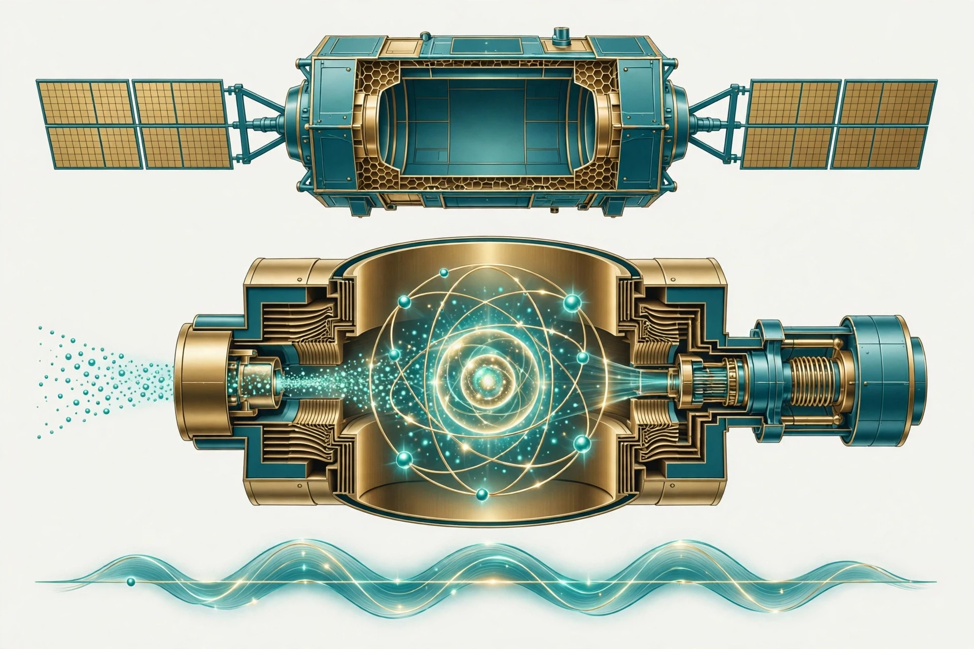
To see how GPS works at the level of timekeeping, start with what a clock counts. A normal clock counts something that repeats: a pendulum swings, a quartz crystal vibrates, a gear turns. An atomic clock counts something far more reliable — the vibration of atoms themselves. In a cesium atomic clock, the clock counts the oscillations of cesium-133 atoms as they flip between two energy states. That flip happens at a frequency fixed by the laws of nature: 9,192,631,770 cycles per second, a number so fundamental that it defines the second itself. Since 1967, the international second has been defined as the time it takes for exactly that many cycles of radiation from a cesium-133 atom to pass. The National Institute of Standards and Technology explains how atomic clocks work, and why cesium became the standard: its frequency does not depend on temperature, on manufacturing, or on anything else that changes from one clock to the next. Every cesium atom in the universe ticks at the same rate.
Rubidium clocks work on the same principle with a different atom, and they are smaller, lighter, and cheaper — which is why most GPS satellites carry rubidium clocks as their main timekeepers, with cesium clocks alongside them. A good rubidium clock in orbit drifts by only a few nanoseconds a day. To put that in perspective, a clock that loses one nanosecond a day would take nearly three million years to lose a single second. Your wristwatch, by comparison, might gain or lose seconds in a week. That gap — between a clock that is wrong by seconds a month and a clock that is wrong by billionths of a second a day — is the gap GPS lives in.
7.2 Why the satellites need them
The satellites need atomic clocks because how GPS works is, at bottom, a timing contest, and the timing has to be good to a few billionths of a second. If a satellite's clock were off by a microsecond, every receiver listening to it would compute a position 300 metres wrong. If it were off by a millisecond, the error would be 300 kilometres. The satellites' clocks are also the reference against which the ground stations measure everything else. The control segment compares the satellite clocks with its own master clocks on the ground, works out the tiny differences, and uploads corrections so the satellites can broadcast accurate time.
I once visited a laboratory where an atomic clock sat in a quiet room, humming behind glass, and the engineer showing me around said something I have never forgotten: "This clock is the most boring machine in the building, and that is the point." It did nothing but count, endlessly, identically, year after year. There were no moving parts to wear out, no springs to stretch, no gears to slip. Just atoms, doing what atoms always do. GPS took that boredom — that perfect, unchanging repetition — and put it in orbit.
7.3 Keeping the clocks honest
Atomic clocks are superb, but they are not perfect. They drift with temperature, with age, and with the radiation of space. The control segment watches for this constantly. Each satellite's clock is compared with ground clocks many times a day, and the difference — the clock bias and its rate of change — is modelled and uploaded. The satellite then broadcasts its clock correction as part of its navigation message, and your receiver applies it automatically. You never see any of this. You only see the blue dot, steady and true, because a network of people and machines on the ground is quietly keeping a fleet of clocks in space honest.
8. Einstein in Your Pocket: The Relativity Correction
8.1 Two effects pulling in opposite directions
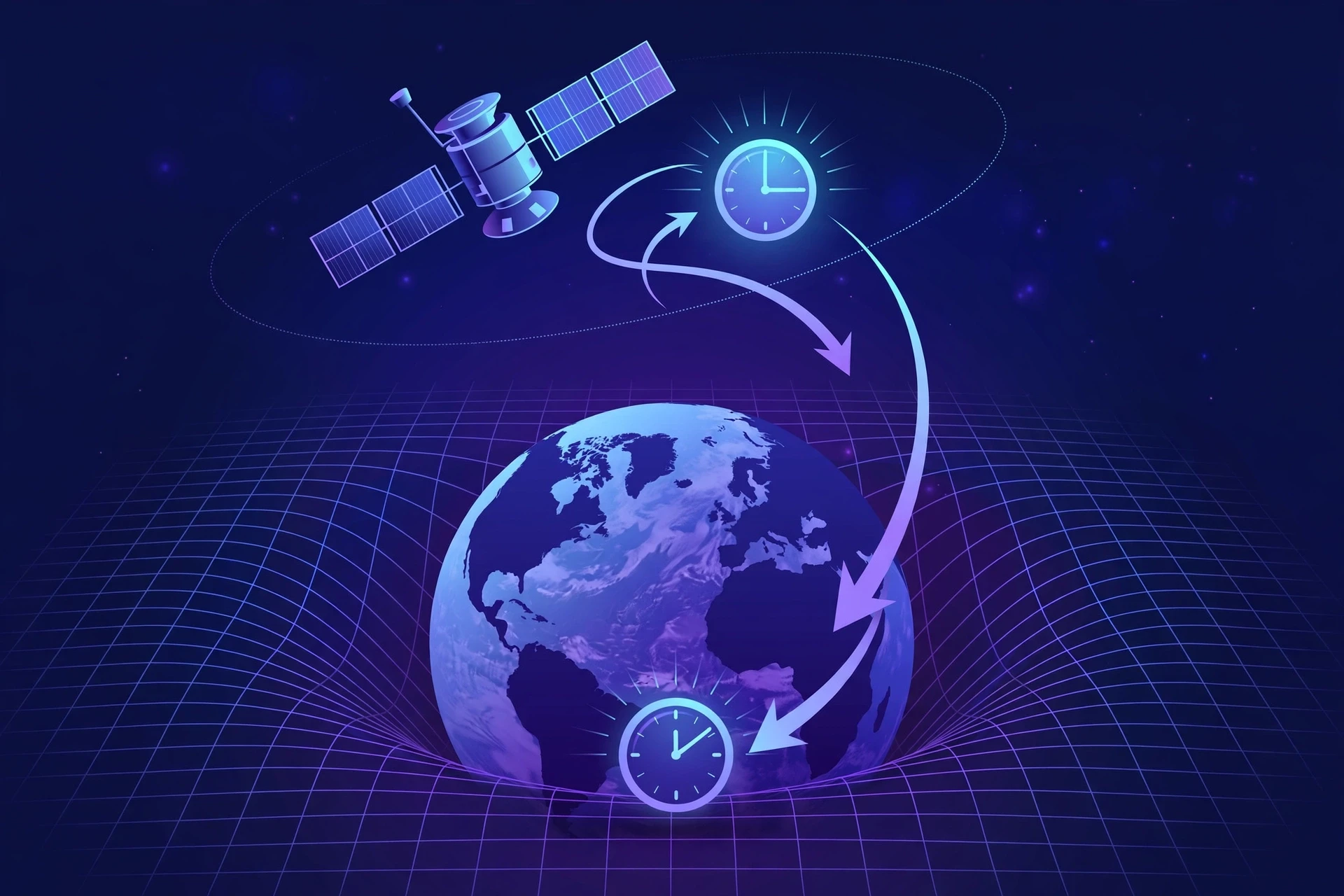
This is the part of how GPS works that still gives me a small thrill, because it is where abstract physics becomes everyday engineering. GPS satellites move fast, and they sit high above Earth in weaker gravity. Both of those facts change how fast their clocks tick, and they pull in opposite directions.
Special relativity says that a moving clock runs slow compared with a clock at rest. A GPS satellite travels at about 3.9 kilometres per second — roughly 14,000 kilometres per hour — and at that speed, its clock loses about 7 microseconds a day relative to a clock on the ground. General relativity says the opposite: a clock in weaker gravity runs fast compared with a clock in stronger gravity. A GPS satellite orbits at 20,200 kilometres, where Earth's gravity is roughly a quarter as strong as at the surface, and that effect makes its clock gain about 45 microseconds a day. The gravitational effect wins. Add them together, and a satellite clock gains about 38 microseconds a day relative to a clock on Earth.
Thirty-eight microseconds sounds like nothing. It is 38 millionths of a second. But light travels about 11 kilometres in 38 microseconds, so if the effect were ignored, your position would drift by roughly 10 to 11 kilometres every single day, accumulating without limit. Within a week, GPS would be useless. Within a month, it would be a joke. NASA's own explainer puts it plainly: the relativistic effects are nearly a thousand times greater than the timing precision GPS requires, and without correcting for them, position errors would accumulate so quickly that the system would be useless for navigation in a matter of minutes. You can read NASA's account of how Einstein's theory of relativity is critical for GPS, and the numbers match the textbook figures: about 7 microseconds slow from speed, about 45 microseconds fast from gravity, a net gain of about 38 microseconds a day.
8.2 The fix: set the clocks wrong on purpose
The engineers who built GPS knew all of this before the first satellite launched, and they built the correction into the hardware. Each satellite's atomic clock is deliberately set to tick slightly slower than it should on the ground — its frequency is offset by about 4.46 parts in ten billion, from 10.23 MHz down to 10.22999999543 MHz — so that once it reaches orbit, the relativistic gain brings it into step with clocks on Earth. It is a clock built to keep the wrong time on Earth so that it keeps the right time in space.
That sentence still delights me. A team of engineers looked at Einstein's equations, trusted them completely, and tuned a piece of hardware to be wrong in exactly the right way, years before the system would prove them right. The first satellite to carry a cesium clock into orbit, in 1977, confirmed the prediction. By the time GPS became operational, relativity was not a theory to be tested by the system — it was a design parameter of the system.
8.3 Why this matters beyond navigation
There is a wider point here, and it is worth pausing on. GPS is the most widely used test of general relativity in human history. Every phone on Earth that finds its position is, in a small way, confirming that time runs at different rates in different places, and that the difference is exactly what Einstein predicted. If you want to understand Einstein's theory of relativity — special and general, speed and gravity — there is no better everyday example than the device in your pocket. The same physics that bends starlight around galaxies is keeping your map honest on the way to the shops. And the same force of gravity that holds the Moon in its orbit is, right now, making the clocks above you tick a little faster than the clock on your wrist.
If GPS ignored relativity, your position would drift by about 10 kilometres every day. The system works because its clocks were deliberately set slow on the ground, so that Einstein's equations bring them into step once they reach orbit.
9. From the First Fix to Following You Down the Street
9.1 Cold starts, warm starts, and assisted GPS
The first time a receiver is switched on in a new place, or after a long time off, it has to do a cold start — and this is where many people first notice how GPS works in practice: it must search the sky for satellites, lock onto their signals, and download each satellite's navigation message, which takes at least 30 seconds to broadcast in full. That is why an old handheld GPS unit could take a minute to find you on a cold morning. Modern phones rarely make you wait, because they use assisted GPS, or A-GPS. The phone downloads the satellites' orbit data over the mobile network or Wi-Fi in seconds, instead of waiting for the slow broadcast from space, and it uses the network's rough knowledge of your location to know which satellites to look for first. The result is a fix in seconds rather than a minute — and a fix indoors, where the satellite signals are too weak to carry the navigation message at all.
A-GPS is a good reminder that the GPS in your phone is a hybrid. The satellites give the precise position; the mobile network gives a head start. Turn off the network, and GPS still works — it just takes longer to get going, and it may struggle indoors. That distinction answers one of the most common questions about the system: no, GPS does not need the internet to work, and no, it does not use your mobile data to find you. It uses data to find you faster.
9.2 Tracking a moving receiver
Once a receiver has a fix, it keeps it by tracking the satellites continuously. As you move, the pseudoranges change, and the receiver solves the four equations again and again, many times a second. It also measures the Doppler shift of each satellite's signal — the change in frequency caused by your motion relative to the satellite — and from that it works out your velocity: how fast you are moving, and in which direction. That is how your map knows not just where you are but which way you are facing, and how a running app knows your pace.
I learned how good this tracking had become on a bicycle ride through a city, watching my position trace the exact curve of a road on the screen, bend for bend, while I rode. A decade earlier, the same ride would have shown a jagged line cutting across buildings. The difference was not one breakthrough but many small ones: more satellites, better antennas, smarter software, and receivers that listen to GPS, Galileo, GLONASS, and BeiDou all at once, picking the best combination moment by moment.
9.3 Altitude, velocity, and time — the bonus measurements
Position is the headline, but a GPS fix gives you three other things for free. Altitude comes from the same calculation: the position is three-dimensional, so the receiver knows how high you are above sea level, usually to within ten or fifteen metres. Velocity comes from the Doppler measurements, accurate to a fraction of a metre per second. And time comes from the clock solution, accurate to within tens of nanoseconds — far more precise than any clock you own. Pilots use the altitude, athletes use the velocity, and the world's infrastructure uses the time. The blue dot is only the most visible product of the system. The invisible one — time — is arguably the more valuable.
10. What Limits Accuracy — and Why Your Phone Sometimes Gets It Wrong
10.1 The error budget
No measurement is perfect, and understanding how GPS works means understanding its errors. The errors have names, sizes, and causes, and knowing them explains almost every strange thing your phone has ever done with your location.
The ionosphere is the largest single source of error for a lone receiver. GPS signals slow down as they pass through this charged layer of the atmosphere, and the delay depends on the number of free electrons along the path, which changes with the time of day, the season, and solar activity. A single-frequency receiver cannot tell how much of the delay is ionosphere and how much is distance, so it applies a model — an educated guess — and the leftover error is typically a few metres. Dual-frequency receivers, which listen on two frequencies, can measure the delay directly, because the ionosphere slows different frequencies by different amounts. That is one reason modern phones, which increasingly use two frequencies, are more accurate than older ones.
The troposphere, the lower atmosphere, adds a smaller delay, mostly from water vapour. It is harder to model because weather changes hour by hour, but its effect is usually under a metre. Satellite orbit and clock errors, even after the control segment's corrections, contribute a metre or two. Multipath — signals bouncing off buildings, cliffs, or the ground and arriving by a longer path — can add several metres, or tens of metres in a bad spot. And the receiver's own noise, the electronic hiss in its circuits, adds a little more. Add them up, and a typical phone in open sky is accurate to about 5 metres. In a city, it may be 10 or 20. In a deep urban canyon, with signals bouncing off glass towers, it can be worse still.
Error source | Typical size | What causes it |
|---|---|---|
Ionosphere | 2 to 5 metres | Signals slow in the charged upper atmosphere |
Troposphere | 0.5 to 1 metre | Water vapour in the lower atmosphere |
Satellite orbit and clock | 1 to 2 metres | Residual errors after ground corrections |
Multipath | 1 to 10 metres, more in cities | Signals reflecting off buildings and ground |
Receiver noise | 0.5 to 1 metre | Electronic noise in the receiver |
Geometry (DOP) | Multiplies the rest | Satellites bunched together in one part of the sky |
10.2 Urban canyons, trees, and tunnels
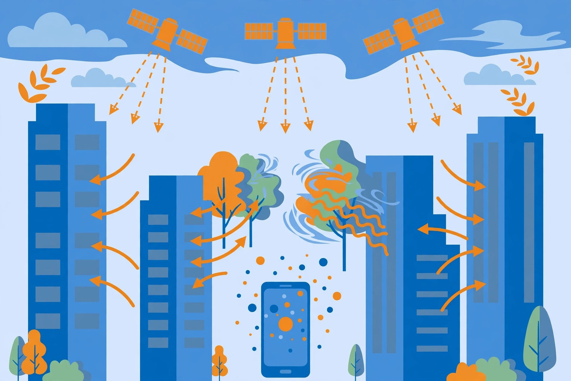
I have a vivid memory of standing on a street in a dense city centre, phone in hand, watching the blue dot jump — a small, vivid lesson in how GPS works when signals bounce from one side of the street to the other, then settle confidently in the middle of a building I was standing next to. The problem was not the satellites. It was the buildings. In a street lined with tall glass towers, a signal can reach your phone directly, or it can bounce off a tower across the street and arrive a fraction of a microsecond late. The receiver cannot always tell the direct signal from the echo, and the echo, having travelled further, makes the satellite look further away than it is. The position shifts. Walk into an open square, and the dot snaps back to where you are.
Trees do the same thing on a smaller scale, which is how I learned the lesson in that forest years ago. Leaves and branches scatter and weaken the signal, and a dense canopy can block satellites low in the sky entirely, leaving the receiver with a poor spread of satellites and a larger error. Tunnels and car parks block the signals completely — there is no GPS underground, because radio waves at GPS frequencies do not pass through rock and concrete. When your map keeps showing you driving through a tunnel long after you have emerged, it is because the receiver is coasting on its last fix, or on the phone's motion sensors, until it can hear the satellites again.
10.3 Differential GPS, RTK, and centimetre accuracy
For most of us, five metres is plenty, and that is the everyday accuracy that how GPS works delivers. For a surveyor marking a property boundary, a farmer steering a tractor, or a construction crew guiding a machine, it is not. Those users get centimetre accuracy from techniques with names like differential GPS and real-time kinematic positioning, or RTK.
The idea is simple. Put a second receiver at a point whose position is known exactly — a reference station. That receiver listens to the same satellites you do, works out how wrong its own computed position is, and broadcasts the correction. Your receiver applies the same correction, and most of the errors — ionosphere, orbit, clock — cancel out, because they affect both receivers in almost the same way. RTK goes further: instead of using the code timing, it uses the phase of the carrier wave itself, counting wavelengths to get a precision of centimetres. Modern farming uses RTK to steer tractors along rows with an accuracy of a couple of centimetres, planting seeds and spraying crops without overlapping or missing a strip. Construction machines grade land to the centimetre. Surveyors map coastlines that move with the tide.
10.4 Geometry matters: dilution of precision
There is one more factor, and it is easy to overlook because it has nothing to do with the hardware. Dilution of precision, or DOP, measures how the arrangement of satellites in the sky affects your accuracy. If the satellites are spread widely across the sky — one to the north, one to the south, one high overhead, one low to the east — the spheres intersect at clean angles, and a small timing error stays a small position error. If they are bunched together in one corner of the sky, the spheres meet at a shallow angle, and the same timing error becomes a much larger position error. Receivers report DOP as a number: low is good, high is bad. A phone that says it is accurate to 5 metres in an open field and 25 metres in a valley is often reporting the same hardware and the same signals — only the geometry has changed.
11. Everyday Uses: More Than a Map
11.1 Getting around
The use everyone knows, and the reason most people first ask how GPS works, is navigation. Turn-by-turn directions, live traffic, finding a restaurant, sharing your location with a friend — all of it rests on the fix we have described. Aviation uses GPS for en-route navigation and for approaches to airports. Ships use it to hold a course and to avoid collisions. Trains use it to know where they are on a network. Emergency services use it to find callers. And the ride-hailing and delivery economy — the driver who finds your door, the courier who finds your building — runs on receivers that cost a few pounds and fit in a pocket.
11.2 The hidden uses: time, farming, and science
The uses most people never see are, in some ways, more important. Mobile phone networks use GPS time to synchronise their base stations, so your call can hand over from one tower to the next without dropping. Power grids use it to timestamp faults and to keep the alternating current of a continent in step. Banks and stock exchanges use it to timestamp transactions, so that the order of trades can be settled to the microsecond. If GPS time vanished tomorrow, the internet would keep running, but the systems that keep it synchronised would start to drift within hours.
Farmers use GPS to steer tractors, map yields, and apply fertiliser only where it is needed, saving money and reducing runoff into rivers. Geologists use it to watch continents move: receivers bolted to bedrock in California measure the slow creep of the San Andreas fault at a few centimetres a year, and receivers on volcanoes in Iceland measure the ground swelling before an eruption. Seismologists use GPS to measure how the ground deformed during an earthquake, in minutes, complementing the slower work of seismometers. Climate scientists use GPS signals reflected off the ocean to measure sea level, and signals passing through the atmosphere to measure water vapour. The system built to guide missiles has become one of the most versatile scientific instruments on Earth.
11.3 The human story: rescue, sport, and exploration
On a personal level, GPS has changed how people move through the world. Hikers carry a safety net in their pocket. Sailors crossing an ocean know their position to a few metres, a precision that would have astonished the navigators who crossed the same water with a sextant and a chronometer. Runners and cyclists measure their routes to the metre and their pace to the second. Search-and-rescue teams find lost walkers faster because the walkers can share an exact position with a single tap. I have a friend who credits GPS with saving his father's life: the ambulance found a remote farmhouse at night because the caller could send a location pin instead of trying to describe a lane with no name and no number. The technology is invisible in that story, and that is the point. The best infrastructure disappears into the background, and you only notice it when it is gone.
12. GPS Is Not Alone: Galileo, GLONASS, and BeiDou
12.1 The other constellations
GPS was first, but it is no longer alone. Russia operates GLONASS, a constellation of satellites in three orbital planes at about 19,100 kilometres, inclined at 64.8 degrees, which gives it particularly good coverage at high northern latitudes — useful for a country that stretches across the Arctic. Europe operates Galileo, a civilian-controlled system with more than 30 first-generation satellites in orbit and a second generation being built, offering highly precise positioning under civilian control, as the European Space Agency's Galileo pages describe. China operates BeiDou, which grew from a regional system into a global constellation of about 45 satellites, including satellites in geostationary orbit over Asia. India operates NavIC, a regional system, and Japan operates QZSS, which augments GPS over Japan and the Asia-Oceania region.
Most modern receivers listen to more than one system at once, and that is a natural extension of how GPS works. A phone in a city street that can see only three GPS satellites may also see three Galileo satellites and two from BeiDou, giving it eight measurements where GPS alone would have given it three — and no fix at all. That is the practical benefit of the multi-constellation era: more satellites in view, better geometry, faster fixes, and resilience when one system is degraded or unavailable. The systems are designed to be interoperable: they use compatible frequencies and time references, so a receiver can mix their signals in a single calculation. The technical architecture of GPS itself — its three segments and their interfaces — is documented in detail in the European Space Agency's Navipedia entry on GPS architecture, which is a useful reference for readers who want the engineering detail.
12.2 Comparing the systems
The systems differ in history, ownership, and design, but from a user's point of view they are remarkably similar: satellites, atomic clocks, and trilateration. The differences that matter are coverage, accuracy, and control. GPS is run by the U.S. military and is free for civilian use worldwide. Galileo is run under civilian control by the European Union, which was a deliberate choice: Europe wanted a system it controlled, for a service it could guarantee. GLONASS is run by Russia. BeiDou is run by China. Each system is a strategic asset for its owner and a public utility for everyone else.
System | Owner | Satellites | Altitude | Control |
|---|---|---|---|---|
GPS | United States | 31 in orbit, 24 operational | About 20,200 km | Military |
Galileo | European Union | 28+ in orbit | About 23,222 km | Civilian |
GLONASS | Russia | About 24 in orbit | About 19,100 km | Military |
BeiDou | China | About 45, including geostationary | About 21,500 km, plus geostationary | Military-civilian |
12.3 Why having four systems is better than one
The multi-system world is not just about redundancy. It is about geometry and availability. A receiver that can hear 20 satellites from four systems has a far better chance of a good spread across the sky than one that can hear 8 from a single system, especially in a city or a valley where much of the sky is blocked. It is also about independence: if one system's signals are jammed or degraded in a region, the others keep working. For critical uses — aviation, emergency services, autonomous vehicles — that independence is not a luxury. It is a safety requirement. The future of navigation is not a single system. It is a chorus of them, and your phone is already listening to the whole choir.
13. Common Misconceptions About How GPS Works
13.1 "GPS needs the internet"
It does not. The short answer to how GPS works without the internet is this: GPS works entirely from satellite signals, and it works in the middle of an ocean, a desert, or a mountain range with no mobile coverage at all. What needs the internet is the map — the picture of streets and places that your position is drawn on — and the assisted data that helps your phone find satellites faster. Download an offline map, and you can navigate with no connection at all. The confusion is understandable, because on a phone the two things arrive together: the dot and the map. But they come from different places. The dot comes from space. The map comes from a server.
13.2 "GPS tracks you"
GPS itself does not track anyone — a fact that follows directly from how GPS works, since the satellites only broadcast and never listen for you. The satellites broadcast, and your receiver listens. Nothing about your position is sent back to space. If an app knows where you are, it is because your phone sent that information over the internet — to the app's servers, or to a friend you shared it with — not because GPS reported you. You can test this yourself: put your phone in aeroplane mode, open an offline map, and watch the blue dot move. It works, and nothing leaves the phone. The privacy question is real, but it belongs to apps and networks, not to the satellites.
13.3 "GPS is triangulation"
As Section 5 explained, a central point of how GPS works is that it is trilateration — distances, not angles. Triangulation is what surveyors did with theodolites, measuring angles between known points. GPS measures how long signals took to arrive and turns those times into distances. The confusion is so common that even many textbooks get it wrong, and it matters because it hides the real insight: GPS is a clock problem wearing a geometry problem's clothes. The geometry is the easy part. The timing is the hard part, and the timing is what the whole system is built around.
13.4 "More bars means better GPS"
The signal bars on your phone show mobile network strength, not GPS strength. A phone with no bars at all can have a perfect GPS fix, and a phone with full bars can have a terrible one. GPS signal strength is not shown as bars, and it is not related to your network. The two systems share the phone, but they share nothing else — different antennas, different frequencies, different satellites, different physics.
13.5 "GPS is accurate to the centimetre"
For a phone, no. For a surveyor with RTK equipment, yes. The difference is the equipment and the corrections, not the satellites. A phone uses code-based ranging with a small antenna and a cheap clock, and it gets metres. A survey receiver uses carrier-phase ranging with a large antenna, a reference station, and careful processing, and it gets centimetres. Both are GPS. The accuracy is not a property of the system alone. It is a property of the system plus the receiver plus the corrections, and anyone who quotes a single number for "GPS accuracy" without saying which receiver they mean is leaving out the most important part.
14. The Latest Research and What Comes Next
14.1 GPS III and the modernised constellation
The GPS constellation is not standing still, and the next chapter of how GPS works is already being written in orbit. The newest satellites, GPS III, carry more accurate atomic clocks, stronger signals, and a new civil signal on L1, called L1C, designed to be interoperable with Galileo. They also carry better anti-jamming features and a search-and-rescue payload that can pick up distress beacons. The next generation, GPS IIIF, will add more signals, more power, and laser retroreflectors for precise orbit measurement. The modernisation matters because the signals most of us use today were designed in the 1970s, for receivers that no longer exist. The new signals are designed for the receivers in our pockets, with faster acquisition, better performance indoors and in cities, and resistance to interference.
14.2 Jamming, spoofing, and resilience
GPS signals are faint, and faint signals are easy to jam. A small, illegal jammer can block GPS over a neighbourhood. A sophisticated spoofer can broadcast fake GPS signals and trick a receiver into believing it is somewhere it is not — a demonstrated risk for ships, aircraft, and autonomous vehicles. The research response is layered: stronger signals that are harder to jam, receivers that can detect spoofing by checking that signals are consistent with each other, and backup systems — inertial sensors, cameras, ground-based radio navigation, and signals from low Earth orbit satellites — that can keep a vehicle on course when GPS fails. The lesson of the last decade is that a system this important cannot have a single point of failure, and the engineering is moving toward a world where GPS is the best source of position, but not the only one.
14.3 Low Earth orbit, optical clocks, and the next leap
Two developments could change how GPS works in the coming years. The first is navigation from low Earth orbit: constellations of hundreds of small satellites, much closer to Earth than GPS, whose signals would be far stronger and harder to jam, and whose rapid motion across the sky would help receivers solve for position faster and more accurately. Several companies and agencies are testing this idea, and it may arrive first as an augmentation to GPS rather than a replacement — a strong, fast signal layered over the precise, proven one.
The second is the optical clock. Atomic clocks based on cesium and rubidium are superb, but clocks based on optical frequencies — using atoms like strontium or ytterbium, ticking at hundreds of trillions of cycles per second — are orders of magnitude more precise again, losing less than a second in billions of years. Optical clocks are still laboratory instruments, large and delicate, but they are shrinking, and the day a version flies in orbit is coming. When it does, the timing at the heart of GPS will get better still, and with it, the accuracy of every position on Earth. The principle will not change. A clock in space, a signal travelling at light speed, and a receiver solving for four unknowns. Only the clock will be better, and the dot will be truer.
14.4 The sky above us
There is a final thought I keep returning to, and it is about our Solar System and the neighbourhood GPS lives in. The satellites orbit in medium Earth orbit, between the low orbit of the International Space Station — about 400 kilometres up — and the geostationary belt at 36,000 kilometres. They are in a quieter part of space than either: high enough to see a wide sweep of Earth, low enough that their signals arrive strong and fast, and in orbits tuned so that the same pattern repeats each day. That choice, made in the 1970s, was a compromise between coverage, signal strength, and launch cost, and it has held for half a century. It is a reminder that good engineering is often about choosing the right compromise, and then keeping it working for decades.
15. The Blue Dot, Explained
So, to sum up how GPS works, in one paragraph: satellites carrying atomic clocks broadcast their position and the time, from 20,200 kilometres up. Your receiver measures how long each signal took to arrive, turns the travel time into a distance, and finds itself at the intersection of spheres centred on the satellites. Three spheres give a position if the clock is perfect; a fourth satellite lets the receiver solve for its own clock error as well. The clocks in space are corrected for relativity before launch, the ground stations keep their orbits and clocks honest, and the whole system gives you a position accurate to a few metres, anywhere on Earth, in seconds.
I think about that rainy evening often, and about the walk through the forest that started all of this. The blue dot felt like magic then. It feels like something better now: a chain of human ideas, each one simple on its own, that together do something no single idea could. A clock that counts atoms. A signal that travels at light speed. A piece of geometry learned in school. A correction from Einstein. A network of ground stations keeping watch in the dark. Put them together, and a phone can find a street corner in the rain.
The next time you follow a blue dot, pause for a second before you follow it. Above you, right now, are dozens of clocks falling around the planet, broadcasting the time to anyone who will listen. Your phone is listening. It is measuring billionths of a second, solving equations, and placing you on the map — and it is doing it with physics that was once the frontier of human knowledge and is now, quietly, the background of everyday life. That is how GPS works. And it is, when you look at it closely, a small wonder.
Frequently Asked Questions
How does GPS work in simple terms?
GPS works by timing radio signals from satellites. Each satellite broadcasts its position and the time the signal was sent. Your receiver measures how long each signal took to arrive, multiplies that time by the speed of light to get the distance to the satellite, and then finds its own position where the distances from several satellites intersect. That method is called trilateration.
Why does GPS need four satellites?
GPS needs four satellites because the receiver must solve for four unknowns: latitude, longitude, altitude, and its own clock error. Three satellites would be enough if the receiver's clock were perfect, but phone clocks are ordinary quartz crystals that drift. The fourth satellite lets the receiver work out how wrong its clock is and correct for it, which also gives the receiver extremely accurate time.
How accurate is GPS?
A typical smartphone in open sky is accurate to about 5 metres. In a city, with signals bouncing off buildings, accuracy may be 10 to 20 metres. Survey-grade receivers using differential corrections and carrier-phase measurements can reach centimetre accuracy. Accuracy depends on the receiver, the satellite geometry, the atmosphere, and whether buildings or trees block or reflect the signals.
Does GPS work without the internet?
Yes. GPS works entirely from satellite signals and needs no mobile network or Wi-Fi. The internet helps your phone find satellites faster, through assisted GPS, and it supplies the map tiles. With an offline map downloaded, you can navigate with no connection at all.
What is the difference between GPS and GNSS?
GPS is the American satellite navigation system. GNSS, or Global Navigation Satellite System, is the general term for all such systems, including GPS, Europe's Galileo, Russia's GLONASS, and China's BeiDou. Most modern phones listen to several GNSS constellations at once, which improves accuracy and reliability.
Does GPS use Einstein's theory of relativity?
Yes, and it must. Satellite clocks run fast by about 38 microseconds a day relative to clocks on Earth, because weaker gravity speeds them up by about 45 microseconds a day while their speed slows them by about 7 microseconds a day. Without correcting for this, positions would drift by about 10 kilometres every day. Engineers set the satellite clocks slightly slow before launch so that relativity brings them into step in orbit.
Can GPS work indoors or underground?
GPS works poorly indoors and not at all underground, because its radio signals are very weak and do not pass through rock, concrete, or thick roofs. Indoors, phones fall back on Wi-Fi positioning, mobile network positioning, and motion sensors. In a tunnel or car park, a receiver coasts on its last fix until it can hear the satellites again.
Sources
GPS.gov — the official U.S. government site for the Global Positioning System
NASA — Einstein's Theory of Relativity, Critical for GPS, Seen in Distant Stars
National Institute of Standards and Technology — How Do Atomic Clocks Work?
European Space Agency — Galileo, Europe's satellite navigation system
ESA Navipedia — GPS Architecture: space, ground, and user segments
National Institute of Standards and Technology — Timekeeping and Clocks FAQs