

The first time I really understood what hurricanes were, I was not reading a textbook. I was a teenager, sitting on a living-room floor, watching a satellite loop of a great white spiral turning slowly over the Atlantic on the evening news. The forecaster traced its path with a finger, and the storm looked almost calm from space — a neat pinwheel, almost pretty. Then the camera cut to the coast, where palm trees bent flat and the rain came in sideways, and I remember thinking that the two pictures could not possibly be the same thing. That gap, between the beautiful spiral seen from orbit and the chaos it brings ashore, is what this article is about.
Hurricanes are the largest and most powerful storms on Earth. A single mature hurricane can be wider than many countries, release more energy in a day than all the power plants on the planet produce in months, and drop enough rain to flood a city that has never seen a river overflow. Yet for all their force, hurricanes follow rules. They need warm water, moist air, a spin from Earth's rotation, and a calm upper atmosphere. Take any one of those away and the storm falls apart. Give them all four, and a cluster of thunderstorms can grow into something that rewrites coastlines.
In this guide we will walk through the whole story of hurricanes, from the first warm breath of air rising off a tropical sea to the moment the storm dies over land or cold water. We will look inside the storm at the eye, the eyewall, and the rain bands, decode the Saffir-Simpson scale, and face the danger most people underestimate: water, not wind. We will also look at forecasting, a warming climate, history's worst storms, and how to prepare. No hype, no guesswork — just the physics, the history, and the practical knowledge that helps people stay safe.
1. What Is a Hurricane?
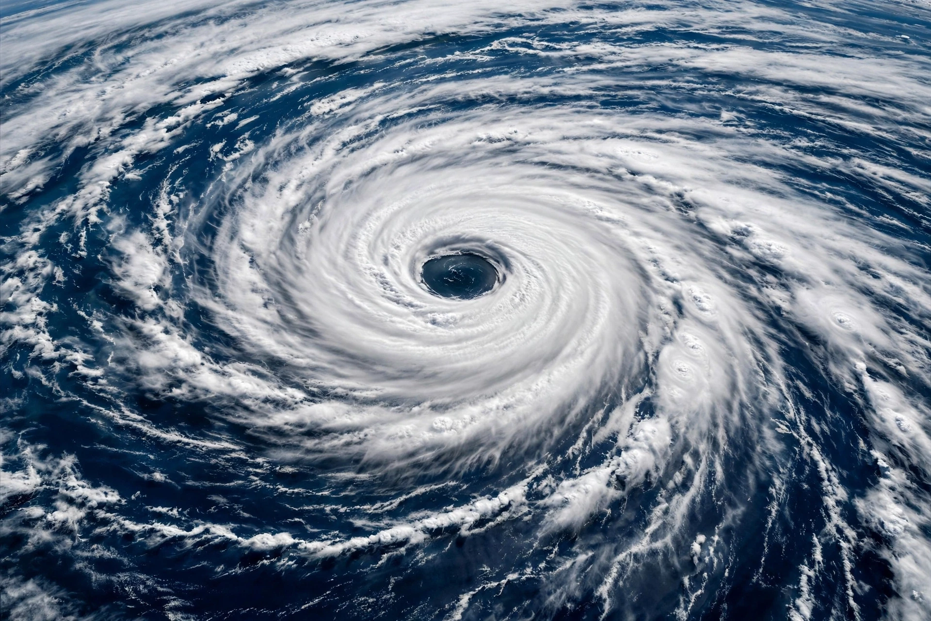
A hurricane is a tropical cyclone — a vast, rotating storm system that forms over warm tropical or subtropical ocean waters. The name changes with the ocean basin. In the Atlantic and the eastern Pacific, these storms are called hurricanes. In the western Pacific they are typhoons, and in the Indian Ocean and around Australia they are cyclones. The physics is the same everywhere; only the local name differs. When this article says "hurricanes," it means the Atlantic version of this global family of storms, though almost everything here applies to its cousins too.
What makes a hurricane different from an ordinary thunderstorm is organisation and scale. A thunderstorm is a local event, a single tower of rising air that lives for an hour and dies. A hurricane is a self-sustaining heat engine, hundreds of kilometres across, that can live for two weeks and travel thousands of kilometres. It feeds on heat and moisture from the sea surface, converts that energy into wind, and uses its own rotation to keep pulling in more fuel. Once it is running, it keeps itself going — until it runs out of warm water or tears itself apart over land.
1.1 The 74 mph line
Not every tropical storm is a hurricane. Forecasters draw a sharp line based on sustained wind speed. A tropical disturbance becomes a tropical depression when its winds reach about 38 mph, and a tropical storm when winds reach 39 mph. At that point it earns a name from a rotating list maintained by the World Meteorological Organization. Only when sustained winds reach 74 mph does the storm officially become a hurricane. That 74 mph threshold is not arbitrary. It is the speed at which wind begins to do serious structural damage — tearing off roof tiles, snapping branches, turning loose objects into projectiles.
Below that line, the storm is still dangerous, and this matters. A tropical storm with 60 mph winds can drown a town with rain even though it never becomes a hurricane. The name on the map is a wind classification, not a danger rating, and some of the deadliest flooding in history has come from storms that never earned the hurricane label. Keep that in mind every time you hear a storm described as "only" a tropical storm.
1.2 How big is a hurricane?
Picture a storm the size of a small country. A typical hurricane is 300 to 500 kilometres across, and the largest hurricanes on record have stretched beyond 1,000 kilometres. The cloud shield alone can cover several states at once. Inside that shield, the storm is not uniform. The worst weather concentrates in a ring near the centre, while the outer bands bring bands of heavy rain separated by stretches of relative calm. A city can sit under a rain band for an hour, then find itself in a lull, then get hit again as the next band spirals in.
The energy numbers are hard to grasp. A mature hurricane releases heat at a rate that dwarfs human power generation — the condensation of water vapour inside the storm alone releases heat on a scale no power station can match. The wind, which is what we feel and fear, is only a small fraction of the storm's total energy. Most of it is hidden in the invisible process of water changing from vapour to liquid, high in the clouds. That is why a hurricane is best understood not as a windstorm, but as a heat engine that happens to produce wind as a by-product.
1.3 Hurricanes, typhoons, and cyclones
The naming confusion trips up a lot of readers, so here is the simple version. All three words describe the same kind of storm: a tropical cyclone. The Atlantic and eastern Pacific use "hurricane," from Huracan, the name of a Caribbean storm god. The western Pacific uses "typhoon," and the Indian Ocean uses "cyclone." A storm does not change its nature when it crosses from one basin's naming area to another; it only changes its label. The strongest typhoons in the western Pacific are often more intense than the strongest Atlantic hurricanes, because the Pacific is larger and offers more warm water for a storm to feed on. The physics, the structure, and the dangers are the same.
2. The Ingredients a Hurricane Needs
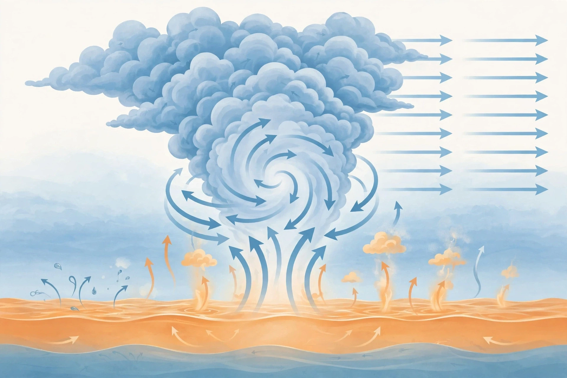
A hurricane cannot form just anywhere, or at any time. It needs a specific recipe, and the ocean and atmosphere must cooperate. Forecasters at the National Hurricane Center check these ingredients every day during hurricane season, because a missing ingredient is often the difference between a storm that fizzles and one that becomes a headline. There are five main ingredients, and each one plays a distinct role.
2.1 Warm ocean water, at least 26.5°C
The first and most famous ingredient is warm water. Hurricanes need sea surface temperatures of at least 26.5°C (about 80°F), and that warm layer must extend tens of metres below the surface. Warm water evaporates easily, loading the air above it with moisture. That moist air is the fuel. When it rises and cools, the water vapour condenses into clouds and releases heat — the latent heat that powers the whole storm. Without a deep layer of warm water, the storm quickly uses up the heat near the surface, pulls up cold water from below, and starves.
I once stood on a beach in late August, when the sea felt more like bathwater than ocean, and a local fisherman told me the water had been warm for weeks and the season felt "ripe." He was not a meteorologist, but he was reading the same signal forecasters read: warm water is stored sunshine, and a hurricane is one way the ocean gives that heat back to the atmosphere. You can feel the fuel with your feet.
The 26.5°C figure is a threshold, not a magic switch. Warmer water generally means more available energy, and the warmest waters on Earth — the western Pacific warm pool, the Gulf of Mexico in late summer — are where the strongest storms are born. The oceans store that heat in currents and layers reaching far below the surface, as explained in the guide to Oceanography. This is also why hurricane season peaks in late summer and early autumn, when the ocean has had all summer to warm up. The air may feel hottest in July, but the sea reaches its peak warmth in August and September, and the storms follow the sea, not the calendar of hot days.
2.2 Moist air through the middle of the atmosphere
Warm water at the surface is not enough on its own. The air halfway up through the atmosphere must also be moist. Dry air in the middle levels acts like a brake: when dry air gets drawn into a developing storm, it causes the rising moist air to evaporate and cool, weakening the updrafts that hold the storm together. Forecasters watch mid-level humidity closely, because a pocket of dry Saharan air drifting off Africa across the Atlantic has killed many would-be hurricanes before they ever got started.
Think of it like a fire. Warm, moist surface air is the wood, but dry mid-level air is a cold draught across the flames. A well-built fire can survive a draught; a small, young one cannot. That is why the early stages of a hurricane are so fragile, and why many tropical waves leaving Africa never become anything at all.
2.3 The Coriolis effect: Earth's spin
A hurricane needs spin, and that spin comes from Earth's rotation. The Coriolis effect deflects moving air to the right in the Northern Hemisphere and to the left in the Southern Hemisphere. Over the scale of a hurricane, that deflection organises the inflowing air into a rotating vortex. Without it, air would simply rush straight into the low-pressure centre and fill it, and no storm could form.
This is why hurricanes almost never form within about 5 degrees of the equator. Near the equator the Coriolis effect is too weak to get the rotation started. The storms that do form close to the equator are rare exceptions, and they usually struggle to organise. It is also why hurricanes spin anticlockwise in the Northern Hemisphere and clockwise in the Southern Hemisphere — the direction is set by the planet, not by the storm. For a deeper look at how the atmosphere moves on a planetary scale, see the guide to Meteorology and how forecasts are made.
2.4 Low wind shear
Wind shear is the change in wind speed or direction with height. A developing hurricane needs low shear — winds that blow at roughly the same speed and direction from the surface up to the top of the storm. When shear is high, the top of the storm gets pushed sideways away from its base, like a chimney leaning in a gale. The storm's heat engine breaks apart because the rising warm air no longer stacks neatly over the low-pressure centre.
High wind shear is one of the best friends coastal residents have. Many storms that look threatening on a satellite image fall apart when they run into strong upper-level winds. Forecasters often describe a storm as "sheared apart," and the satellite picture tells the story: the cloud tops get blown off to one side, the centre becomes exposed, and the storm weakens within hours.
2.5 A pre-existing disturbance
Finally, a hurricane needs a starting push — some existing area of low pressure or a cluster of thunderstorms to organise around. In the Atlantic, most of these seeds are tropical waves, ripples in the atmosphere that roll off the west coast of Africa every few days during summer. Others form from old weather fronts that stall over warm water, or from the remnants of earlier storms. The seed does not need to be strong. It just needs to be there, giving the inflowing air something to circle around while the other ingredients do their work.
A hurricane is not created by any single ingredient. It is the moment when warm water, moist air, planetary spin, calm upper winds, and a small disturbance all arrive at the same place at the same time — and the atmosphere decides to organise.
3. How a Hurricane Forms, Step by Step
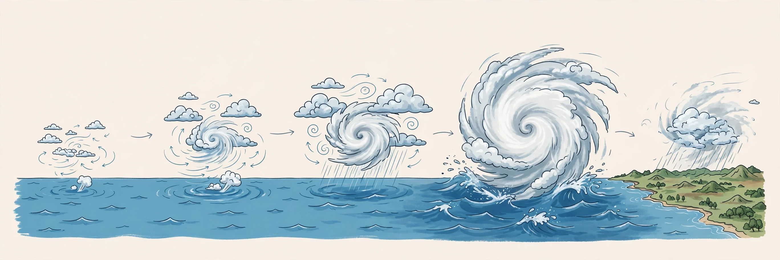
Formation is a process, not an event. A hurricane does not appear fully formed. It grows through stages, and at each stage it can stall, weaken, or die. Understanding the stages helps explain why forecasters talk about a storm "developing" or "failing to develop" — they are watching a chain of events, and any broken link stops the chain.
3.1 Stage one: a tropical disturbance
It starts with a cluster of thunderstorms over warm water, usually riding along a tropical wave. At this stage there is no closed circulation, no eye, no real organisation — just a messy patch of showers and gusty winds. The air near the surface is warm and humid, and it rises in scattered updrafts. If the other ingredients are in place, those updrafts begin to draw in more air from the surroundings, and the whole cluster starts to rotate slowly.
Most disturbances never get past this stage. Dry air, wind shear, or cooler water can scatter them within a day. Forecasters give each disturbance a number and watch it, but they do not name it yet. Naming comes later, when the storm has earned a closed circulation and a defined centre.
3.2 Stage two: tropical depression
When the disturbance develops a closed circulation — air flowing in a complete circle around a low-pressure centre — and its sustained winds reach 38 mph, it becomes a tropical depression. The rotation is now real, though still weak. Thunderstorms begin to cluster closer to the centre, and the pressure at the centre begins to fall. Falling pressure is the key signal: the lower the central pressure, the stronger the storm can become, because a bigger pressure difference between the centre and the surroundings drives faster winds.
At this stage the storm is fragile. A burst of dry air or a rise in wind shear can still kill it. But if the warm water keeps feeding it, the depression tightens and speeds up, and the thunderstorms wrap more tightly around the centre.
3.3 Stage three: tropical storm
When sustained winds reach 39 mph, the depression becomes a tropical storm and receives a name. This is the moment the public usually first hears about it. The circulation is now well defined, the thunderstorm activity is organised into curved bands, and the storm begins to look like a spiral on satellite images. The warm core — a column of warm air at the centre of the storm — starts to build, and that warm core is what separates a tropical cyclone from an ordinary low-pressure system.
A tropical storm can already be deadly. Its winds can topple trees and damage roofs, and its rain can cause flash flooding far from the coast. Some tropical storms have produced catastrophic flooding after stalling over land, dropping rain on the same area for days. The name is a wind label, not a safety label, and that distinction saves lives when people understand it.
3.4 Stage four: hurricane
When sustained winds reach 74 mph, the tropical storm becomes a hurricane. By now the structure is mature: a clear eye may appear at the centre, surrounded by the eyewall, with spiral rain bands wrapping around the outside. The storm is now a heat engine running at full power, drawing in warm, moist air at the surface, lifting it through towering thunderstorms, and venting it out at the top, high in the atmosphere. As long as a hurricane stays over warm water and the shear stays low, it can keep strengthening, sometimes rapidly.
Rapid intensification is one of the most closely studied parts of hurricane science. A storm can jump a full category or more in a single day when it passes over a patch of especially warm water with very low shear. This is why forecasts are updated every few hours: a storm that was a Category 1 in the morning can be a Category 3 by nightfall, and the people in its path need to know.
3.5 Stage five: weakening and death
Hurricanes die in two main ways. The first is landfall. Over land, the storm loses its fuel supply — there is no warm ocean to evaporate water into the storm — and friction with the ground slows the winds. A hurricane can still be devastating for hours after landfall, and its rain can travel far inland, but without its fuel source it weakens steadily. The second way is moving over cold water. When a hurricane curves northward into the cold Atlantic, it loses its heat source and gradually transforms into a different kind of storm, an extratropical cyclone, or simply falls apart.
Some storms die quietly at sea, never touching land. Others die slowly over land, dumping rain for days as a tropical depression. Either way, the death of a hurricane shows how dependent it is on its fuel. Cut off the warm water, and the most powerful storm on Earth becomes ordinary rain.
4. Inside the Storm: Eye, Eyewall, and Rain Bands
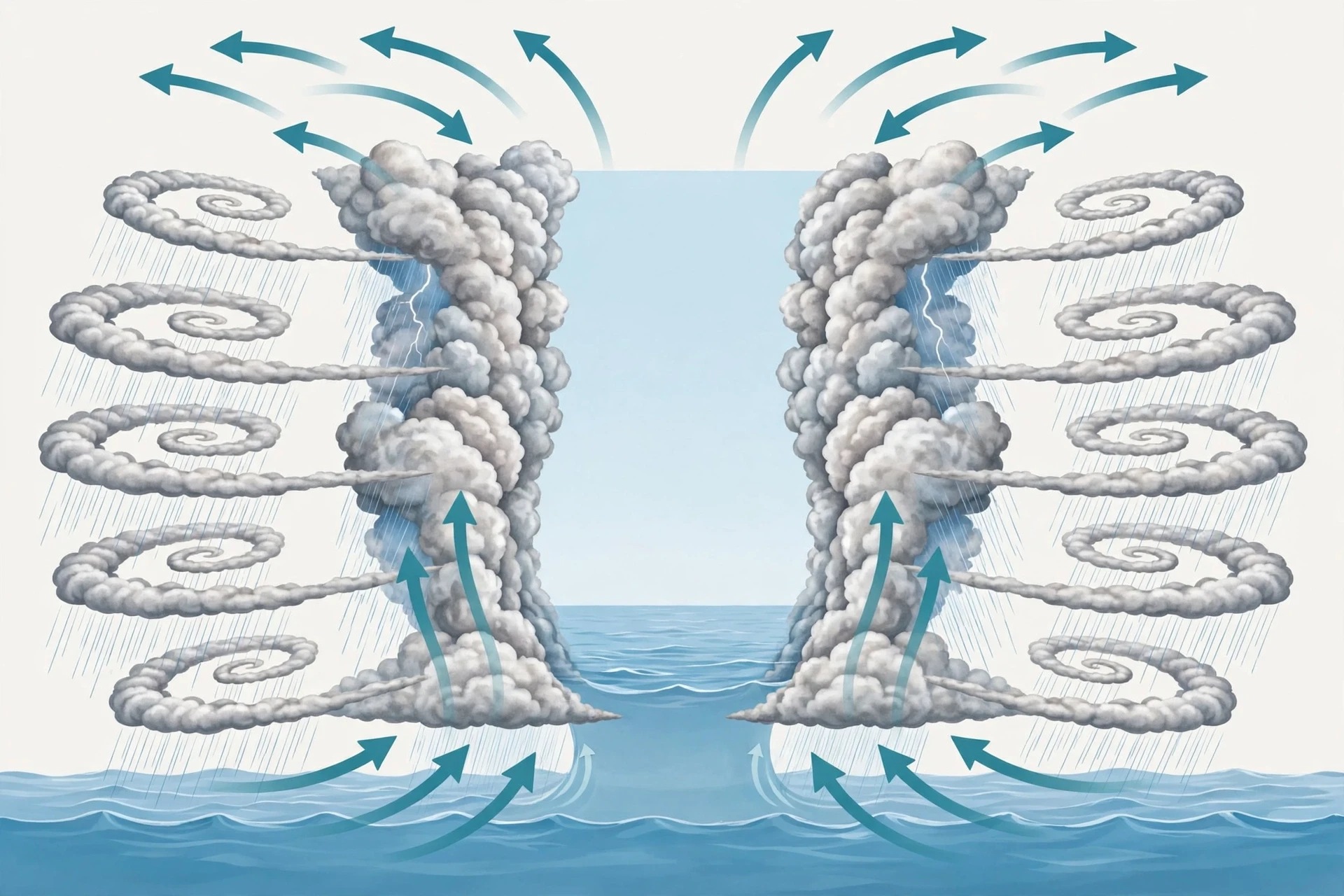
From the outside, a hurricane looks like a single swirling mass. From the inside, it has distinct parts, and each part brings different weather. Knowing the parts matters, because the experience of a hurricane depends entirely on which part passes over you — and the calmest part sits right next to the most violent.
4.1 The eye: a calm centre
The eye is a roughly circular area of calm at the centre of the storm, typically 30 to 65 kilometres across, though some eyes are much wider. Inside the eye, winds are light, skies can clear, and rain may stop entirely. The air in the eye is sinking, warming as it descends, which suppresses cloud formation. From a satellite, the eye looks like a dark hole punched through the clouds.
The eye is famous for fooling people. When the eye passes over a town, the storm seems to end. The wind drops, the sun may even come out, and it is tempting to go outside to check the damage. That is exactly the wrong moment to leave shelter, because the other side of the eyewall is coming, and its winds will blow from the opposite direction with the same force. Emergency officials repeat this warning before every landfall, and every season some people learn it the hard way. If the calm arrives, stay inside. The storm is only half over.
4.2 The eyewall: where the worst weather lives
Around the eye sits the eyewall, a ring of towering thunderstorms that holds the storm's strongest winds and heaviest rainfall. This is the most dangerous part of a hurricane. The air here rises violently, carrying moisture upward at tremendous speed, and the winds at the surface reach their peak. When a hurricane makes landfall, the damage is worst in the places the eyewall passes over, and the damage track follows the eyewall's path.
The eyewall is not always a perfect ring. Sometimes it undergoes an eyewall replacement cycle: a new, wider eyewall forms outside the old one, the old one collapses, and the new one contracts. During this process the storm often weakens temporarily, then can strengthen again. Forecasters watch these cycles closely, because they can change the size of the storm — a storm with a wider eye after replacement can affect a larger area, even if its peak winds drop slightly.
4.3 Rain bands: spiralling arms of storms
Outside the eyewall, spiral rain bands wrap around the storm like arms. These bands are lines of thunderstorms separated by gaps of lighter rain or even clear sky. They can extend hundreds of kilometres from the centre, so a coastal town can experience heavy rain and gusty winds hours before the hurricane's centre arrives. The rain bands also contain most of the storm's tornadoes: small, fast-spinning funnels that form inside the bands, especially in the right-front quadrant of the storm in the Northern Hemisphere.
I have always found the rain bands strangely deceptive. On a radar loop they look like gentle swirls, almost decorative. On the ground, a single rain band can drop several centimetres of rain in an hour and spin up a tornado with almost no warning. The beauty of the pattern and the violence inside it sit side by side.
4.4 The outflow: the storm's exhaust
At the top of the hurricane, around 15 kilometres up, air flows outward away from the centre. This outflow is the storm's exhaust system. For the storm to keep running, air must leave at the top as fast as it enters at the bottom. When the outflow is strong and well organised, the storm can intensify. When something blocks the outflow — for example, another weather system sitting on top of the storm — the engine chokes and the hurricane weakens. A storm with a clear, symmetric outflow is a storm with room to grow.
5. The Saffir-Simpson Scale: What the Categories Really Mean
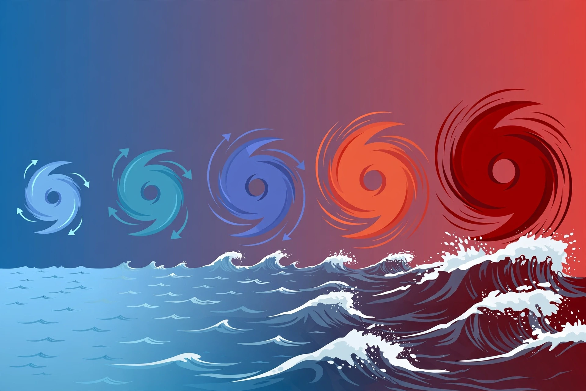
The Saffir-Simpson Hurricane Wind Scale is the system forecasters use to classify hurricanes by their sustained wind speed, from Category 1 to Category 5. It was developed in the 1970s by engineer Herbert Saffir and meteorologist Robert Simpson, and it remains the standard in the Atlantic basin. The scale is a wind scale only. It says nothing directly about rainfall, storm surge, or the size of the storm — and that limitation matters, as the next sections will show.
The table below gives the wind speeds and the typical damage for each category. Read it carefully, because the jump between categories is bigger than it looks: wind damage rises steeply with speed, so a Category 4 storm is not just a little worse than a Category 3. It is a different kind of event.
Category | Sustained winds (mph) | Sustained winds (km/h) | Typical damage |
|---|---|---|---|
1 | 74–95 | 119–153 | Damage to roofs, gutters, and unanchored structures; large tree branches snap; power outages may last days. |
2 | 96–110 | 154–177 | Major roof and siding damage; many trees uprooted; near-total power loss for days to weeks. |
3 | 111–129 | 178–208 | Devastating damage: roofs torn off well-built homes, many trees uprooted, electricity and water unavailable for weeks. |
4 | 130–156 | 209–251 | Catastrophic damage: most roofs lost, exterior walls collapse on some homes, most trees snapped or uprooted, power outages for months. |
5 | 157 or higher | 252 or higher | Catastrophic damage: a high percentage of framed homes destroyed, total roof failure, power outages for weeks to months, areas uninhabitable for months. |
5.1 Category 1 and 2: dangerous, not minor
It is easy to hear "Category 1" and relax. That is a mistake. A Category 1 hurricane carries winds strong enough to tear off roofs, hurl debris, and knock out power for days. Its storm surge can flood coastal roads, and its rain can trigger flash floods inland. People die in Category 1 hurricanes every season — usually from water, not from wind. The category number describes the wind. It does not describe the risk to your life.
Category 2 storms add a large step up in damage. Trees that survived a Category 1 come down, roofs that held start to fail, and power outages stretch from days into weeks. Emergency services may not be able to respond during the storm, and the period after the storm — without power, water, or passable roads — can be as hard as the storm itself.
5.2 Category 3, 4, and 5: major hurricanes
Forecasters call Categories 3, 4, and 5 "major hurricanes," and the name is earned. A Category 3 storm can strip the roof from a well-built home. A Category 4 can destroy large parts of a town's housing. A Category 5, with winds above 157 mph, can leave a landscape that looks unrecognisable — homes flattened to their foundations, forests stripped bare, and entire neighbourhoods uninhabitable for months.
Two things are worth knowing about the top of the scale. First, there is no Category 6, and there are good reasons not to add one: the scale already describes total destruction at Category 5, and a higher number would not change what people should do, which is to leave the area. Second, a storm's category can change fast. A Category 2 storm can become a Category 4 overnight over very warm water, which is why forecasters stress preparation before the storm arrives, not after the category number climbs.
The Saffir-Simpson scale measures wind, not danger. A slow Category 1 storm that stalls and dumps rain for three days can kill more people than a fast-moving Category 4 that crosses the coast in six hours.
5.3 What the scale leaves out
The scale's biggest gap is water. Storm surge, rainfall flooding, and tornadoes are not part of the category number, yet water causes the great majority of hurricane deaths. A large Category 2 storm pushing a huge surge can flood more coastline than a compact Category 4. A storm that barely qualifies as a hurricane can stall and drop a metre of rain on one city. This is why the National Hurricane Center now issues separate storm surge watches and warnings, and why forecasters talk about rainfall totals and surge heights as loudly as they talk about wind speed. The category is a starting point for understanding a storm, not the whole story.
For the official definitions and the latest guidance on each category, the National Hurricane Center's Saffir-Simpson page is the source forecasters themselves use.
6. Storm Surge: The Deadliest Part of a Hurricane
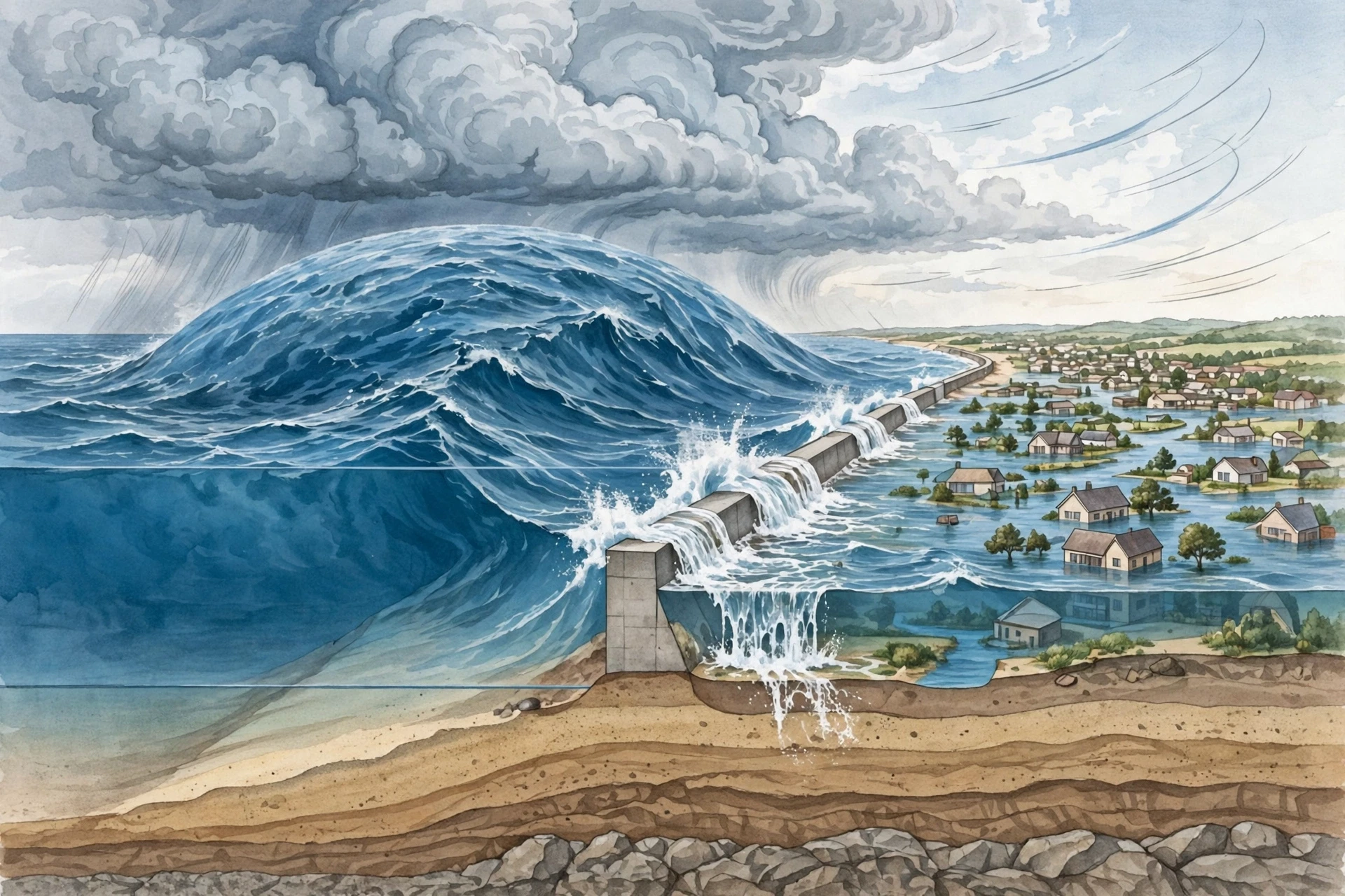
If you remember one thing from this article, make it this: water kills more people in hurricanes than wind does. And within water deaths, storm surge is the leading cause. Storm surge is the abnormal rise of seawater above the normal tide level, pushed ashore by a hurricane's winds. It is not a wave. It is a dome of water, kilometres wide, that rises as the storm approaches the coast and floods everything in its path. A surge of just two metres can sweep away cars, destroy ground-floor rooms, and make roads impassable. A surge of five or six metres can submerge entire neighbourhoods.
6.1 How surge forms
As a hurricane approaches the coast, its powerful winds push surface water toward the shore. The water has nowhere to go, so it piles up. The lower the pressure at the storm's centre, the more the sea surface can rise, but wind is the main driver — the strong onshore winds in the storm's right-front quadrant do most of the pushing. The shape of the coastline matters enormously. A gently sloping continental shelf, a bay, or a funnel-shaped estuary can amplify surge, while a steep coastline may see less. This is why two towns hit by the same storm can experience very different flooding.
Surge is measured above the normal astronomical tide, and the total water level is the surge plus the tide plus the waves riding on top. If a hurricane makes landfall at high tide, the total can be a metre or more higher than the surge alone. A storm that arrives at low tide may spare a town that the same storm would have drowned at high tide.
6.2 Why surge is so hard to escape
Surge water moves fast and carries debris. It is not a slow, gentle flood. It arrives as a rushing wall of water filled with sand, wood, cars, and pieces of buildings, and it can rise several metres in minutes. People who try to drive through surge water discover too late that a car floats in surprisingly little water — about 60 centimetres of moving water can sweep a car away, and 30 centimetres can knock an adult off their feet. The National Hurricane Center's storm surge guidance, available at the NHC storm surge page, exists because surge is the part of a hurricane that most often turns a survivable storm into a deadly one.
Most people assume the wind is the main threat, but what the records actually show is that water accounts for the overwhelming majority of deaths from hurricanes in the United States, and surge is the largest single share of that toll. That is not a small correction to a minor detail. It changes what preparation means: the most important decision in a hurricane is often not how strong your windows are, but whether you are in a surge evacuation zone at all.
6.3 Surge, tide, and waves: three different things
Readers often mix up three terms, so here is the distinction. Storm surge is the rise in sea level caused by the storm's winds and low pressure. Storm tide is the total water level: surge plus the normal astronomical tide. Waves are the wind-driven surface ripples riding on top of the storm tide, and they add their own destructive battering to buildings and seawalls. A forecast that says "surge of 3 metres" does not include the tide or the waves. The actual water at your door could be higher, and emergency managers plan for the total, not for the surge number alone.
7. The Other Dangers: Rain, Wind, and Tornadoes
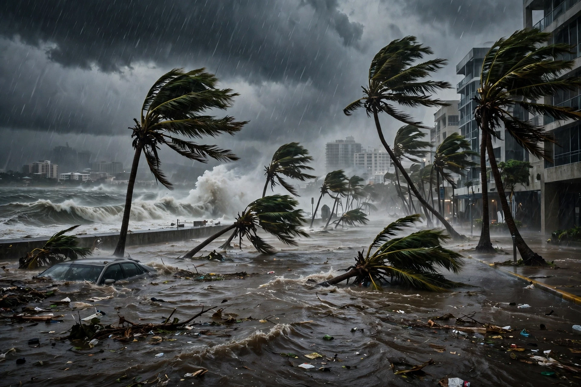
Wind gets the headlines and the category number, but a hurricane brings a full set of hazards, and they do not all arrive at the same time or in the same place. Some of the worst damage happens far from the coast, hours or days after landfall, in towns that never felt the strongest winds at all.
7.1 Rainfall and inland flooding
Hurricanes are rain machines as much as windstorms. Warm, moist air rises through the storm, condenses, and falls as rain — sometimes at rates of several centimetres per hour, sustained for hours. When a storm moves slowly or stalls, the same area gets rained on again and again, and the totals become extraordinary. Rivers rise, dams are tested, and flash floods sweep through streets and valleys. Inland flooding is the second-leading cause of hurricane deaths, after surge, and it can happen hundreds of kilometres from the coast.
The worst flooding often comes from storms that weaken after landfall. A hurricane that drops to tropical-storm strength over land can still carry enormous amounts of moisture, and if it stalls against a mountain range or a weather front, it can dump rain on the same watershed for days. Residents inland sometimes feel safe because the wind has eased, while the water is still rising around them. The lesson is simple: a hurricane is not over when the wind dies down. It is over when the rain stops and the rivers fall.
7.2 Wind damage and flying debris
Wind damage follows a clear pattern. Roofs fail first, often starting at the edges and corners where the wind gets underneath. Once a roof is gone, rain pours into the house, and the walls lose their support. Windows break, and the wind entering a house can push up on the roof from inside, like air inflating a bag. Trees fall on houses and power lines, and loose objects — roof tiles, signs, garden furniture, pieces of fencing — become projectiles travelling at highway speeds.
The force of wind grows with the square of its speed: doubling the wind speed quadruples the force on a building. This is why the jump from Category 2 to Category 4 is so much more destructive than the numbers suggest, and why building codes in hurricane-prone regions focus on roof connections, window shutters, and garage doors. A garage door that fails can let wind into a house and lift the roof from the inside out.
7.3 Tornadoes inside hurricanes
Hurricanes spin up tornadoes, usually in the outer rain bands and most often in the right-front quadrant of the storm, relative to its direction of travel. These tornadoes are usually weaker and shorter-lived than the tornadoes of the Great Plains, but they are dangerous precisely because they arrive with little warning during a storm when people are already sheltering, and because they can form far from the hurricane's centre. A tornado watch issued during a hurricane is not a formality. It means the conditions inside the rain bands are right for funnels to form, and the safest place is an interior room on the lowest floor, away from windows.
7.4 Power, water, and the long aftermath
For many people, the hardest part of a hurricane is not the night of the storm but the weeks after it. Power lines lie across roads, water treatment plants flood, mobile networks fail, and fuel and food run short. Hospitals run on generators, and the elderly and the ill are the most vulnerable. This long aftermath is why preparation matters as much as the storm itself: a household that can live without power and running water for several days is a household that does not need to be rescued.
8. How Hurricanes Are Tracked and Forecast
A century ago, a hurricane could strike a coast with almost no warning. Ships at sea were the only observers, and a storm that stayed offshore was invisible until it arrived. Today, hurricanes are among the most closely watched weather events on Earth, tracked by satellites, aircraft, radar, and buoys, and forecast by models that run on some of the most powerful computers in the world. The improvement in forecasting is one of the great quiet successes of modern science — and it has saved countless lives.
8.1 Satellites: the eye in the sky
Geostationary satellites sit above the equator and stare at the same patch of ocean continuously, sending back a new image every few minutes. Forecasters use these images to locate a storm's centre, estimate its strength from the cloud pattern, and watch for signs of organisation or decay. Other satellites pass overhead in polar orbits, measuring sea surface temperature, rainfall rates, and wind speeds over the ocean, including the winds inside the storm itself. Without satellites, there would be no forecasting of hurricanes as we know it. The ocean is too big, and the storms too far from land, for any ground-based network to watch them.
8.2 Hurricane Hunter aircraft
Satellites see the top of the storm. To see the inside, forecasters send aircraft — the famous Hurricane Hunters, flown by the US Air Force Reserve and NOAA. These planes fly directly through the storm, measuring wind speed, pressure, temperature, and humidity at flight level, and dropping instruments called dropsondes that parachute down through the storm, radioing back data all the way to the sea surface. The most important number they measure is the central pressure, because a falling pressure means a strengthening storm, and that measurement cannot be made reliably from space.
I remember watching footage of a Hurricane Hunter flight for the first time and being struck by how ordinary the crew looked — calm, methodical, checking instruments — while the plane shook through the eyewall. The data those flights collect goes straight into the forecast models, and the forecast cone on the evening news is, in a very direct way, drawn from measurements taken inside the storm itself.
8.3 The forecast cone and its limits
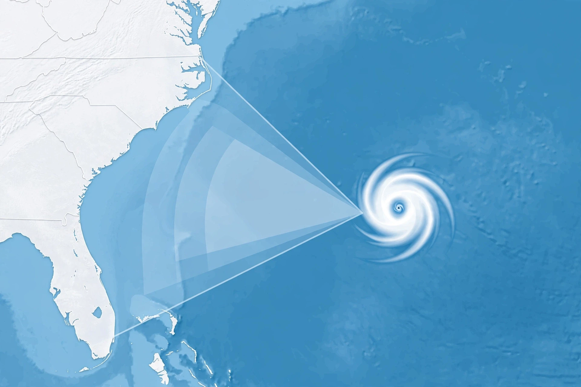
The forecast cone is probably the most widely seen weather graphic in the world, and also one of the most misunderstood. The cone shows the probable path of the storm's centre over the next five days, based on the track forecast. It does not show the size of the storm, the area that will experience dangerous weather, or the area that should evacuate. A town outside the cone can still be hit by rain bands, surge, and tornadoes, because the storm's dangerous weather extends far beyond its centre. And a town inside the cone is not guaranteed to be hit. The cone is a statement about the centre's path, not a map of danger.
Forecasters also publish wind-speed probabilities, storm surge warnings, and rainfall forecasts, and these matter more for individual decisions than the cone alone. If you live on the coast, the surge warning for your zone matters more than whether the centre of the cone passes over your town. If you live inland, the rainfall forecast matters more than the wind category.
8.4 How accurate are hurricane forecasts?
Track forecasts have improved dramatically. A five-day track forecast today is roughly as accurate as a three-day forecast was twenty years ago. Intensity forecasts — predicting how strong the storm will be — have improved more slowly, because intensity depends on small-scale processes inside the storm and on the temperature of the water just below the surface, both of which are hard to measure. Rapid intensification remains the hardest problem in hurricane forecasting, and it is an active area of research.
Forecasters are honest about this uncertainty, and they show it. The cone widens with time because the future is less certain further ahead. The official forecast is updated every six hours, with intermediate updates when a storm threatens land. Checking the latest forecast, rather than relying on one seen a day earlier, is one of the simplest safety habits a coastal resident can build. For a fuller picture of how weather forecasts are assembled from observations and models, see the guide to Meteorology.
9. Hurricanes and a Warming Climate
Few questions about hurricanes are asked more often than this one: is climate change making hurricanes worse? The honest answer is more interesting than a simple yes or no, because climate change affects different parts of a hurricane in different ways. Scientists at NOAA, NASA, and universities around the world have studied this carefully, and the picture that has emerged is one of nuance, not slogans.
9.1 What the evidence shows
The clearest finding is about rainfall. A warmer atmosphere holds more water vapour — about 7 percent more for each degree Celsius of warming — and hurricanes, which are already rain machines, can therefore drop more rain than they used to. When a storm stalls, as Hurricane Harvey did over Texas in 2017, the rainfall totals can be staggering. Researchers studying Harvey's rainfall found that climate change had increased the odds of such extreme rainfall, and the same physics applies to other storms: warmer air, more moisture, heavier rain.
A second finding concerns intensity. The strongest storms — the Category 4 and 5 hurricanes — appear to be getting stronger, and a larger share of storms now reach major-hurricane strength. Warmer ocean water gives storms more energy to draw on, and there is evidence that the proportion of the most intense storms is rising, even if the total number of storms is not. This is consistent with the physics: more fuel in the ocean should produce stronger storms at the top end.
9.2 What is still uncertain
The total number of hurricanes each year is a different question, and here the answer is less clear. Some studies suggest the overall number of hurricanes each year may stay the same or even fall slightly, because changes in wind shear and atmospheric patterns could make it harder for storms to form, even as warmer water makes the ones that do form stronger. In other words, the future may hold fewer storms, but a bigger share of very strong ones. That is a plausible outcome, not a settled fact, and researchers still disagree on the details.
9.3 Sea level rise and storm surge
One effect is not uncertain at all. Sea levels are rising as the ocean warms and expands and as land ice melts, and higher sea level means that the same storm surge now starts from a higher baseline and reaches further inland. A surge that would have stopped at the beach fifty years ago can now push into streets and homes. This is true regardless of whether storms themselves change, and it is one of the reasons coastal planning has become urgent in low-lying regions. For the wider story of how a warming planet is changing weather and oceans, see the guide to Climate Change.
9.4 What this means for coastal communities
The practical message is not panic but preparation. The storms of the coming decades are likely to bring heavier rain, higher surge on top of higher seas, and a larger share of very intense storms. Buildings, drainage, evacuation plans, and insurance systems designed for the storms of the past may not match the storms of the future. Communities that update their flood maps, strengthen their building codes, and protect their wetlands — which absorb surge and slow floodwater — will be better placed than those that do not. The climate story of hurricanes is ultimately a story about risk, and risk can be reduced, even when the storms themselves cannot be stopped.
10. History's Most Destructive Hurricanes
Hurricane history is a record of lessons learned, often at terrible cost. Each major disaster changed something: a building code, a forecasting practice, an evacuation policy. Knowing the history is not morbid curiosity. It is how we understand what these storms can do and what mistakes to avoid repeating.
10.1 Katrina, 2005: the surge that broke a city
Hurricane Katrina made landfall on the US Gulf Coast in August 2005 as a Category 3 storm at landfall, though it had reached Category 5 over the Gulf. Its most destructive force was not its wind but its storm surge and the flooding that followed, above all in New Orleans, where levees failed and much of the city went under water. More than a thousand people died, and the damage ran to roughly $125 billion, making Katrina one of the costliest natural disasters in American history. The disaster exposed failures in levees, in evacuation planning for people without cars, and in the emergency response — and it led to a major rebuilding of New Orleans' flood defences and to reforms in disaster management.
10.2 Harvey, 2017: the rain that would not stop
Hurricane Harvey struck Texas in August 2017 and then stalled, dropping extraordinary amounts of rain on the Houston area over several days. Some places received more than a metre of rain, and the flooding damaged or destroyed hundreds of thousands of homes. Harvey's damage was also estimated at roughly $125 billion, tying it with Katrina as one of the costliest hurricanes on record. The lesson of Harvey was about rain: a storm does not need record winds to cause record damage. A storm that stops moving over a city can do more harm with water than a stronger storm that passes through quickly.
10.3 Maria, 2017: a long aftermath
Hurricane Maria struck Puerto Rico in September 2017 as a Category 4 storm, knocking out power to the entire island. The aftermath was worse than the storm itself: large parts of the island went without electricity for months, and the death toll from the prolonged loss of power, water, and medical care was far higher than the toll on the day of the storm. Maria is a stark reminder that a hurricane's damage is measured not only in the hours of wind and rain, but in the months it takes a community to recover — and that the poorest and most isolated communities recover slowest.
10.4 Sandy, 2012: the storm that was not a hurricane at landfall
Hurricane Sandy is a case study in why labels can mislead. Sandy was nearly 2,000 kilometres across, and when it reached New Jersey and New York in October 2012 it had technically transitioned into a post-tropical cyclone — no longer a hurricane by the formal definition. The surge it pushed into New York Harbor flooded subways, tunnels, and neighbourhoods, and the damage ran into the tens of billions of dollars. Sandy taught forecasters and the public that a storm's danger is not contained in its category or even in its name. Size, surge, and the vulnerability of the place it hits matter just as much.
10.5 The lesson of history
Every one of these hurricanes changed something. Katrina changed flood defences and disaster planning. Harvey changed how forecasters talk about rainfall. Maria changed how the recovery of an island is planned. Sandy changed how New York thinks about coastal flooding. The pattern is consistent: the storm reveals a weakness, and the rebuilding fixes it — until the next storm reveals another. The best use of this history is to fix the weakness before the storm finds it.
11. Common Misconceptions About Hurricanes
Hurricanes are surrounded by myths, and some of them are dangerous. Here are the ones forecasters hear most often, and what the evidence actually says.
11.1 "The category tells you how dangerous the storm is"
This is the most common misconception, and the most dangerous. The category measures wind speed only. It says nothing about storm surge, rainfall, the size of the storm, or how slowly it is moving. A large, slow Category 1 storm can flood more homes than a compact, fast-moving Category 4. Judge a storm by the full forecast — surge warnings, rainfall totals, and evacuation orders — not by its category number alone.
11.2 "Opening windows will save your house"
This old advice claims that opening windows equalises the pressure and stops a roof from blowing off. It is wrong. Wind damage comes from the force of the wind on the building and from wind entering through broken windows and doors, not from a pressure difference between inside and outside. Opening windows lets wind and rain in, and it can help lift the roof from the inside. Keep windows closed and shuttered, and shelter in an interior room.
11.3 "Taping windows stops them breaking"
Taping a window does nothing useful. It does not make the glass stronger, and it can make the broken pieces larger and more dangerous when the window fails. If you cannot fit proper shutters or plywood, the honest answer is that the window may break, and the plan should be to shelter away from windows, not to tape them. Tape is a ritual that feels like preparation without providing any.
11.4 "The eye is the safest place"
The eye is calm, but it is surrounded by the eyewall, and it moves. When the eye passes over you, the calm is temporary, and the wind will return from the opposite direction, often just as strong. People have been injured going outside during the eye to inspect damage or take photographs. The eye is not a safe place. It is the middle of the storm, and the storm is not over.
11.5 "A hurricane cannot produce tornadoes"
It can, and it does. Hurricanes regularly produce tornadoes in their outer rain bands, sometimes dozens of them across a region. They are usually weaker than the tornadoes of the Great Plains, but they can still destroy homes and kill people, and they can form with very little warning while the hurricane is still raging. Take tornado warnings during a hurricane seriously.
11.6 "If I survived the last one, I will survive the next"
Every storm is different. The last hurricane may have missed your street, arrived at low tide, moved quickly, or weakened before landfall. The next one may stall, arrive at high tide, or take a slightly different track that puts your neighbourhood under the eyewall. Past luck is not protection. Evacuation orders are based on the storm in front of you, not on the one you remember.
Most people assume that surviving a hurricane is about being strong enough to ride out the wind. What the evidence actually shows is that surviving is mostly about making the right decision early — leaving a surge zone before the water rises, and staying inside while the storm passes.
12. How to Prepare for a Hurricane
Preparation is not complicated, but it is time-sensitive. The best time to prepare for hurricanes is before hurricane season starts. The second-best time is the moment a storm is named and a watch is issued. The worst time is the night before landfall, when the shops are empty, the roads are jammed, and the weather is already turning. A little planning, done early, turns a frightening event into a manageable one.
12.1 Know your risk before the season starts
The first step is information. Find out whether you live in a storm surge evacuation zone, a flood zone, or an area that loses power easily. Your local emergency management office publishes evacuation zone maps, and your flood risk is a matter of public record. Know your evacuation route and where you would go — a friend or relative inland, a hotel, or a public shelter. If you live in a surge zone and an evacuation order is issued, leave. No house is worth a life, and emergency services cannot reach you during the worst of the storm.
12.2 Build a kit that lasts at least three days
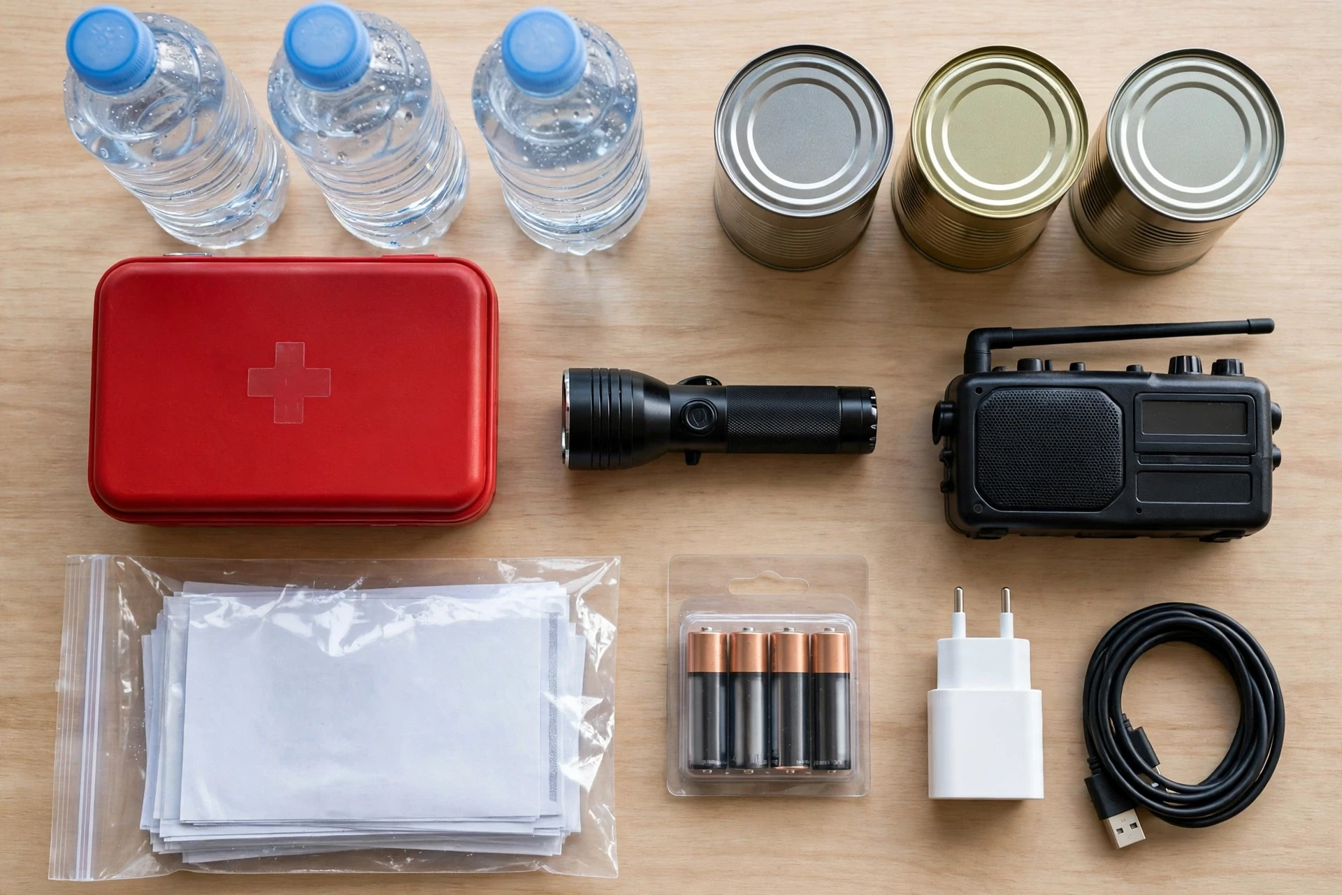
Emergency officials recommend enough supplies for at least three days without power or running water, and a week is better. The basics are water — about four litres per person per day — non-perishable food, a manual can opener, a flashlight and extra batteries, a battery-powered or hand-crank radio, a first aid kit, prescription medicines, important documents in a waterproof bag, phone chargers, cash, and supplies for pets and babies. Keep the kit in one place, check it at the start of every season, and replace anything that has expired.
I keep a small kit of my own, and I check it every year at the start of summer — rotate the water, check the batteries, make sure the documents are still in the bag. The point of a kit is not that you expect the worst. It is that you never have to think about the basics while the storm is coming, because the thinking is already done.
12.3 Protect your home, then your documents
Before a storm, bring in anything that can become a projectile: garden furniture, bins, plant pots, children's toys. Close and shutter windows, or board them with plywood. Secure the garage door, which is one of the weakest points of a house in high wind. Take photographs of your home and your belongings for insurance, and store copies of important documents — identification, insurance policies, medical records — in a waterproof container and, if possible, as digital copies somewhere you can reach them from anywhere.
12.4 During the storm: stay inside, stay low, stay away from windows
When the storm arrives, stay indoors, in an interior room on the lowest floor that is not at risk of flooding. Stay away from windows and glass doors. Do not go outside during the eye. Do not drive through flooded roads — the depth of floodwater is impossible to judge from a car, and most flood deaths in vehicles happen because a driver misjudged a few centimetres of water. If floodwater rises in your home, move to the highest floor, but never into a sealed attic without a way out. And keep a battery-powered radio on, because it may be your only source of information if the power and mobile networks fail.
12.5 After the storm: the dangers do not end
After the storm passes, the hazards change shape. Floodwater can hide live power lines, sharp debris, and contamination, and damaged buildings can collapse without warning. Do not use a generator indoors or in a garage — carbon monoxide from generators kills people after almost every major hurricane. Drink only water that officials say is safe, and be careful with chainsaws and ladders during cleanup. Check on neighbours, especially older people and those living alone: the first days after a storm are when neighbours matter most.
For detailed, official safety guidance, the National Weather Service hurricane safety page at weather.gov and the hurricane preparedness guide at weather.gov are the sources emergency officials themselves point people to.
13. What Hurricanes Teach Us
A hurricane is a reminder of how much power the natural world still holds, and how small our control over it really is. We cannot stop hurricanes from forming, steer them away from a coast, or weaken them on demand — though researchers have studied ideas for doing so, from cloud seeding to cooling the sea surface, and none of them has proved practical at the scale of a real storm. What we can do is understand these storms, forecast them better, build for them more wisely, and get out of their way when they come.
That is not a small achievement. A century ago, a hurricane could arrive without warning and kill thousands before anyone knew it was coming. Today, a storm is tracked for days before landfall, its path forecast with remarkable accuracy, and whole cities evacuated in time. The science of hurricanes — satellites, aircraft, models, surge forecasts — is one of the clearest examples of knowledge turning into saved lives.
There is also something else hurricanes teach us, and it is less technical. They teach us that water, not wind, is the real danger; that a category number is not a risk rating; that the poorest communities suffer longest; and that preparation, done early and calmly, matters more than courage in the middle of the storm. The next hurricane season will come, as it always does. The question is not whether the storms will arrive, but whether we will be ready when they do. Understanding how hurricanes work is the first step, and it is a step anyone can take — starting with this article, and finishing with a plan, a kit, and a route out of the surge zone.
Frequently Asked Questions
How do hurricanes form?
Hurricanes form over warm ocean water of at least 26.5°C (80°F), when moist air rises, cools, and condenses, releasing heat that powers the storm. The Coriolis effect from Earth's rotation organises the rising air into a spin, low wind shear keeps the storm upright, and a pre-existing disturbance — usually a tropical wave off Africa — gives it a centre to organise around. All five ingredients must be present at the same time.
What is the difference between a hurricane, a typhoon, and a cyclone?
There is no physical difference. All three are tropical cyclones, and the name depends on where the storm forms. Hurricanes form in the Atlantic and eastern Pacific, typhoons in the western Pacific, and cyclones in the Indian Ocean and around Australia. The structure, the dangers, and the physics are the same.
What is the strongest hurricane category?
Category 5 is the highest on the Saffir-Simpson scale, with sustained winds of 157 mph (252 km/h) or higher. There is no Category 6, because Category 5 already describes catastrophic damage, with most homes destroyed and areas uninhabitable for months. A Category 5 storm's winds can strip trees bare and flatten well-built buildings.
What is storm surge, and why is it so dangerous?
Storm surge is the abnormal rise of sea level pushed ashore by a hurricane's winds, on top of the normal tide. It is dangerous because it arrives as a fast-moving wall of water that can rise several metres in minutes, sweeping away cars, destroying ground floors, and flooding whole neighbourhoods. Surge causes more hurricane deaths than wind, which is why evacuation orders are usually based on surge zones.
Can hurricanes happen outside hurricane season?
Yes, though it is rare. The Atlantic hurricane season officially runs from 1 June to 30 November, and most storms form between August and October, when the ocean is warmest. Occasionally hurricanes form in May or December over unusually warm water. Out-of-season storms are usually weaker, but they can still bring heavy rain and flooding.
How long do hurricanes last?
A hurricane typically lasts from a few days to about two weeks. The time from formation to landfall can be a week or more, and the storm may spend days crossing the ocean before it reaches land. Once it moves over land or cold water, it weakens, usually within a day or two, though its rain can continue for days as a tropical depression.
How should I prepare for a hurricane?
Start before the season: know whether you live in a surge evacuation zone, plan your evacuation route, and build a kit with at least three days of water, food, medicines, a radio, a flashlight, and important documents in a waterproof bag. When a storm threatens, follow official evacuation orders, protect your home, and stay indoors during the storm. After the storm, avoid floodwater and fallen power lines, and never run a generator indoors.