

I was eight years old, standing in a schoolyard in the first snow of the year, when a teacher told our class to stick out our tongues and catch a flake. I did what I was told, and then I did something she had not told us to do: I caught one on the dark wool of my mitten and stared at it. It was not a white blob. It was a star, thin as paper — my first glimpse of how snowflakes form, though I did not know the science then — with six arms that split into smaller branches, and branches off those branches, all of it perfect and all of it gone in seconds. I remember the small shock of it — that something so exact could fall out of a grey sky and melt on a child's glove before anyone could keep it. That is the question at the heart of this article: how snowflakes form, and how a cloud full of invisible vapour turns into geometry you can see with your naked eye.
A snowflake is not a frozen raindrop. It never was liquid water falling from the sky. It grows the other way around: water vapour in a cloud turns straight into ice, molecule by molecule, on a tiny speck of dust or pollen, and the crystal that grows from that speck is shaped by the air it falls through. Every arm, every branch, every needle and plate is a record of the temperatures and humidities the flake passed through on its way down. Read a snowflake the right way and you can read the cloud it came from, the way a tree ring records a summer.
This guide follows that journey from beginning to end. We will start inside a single water molecule, because the six-sided shape of a snowflake is already written there, in the angle between two hydrogen atoms. Then we will climb into a cloud, watch the first crystal take hold on a speck of dust, follow it as it branches, and see how temperature and humidity decide whether it becomes a flat plate, a long needle, or a feathery star. Along the way we will meet the farmer who photographed thousands of snowflakes on black velvet in Vermont, the physicist who learned to grow designer snowflakes in a laboratory, and the snow surveyors who weigh winter itself to predict a summer's water. We will also clear up the myths — about identical flakes, about frozen rain, about what snow really is — and finish with the part that matters most: what happens after a snowflake lands, when trillions of them together become the snowpack that stores water, reflects sunlight, and shapes the climate of whole continents.
1. What a Snowflake Really Is
A snowflake is a single crystal of ice, or a cluster of crystals stuck together, that grew directly from water vapour in a cloud. That one sentence carries most of the science in this article, so it is worth unpacking slowly. A crystal is a solid in which the atoms or molecules are arranged in a repeating, orderly pattern. In ice, water molecules lock into a hexagonal lattice — a honeycomb pattern that repeats in three dimensions — and that lattice is the reason a snowflake has six sides instead of five or eight. The flake you catch on your sleeve is not a random lump. It is a piece of that lattice grown large enough to see.
Snowflakes are small, and part of how snowflakes form explains why. A typical one measures a few millimetres across, about the width of a pencil eraser or smaller, though the feathery dendrites that fall in calm, moist air can reach a centimetre or more. The largest snowflakes ever reliably measured were reported in Montana in the late nineteenth century, at around 38 centimetres across — flakes so wide they were described as being the size of dinner plates. Those giants were almost certainly many flakes stuck together, not single crystals, and they fell in air so still and moist that clumps could grow enormous before gravity pulled them down. Most of the time, what lands on your coat is a single crystal or a small cluster, and it weighs almost nothing. A single snowflake weighs roughly a few milligrams. It takes about a million of them to make a kilogram of snow, and a typical winter storm drops trillions.
Snow is not the same as frozen rain, and the difference is the whole story. Rain freezes when liquid water drops cool below freezing. Snow never passes through the liquid stage at all. It forms when water vapour — the invisible gas form of water — deposits directly onto a solid surface as ice. Scientists call that process deposition, and it is the reverse of sublimation, the process by which ice turns straight back into vapour without melting. You have seen deposition at home without knowing its name: the frost that grows in feathery patterns on a cold window on a winter morning is water vapour from the air inside the room depositing onto the cold glass as ice. A snowflake is that same frost, grown in a cloud instead of on a window, and free to fall.
That distinction explains why snowflakes are crystalline and hailstones are not. A hailstone grows when a lump of ice is tossed up and down inside a thunderstorm, collecting layers of liquid water that freeze onto it. It is built by freezing liquid, layer on layer, like an onion. A snowflake is built by adding vapour, molecule by molecule, onto a growing crystal face. The two processes leave different fingerprints, and you can see the difference with your eyes: hail is a hard, round pellet of layered ice, while a snowflake is a flat, open, branching crystal. Section 8 will lay out the whole family of frozen precipitation side by side, because telling them apart is one of the most useful things a winter watcher can learn.
The word "snowflake" also gets used loosely for two different things, and the looseness causes confusion. Strictly, a snowflake is one ice crystal. In everyday speech, and in most weather reports, a snowflake is whatever falls from the sky — often a cluster of many crystals that bumped into each other and stuck together on the way down. Scientists call those clusters aggregates. When snow falls in big, soft, wet clumps that stick to everything, you are mostly seeing aggregates. When it falls as fine, dry, glittering powder that squeaks under your boots, you are mostly seeing single crystals. Both are snow. Both began the same way, as vapour turning to ice on a speck of dust.
Why does any of this matter beyond curiosity? Because snow is not just weather. It is a reservoir, a mirror, and a messenger. The snowpack that builds up over a winter stores water and releases it slowly in spring, feeding rivers and farms and cities across the western United States, the Himalayas, the Alps, and the Andes. Fresh snow reflects most of the sunlight that hits it, which cools the planet and shapes regional climate. And the shape of snowflakes tells scientists about the clouds they came from — their temperature, their moisture, their turbulence — in a way no instrument inside a cloud can easily match. A snowflake is a small thing that carries large information.
2. How Snowflakes Form Starts With a Bent Molecule
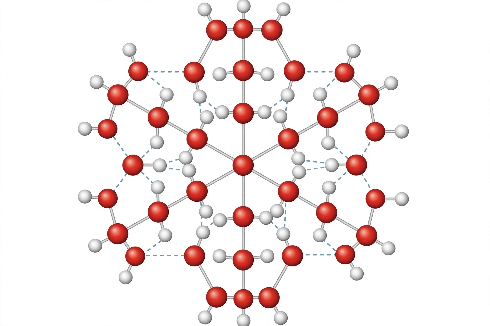
The question of how snowflakes form begins not in a cloud but inside a water molecule, because the shape of the molecule decides the shape of the crystal. A water molecule is two hydrogen atoms attached to one oxygen atom, and the three atoms do not sit in a straight line. They sit in a bent shape, with the two hydrogens on the same side of the oxygen, at an angle of about 104.5 degrees between them. That bend gives the molecule a lopsided distribution of electric charge: the oxygen end carries a slight negative charge, and the hydrogen ends carry a slight positive charge. The molecule is a tiny magnet with two poles, and that polarity is the engine of almost everything water does.
When water molecules slow down enough to lock together as ice, each molecule links to four neighbours through hydrogen bonds — weak electrical attractions between the positive hydrogen end of one molecule and the negative oxygen end of another. Those bonds are weak individually, but together they hold the crystal rigid. And because of the bent shape of the molecule, the most stable way for those bonds to arrange themselves is in a hexagonal pattern: rings of six molecules, stacked in layers, each layer offset from the one below. That hexagonal lattice is the hidden skeleton of every snowflake. The six arms you see on a flake are the six directions in which that lattice grows fastest.
This is why snowflakes have six sides and never five or seven. The number six is not a coincidence, and it is not an aesthetic choice by nature. It is the direct consequence of molecular geometry. Change the angle of the water molecule and you would change the symmetry of the snowflake. The same hexagonal pattern shows up everywhere ice forms: in the frost on your window, in the ice cubes in your freezer, in the glaciers that carve valleys. Look closely at frost on glass some cold morning and you will see the same six-sided stars, the same branching, at a smaller scale. The window is doing, on a flat surface, what a cloud does in open air.
I first saw the connection between the molecule and the flake in a teaching laboratory, on a day when an experiment was going wrong in the most useful way. We were trying to grow large, clear ice crystals in a cold chamber, and the chamber kept frosting over. The frost on the inside of the viewing window grew in perfect little stars, each one six-armed, each one slightly different from its neighbours. A student asked why the frost was so neat when the chamber was so messy, and the honest answer was that the mess was at our scale, not the molecules' scale. Down at the scale of the crystal, the rules are strict: bonds form at fixed angles, and fixed angles make hexagons. The disorder we saw was in the air currents and the temperature gradients, not in the chemistry. That is a pattern you will see again and again in this article: strict rules at the small scale, wild variety at the large scale, and the variety comes from the journey, not from the rules.
Water is a strange molecule in other ways that matter for snow. It expands when it freezes, which is why ice floats and why a bottle of water left in a freezer can crack. It takes a large amount of energy to melt ice or to evaporate water, which is why snow can linger for weeks in shade and why a snowpack melts slowly rather than all at once. And water vapour in the air is invisible — the white puff you see above a kettle is not vapour but tiny liquid droplets that have already condensed. The vapour itself, the gas that feeds a growing snowflake, cannot be seen at all. All of this strangeness is worth a closer look, because snow is water behaving strangely at low temperature, and the strangeness starts with the molecule. If you want the full story of water's oddities, the companion article on why water is the weirdest molecule walks through them one by one, from the bent shape to the floating ice.
2.1 Hydrogen bonds: weak links, strong crystal
A hydrogen bond is about a twentieth as strong as the chemical bond that holds a water molecule together. On its own it is feeble. In a crystal, there are billions of them, and they add up to a rigid solid. The trick is that hydrogen bonds are directional: they form most strongly when the molecules line up at particular angles. That directionality is what turns a pile of molecules into a lattice instead of a jumble. Think of it as the difference between stacking bricks and pouring sand. Bricks have flat faces and fixed angles, so they stack into walls. Sand has no fixed angles, so it piles into a heap. Water molecules are bricks. Their hydrogen bonds are the mortar, and the mortar only sets at certain angles.
Temperature decides how strict those angles are. In warm liquid water, molecules have enough energy to break hydrogen bonds constantly, re-forming them in new arrangements thousands of times a second. The liquid flows because the bonds keep breaking. As water cools, the molecules slow down, the bonds last longer, and the liquid thickens. Below freezing, the molecules no longer have enough energy to break free, and the hexagonal lattice locks in. The freezing point is not a magic line. It is the temperature at which the thermal jiggling of the molecules becomes weaker than the pull of the hydrogen bonds. That is a useful way to think about all phase changes: they are negotiations between heat energy, which shakes things apart, and bonding energy, which holds things together. The OpenStax chapter on phase transitions explains that negotiation with the heating and cooling curves that every chemistry student meets, and it is worth reading if you want the energy numbers behind the story told here.
2.2 Why six, and why not some other number
It is worth pausing on the number six, because it is the most famous fact about snowflakes and the most often misunderstood. People sometimes say snowflakes have six sides because six is a special number in nature, or because of some deep symmetry in the universe. The real answer is more ordinary and more satisfying: six is what you get when you pack bent molecules with tetrahedral bonding into a flat layer. Each water molecule in ice bonds to four neighbours in a roughly tetrahedral arrangement, and when you project that arrangement onto a flat plane, the repeating unit is a hexagon. The crystal grows fastest along six directions in that plane, and slowest in the direction perpendicular to it, which is why snowflakes are flat rather than chunky. A snowflake is wide and thin because its crystal grows outward in six directions much faster than it grows upward.
That flatness matters. A flat crystal falls slowly, fluttering and tumbling, which gives it more time in the cloud to grow. A chunky crystal would fall fast and stay small. The flatness is also why snowflakes are so visible: a thin plate catches light across a broad face, and a sky full of falling plates glitters. And the flatness is why the flakes you catch on a dark sleeve show their pattern so clearly — you are looking at the crystal face-on, the way it grew.
3. Where Snow Begins: Inside a Cloud
Snow begins in a cloud, and not in any cloud. It begins in a cloud that is cold enough, moist enough, and mixed enough for ice to grow. The clouds that make snow are usually the broad, layered clouds of a winter storm — nimbostratus, the grey sheet that covers the sky for hours, or the tall, cold tops of cumulonimbus in a winter thunderstorm — but any cloud whose top reaches well below freezing can produce snow, provided the air below it stays cold enough for the flakes to survive the fall. A cloud is not a thing so much as a place: a region of air where water vapour has condensed into droplets or deposited into crystals, and where those droplets and crystals hang suspended because they are tiny and the air is moving.
Clouds form when moist air rises and cools. Warm air near the ground can hold a lot of water vapour. As it rises, the pressure drops, the air expands, and expansion cools it. Cool air cannot hold as much vapour as warm air, so the excess vapour has to go somewhere — and it goes onto tiny particles in the air, condensing as liquid droplets. That is the birth of a cloud: not a sudden appearance, but a threshold crossed, the moment when rising air becomes too cold to hold all its water as gas. The water cycle article follows that rising air through evaporation, condensation, and precipitation, and snow is one of the cycle's most elegant branches: water that leaves the ocean as vapour, rides the wind for days, and returns to the ground as a crystal.
Inside a winter cloud, the temperature falls with height. Near the base, the cloud may be only just below freezing, and its droplets are liquid — supercooled liquid, which is liquid water that has cooled below zero without freezing. Higher up, where it is colder, ice crystals appear and grow. The coldest part of a cloud, near its top, can be minus 30 or minus 40 degrees Celsius, and there the air is almost entirely ice. A snowflake is born somewhere in that cold upper region, and its whole life is a fall through the layers below, growing as it goes.
The key fact about a winter cloud, and about how snowflakes form inside one, is that it is a mixed-phase cloud: liquid droplets and ice crystals coexist in the same air. That coexistence is unstable, and the instability is what makes snow grow fast. It is called the Bergeron process, after the Swedish meteorologist Tor Bergeron, who worked it out in the 1920s, and it is one of the most important ideas in all of weather science. The rule is simple: at the same temperature below freezing, the air is more saturated with respect to ice than with respect to liquid water. In plain language, ice is greedier than liquid. Water vapour would rather be ice than liquid when it is cold enough, so vapour leaves the liquid droplets and deposits onto the ice crystals. The droplets shrink and evaporate. The crystals grow. A cloud that starts as a crowd of tiny droplets ends up feeding a smaller number of growing crystals, and those crystals become snowflakes.
The Bergeron process is the quiet engine of winter precipitation: ice crystals grow at the expense of liquid droplets, because cold air holds vapour more easily over water than over ice, and the vapour follows the easier path.
I have always liked the Bergeron process because it is an example of a small difference doing large work. The difference in saturation vapour pressure between ice and water is only a few percent. But over minutes and hours, across billions of droplets and crystals, that few percent moves an enormous amount of water from liquid to ice. It is the same kind of leverage you see everywhere in weather: small gradients, huge consequences. A difference of a degree or two in cloud temperature can decide whether a storm drops rain or snow, and a difference of a few percent in humidity can decide whether a flake becomes a plate or a dendrite. Weather is a science of small differences, and snow is one of its sharpest examples.
3.1 The cloud as a factory
Think of a winter cloud as a factory with three inputs: cold air, water vapour, and tiny particles. The cold air sets the rules. The vapour supplies the raw material. The particles supply the starting points. Remove any one of the three and the factory stops. Warm the cloud by a few degrees and the crystals melt into rain. Dry the air and the crystals starve, evaporating before they can grow. Remove the particles — which is almost impossible in the real atmosphere, because the air is full of dust, salt, pollen, and pollution — and the vapour has nowhere to start, and the cloud stays as supercooled droplets that refuse to freeze. That last point surprises people: pure water can cool well below freezing without turning to ice, because freezing needs a starting point, a surface to build on. In a laboratory, a droplet of very pure water can be supercooled to minus 40 degrees before it freezes on its own. In the real sky, dust does the job long before that.
The factory runs on updrafts. Rising air inside a cloud carries droplets and small crystals upward, keeping them suspended while they grow, and the stronger the updraft, the longer a crystal can stay up and the bigger it can get. In a gentle, layered cloud, the updrafts are weak — a few centimetres per second — and the flakes that form are small and simple. In a vigorous winter storm, with stronger lift, flakes can stay aloft longer, grow larger, and develop the elaborate branching that makes the classic snowflake photographs. That is why the most spectacular snowflakes fall in calm, moist, slowly rising air, not in violent storms: the air has to be still enough for the crystal to grow undisturbed, and moist enough to feed it, for a long time.
Clouds also move. A snowflake that begins its life over one town may land over another, and the cloud that made it may have travelled hundreds of kilometres from the ocean where its water evaporated. Snow is a traveller. The water in a flake that lands on a mountain in Colorado may have evaporated from the Pacific days earlier, ridden the wind across the desert, and climbed the mountains in a storm. The water cycle is not a local loop. It is a planetary conveyor belt, and snow is one of its delivery methods.
4. The First Crystal: Nucleation
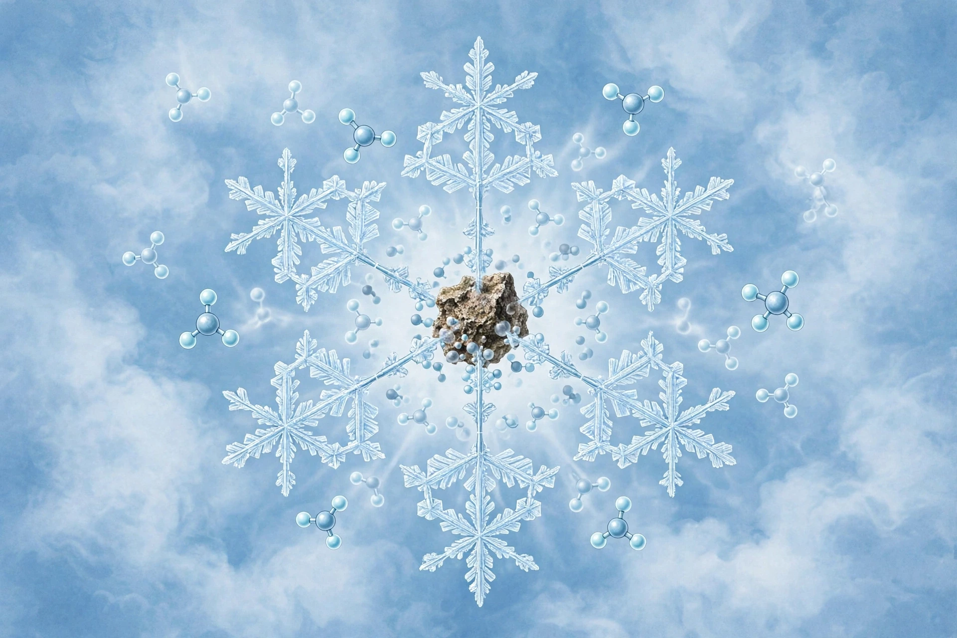
Every snowflake starts with a speck. Water vapour, left to itself in clean air, will not freeze into a crystal at the temperatures found in most clouds. It needs a surface to build on, a template that lowers the energy barrier to forming ice. That surface is provided by an ice nucleating particle: a microscopic speck of dust blown off a desert, a grain of sea salt, a pollen grain, a bacterium, a particle of clay, even a fragment of pollution. The process is called nucleation, and it is the moment a cloud stops being a crowd of droplets and starts making snow.
Nucleation works because forming a brand-new crystal from scratch is expensive, in energy terms. A tiny cluster of ice molecules has a large surface compared with its volume, and the surface costs energy. Below a certain size, a cluster is more likely to fall apart than to grow. A solid particle changes the calculation: water molecules can line up on its surface, borrowing its structure, and the cluster reaches a stable size much sooner. Think of it as the difference between starting a wall in mid-air and starting it against an existing foundation. The foundation does not do the building, but it makes the first course possible. Once the crystal is past a critical size — a few nanometres across, a few hundred molecules — it becomes stable, and from then on, adding more vapour makes it grow rather than dissolve.
Not all particles are equally good at this job. The best ice nucleators have surfaces whose molecular spacing roughly matches the spacing of ice, so water molecules can settle onto them in something close to the hexagonal pattern they prefer. Certain clay minerals are good at it. Some bacteria are astonishingly good at it: a bacterium called Pseudomonas syringae, which lives on plants, produces a protein that arranges water molecules into an ice-like pattern, and it can trigger freezing at temperatures as warm as minus 2 degrees Celsius. That is warmer than almost any other natural nucleator, and it is no accident — the bacterium benefits when frost damages the plant leaves it lives on, releasing nutrients. Nature, as usual, has found a way to turn physics into a living strategy. Silver iodide, the chemical used in cloud seeding, works the same way: its crystal structure is close enough to ice that vapour deposits onto it readily, and seeding a cloud with silver iodide can encourage snow to form where it might otherwise have stayed as droplets.
A snowflake begins on something you would never notice: a speck of dust, a grain of salt, a single bacterium. Without that speck, the cloud would stay liquid, cold and clear, and no snow would fall at all.
The number of nucleating particles in a cloud matters as much as their quality. If a cloud has many active nuclei, the available vapour is shared among many growing crystals, and each one stays small. The result is a large number of small, simple flakes. If a cloud has few nuclei, each crystal gets more vapour to itself and grows larger and more elaborate. That is one reason the same storm can drop fine powder in one place and large, showy flakes in another: the air masses feeding the cloud carried different loads of dust. It is also why snow that falls after a dust storm, or downwind of a desert, can look different from snow that falls in clean maritime air. The sky's dust is part of the snowflake's biography.
I learned how much a speck matters on a winter field trip that was supposed to be about something else entirely. We were measuring snow depth on a mountain ridge, and the wind was carrying fine dust off a dry lake bed miles away. The snow that fell that afternoon was full of tiny, simple plates — thousands of them, all small, all hexagonal, none of them branched. A colleague who had grown up in the same mountains said the snow always looked like that when the wind came from the desert. The dust was seeding the cloud so heavily that no single crystal could get enough vapour to branch. It was a small observation, but it stuck with me: the shape of a snowflake is not just about temperature and humidity. It is about what was floating in the air before the flake was even born.
4.1 Supercooled water and the freezing threshold
Supercooled water deserves a closer look, because it is one of the most counterintuitive facts in this story. Liquid water can exist below zero degrees Celsius — well below it — as long as nothing disturbs it and nothing gives it a surface to freeze onto. Cloud droplets routinely sit at minus 10 or minus 20 degrees, still liquid, waiting for a nucleus. Aircraft flying through such clouds can pick up ice rapidly on their wings, because the supercooled droplets freeze the instant they touch a solid surface. That is a hazard pilots train for, and it is also a laboratory for the physics of nucleation: every droplet that hits a wing is a nucleation experiment, run at 500 kilometres per hour.
The threshold at which water freezes on its own, without any particle at all, is called homogeneous nucleation, and for pure water it happens around minus 38 to minus 40 degrees Celsius. Below that temperature, even perfectly clean water cannot stay liquid. Random clusters of molecules become stable by chance, and the droplet freezes from the inside out. Above that temperature, freezing needs help — a particle, a surface, a disturbance. Almost all snow in the real atmosphere forms by heterogeneous nucleation, the kind that uses a particle, because the air is never clean enough and the temperatures are rarely cold enough for the unaided kind. The cloud tops that reach minus 40 degrees do make ice on their own, but most of the snow that reaches the ground started on dust.
4.2 What the nucleus becomes
Once nucleation has happened, the particle itself is buried inside the growing crystal, and it stays there. Cut a snowflake open — if you could — and at its centre you would find the speck that started it. Scientists have melted snowflakes and analysed the residue to learn what seeded them, and the results read like a census of the atmosphere: desert dust, sea salt, volcanic ash, pollen, soot, bacteria, fungal spores. Each flake carries a tiny sample of the air it was born in. In a way, a snowflake is a time capsule twice over: its shape records the cloud's temperature and humidity, and its core records the cloud's dust.
That core also explains why snow is never chemically pure. The water in a snowflake is clean, but the flake contains whatever the nucleus brought with it, plus whatever gases dissolved into it as it grew. Snow that falls in a city carries traces of the city's air. Snow that falls on a glacier carries the dust of distant deserts, and when that snow is buried and compressed into ice, the dust layers become a record that glaciologists read like a history book, layer by layer, to learn about past climates. The speck that starts a snowflake can end up, centuries later, telling scientists about a drought in a desert the flake never saw.
5. Branching: How Arms Grow
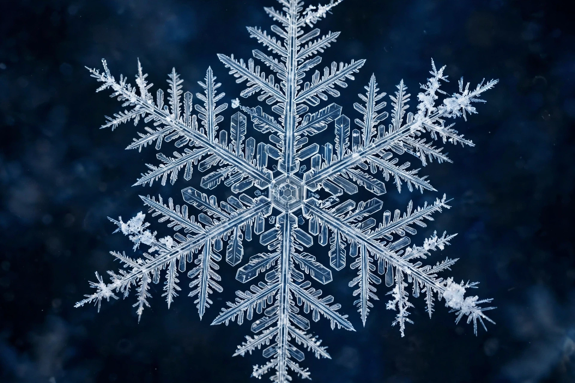
Once the first crystal exists, it grows by deposition: water vapour molecules land on its surface and lock into the lattice. But they do not land evenly. The corners of a hexagonal crystal stick out farther into the surrounding air than the flat faces do, and the air near a corner is slightly richer in vapour than the air near a flat face, because the corner is exposed on more sides. Vapour reaches the corners first, so the corners grow faster than the faces. The crystal's six corners stretch outward into arms. Then the same thing happens again, at a smaller scale: the tip of each arm has corners of its own, and those corners grow faster than the flat sides of the arm, so the arm sprouts side branches. Branches sprout branches. The result is a dendrite — the feathery, tree-like crystal that most people picture when they hear the word snowflake.
This is an instability, and instabilities are how nature makes complex shapes from simple rules. A perfectly flat crystal face is unstable because any tiny bump on it sticks out into richer vapour and grows faster than the flat surface around it, so the bump becomes a bigger bump, and then a branch. The process feeds on itself. It is the same kind of instability that makes frost grow in ferns on a window, and that makes a river delta branch into channels. The physicist who first worked out the mathematics of it, in the context of crystal growth, showed that the branching is not an accident. It is the inevitable result of growth limited by how fast vapour can diffuse through the air to the crystal surface. Where vapour is plentiful and the crystal is growing fast, branching is strong. Where vapour is scarce and growth is slow, the crystal stays compact and faceted.
Branching is not decoration. It is what happens when the corners of a crystal reach fresh vapour before its flat faces do, and the tip of every branch does the same thing again at a smaller scale.
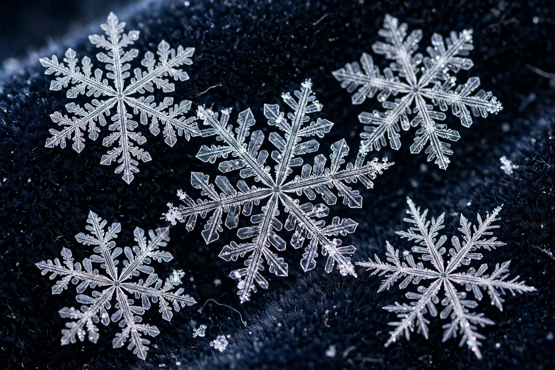
The arms of a snowflake grow in a specific way that keeps the symmetry. All six arms experience the same conditions at the same time, because the flake is small and the air around it is nearly uniform. So all six arms branch in the same pattern, at the same time, and the flake stays six-fold symmetric even as it becomes more complex. That is why a snowflake looks designed: the six arms are not six separate growths. They are one growth, repeated six times by symmetry, and the repetition is exact because the conditions are shared. Break the symmetry — let one arm fall into slightly drier air, or let the flake tumble so one side is sheltered — and the arms diverge. Real snowflakes are rarely perfectly symmetric. The photographs that show perfect stars are the best specimens, chosen from thousands, and the ordinary flake is a little lopsided, a little ragged, and all the more honest for it.
The speed of growth is startling, and it is central to how snowflakes form in real time. A dendritic snowflake can grow from a speck to a visible crystal in minutes, adding millions of molecules a second. The growth is fastest at the tips of the arms, where the vapour supply is richest, and slowest in the sheltered valleys between branches, where the air is depleted. That difference is what keeps the branches thin and sharp: the valleys starve while the tips feast. If you watch a snowflake grow in a laboratory cold chamber — and researchers do exactly that, with microscopes and carefully controlled air — you can see the arms extend in real time, and you can see side branches appear at regular intervals, like a fern unfurling. It is one of the most quietly thrilling sights in all of science: a crystal building itself, molecule by molecule, in front of your eyes.
5.1 Diffusion: the speed limit of growth
Growth by deposition is limited by diffusion, the slow wandering of vapour molecules through the air. A vapour molecule does not fly straight to the crystal. It collides with air molecules thousands of times, zigzagging in a random walk, and only by chance does it arrive at the crystal surface. The crystal can only grow as fast as diffusion can deliver new molecules, and diffusion is slow over distances of more than a millimetre or so. That is one reason snowflakes stay small: the bigger a flake gets, the farther vapour has to travel to reach its centre, and the centre starves while the tips keep growing. The flake becomes more open and lacy as it grows, because the open structure lets vapour reach the growing tips more easily than a solid plate would.
Diffusion also explains why the air around a growing crystal becomes depleted. As the crystal takes up vapour, the air nearby becomes drier, and the crystal has to wait for fresh vapour to wander in from farther away. In a cloud, that waiting is not long, because the cloud is full of vapour and the droplets around the crystal are evaporating, feeding it. But the depletion is real, and it shapes the flake: the valleys between branches are depleted, the tips are fed, and the contrast between them is what makes the branching sharp. Change the humidity and you change the contrast, and you change the shape. That is the bridge to the next section, where temperature and humidity together decide the whole wardrobe of snowflake shapes.
5.2 Why branches stay thin
A branch that grew thick would stop being a branch. It would fill in the valleys, and the flake would become a solid plate. What keeps the branches thin is the same diffusion limit: the sides of a branch are sheltered by the branch itself, and vapour reaches them slowly, while the tip is exposed and grows fast. The branch extends rather than thickens. The ratio of tip growth to side growth depends on the humidity: in very moist air, the sides get enough vapour to thicken, and the branches become broad and feathery. In drier air, the sides starve, and the branches stay needle-thin. Photographs of snowflakes show the whole range, from bold, fern-like dendrites with wide arms to skeletal, spidery crystals that look as if they were drawn with a single hair. Both are the same physics, run at different humidities.
There is a limit, too. A branch cannot grow forever, because the flake is falling, and the air it falls through keeps changing. A branch that started in moist air may find itself in dry air a few seconds later, and its growth stalls. The flake's final shape is a sum of all the airs it passed through, and the outermost tips record the last air it met. That is why reading a snowflake is like reading a diary written in ice: the centre tells you about the cloud top where it was born, and the tips tell you about the air just above the ground where it was caught.
6. Temperature and Humidity: The Recipe for Shape
If you could control only two things in a cloud — temperature and humidity — you could decide almost everything about the snowflakes that fall from it. That is the finding that turned snowflake science from description into prediction, and it comes from decades of laboratory work, most famously by the physicist Kenneth Libbrecht at Caltech, who grew snowflakes in a controlled chamber and mapped how their shapes change with conditions. His work, explained for a general audience on the snow-crystal research pages, shows that temperature sets the basic shape — plate or column — and humidity sets how elaborate that shape becomes. Together they are a recipe, and the recipe has been tested thousands of times.
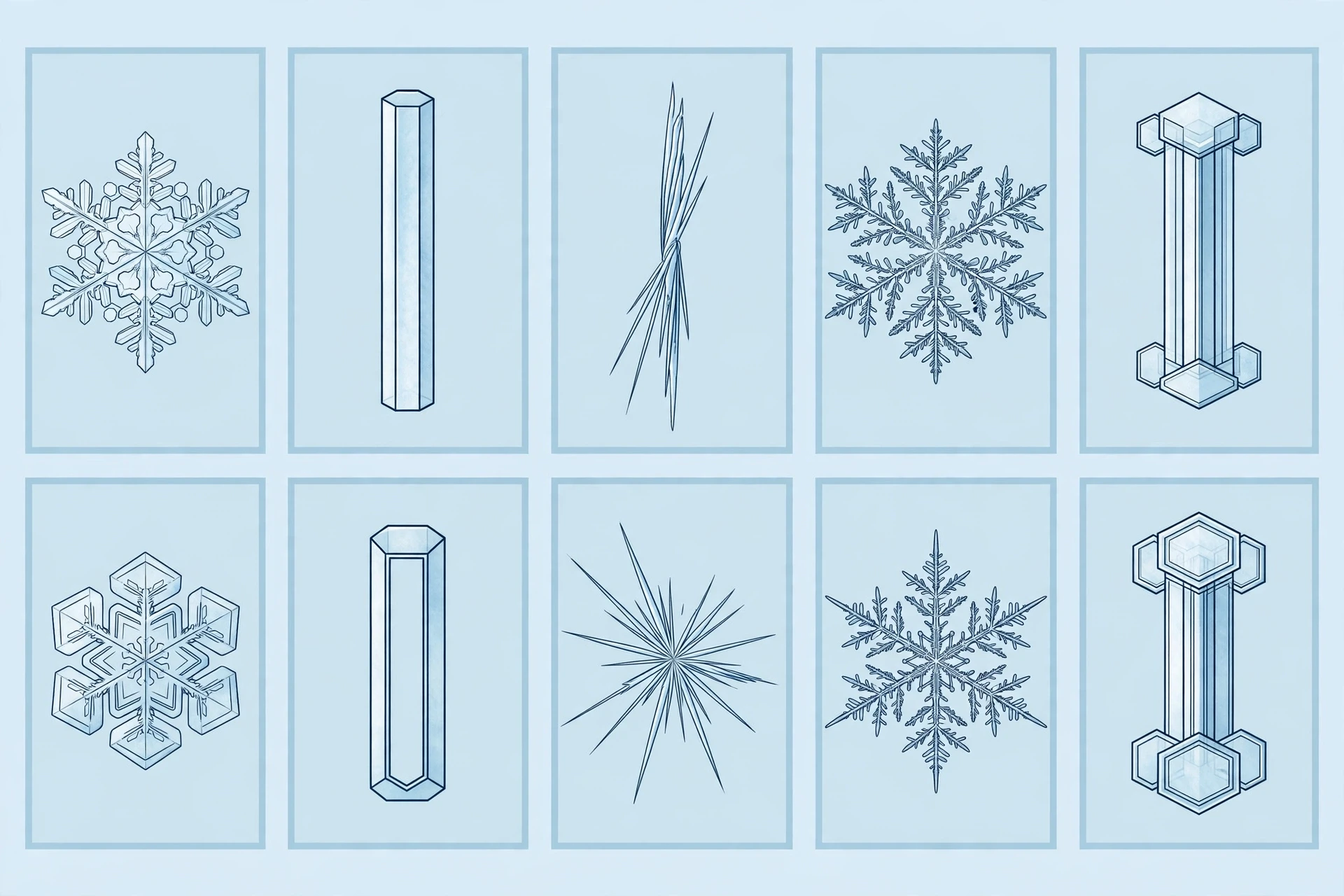
The pattern is called the morphology diagram, and it is one of the most useful charts in atmospheric science. Near zero degrees Celsius, just below freezing, snowflakes grow as thin hexagonal plates. Cool the air to around minus 5 degrees and the shape flips: the crystal grows as a long, thin column or a needle. Cool it further, to around minus 10 to minus 15 degrees, and it flips back to plates — but now the plates branch into the classic dendrites, the most elaborate and beautiful form. Near minus 20 degrees, columns return. The alternation of plates and columns as temperature falls is not random. It reflects how fast different crystal faces grow at different temperatures, and those growth rates depend on the molecular details of how vapour molecules attach to the ice surface. The physics is subtle, and researchers are still working out the exact mechanism, but the pattern itself is rock solid: it has been seen in laboratories and in clouds all over the world.
Humidity acts as a volume control on that pattern. In dry air, just barely saturated with respect to ice, the crystals grow slowly and stay simple: small plates, short columns, plain prisms with flat faces and sharp edges. In moist air, well saturated, the crystals grow fast and branch: the plates become dendrites, the columns grow hollow ends and caps, the needles cluster into sprays. The most spectacular snowflakes — the big, feathery stars that photographers chase — grow in air that is both near minus 15 degrees and very moist, the sweet spot where plates branch most freely. That combination is common in winter storms over the Great Lakes and in the mountains of Japan, which is why those places produce some of the finest snowflake photographs in the world.
Cloud temperature (approx.) | Humidity | Typical crystal shape | What it looks like |
|---|---|---|---|
0 to -3 °C | Low to high | Thin hexagonal plates | Flat, coin-like discs with six sides |
-3 to -8 °C | Low | Solid prisms and short columns | Tiny hexagonal pencils |
-5 to -10 °C | High | Needles and hollow columns | Long, thin spikes, sometimes hollow |
-12 to -16 °C | High | Dendrites and fern-like stars | The classic feathery six-armed snowflake |
-12 to -16 °C | Low | Sector plates | Flat plates with ridges, little branching |
-16 to -25 °C | Low to high | Columns and capped columns | Pencils with flat plates on each end |
Below -25 °C | Low | Small plates and prisms | Simple, tiny crystals; diamond dust |
Read the table from top to bottom and the alternation jumps out — this is the clearest summary of how snowflakes form under different conditions: plates, then columns, then plates again, then columns again, as the air gets colder. That alternation is the morphology diagram in miniature, and it is worth remembering the next time you look at falling snow. The shape of the flakes in your hand is a thermometer reading from the cloud above you, written in ice. The Met Office guide to snow describes the same range of shapes from the forecaster's side, and the National Weather Service JetStream pages on snow explain how those shapes fit into the wider story of winter storms.
6.1 Capped columns: a flake that changed its mind
Some of the most revealing snowflakes are the ones that changed shape halfway through growing. A capped column is a column with a flat plate on each end, like a dumbbell or a tiny spool. It forms when a crystal starts growing as a column in air around minus 6 degrees, then falls into colder air around minus 15 degrees, where plates grow. The column stops lengthening and the ends sprout plates. The result is a flake that records two temperatures in its own body: a columnar childhood and a platy adulthood. Find a capped column in the snow and you know the flake fell through at least two different layers of cloud, and you know roughly what temperatures those layers were. It is a small, legible history.
Other flakes record the same kind of journey in subtler ways: a plate that suddenly sprouts branches at its rim, a dendrite whose tips thicken into plates, a needle that ends in a tiny star. Every change in shape is a change in the air, and a careful observer can read the sequence. That is why snow-crystal researchers photograph flakes in the field and in the laboratory with such care: each flake is a data point, and a thousand flakes are a profile of the cloud. The laboratory work matters because it calibrates the reading. By growing crystals at known temperatures and humidities, researchers learned exactly which shape goes with which condition, and then they could turn the process around and read real clouds from real flakes.
6.2 Diamond dust and the coldest snow
At the coldest end of the scale, below about minus 25 degrees, snow stops looking like snow at all. The air is so cold and so dry that crystals grow slowly and stay tiny: small plates, small prisms, glittering points of ice that drift down in clear air and sparkle in the sunlight. In the Arctic and Antarctic, this is called diamond dust, and it can fall from a cloudless sky, forming directly in the cold air near the ground. It is beautiful — the air itself seems to glitter — and it is a reminder that snow does not need a storm. It needs cold air, a little vapour, and a speck to start on. Given those, even a clear polar sky can snow.
Diamond dust also matters for climate, because the tiny crystals it is made of reflect sunlight and trap heat in ways that differ from ordinary snow. In the high Arctic, diamond dust is a regular part of the winter, and researchers study it to understand how the polar atmosphere handles energy. It is a small phenomenon with a large footprint, and it is one more reason to take the morphology diagram seriously: the shape of a crystal is not a curiosity. It changes how the crystal interacts with light, how fast it falls, and how long it lasts.
7. The Fall: A Snowflake's Journey to the Ground
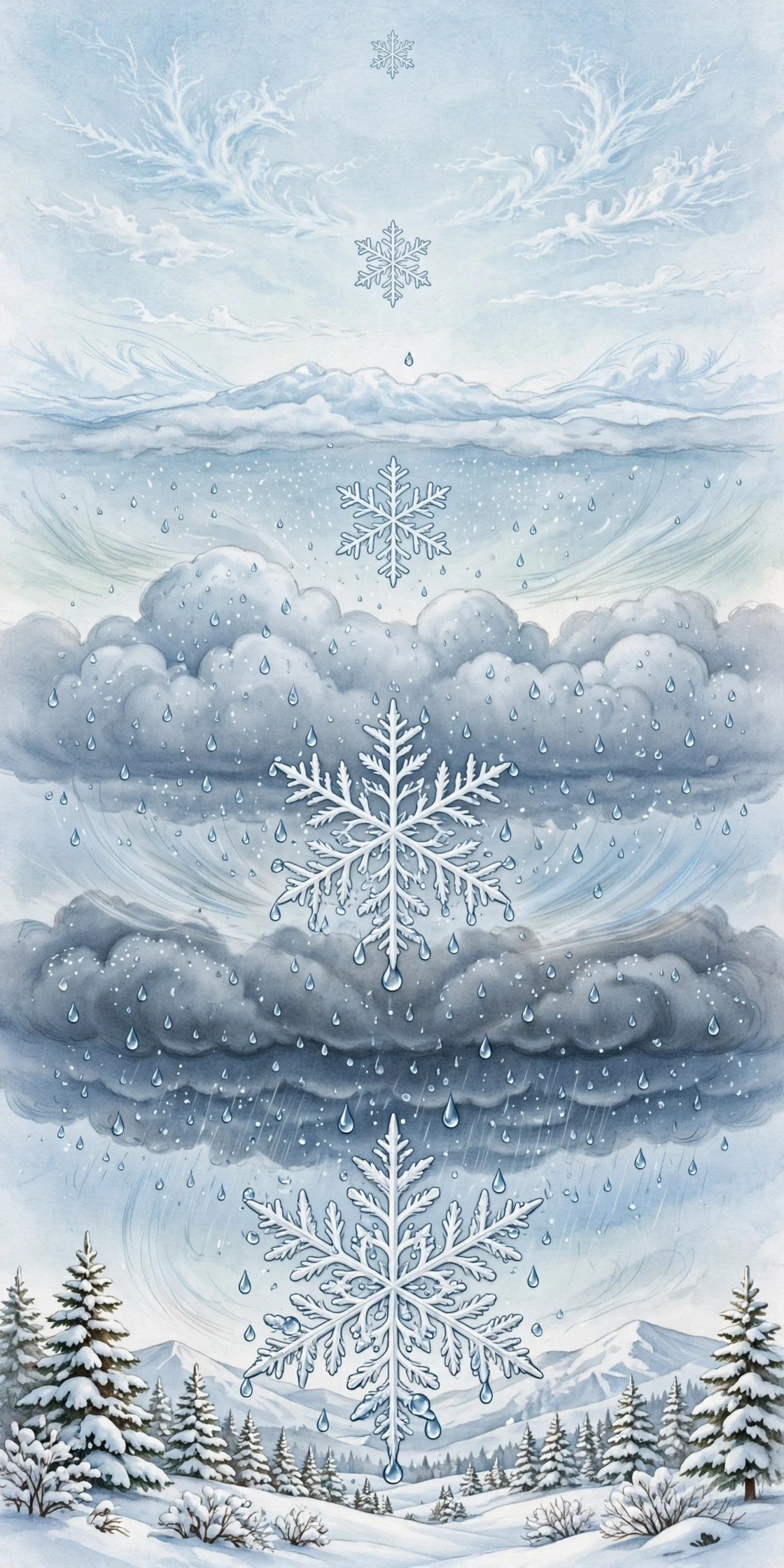
A snowflake is born high in a cloud and spends most of its life falling. The fall is slow — a typical snowflake falls at roughly 1 to 2 metres per second, about the speed of a gentle walk — and it is anything but straight. The flake tumbles, flutters, and drifts, carried sideways by the wind, lifted and dropped by turbulence, and the whole journey can take many minutes. In that time it may fall a kilometre or more, passing through layers of air that differ in temperature and humidity, growing, shrinking, colliding, and changing shape the whole way down. The flake that lands is not the flake that was born. It is the flake that survived the fall.
Growth continues during the fall, as long as the air stays moist and cold. The flake sweeps up vapour as it falls, and it also collides with tiny cloud droplets, which freeze onto its surface on contact. That process is called riming, and it changes the flake's appearance: a lightly rimed flake looks frosted, its branches thickened and softened; a heavily rimed flake becomes a lump of opaque ice called graupel, which is a different kind of precipitation altogether. Riming is also how a snowflake can grow large quickly. A dendrite that falls through a region rich in droplets can double its mass in minutes, not by adding vapour molecule by molecule but by sweeping up droplets wholesale. The trade-off is that riming blurs the sharp branching that makes a flake beautiful. The most photogenic flakes are the ones that fell through clean, moist air with few droplets to collide with.
Collisions with other flakes matter too. In a cloud full of falling crystals, flakes bump into each other and stick, forming aggregates — the big, soft clumps that fall in wet snow. Aggregation is most effective near zero degrees, where the flakes are slightly sticky, and it is the reason wet snow falls in large flakes and dry snow falls in small ones. A wet snowflake can be an aggregate of hundreds of individual crystals, and it can be centimetres across. A dry snowflake, falling in very cold air, is usually a single crystal, small and sharp. Skiers know the difference by feel: wet snow packs into snowballs and sticks to everything, dry snow squeaks and will not pack at all. The difference is aggregation, and aggregation is a property of temperature.
7.1 Melting, shrinking, and surviving
Not every snowflake reaches the ground. A flake that falls into warm air melts, first at its tips and then through its body, and becomes a raindrop. A flake that falls into dry air shrinks by sublimation, its ice turning back into vapour, and it may vanish entirely before it lands. Meteorologists call that virga: precipitation that evaporates before it reaches the ground, visible as streaks hanging beneath a cloud. Virga is common in dry climates, and it is a reminder that the sky can snow without the ground ever knowing. The flake's survival depends on the whole column of air below the cloud, not just on the cloud itself. A deep, cold, moist layer below the cloud lets flakes survive and grow. A shallow, warm, dry layer kills them.
That is why snow can fall when the temperature at the ground is slightly above freezing. A flake falling into air at 2 or 3 degrees Celsius will melt, but melting takes energy, and the energy comes from the air around the flake, which cools as the flake melts. A heavy snowfall can cool the air it falls through by several degrees, a process called evaporative and melting cooling, and that cooling can turn rain to snow at the ground even when the forecast said the air was too warm. I have watched that happen on a hillside in early spring: rain in the morning, then the air cooling as the precipitation intensified, then the rain turning to wet snow, then to dry snow, all in the space of an hour, with the temperature gauge barely moving. The snow was making its own cold. It is a feedback loop, and it is one of the reasons snow forecasting is hard: the snow changes the air it falls through, and the changed air changes the snow.
7.2 How fast, and how far sideways
A snowflake's fall speed depends on its size, its shape, and the air's density. Large, open dendrites fall slowly because they have a lot of surface area for their weight — they are, in effect, tiny parachutes. Small, compact plates and columns fall faster. The difference is only a factor of two or three, but over a fall of a kilometre it adds up to minutes of extra time in the air, and minutes of extra growth. The wind matters more than the fall speed for where a flake lands. A flake falling at 1 metre per second through a kilometre of air takes about 15 minutes to reach the ground, and in a wind of 10 metres per second it will drift 9 kilometres sideways in that time. Snow rarely falls straight down. It falls at a slant, sometimes a steep one, and the snow on your roof may have been born over a town miles away. That drift is why snow piles up in drifts on the lee side of fences and buildings, and why a snowstorm can bury one valley and barely dust the next.
The tumbling matters for growth, too. A flake that tumbles presents different faces to the vapour as it falls, and the growth stays roughly symmetric. A flake that falls flat, stable, with one face down, grows more on its upper face than its lower one. Real flakes do a bit of both, fluttering and spinning as they fall, and the flutter is part of why the six arms stay roughly equal: the tumbling averages out the differences in the air around the flake. Watch snow falling on a calm evening and you can see the flutter with your eyes. The flakes do not drop like stones. They wander down, side to side, as if they were deciding where to land.
8. Snowflake, Hail, Sleet, and Graupel: Telling Them Apart
Winter precipitation comes in several forms, and people mix them up constantly. The confusion is understandable: all of them are ice falling from the sky, and in the dark, in a storm, they can feel similar. But they form in different ways, in different clouds, and they mean different things for weather, for safety, and for the ground below. Learning to tell them apart is one of the most practical skills in this article, and it takes only a few minutes.
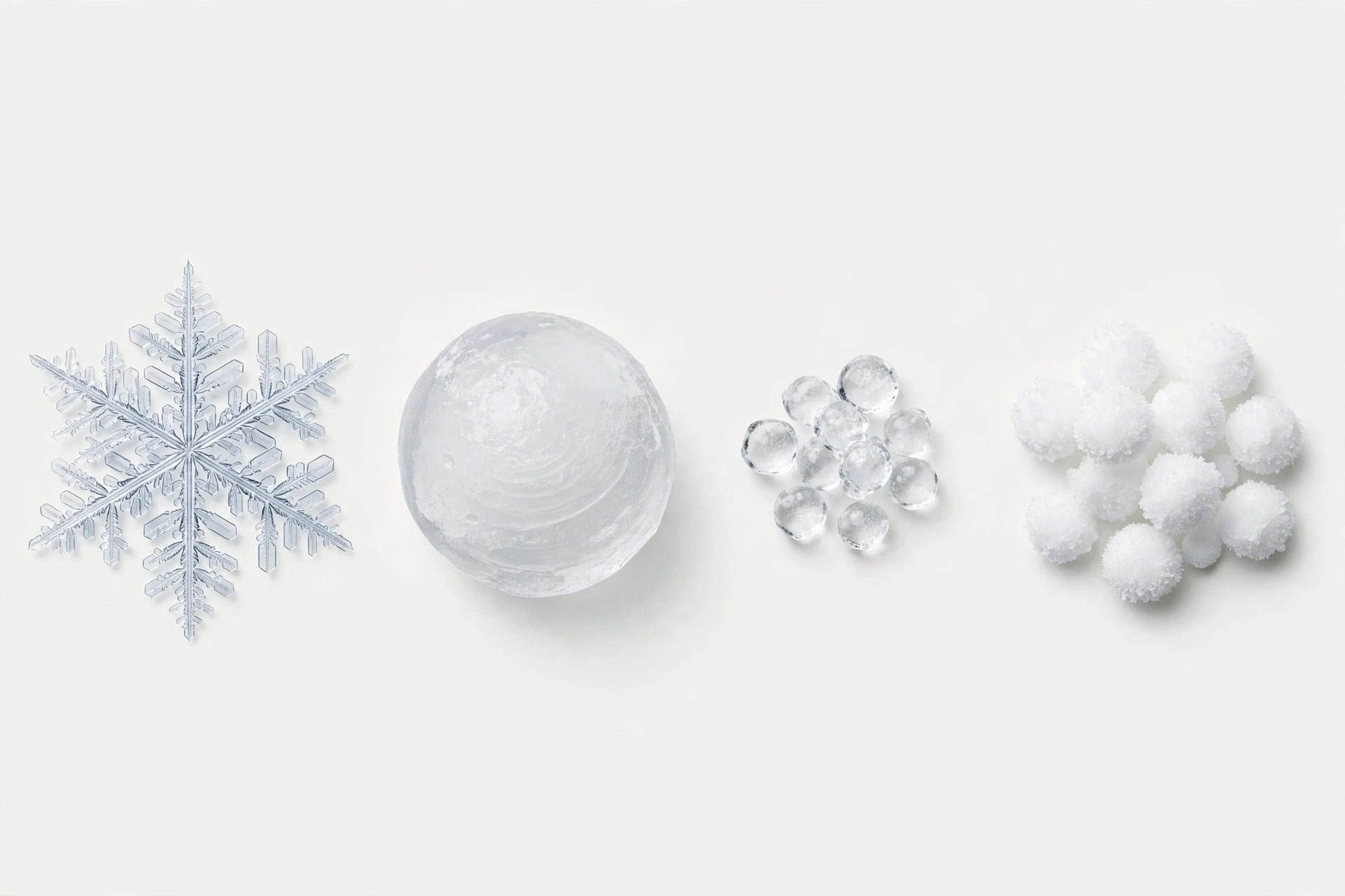
Snow is the crystal grown from vapour, as described in this article. Hail is a pellet of layered ice grown in a thunderstorm, tossed up and down by strong updrafts, collecting liquid water that freezes onto it in layers. Sleet is a raindrop that froze on the way down, or a snowflake that melted and then refroze: a small, hard, transparent pellet of ice. Graupel is a snowflake that collected so many supercooled droplets by riming that its branches were buried and it became a soft, opaque, round pellet, sometimes called snow pellets. Freezing rain is rain that falls as liquid and freezes on contact with a cold surface, coating everything in ice. Each one has a signature, and the table below lays them out side by side.
Form | How it forms | Appearance | Typical size |
|---|---|---|---|
Snowflake | Vapour deposits directly as ice on a nucleus in a cloud | Flat, six-sided crystal or soft clump of crystals | A few mm, up to 1-2 cm |
Hail | Ice pellet carried up and down in a thunderstorm, collecting freezing water in layers | Hard, round, layered ball of clear and cloudy ice | 5 mm to 10 cm or more |
Sleet (ice pellets) | Snowflake melts in a warm layer, then refreezes in cold air below | Small, hard, transparent pellet; bounces on impact | 2-5 mm |
Graupel | Snowflake heavily rimed with frozen droplets until branches are buried | Soft, opaque, white pellet; crushes easily | 2-5 mm |
Freezing rain | Supercooled raindrops freeze on contact with cold surfaces | Clear glaze of ice on roads, trees, wires | Coating, not pellets |
The simplest field test is to catch a pellet and squeeze it. Graupel crushes easily between your fingers, because it is soft, rimed snow. Sleet does not crush: it is hard, clear ice, and it bounces when it hits the ground. Hail is much larger than either, and it falls in summer thunderstorms, not in winter snow. Snow itself is the only one of the group that is a crystal you can see branching with your eyes. The National Weather Service winter weather pages describe these forms from the safety side, and they are worth reading before a winter storm: sleet and freezing rain make roads far more dangerous than snow does, because they form a hard, slick layer that snow does not.
8.1 Why the distinction matters
The distinction is not academic. It decides how a storm behaves on the ground. Snow accumulates as a soft, insulating layer that can be ploughed and shovelled. Sleet accumulates as hard pellets that roll and bounce, and it is a sign that the atmosphere has a warm layer aloft — a layer that may also be producing freezing rain nearby. Freezing rain is the most dangerous of the group: a few millimetres of glaze can bring down power lines, snap tree branches, and turn a road into a skating rink. Forecasters watch the temperature profile of the atmosphere precisely to predict which form will fall, and a change of a degree or two in a layer a kilometre up can flip a forecast from snow to freezing rain. That is why winter forecasts talk about "wintry mix" with such caution. A mix means the atmosphere is balanced on a knife edge, and the precipitation type can change from hour to hour.
For the snowpack, the distinction matters too. A layer of graupel or sleet buried inside a snowpack creates a weak layer, a slick surface that later snow can slide on. Avalanche forecasters pay close attention to those layers, because they are often the sliding surface for a slab avalanche. A snowpack is not a uniform pile. It is a stack of layers, each one a record of a storm, and the weak layers are the ones that matter most. Reading a snowpack is like reading the snowflake's diary at a larger scale: the layers tell the winter's story, storm by storm.
9. Why No Two Snowflakes Are Alike
The saying that no two snowflakes are alike is one of the most repeated claims in popular science, and it is worth asking what it actually means. In the strictest sense, it is almost certainly true for the large, elaborate dendrites, and almost certainly false for the simplest crystals. Two tiny hexagonal plates, grown in the same cloud under the same conditions, can be very similar, and under a microscope they might be hard to tell apart. But two large dendrites, each with thousands of branches, each branch shaped by the exact sequence of temperatures and humidities the flake passed through, are vanishingly unlikely to be identical. The number of possible branching patterns is astronomically large, and the chance that two flakes took the same path through the same cloud, meeting the same air at the same times, is essentially zero.
The reason is the journey. A snowflake's shape is not decided at birth. It is decided continuously, minute by minute, as the flake falls through changing air. Two flakes that start side by side in the same cloud will separate within seconds, carried by slightly different currents, and from then on their histories diverge. One passes through a moist pocket and branches. The other passes through a dry pocket and stays compact. One tumbles one way, the other another. By the time they land, they are different in the way two trees are different: same species, same rules, different lives. The claim is not about the molecules. The molecules are identical. It is about the history, and history is never repeated exactly.
That is why the laboratory work matters so much. In a laboratory, a researcher can grow two snowflakes under identical conditions, and they come out looking very similar — not identical, because the branching instability amplifies tiny differences, but recognisably the same design. The physicist Kenneth Libbrecht grew pairs of "identical twin" snowflakes in his laboratory by controlling the conditions precisely, and the twins were strikingly alike, which proves the point from the other side: when the history is the same, the shape is the same. When the history differs, the shape differs. The snowflake is a record, and the record is only as repeatable as the weather that wrote it. The snow-crystal research pages show those laboratory twins and explain the chamber that made them, and they are the best place to see the argument made with pictures rather than words.
9.1 Wilson Bentley: the man who saved snowflakes
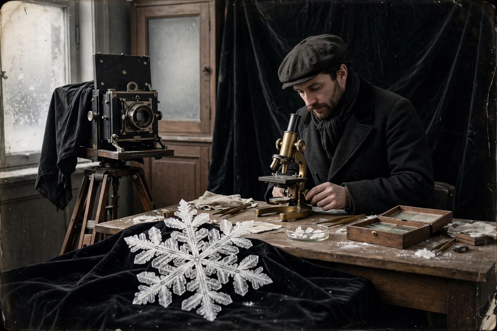
The first person to prove, with photographs, how varied snowflakes are was a farmer from Vermont named Wilson Alwyn Bentley. In 1880, at the age of fifteen, Bentley attached a microscope to a bellows camera and began photographing snowflakes on black velvet, catching them on a tray and transferring them with a splinter of wood before they could melt. Over the next fifty years he photographed more than 5,000 snowflakes, and he never found two alike. He sold his photographs to schools and magazines, and he gave the world its first close look at the architecture of snow. His images are still reproduced today, and they still stop people in their tracks: the precision, the variety, the sheer inventiveness of the branching.
Bentley worked in conditions that modern photographers would find brutal: a cold shed, a microscope that fogged, flakes that melted in seconds, and a camera that needed long exposures. He solved the problems with patience and with a trick that is still used today: black velvet, which makes the white crystal stand out and absorbs enough heat to slow the melting slightly. He also understood, before the science was fully worked out, that the flakes were worth collecting because they were records. He wrote that the snowflake was a letter from the sky, and that each one was different because the conditions that made it were never repeated. He was right, and the science that followed has only confirmed him. The laboratory snowflakes grown a century later are his heirs: same crystals, same rules, now under control.
9.2 Growing snowflakes on purpose
Bentley's work was observation. The modern work is control. In a laboratory cold chamber, a researcher can set the temperature and humidity, seed a crystal on a tiny filament, and watch it grow under a microscope, photographing it as it branches. By changing the conditions partway through, the researcher can make a crystal that changes shape halfway — a plate that becomes a dendrite, a column that grows caps — and confirm exactly which conditions produce which shapes. That is how the morphology diagram was mapped, and it is how the physics of branching was tested. It is also, frankly, a delight: the laboratory snowflakes are as beautiful as the natural ones, and they are made to order.
The control has a practical side. The same physics that grows a snowflake grows frost on an aircraft wing, ice on a power line, and snow in a cloud-seeding experiment. Understanding the growth rates and the branching helps engineers predict icing, helps forecasters predict snowfall, and helps climate scientists model how clouds reflect sunlight. A snowflake is a small system, but it is a model system: the same diffusion-limited growth shapes frost, snow, and the ice crystals in high clouds that regulate the planet's temperature. Study the snowflake and you are studying, in miniature, the physics of ice everywhere.
10. Snow After Landing: Snowpack, Water, and Climate
A snowflake's story does not end when it lands, and understanding how snowflakes form is only half the picture. On the ground, trillions of flakes together become a snowpack, and the snowpack is one of the most important features of the winter landscape. It stores water, insulates the ground, reflects sunlight, and feeds rivers. A single flake is a curiosity. A snowpack is infrastructure — natural infrastructure, built one crystal at a time, and whole regions depend on it.
The water stored in a snowpack is measured as snow water equivalent: the depth of water you would get if the snow melted all at once. Fresh snow is mostly air — a centimetre of fresh snow typically holds only about a millimetre of water — but a deep snowpack, compacted over months, can hold a metre or more of water. In the mountains of the western United States, the snowpack is the largest reservoir in the region, bigger than any dam, and it releases its water slowly through the spring and summer, when farms and cities need it most. Snow surveyors measure it with tubes driven into the snow, weighing the core to find the water content, and their measurements are the basis for water forecasts that decide how much land can be irrigated and how much power a hydroelectric dam can generate.
I once joined a snow survey on a mountain ridge in late winter, and the work taught me more about snow than any laboratory had. We drove a hollow aluminium tube down through the snowpack, pulled out a core, and weighed it. The core was layered like a cake: a crust of ice from a January thaw, soft powder from a February storm, a band of graupel from a March squall, each layer a different storm, each with its own density. The surveyor read the layers the way a forester reads tree rings, and he could tell me, layer by layer, what the winter had been. That is the snowpack as a record, and it is also the snowpack as a resource: the water in that core would be in a river by June, in a field by July, and in a glass by August. Snow is not just winter's decoration. It is next summer's water, stored in the mountains.
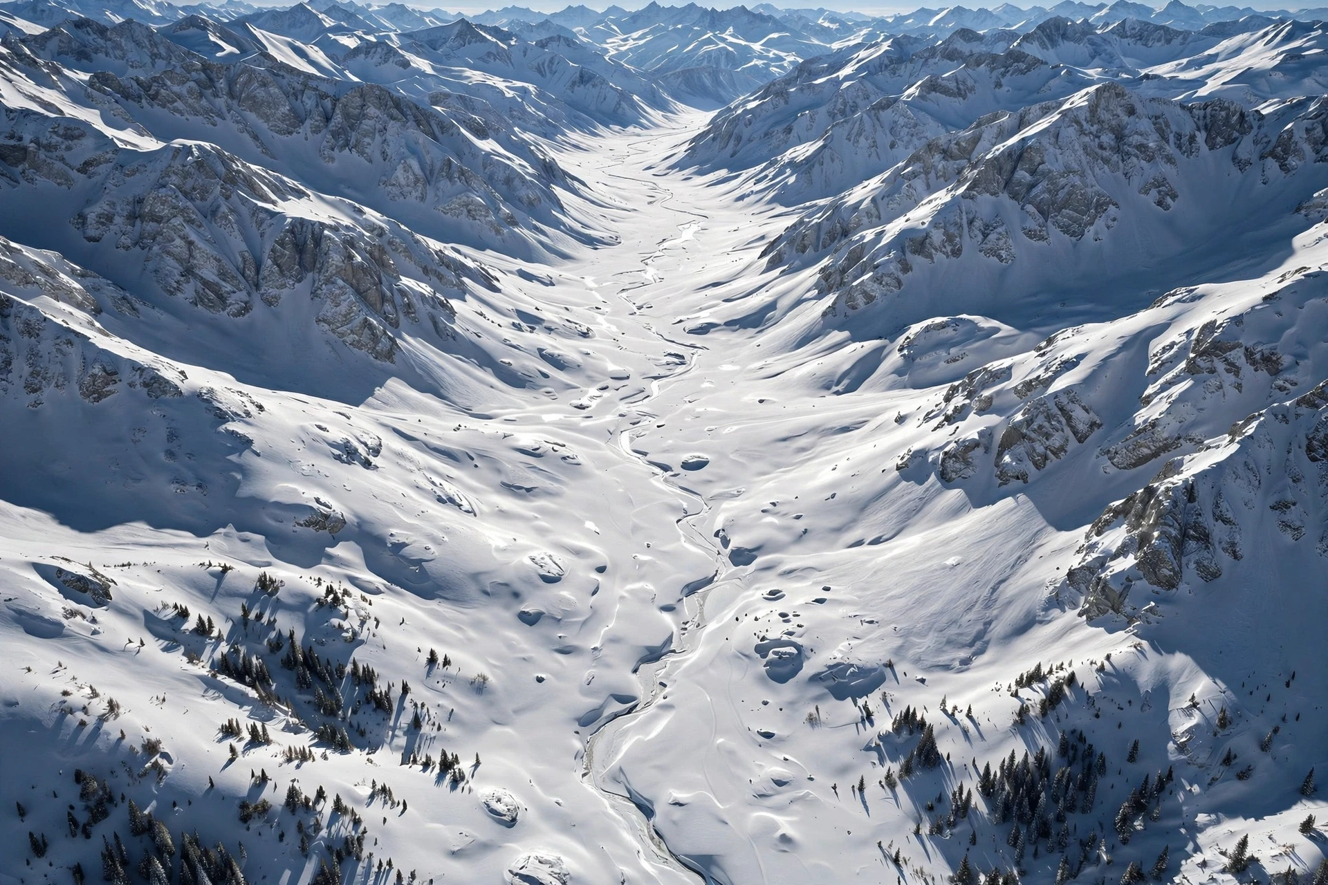
Snow also cools the planet. Fresh snow reflects 80 to 90 percent of the sunlight that hits it, a property called albedo, compared with 10 to 20 percent for bare ground or forest. A snow-covered landscape absorbs far less solar energy than the same landscape bare, and that cooling feeds back on itself: cold air preserves the snow, and the snow keeps the air cold. In the Arctic, the spring melt of sea ice and snow is one of the most consequential events in the climate system, because as the white surface shrinks, the darker ocean and land beneath absorb more heat, which melts more snow and ice. That feedback is a major reason the Arctic is warming faster than the rest of the planet.
That brings us to the question of how snowflakes form in a warming world, and what happens to snow as the climate changes. The physics of a single flake does not change with the climate: water still bonds in hexagons, crystals still branch, and the morphology diagram still holds. What changes is where and when the conditions for snow occur. As winters warm, the rain-snow line moves uphill and poleward, more winter precipitation falls as rain, the snow season shortens, and the snowpack melts earlier. The flakes still form in the clouds, but fewer of them reach the ground as snow, and the snow that does fall melts sooner. The consequences are practical and large: less water stored for summer, more winter flooding from rain on snow, and ecosystems timed to a snowmelt that arrives weeks earlier than it used to. The companion article on climate change follows those consequences in detail, from the shrinking snowpack to the shifting seasons.
There is a subtlety worth stating plainly, because it confuses people every winter: a warming climate does not mean the end of snow, and a heavy snowfall does not disprove warming. A warmer atmosphere holds more water vapour, and when the air is still cold enough for snow, that extra moisture can produce heavier snowfalls. Some of the biggest snowstorms on record have fallen in warming winters, fed by warmer oceans evaporating more water into storms that then meet cold Arctic air. The pattern is not less snow everywhere. It is snow redistributed: more intense storms where it is still cold enough, less snow overall where it is not, and a shorter season almost everywhere. The snowflake is unchanged. The world it falls into is not.
11. Common Misconceptions About Snowflakes
Most people assume a snowflake is a frozen raindrop — a drop of water that froze while falling. What the evidence actually shows is the opposite: a snowflake never was a raindrop at all. It grew from vapour, molecule by molecule, and it never passed through the liquid stage. A frozen raindrop is sleet, and it looks nothing like a snowflake. The distinction is not a technicality. It is the difference between two completely different growth processes, and it is the reason a snowflake has branches and a sleet pellet does not.
Another common belief is that snowflakes are white because ice is white. Ice is not white. A single ice crystal is clear and transparent, like glass. Snow looks white because it is made of many tiny crystals, each one scattering light in all directions. The light bounces from crystal to crystal, and the scattered light reaches your eye as white — the same reason crushed ice looks white while a solid ice cube looks clear, and the same reason clouds look white. A single snowflake held up to the light is nearly transparent. A snowbank is white because it is a crowd.
People also assume that no two snowflakes are alike in some absolute, proven sense, as if scientists had checked them all. They have not, and they cannot. What the science of how snowflakes form supports is narrower and more interesting: two large, elaborate dendrites are vanishingly unlikely to be identical, because their shapes record unique histories, while two tiny, simple plates can be very similar indeed. The saying is a good summary of the dendrites, and an overstatement for the simple crystals. Precision matters here, because the overstatement hides the real point — that the variety comes from the journey, not from magic.
A fourth misconception is that it has to be below freezing at the ground for it to snow. It does not. Snow can fall when the air at the ground is a few degrees above freezing, because the flakes cool the air as they melt, and because a flake falling through a deep cold layer can survive a short trip through warm air near the ground. What matters is the temperature of the whole column of air, not just the reading on a thermometer at eye level. That is why snow sometimes falls on a day that feels too warm for it, and why forecasters look at the atmosphere in layers rather than at a single number.
Finally, many people think snow is pure, clean water. It is not, and it never was. Every snowflake carries its nucleus — dust, salt, pollen, soot — at its centre, and it collects gases and particles as it falls. Snow that falls in a city is measurably dirtier than snow that falls in the mountains, and that dirt matters: dark particles in snow lower its albedo, so the snow absorbs more sunlight and melts faster. In the Arctic, soot from distant fires and industry darkens the snow and speeds the melt, a small effect per flake that adds up across a continent. Snow is a sample of the air it fell through, and the air leaves its mark.
Frequently Asked Questions
How do snowflakes form?
How snowflakes form comes down to three steps: water vapour in a cold cloud deposits directly as ice onto a tiny particle such as dust or pollen, the ice grows into a hexagonal crystal because of the shape of the water molecule, and the crystal branches as it falls through moist air, with its corners growing faster than its flat faces. No liquid stage is involved.
Why do snowflakes have six sides?
Snowflakes have six sides because water molecules bond in a hexagonal lattice. Each water molecule is bent, and its hydrogen bonds lock neighbours into rings of six. The crystal grows fastest in six directions in the plane of that lattice, so the flake develops six arms.
Are no two snowflakes really alike?
For large, elaborate dendrites, effectively yes: each one records a unique journey through changing cloud conditions, so two identical ones are vanishingly unlikely. For tiny, simple plates grown under the same conditions, two flakes can be very similar. The variety comes from the history, not from the molecules, which are identical.
What temperature do snowflakes form at?
Snowflakes form in clouds at temperatures below freezing, and their shape depends on the exact temperature: thin plates near 0 °C, columns and needles around -5 to -10 °C, feathery dendrites around -12 to -16 °C, and small simple crystals below -25 °C. Humidity decides how elaborate the shape becomes.
Is a snowflake a frozen raindrop?
No. A snowflake grows directly from water vapour as ice and never passes through the liquid stage. A frozen raindrop is sleet — a small, hard, transparent pellet — and it forms when a snowflake melts in a warm layer and refreezes, or when a raindrop freezes while falling.
How big can a snowflake get?
A typical single-crystal snowflake is a few millimetres across. Large dendrites can reach a centimetre or more in calm, moist air. The biggest flakes ever reported, around 38 centimetres across in Montana, were almost certainly aggregates of many flakes stuck together, not single crystals.
Can it snow when it is above freezing?
Yes. Snow can reach the ground when the air at ground level is a few degrees above freezing, because melting flakes cool the air around them and because a flake can survive a short fall through a shallow warm layer if the air above is cold and the snowfall is heavy.