

The rain arrived in Mumbai on a Tuesday afternoon, and within an hour the city I thought I knew had turned into a different place. Monsoons do that to a city. Streets became rivers. Trains stopped where they stood. People who had been hurrying to offices a few minutes earlier were now wading through knee-deep water, holding their shoes in one hand and their phones above their heads with the other. I stood under a shop awning watching the sky empty itself, and a shopkeeper beside me shrugged with the calm of a man who had seen this exact scene every year of his life. "Monsoon," he said, as if that one word explained everything. In a way, it did — and in a way, it explained nothing at all.
That afternoon stayed with me because it made a simple fact impossible to ignore: for billions of people, monsoons are not weather. They are the calendar. They decide when farmers plant, when rivers rise, when cities flood, and when children get sent home from school. Monsoon seasons shape economies, move harvests, and, in bad years, take lives. Yet most people outside the monsoon regions know it only as a word for "heavy rain." That is the first thing to unlearn.
Monsoons are not a type of rain. They are a type of wind — a vast, seasonal reversal of the winds that blow across entire continents, driven by the difference between how quickly land and ocean heat up and cool down. The rain is what the winds carry. Once you see the monsoon as a wind system, everything else about it starts to make sense: why it arrives on a schedule, why it sometimes fails, why the same season can bring both floods in one district and drought in the next, and why a warming planet is rewriting its rules.
I first tried to explain monsoons to a classroom of students years ago, armed with a diagram of arrows and a confident tone. Halfway through, a student raised her hand and asked a question that stopped me cold: if the wind simply blows from the sea in summer, why does it rain so hard in some places and barely at all in others only a few hundred kilometres away? I did not have a good answer that day. The honest answer took me years of reading, watching satellite loops of cloud bands curling across the Indian Ocean, and standing in actual monsoon rain to piece together. This article is that answer, built slowly, the way understanding usually is.
What follows is a tour of the whole system. We will start with what a monsoon actually is and the simple physics that drives it, then travel through the three great monsoon systems of the world — Indian, East Asian and Australian — and look inside the machinery of the monsoon trough and the low-pressure systems that do much of the raining. We will face the two faces of the season, flood and drought, trace how monsoons feed more than half the world's people, and look at what climate change is doing to them.
1. What a Monsoon Really Is
The word "monsoon" comes from the Arabic mausim, meaning "season." That origin is a clue to the whole definition. A monsoon is a seasonal wind — specifically, a wind system that reverses direction between summer and winter over a large region. In summer, the wind blows from the ocean toward the land. In winter, it blows back from the land toward the ocean. The reversal is what defines monsoons. Everything else — the clouds, the downpours, the flooded streets of Mumbai — is a consequence of that reversal.
This is the point where most explanations go wrong, and it is worth pausing on. Monsoons are not storms, not single rainy events, and not a synonym for "tropical rain." A thunderstorm can happen anywhere. Monsoons are continent-scale patterns that last for months. When the summer monsoon arrives over South Asia, it does not rain continuously for four months. It rains in bursts — active spells of heavy rain lasting days, broken by quieter spells of sunshine — all carried along by the same great southwesterly flow. The season has a rhythm, and farmers, fishermen and forecasters have learned to read that rhythm the way sailors read tides.
How big is the system? The Asian monsoons alone affect more than half of humanity. The summer monsoon winds sweep across the Indian Ocean, the Arabian Sea and the Bay of Bengal, pushing moist air over India, Bangladesh, Nepal, Myanmar, Thailand, southern China and beyond. The winter monsoon reverses the flow, sending dry, cooler air from the Asian interior out over the seas. That is how monsoons work: a wind system that turns with the seasons. The same pattern, with local variations, shapes the climate of East Asia and northern Australia. There are smaller monsoon systems elsewhere too — over West Africa, over North America in the southwestern United States and Mexico, and over parts of South America — but the Asian-Australian system is the giant, the one that sets the template.
1.1 The seasonal reversal in plain terms
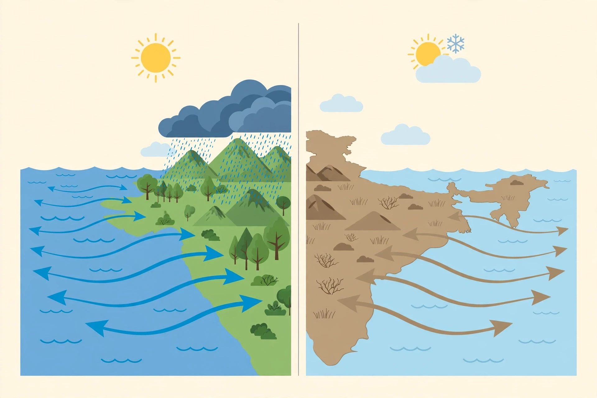
Picture the atmosphere as a restless ocean of air, always flowing from high pressure to low pressure, always trying to even itself out. In summer, the land heats up fast. Warm air over the land rises, leaving lower pressure behind at the surface. Over the ocean, the water warms slowly, the air above it stays cooler and heavier, and pressure stays higher. Air flows from the high pressure over the sea toward the low pressure over the land — a great inrush of moist ocean air. That is the summer monsoon wind.
In winter, the whole arrangement flips. The land cools quickly, the air above it grows cold and dense, and high pressure builds over the continent, while the ocean, which held onto its summer warmth, is now relatively warm, with lower pressure above it. Air flows outward, from the land to the sea. The winter monsoon is usually dry, because the air leaving the land has travelled over dry ground and carries little moisture. That dry season is part of what makes monsoons so distinctive: the same winds that bring the rains take the water away again. In northern India, winter monsoons bring cool, clear days. In parts of Southeast Asia, the winter monsoon picks up moisture as it crosses warm seas and can still bring rain — a reminder that the same wind system behaves differently depending on the geography it crosses.
1.2 Why the reversal matters more than the rain
The reversal matters because it is predictable, and predictability is what makes agriculture possible. Monsoons provide that framework. A farmer in the Deccan plateau does not need rain on a particular Tuesday; she needs to know, within a week or two, when the rains will arrive, how long they will last, and roughly how much water they will bring. Its onset over Kerala, at the southern tip of India, is one of the most watched dates in Indian meteorology, announced each year by the India Meteorological Department and followed by millions of people like a national event.
The reversal also explains why monsoons create such a sharp wet season and dry season. In Mumbai, roughly three-quarters of the year's rain falls in about four months. For the other eight months, the city is largely dry. That contrast — feast, then fast — shapes everything from water storage to disease patterns to the price of onions. It is also why monsoons are so vulnerable to disruption: systems that deliver most of a year's water in a few months have very little slack. A delay of two weeks, or a break of ten days in the middle of the season, can matter more than a modest shortfall in the total.
1.3 Monsoons beyond Asia
Asia owns the most famous monsoons, but the pattern is not unique to it. West Africa has a monsoon that brings the rains to the Sahel each summer, as moist air from the Gulf of Guinea pushes northward. The North American monsoon brings summer thunderstorms to Arizona, New Mexico and northwestern Mexico, when winds shift and draw moisture from the Gulf of California and the Gulf of Mexico. Parts of South America and northern Australia have their own versions. The ingredients are always the same: a large landmass next to a warm ocean, a strong seasonal swing in heating, and a wind system large enough to reverse. Wherever those ingredients meet, a monsoon can form.
That said, the Asian monsoon remains the benchmark, and most of what we know about monsoon physics was learned by studying it. The Indian monsoon has been observed and recorded for centuries — by sailors who waited for the winds to carry them across the Arabian Sea, by administrators who tracked rainfall because famines followed its failure, and by modern scientists with satellites and supercomputers.
2. The Engine: How Land and Sea Heat Differently
Every monsoon begins with a simple fact of physics: land and water do not heat at the same speed. Stand on a beach on a summer morning and you can feel it. The sand is already hot under your feet by mid-morning, while the sea is still cool. By evening, the sand has cooled again, but the water is still holding its warmth. That everyday observation, scaled up to the size of a continent and an ocean, is the engine of monsoons everywhere.
Land heats fast and cools fast. Soil and rock absorb heat in a thin surface layer, so a modest amount of sunshine raises their temperature quickly. Water behaves differently. Sunlight penetrates metres into the sea, the heat is mixed downward by waves and currents, and water needs far more energy to warm by a single degree. The ocean is a giant thermal flywheel: slow to warm, slow to cool, steady through the seasons. The continent beside it is a thin sheet of metal in the sun: hot by noon, cold by midnight.
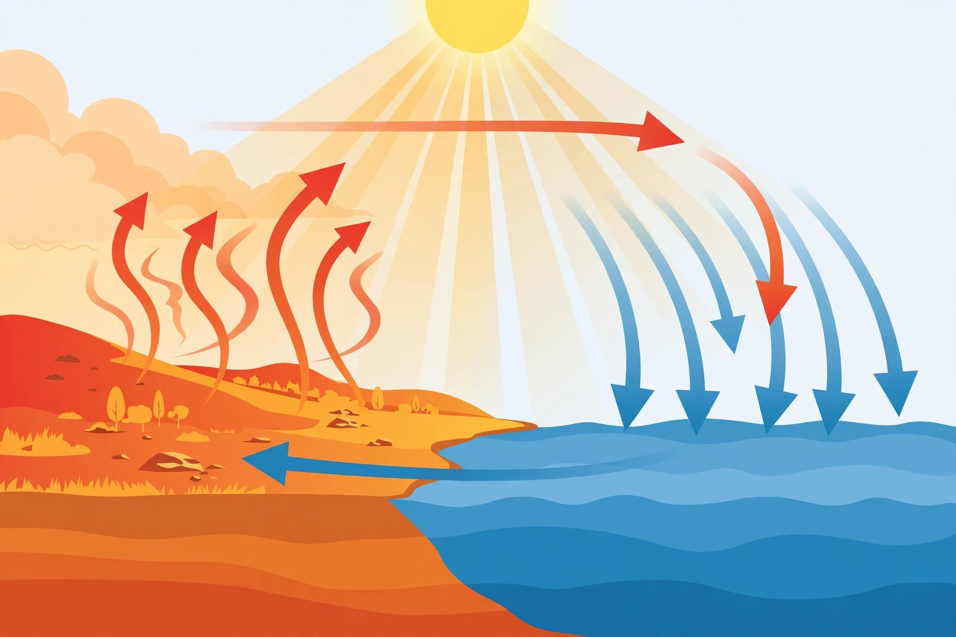
In summer, the difference becomes dramatic. The Asian landmass, especially the Tibetan Plateau and the plains of India and central Asia, heats intensely under the high summer sun. The air above the hot land warms, expands and rises, and surface pressure falls. A broad low-pressure area forms over the continent. Meanwhile, the Indian Ocean to the south stays comparatively cool, and higher pressure sits over the water. Air rushes from high to low — from the ocean toward the land — and that rush is the summer monsoon.
2.1 The role of the Tibetan Plateau
No account of the monsoon engine is complete without the Tibetan Plateau, the vast high tableland north of India that rises to an average height of around 4,500 metres. The plateau acts like a giant hot plate suspended in the middle of the atmosphere. In summer, its elevated surface heats the air around it far above the surrounding free atmosphere, strengthening the low pressure over Asia and pulling the monsoon winds further inland. In winter, the plateau cools and helps build the high pressure that drives the dry outflow.
I remember the first time a colleague sketched this for me on a napkin in a canteen: a cross-section of Asia with the plateau drawn as a raised block, arrows curving up over it, and the words "the heater on the roof of the world" underneath. It was a crude drawing, but it captured something real. The plateau does not cause the monsoon on its own — the land-sea contrast would exist without it — but it amplifies the system and shapes where the rain falls. Remove the Himalayas and the plateau from a climate model, and the Indian monsoon weakens dramatically. The mountains matter twice over: they heat the air, and they force the moist monsoon winds to rise, cool and dump their rain on their southern slopes.
2.2 Moisture: the fuel in the wind
A wind alone does not make rain. The summer monsoon winds are powerful because of what they carry: water vapour evaporated from warm tropical oceans. As the air travels hundreds of kilometres over the Arabian Sea and the Bay of Bengal, it picks up moisture. When that moist air reaches land and is forced upward — by the rising heat of the continent, by hills and mountains, or by converging winds — it cools, the vapour condenses into cloud droplets, and rain falls. The condensation releases latent heat, which warms the air further and strengthens the rising motion. The monsoon, in other words, feeds itself: the wind brings moisture, the moisture makes rain, and the rain's heat strengthens the wind.
This is also why sea surface temperature matters so much. Warmer oceans evaporate more water, so the air arriving over land carries a heavier load. Forecasters watch the Indian Ocean and the Pacific closely, because those waters set the fuel supply for the whole season. When the tropical Pacific warms during an El Niño event, the Indian monsoon often — though not always — weakens; when the Pacific cools during La Niña, it often strengthens. The connection is real but not a simple rule, and it is one of the reasons monsoon forecasting remains a hard science rather than a solved one.
2.3 The sea breeze writ large
If monsoons feel familiar, they should. It is the same physics as a sea breeze, scaled up by a factor of thousands. On a summer afternoon at the coast, the land heats, air rises, and a cool breeze blows in from the sea. By night, the land cools, and a land breeze blows back out to the water. The monsoon is that daily cycle stretched across seasons and continents: a summer-long sea breeze and a winter-long land breeze, driven by the same contrast, operating on a planetary scale.
The analogy helps, but it has limits. A sea breeze is a local, shallow circulation, a few tens of kilometres across and a kilometre or two deep. The monsoon is a deep, continent-scale overturning of the tropical atmosphere, reaching ten kilometres up and thousands of kilometres across, tied into the global circulation — the trade winds, the jet streams, the great rising and sinking branches of the tropics. Treating the monsoon as "just a big sea breeze" is a useful starting point, and a misleading ending point. The real system has its own dynamics, its own rhythms, and its own surprises.
2.4 Why the monsoon arrives in bursts
One of the most confusing things about monsoons for a newcomer is that the rain does not fall steadily. A monsoon season is a sequence of active spells and break spells. During an active spell, rain falls heavily for days across a wide region. During a break, the rain shifts elsewhere — often northward toward the Himalayan foothills — and the plains bake under a hot sun. Farmers know these rhythms intimately. A break of a week is normal. A break of three weeks can ruin a crop.
The bursts happen because monsoons are not single smooth flows but restless systems of waves, troughs and travelling disturbances. The monsoon trough — a long band of low pressure stretching across northern India — wobbles north and south. Low-pressure systems form over the Bay of Bengal and travel westward across the country, each one bringing a pulse of rain. The result is a season with a pulse, like a heartbeat with irregular beats. Understanding that pulse — and learning to forecast it a week or two ahead — is one of the great practical achievements of modern monsoon science, and still one of its unfinished jobs.
3. The Indian Summer Monsoon
Of all the monsoons on Earth, the Indian summer monsoon is the most studied, the most watched, and the most consequential. It brings the rain that waters the crops feeding more than a billion people, fills the reservoirs of a subcontinent, and sets the rhythm of an entire civilization's year. When the monsoon is good, India eats. When it fails, the consequences ripple through food prices, rural incomes, and politics. No other weather system on the planet carries quite that weight.
The Indian summer monsoon runs roughly from June to September. Its onset is a process, not a moment: the rains typically arrive over Kerala, at the southern tip of India, around the start of June, then advance northward and westward across the country over the following weeks, reaching the northwest by mid-July. The advance is tracked daily by the India Meteorological Department, and the progress of the monsoon front is reported like the advance of an army — because, in a sense, that is what it is: a front of moist air marching across a continent.
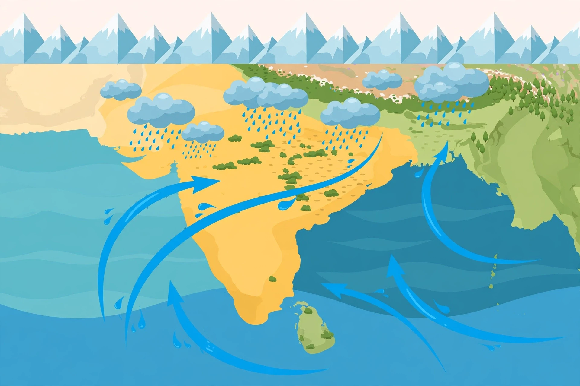
The winds that drive it are the southwesterlies. Moist air from the Arabian Sea blows onto the west coast of India, where the Western Ghats mountains force it upward, squeezing out heavy rain on the windward slopes — some of the wettest places on Earth sit in those hills. Another branch of the flow curves around the southern tip of India and sweeps up the Bay of Bengal, carrying moisture toward the northeast, where it collides with the Himalayas and produces extraordinary rainfall in places like Cherrapunji, a town famous for being among the wettest inhabited places on the planet. Between the two branches lies the great plain of northern India, watered by the monsoon trough and by the low-pressure systems that travel along it.
3.1 Onset: the most watched date in India
Ask an Indian farmer what date matters most in the year, and the answer is often the date the monsoon arrives. The India Meteorological Department issues an onset forecast each spring, and the actual arrival is confirmed by rainfall, wind and cloud observations. The onset is declared over Kerala when specific conditions are met — sustained rainfall, deep westerly winds, and a characteristic cloud pattern. It is a scientific judgement, but it is followed with the intensity of a festival.
The onset matters because it sets the planting calendar. Rice nurseries are prepared, seeds are sown, and the whole machinery of the farming year starts moving. A late onset compresses the season. An early onset can be a gift — or a curse, if it is followed by a long break that dries out freshly sown fields. I once spoke with an agricultural scientist who had spent decades in the field in Maharashtra, and he described the onset as "the starting gun of the Indian year." He was right. Everything from sowing to school holidays to the stock market's mood bends around it.
3.2 The four months that feed a nation
June to September is when India receives the bulk of its annual rainfall. The numbers vary by region — the west coast and the northeast are drenched, the interior Deccan is more modestly watered, the northwest is comparatively dry — but the seasonal pattern is the same everywhere: a short, intense wet season carrying the year's water. The kharif crops — rice, maize, cotton, soybeans, pulses — are sown with the monsoon and harvested after it. The reservoirs that supply cities and irrigate winter crops are filled by it. Groundwater, the invisible reserve that millions of wells draw on, is recharged by it.
The dependence is so deep that the monsoon's performance is treated as an economic indicator. A good monsoon lifts rural incomes and holds food prices down; a weak one does the opposite. The connection is not as absolute as it once was — irrigation now covers a large share of farmland — but the monsoon still moves the needle in ways no other weather system does in any large country. That is why the seasonal forecast issued each spring is front-page news.
3.3 Breaks, active spells and the monsoon trough
Within the season, the rain comes in waves. The monsoon trough — a long, shallow band of low pressure stretching from the heat low over Pakistan across northern India to the Bay of Bengal — is the spine of the system. When the trough sits over the plains, rain falls widely. When it shifts north toward the Himalayan foothills, the plains dry out and the foothills flood. When it shifts south, the peninsula gets the rain. The trough's position, day by day, is one of the main things forecasters watch.
Superimposed on the trough are the low-pressure systems that form over the Bay of Bengal and travel westward across India. These are the workhorses of monsoon rain: each one can deliver several days of steady rain over a wide area as it moves. In a good season, a steady stream of them crosses the country. In a poor season, they are few, or they form and fizzle, or they track too far north or south. The difference between a good and a bad monsoon is often the difference between a handful of these systems.
The Indian summer monsoon is the largest seasonal wind system on Earth, and it is also the most consequential: the rains it carries water the crops that feed more than a billion people.
There is also the question of timing within the season. Early-season rain matters for sowing, mid-season rain for growth, and late-season rain for grain filling — and a late withdrawal can damage crops ready for harvest. A monsoon that delivers the right total but at the wrong times can still be a bad monsoon. This is why meteorologists now track the distribution of rain week by week, district by district. The total is a headline; the distribution is the story.
3.4 The winter monsoon and the northeast rains
When summer ends, the winds reverse. The northeast monsoon — the retreating, winter monsoon — brings a second rainy season to parts of southern India, especially Tamil Nadu and coastal Andhra Pradesh, as the northeasterly winds pick up moisture crossing the Bay of Bengal. For Tamil Nadu, the October-to-December rains are the main rainy season, not a footnote, and Chennai can receive a large share of its annual rain in those three months. The northeast monsoon is smaller than the summer monsoon, but for the millions who depend on it, it is every bit as important.
4. The East Asian Monsoon
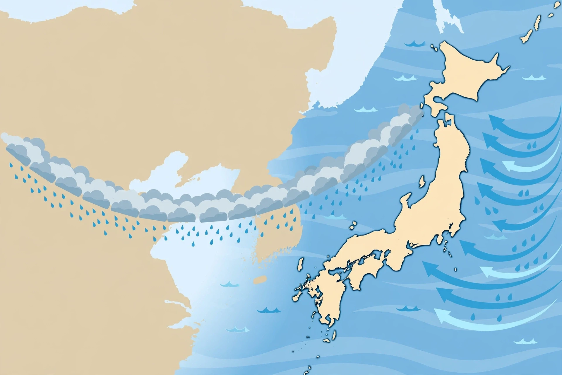
East of India, monsoons take a different shape. The East Asian monsoon waters China, Japan, Korea and Taiwan, and it feeds some of the most densely populated and intensively farmed land on Earth. It is driven by the same land-sea contrast, but the geography is different — a long coastline facing the Pacific, a chain of mountains and plateaus inland, and a vast continent behind them — and the resulting rain has its own personality: a slow, northward-marching rain belt that the Chinese call meiyu and the Japanese call baiu, the "plum rains," because they arrive as the plums ripen.
The East Asian summer monsoon typically begins in the south in May, then the rain belt advances northward through June and July, reaching northern China by late July. The belt is a front — a boundary between warm, moist tropical air from the south and cooler, drier air from the north — and along it, clouds pile up and rain falls for days at a time. When the belt stalls over a region, the rain can be relentless. When it jumps north too quickly, the south dries out. The position of the belt, week by week, is the central question of the East Asian monsoon season.
4.1 Meiyu, baiu and the marching rain belt
The plum rains have been observed and written about for centuries. Farmers in the Yangtze valley expect a period of damp, cloudy weather in June and early July — not violent downpours so much as a long, grey, dripping persistence that soaks the rice fields and swells the rivers. The Japanese baiu season is similar: weeks of rain and humidity over southern Japan, gradually moving north. The names differ, but the mechanism is one system: the monsoon front, advancing with the season.
What makes the East Asian monsoon distinctive is its interaction with the mid-latitudes. Unlike the Indian monsoon, which is largely tropical, the East Asian system sits at the boundary between the tropics and the temperate zone. Cold air from the north, the westerly jet stream overhead, and the warm Pacific all play a part, so a typhoon in the western Pacific, a shift in the jet stream, or a cold outbreak from Siberia can all nudge the rain belt. It is a monsoon with more moving parts, and correspondingly harder to forecast.
4.2 China, Japan and Korea: one system, many climates
East Asian monsoons do not treat the region uniformly. Southern China receives abundant rain early in the season. The Yangtze valley gets its heaviest rain in June and July. Northern China receives less, later, and more variably — the rain belt sometimes barely reaches it before retreating. Japan's rains are shaped by its islands and mountains, with heavy falls on the Pacific side and a different rhythm on the Sea of Japan side. Korea sits between the two, with a short, intense rainy season in July known as jangma.
This variety is a consequence of geography, but it is also a consequence of history. The rice cultures of East Asia grew up around the monsoon's rhythms. The paddies of the Yangtze, the terraces of southern China, the rice fields of Japan and Korea — all depend on the reliable arrival of the summer rains. The engineering of East Asia, from ancient irrigation to modern dams on the Yangtze, is in large part an engineering of the monsoon: storing its water and taming its floods.
4.3 Typhoons and the monsoon
One feature the East Asian monsoon has that the Indian monsoon largely lacks is the typhoon. Tropical cyclones form over the warm western Pacific and travel northwestward, often interacting with the monsoon flow. A typhoon can dump enormous rain in a day, break a drought, or turn a wet season into a disaster. It can also pull the monsoon flow around, shifting the rain belt and changing the season's pattern. The relationship runs both ways: the monsoon trough is a birthplace for typhoons, and typhoons feed moisture and energy back into the monsoon. Forecasters in the region watch both systems together, because neither makes sense alone.
5. The Australian Monsoon
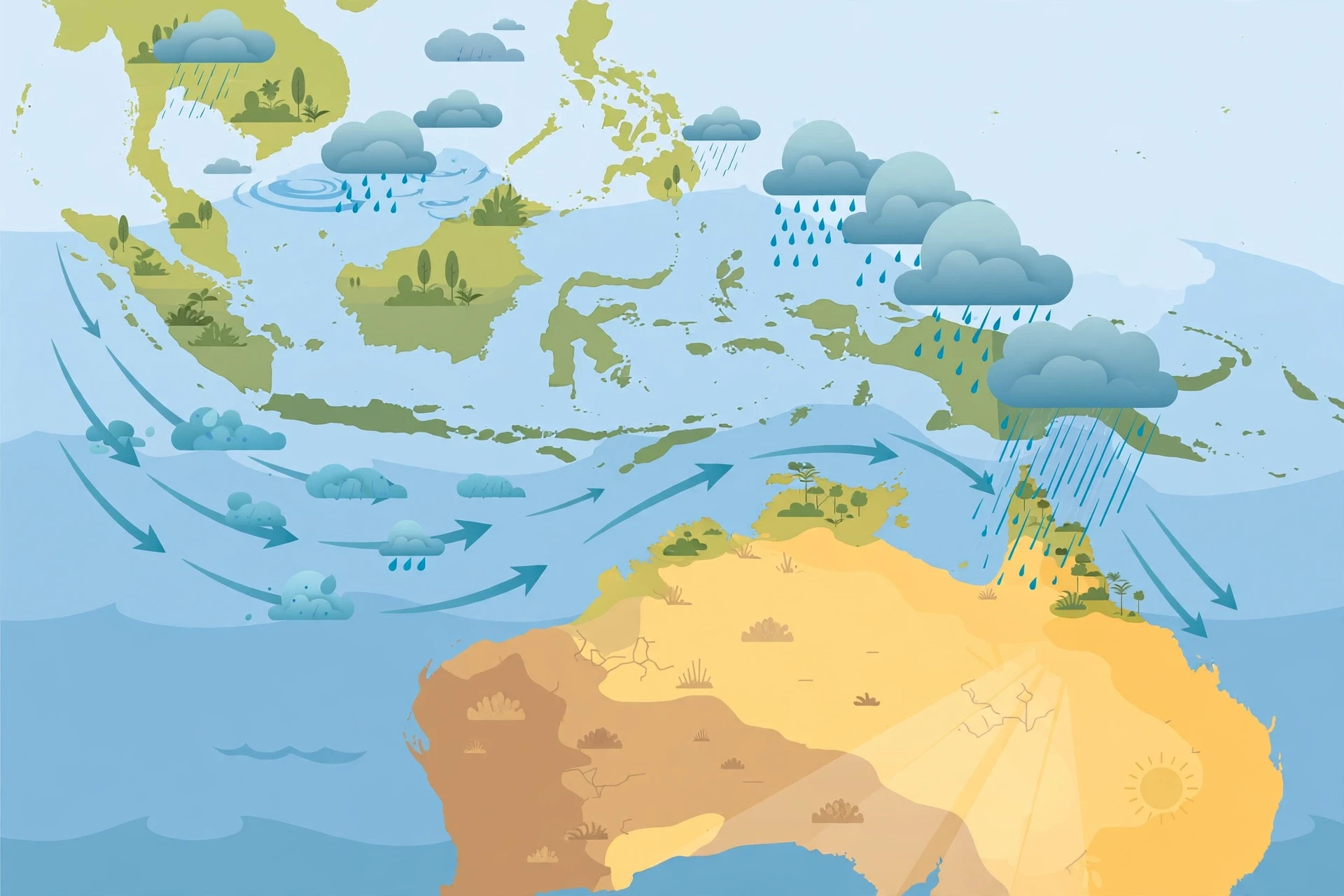
Cross the equator to the Southern Hemisphere, and monsoons flip their calendar. The Australian monsoon brings the wet season to the tropical north of Australia — Darwin, the Top End, the Kimberley, Cape York — from roughly December to March, during the southern summer. When the Asian landmass is cooling and its monsoon is retreating, the Australian continent is heating, and its own monsoon is gathering. The two systems are linked: the great monsoon circulation of Asia and Australia is, in a sense, one system that migrates with the sun, following the season across the equator.
The Australian summer monsoon is driven by the same contrast — a hot continent beside warm seas — but the geometry is different. The moisture comes from the seas to the northwest: the Timor Sea, the Arafura Sea, and the warm waters of Indonesia. The winds arrive from the northwest, carrying humid air over the north Australian coast. The rains fall in bursts, often in violent thunderstorms and in the heavy downpours of tropical lows and cyclones. Darwin, a city built for the monsoon, receives most of its annual rainfall in four months, and the landscape transforms: dry, brown savanna turns green almost overnight, rivers that were a chain of pools become torrents, and the wetlands fill with birds.
5.1 A wet season in the Southern Hemisphere
The Australian wet season is not a gentle affair. The monsoon trough sits over northern Australia, and within it, thunderstorms build daily — towering clouds, lightning, rain falling in sheets that can drop a month's worth of water in a day. Tropical cyclones form in the surrounding seas and sometimes cross the coast, bringing destructive winds and flooding.
For the people of the Top End, the wet season is both a joy and a test. Roads flood and communities are cut off for weeks, and the heat and humidity are relentless. But the rain is also life: it fills the wetlands, feeds the rivers, and sustains the ecosystems of Kakadu and the Kimberley. The scientific account of the Australian monsoon is recent. The human knowledge of it is ancient.
5.2 The monsoon, the Madden-Julian Oscillation and the far north
The Australian monsoon is strongly influenced by the Madden-Julian Oscillation, the great travelling wave of tropical cloud and rain that circles the globe over 30 to 60 days. When the active phase of the oscillation passes over northern Australia, the monsoon bursts into life: weeks of heavy rain, thunderstorms and tropical lows. When the suppressed phase passes, the monsoon weakens, the skies clear, and the heat builds. The oscillation is one of the main reasons the Australian wet season is so episodic — and one of the main tools forecasters use to predict its bursts a week or two ahead.
The Australian monsoon is also tied to the Asian monsoon across the equator. The same large-scale circulation that carries the Asian summer monsoon northward in June carries the Australian monsoon southward in December. The two systems share the same tropical air, the same oceans, the same great overturning. Studying one without the other is like studying one half of a breathing cycle.
6. The Monsoon Trough and Low-Pressure Systems
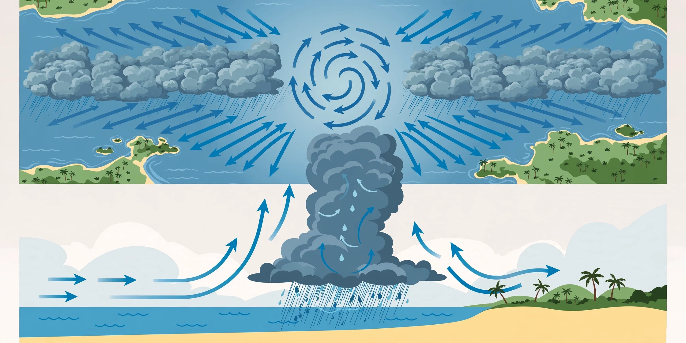
So far we have talked about monsoons as great seasonal winds. Now we need to look inside the machine, at the smaller structures that actually make most of the rain. The monsoon is not a uniform flow of moist air that rains evenly as it moves. It is a flow full of structure — bands, troughs, vortices and waves — and the rain concentrates where those structures force air to rise. Two of the most important structures are the monsoon trough and the low-pressure systems that travel along it.
The monsoon trough is a long band of low pressure that stretches across monsoon regions. Over South Asia, it runs from the heat low over Pakistan, across the Indo-Gangetic plain, to the head of the Bay of Bengal. It is the line along which the monsoon winds converge: air from the south meets air from the north, and the combined flow is forced upward. Where the trough sits, clouds build and rain falls; where it moves away, the rain stops. The trough's north-south wobble is the main reason a monsoon season has active and break spells.
6.1 How a low-pressure system makes rain
Low-pressure systems — called monsoon lows and monsoon depressions — form over the warm waters of the Bay of Bengal and, less often, the Arabian Sea. They are broad, slow-moving vortices, hundreds of kilometres across, with winds spiralling inward and upward. As moist air spirals in and rises, it cools and condenses, producing wide areas of cloud and rain. A single monsoon depression can bring several days of steady rain over a region the size of a small country as it travels westward across India at a walking pace.
These systems are not hurricanes. They lack the tight, violent core of a tropical cyclone, and their winds are comparatively modest. What they have is size and persistence: over a season, the handful of depressions that cross India deliver a large share of the total rain. In some years, the difference between a normal monsoon and a failed one is the difference between five depressions and two. They are the quiet workhorses of the season.
6.2 The offshore trough and the west coast rains
Not all monsoon rain comes from travelling lows. Along the west coast of India, a different structure does the work: the offshore trough, a band of low pressure that runs parallel to the coast over the Arabian Sea. When the monsoon winds blow onto the coast, the trough helps lift the moist air, and the Western Ghats mountains finish the job, forcing the air up their steep slopes. The result is some of the heaviest seasonal rainfall on Earth — the windward slopes of the Ghats can receive several metres of rain in a season. The leeward side, in the rain shadow, receives far less. Two places a hundred kilometres apart can have entirely different monsoon experiences, and the difference is written in the shape of the land.
The same principle applies wherever monsoon winds meet mountains: the Himalayas, the mountains of Myanmar, the ranges of southern China. Mountains are rain machines in a monsoon climate, concentrating a broad, moist flow into narrow bands of intense rainfall — a blessing for the rivers that rise there, and a hazard for the people below, where flash floods and landslides follow the heaviest bursts.
6.3 Waves, pulses and the rhythm of the season
Beyond the trough and the lows, the monsoon is full of waves. The Madden-Julian Oscillation, already mentioned, travels around the tropics and switches the monsoon between active and suppressed phases. Shorter waves travel westward along the monsoon trough. The monsoon flow itself can surge and relax. The result is a season that pulses on many timescales at once: days, weeks, and the season as a whole.
This pulsing is why the monsoon is so hard to forecast in detail, and why it is so rewarding to study. A forecaster who can predict the next active spell two weeks ahead can help farmers decide when to sow, help reservoir managers decide when to release water, and help disaster managers prepare for floods. The science of sub-seasonal forecasting — predicting the weather two to four weeks ahead — has grown up largely around the monsoon, because nowhere else does a two-week forecast matter so much to so many people.
Most of the monsoon's rain does not fall from a uniform flow. It falls where the monsoon trough, travelling low-pressure systems and mountains force moist air to rise — and that is why the same season can be wet in one district and dry in the next.
7. When Monsoons Go Wrong: Floods and Droughts
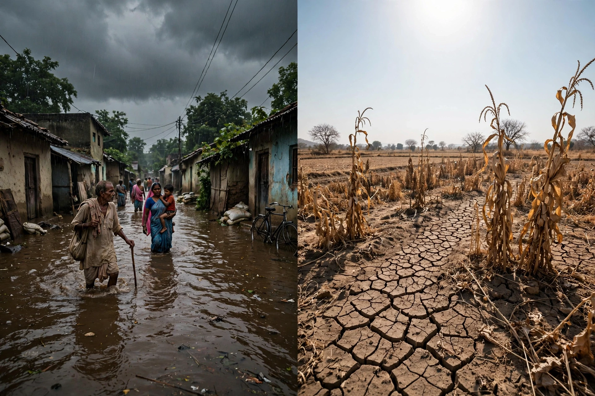
Monsoons are delivery systems, and like any delivery system, they can deliver too much, too little, or at the wrong time. The same season that waters the crops can drown them. The same rains that fill the reservoirs can burst their banks. Flood and drought are not two different problems in monsoon climates; they are the two faces of the same variability, and they often strike in the same season, in neighbouring districts, in the same week.
Floods in a monsoon climate come in several forms. River floods build slowly as rain falls over a wide catchment for days or weeks, the rivers rise, and the water spreads across the floodplains. Flash floods strike suddenly when an intense burst of rain falls on steep ground or a city, the water having nowhere to go. Urban floods are a growing problem: as cities pave over soil and wetlands, rain that once soaked into the ground now runs off concrete and overwhelms drains in minutes. Mumbai, Chennai, Dhaka, Bangkok — the great cities of the monsoon world have all learned, expensively, that a city built for the dry season is a city that drowns in the wet one.
7.1 The flood side of the season
The damage from monsoon floods is not only the water itself. Floods destroy standing crops, drown livestock, wash away roads and bridges, contaminate drinking water, and spread disease. They displace millions of people, often the poorest, who live on floodplains and in low-lying settlements because that is the land they can afford. The human cost — lives lost, homes destroyed, livelihoods interrupted — is harder to count and slower to heal.
Yet floods are also, in a complicated way, part of the system that sustains life in monsoon regions. The great river deltas — the Ganges-Brahmaputra, the Mekong, the Irrawaddy — were built by flood sediment over thousands of years, and their fertility depends on the annual renewal of silt. The challenge is not to eliminate floods, which is impossible, but to live with them: to build houses that can survive them, to keep the floodplains from being paved over, and to give people warning and somewhere safe to go.
7.2 The drought side of the season
Drought in a monsoon climate is quieter than flood, and in some ways more damaging. A monsoon drought does not mean no rain at all; it usually means rain that is late, or interrupted by long breaks, or concentrated in a few violent bursts with dry weeks between them. Crops sown in hope wither in the gaps. Reservoirs that should have filled stay low. Groundwater, drawn down year after year, falls further. The hardship spreads slowly, through falling farm incomes, rising food prices, migration to cities, and debt.
The worst monsoon droughts in history have caused famines. The great famines of nineteenth-century India followed failed monsoons, and the connection between monsoon failure and famine shaped the early science of the monsoon itself — the first rainfall records and the first attempts at seasonal forecasting were driven by the need to predict famine. Modern India, with irrigation, food stocks, transport and relief systems, is far more resilient than it was. But the vulnerability has not vanished.
7.3 When both happen at once
One of the strangest features of monsoon variability is that flood and drought often occur in the same season. A monsoon trough that sits too far north brings floods to the Himalayan foothills and drought to the central plains, and a low-pressure system that stalls over one region drowns it while the next stays dry. A season that ends with a near-normal total can still contain a flood in July and a drought in August. That is why the seasonal total is a poor guide to what people actually experienced: the distribution — where the rain fell, and when — is what decides whether the season was good or bad for any particular community.
I learned this the hard way while trying to summarise a monsoon season for a general audience years ago. I wrote, confidently, that the season had been "normal." A colleague who worked on agricultural impacts sent me a short reply: normal for whom? The national total was near average, but the rain had fallen in the wrong places at the wrong times, and millions of farmers had a bad year. I have never written "normal monsoon" without a qualifier since. The word hides more than it reveals.
8. Agriculture and Food Security
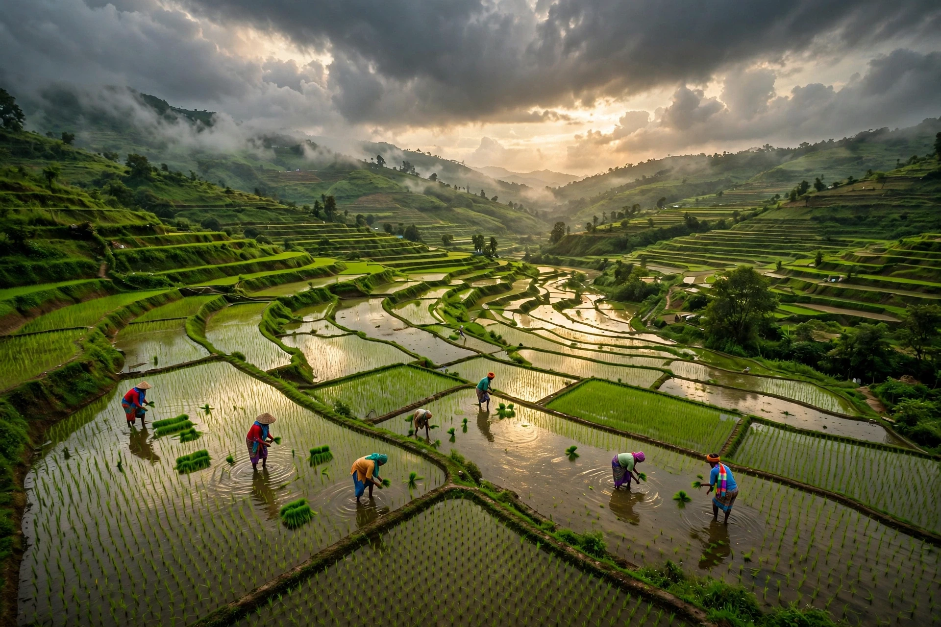
If you want to understand why monsoons matter, follow the rice. Rice is the staple food of more than half the world's people, and most of that rice is grown in monsoon Asia — in the paddies of India, China, Bangladesh, Vietnam, Thailand, Myanmar and Indonesia. Rice is a thirsty crop. It grows in flooded fields, and it needs reliable water through the growing season. The monsoon provides that water, on a scale no irrigation system could match. The harvests of monsoon Asia are, in the most literal sense, harvested rain.
The relationship between the monsoon and agriculture goes far beyond rice. In India, the kharif season — the monsoon crop season — produces rice, maize, cotton, soybeans, groundnuts, pulses and sugarcane. In China, the monsoon waters rice, wheat, maize and soybeans. In Southeast Asia, it waters rice, maize, cassava and a host of other crops. The livestock that graze on monsoon-fed grasslands, the fisheries that depend on monsoon-fed rivers and flooded wetlands, the forests that grow in the wet season — all of them run on monsoon water. Take the monsoon away, and the food system of Asia collapses. There is no substitute, and there never has been.
8.1 Rice, rain and the planting calendar
Rice farming in monsoon Asia is choreographed to the season. Nurseries are prepared before the rains, seedlings are transplanted into flooded paddies as the rains arrive, and the crop grows through the wet months, maturing as the rains retreat. The timing is precise: transplant too early, and the seedlings may dry out in a break; transplant too late, and the crop may not mature before the dry season. Generations of farmers have learned to read the sky, the wind, and the behaviour of birds and insects for signs of the onset. Modern forecasts now add a scientific layer to that traditional knowledge, but the calendar itself is older than any forecast.
The water cycle that makes this possible is worth understanding in its own right: evaporation from warm oceans, transport by the monsoon winds, condensation and rain over land, and return to the sea through rivers. Readers who want the full picture of that cycle can find it in our guide to the water cycle. The monsoon is one of the largest and most consequential movements of water in that cycle — a seasonal river of vapour in the sky, carrying more water than all the world's rivers combined.
8.2 Who depends on the monsoon
The dependence is not evenly spread. Smallholder farmers, who grow much of Asia's food on plots of a few hectares or less, depend on the monsoon most directly, because they have the least irrigation and the least savings to fall back on. Landless labourers depend on it indirectly, through the work the harvest provides, and city dwellers through food prices and water supply. The monsoon is not a rural concern; it is a national one, and in the largest countries of Asia it touches almost everyone.
The numbers help to make the scale concrete. Roughly half of India's farmland is rain-fed, with no irrigation at all. In Bangladesh, the monsoon shapes not only agriculture but the entire geography of life — the rivers, the delta, the annual flood that brings both fertility and danger. In Vietnam's Mekong Delta, the monsoon flood pulse drives the rice and fish production that feeds the country. The monsoon is not a backdrop to Asian food security. It is the foundation of it.
Monsoon system | Main rainy season | Key regions | Staple crops watered |
|---|---|---|---|
Indian summer monsoon | June to September | India, Bangladesh, Nepal, Pakistan, Sri Lanka | Rice, maize, cotton, pulses, soybeans |
East Asian monsoon | May to August | China, Japan, Korea, Taiwan | Rice, wheat, maize, soybeans |
Australian monsoon | December to March | Northern Australia, Indonesia | Rice, sugarcane, tropical fruits |
West African monsoon | June to September | Sahel, West Africa | Millet, sorghum, groundnuts |
North American monsoon | July to September | Southwestern USA, northwestern Mexico | Maize, beans, squash |
8.3 Irrigation, reservoirs and the buffer
Irrigation is the great buffer against monsoon variability. Where canals, wells and reservoirs exist, a weak monsoon hurts less, because stored water can carry crops through the dry spells. India has built one of the world's largest irrigation systems, and groundwater pumping has expanded dramatically in recent decades. The buffer is real, but it has limits. Groundwater is being drawn down faster than it is recharged in many regions, and reservoirs depend on the monsoon to fill them in the first place. Irrigation stretches the monsoon's water; it does not replace it.
Reservoir management is itself a monsoon skill. A dam operator must decide, through the season, how much water to release and how much to hold — release too much early, and there is nothing left for the dry months; hold too much, and a late burst of rain can flood the towns below. The monsoon rewards those who can store its water, and punishes those who cannot.
8.4 Food security in a variable climate
Food security in monsoon Asia is a system, not a single harvest: the monsoon rains, irrigation, seed varieties, storage, transport, markets, prices and government policy. When the monsoon fails, the system is tested at every link — stocks are drawn down, imports rise, prices climb, and the poorest households eat less. When the monsoon is good, stocks are rebuilt, prices fall, and rural incomes rise. The monsoon is the largest single variable in that system, and it is the one nobody controls.
This is why monsoon science is not an academic luxury. Better forecasts, better water management, drought-resistant crop varieties, and better warning systems for floods all translate directly into food on tables. The gap between what science can do and what reaches the farmer in the field is still the frontier — and closing it is one of the most valuable things monsoon research can do.
9. Monsoons in a Warming Climate
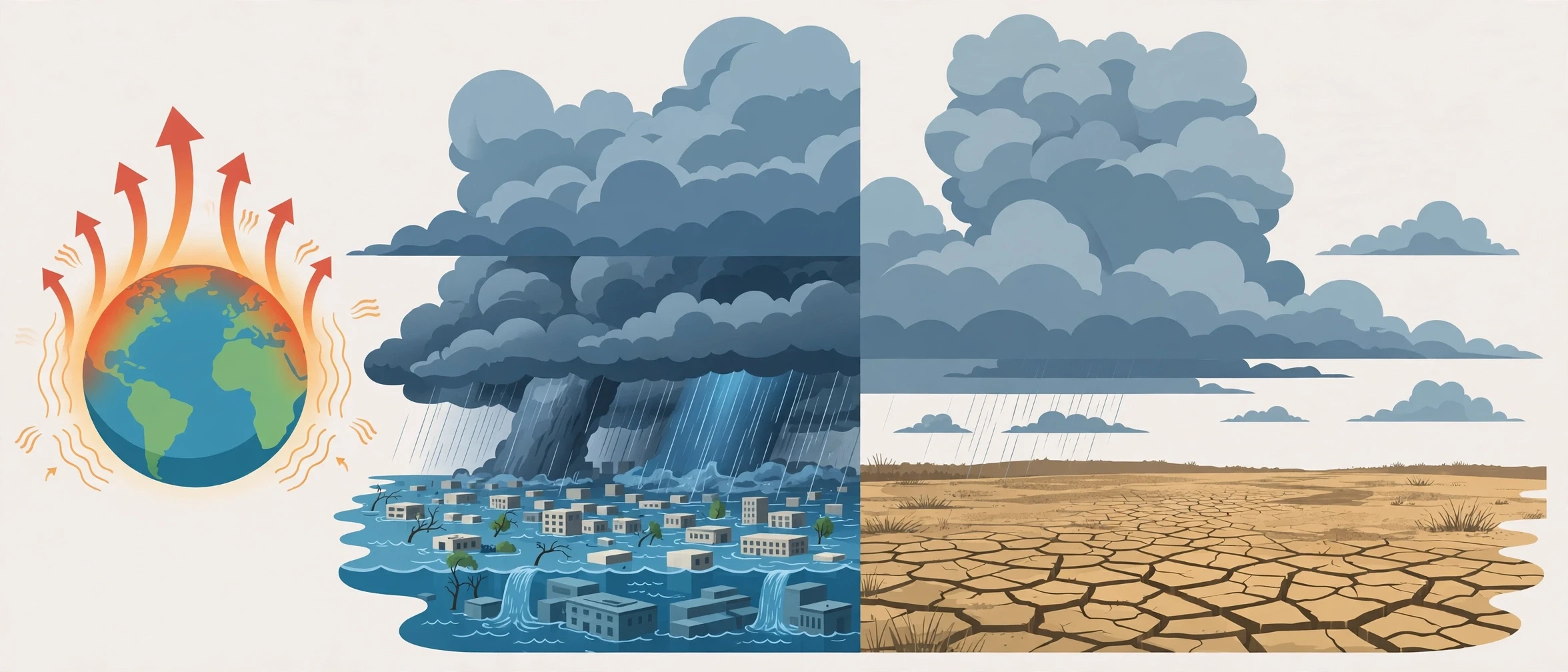
The climate is warming, and the monsoons are changing with it. That much is clear. What is less clear — and where honest science must admit uncertainty — is exactly how. The monsoon is a complex system, and warming pulls it in several directions at once. Warmer air holds more moisture, which should mean heavier rain when it rains. Warmer land should strengthen the land-sea contrast, which should strengthen the winds. But warming also changes the temperature patterns of the oceans, the strength of the winds aloft, and the stability of the atmosphere, and those changes can weaken the circulation. The net result is not a simple story of "stronger" or "weaker." It is a story of change in character: more intense rain, more variability, and a less predictable season.
The most robust expectation is about intensity. As the atmosphere warms, it can hold roughly seven percent more water vapour for each degree of warming, and the moisture carried by the monsoon winds increases accordingly. When the rain does fall, it can fall harder. Observations already show this: in India, the frequency of very heavy rainfall events has increased in recent decades, even as the total seasonal rainfall has shown little long-term trend or a slight decline in some regions. The rain is becoming more concentrated — more of it arriving in fewer, heavier bursts, with longer dry spells between them. For a farmer, that is the worst of both worlds: floods when it rains, drought when it does not.
9.1 Heavier downpours, longer dry spells
The shift toward heavier, more concentrated rainfall has practical consequences that go beyond the statistics. A field that receives its month's rain in two days loses much of it as runoff; the soil cannot absorb it fast enough, and the water floods away instead of soaking in. A city that receives a month's rain in an afternoon floods, no matter how good its drains. A reservoir that fills in a single burst may have to release water to stay safe, wasting the supply it was built to store. The monsoon has always delivered its water unevenly, but warming is making the unevenness worse.
At the same time, the dry spells within the season appear to be lengthening in some regions. For rain-fed crops, a long break at the wrong time — during flowering or grain filling — can cut yields sharply, even if the season's total rain ends up near normal. The combination of heavier bursts and longer breaks is the signature of a warming monsoon, and it is the change that worries agricultural scientists most.
9.2 What the models say — and where they disagree
Climate models generally project that the Asian summer monsoon will bring more rainfall overall as the planet warms, because of the extra moisture in the air. They also project more variability from year to year, and more extreme rainfall events. But the models disagree on the details: how much more rain, where exactly, and whether the winds will strengthen or weaken. Some show a stronger monsoon circulation; others a weaker one, with the extra rain coming from the extra moisture rather than stronger winds. The disagreement is not a sign that the science is broken; it is a sign that the monsoon is genuinely hard to simulate, with processes — clouds, aerosols, the Himalayas, the Indian Ocean — that push the models to their limits.
One factor that complicates the picture is air pollution. Aerosols — tiny particles from burning fossil fuels, biomass and dust — reflect sunlight and cool the land surface, weakening the land-sea contrast that drives the monsoon. Studies of the Indian monsoon have suggested that aerosol pollution contributed to a weakening of the monsoon in the second half of the twentieth century, even as greenhouse warming pushed in the opposite direction. As air quality improves, that cooling effect may fade, and the monsoon's response to warming may become clearer. The interaction of pollution and warming is one of the most active areas of monsoon research.
9.3 Sea level, cyclones and the coasts
Warming also changes the monsoon's surroundings. Sea levels are rising, which makes coastal flooding during monsoon storms worse — the same rainfall now meets a higher sea, and storm surges reach further inland. The great river deltas, home to hundreds of millions of people, are among the most exposed places on Earth to this combination. Tropical cyclones in the Bay of Bengal and the western Pacific may become more intense, even if they do not become more frequent, bringing stronger winds and heavier rain to coasts that are already crowded and low-lying.
These are not distant, abstract risks. The people of the Ganges-Brahmaputra delta, the Mekong delta, and the coasts of Bangladesh, Myanmar and eastern India live with them now, in every monsoon season. Their experience is a preview of what warming means for the monsoon world: not a single dramatic change, but a steady accumulation of pressures — heavier rain, higher seas, stronger storms, longer dry spells — on communities that were already living close to the edge.
9.4 Adapting to a changing monsoon
Adaptation is not optional; it is already happening. Farmers are shifting sowing dates and adopting shorter-duration crop varieties. Cities are rebuilding drainage, restoring wetlands that absorb floodwater, and improving early-warning systems. Governments are investing in better forecasts, from the seasonal outlook down to the three-hour warning of a cloudburst.
None of this removes the risk, but it reduces it. Monsoons will remain variable, and they will remain powerful. The question is not whether we can control it — we cannot — but whether we can live with it more skilfully: storing its water, respecting its floods, preparing for its failures, and giving the people who depend on it the information and the infrastructure to adapt. For a fuller picture of the warming that is reshaping the monsoon, see our guide to climate change.
10. Common Misconceptions About Monsoons
Monsoons are widely misunderstood, and the misunderstandings matter, because they shape how people prepare, how they interpret forecasts, and how they think about climate change. Here are the most persistent ones, and what the evidence actually shows.
Misconception 1: A monsoon is just heavy rain. This is the most common error, and we began with it for a reason. A monsoon is a seasonal wind reversal. The rain is a consequence, not the definition. The distinction matters because a monsoon can be weak in wind terms and still produce floods, or strong in wind terms and still leave a district dry. Judging a monsoon by a single downpour is like judging a river by a single wave.
Misconception 2: The monsoon arrives on a fixed date. The onset is a process that varies by days or weeks from year to year, and it arrives in different places at different times. Treating a single date as a promise leads to disappointment when the rains are late, and to complacency when they are early. The onset forecast is a probability, not a timetable.
Misconception 3: A "normal" monsoon means a good monsoon for everyone. Most people assume that if the seasonal total is near average, the season must have been fine. What we actually see in the data is something else: a season can end with a near-normal total and still have been disastrous for millions of people, because the rain fell in the wrong places, at the wrong times, or in bursts too heavy for the soil to absorb. The total is an average over a continent; nobody lives in an average.
Misconception 4: More rain is always better. In a monsoon climate, more rain is often worse. Heavy rain destroys crops, floods cities, triggers landslides and spreads disease. The ideal monsoon is not the wettest one; it is the best distributed one — steady, well-spread rain that soaks in rather than running off. Farmers pray for a good monsoon, not a heavy one, and the distinction is precise.
Misconception 5: The monsoon is only an Asian phenomenon. Asia has the largest monsoons, but the pattern exists wherever a large landmass meets a warm ocean with a strong seasonal cycle — West Africa, North America, South America and northern Australia all have monsoon systems. The physics is universal; the geography is local.
Misconception 6: Climate change will simply make monsoons wetter or drier. The real change is in character, not just in total. Warmer air holds more moisture, so the rain is likely to fall in heavier bursts, with longer dry spells between them, and with more year-to-year variability. A future monsoon may deliver more rain overall and still be harder to live with. That is the change to prepare for.
Misconception 7: We cannot forecast the monsoon. Seasonal forecasting has limits, and nobody can tell a farmer in April exactly how much rain will fall on her field in July. But the science has advanced enormously: the onset, the active and break spells, and the risk of extreme rain can now be forecast with useful skill days to weeks ahead, and seasonal outlooks correctly capture the broad tendency more often than not. The forecast is a tool, not a crystal ball — and like any tool, it works best when people understand what it can and cannot do. For the science of forecasting itself, see our guide to meteorology.
Frequently Asked Questions
What is a monsoon?
A monsoon is a seasonal wind system that reverses direction between summer and winter over a large region. In summer, moist winds blow from the ocean toward the land, bringing the rainy season. In winter, the winds reverse and blow dry air from the land out to the sea. The rain is a consequence of the wind reversal, not the definition of the monsoon itself.
When is monsoon season?
It depends on the hemisphere. The Indian summer monsoon runs roughly from June to September, the East Asian monsoon from May to August, and the West African monsoon from June to September. The Australian monsoon, in the Southern Hemisphere, runs from about December to March. Within each region, the rains arrive at different times in different places — the Indian monsoon, for example, reaches Kerala in early June and the northwest of India by mid-July.
Why do monsoons happen?
Monsoons happen because land and ocean heat at different speeds. In summer, the land heats quickly, the air above it rises, and lower pressure forms over the continent. Moist air from the cooler ocean flows in to replace it — that flow is the summer monsoon wind. In winter, the land cools quickly, high pressure builds over the continent, and the flow reverses. The Tibetan Plateau and the Himalayas amplify the Asian monsoon by heating the air above them and forcing moist winds upward.
Which countries are affected by monsoons?
The largest monsoons affect India, Bangladesh, Nepal, Pakistan, Sri Lanka, Myanmar, Thailand, China, Japan, Korea, Taiwan, Indonesia and northern Australia. Smaller monsoon systems affect the Sahel and West Africa, the southwestern United States and northwestern Mexico, and parts of South America. In total, well over half of the world's people live in regions shaped by a monsoon.
Are monsoons dangerous?
They can be. Monsoon floods kill people, destroy crops and homes, and spread waterborne disease. Monsoon droughts — when the rains are late, weak or badly distributed — damage harvests and livelihoods. Tropical cyclones that form during the monsoon season add destructive winds and storm surges. At the same time, the monsoon is essential: it provides most of the year's water for farming, drinking and industry across monsoon Asia. The danger and the necessity are the same system.
How is climate change affecting monsoons?
Warming is changing the character of monsoons more than their totals. Warmer air holds more moisture, so rainfall is increasingly concentrated in heavier bursts, with longer dry spells between them. Observations in India already show more frequent very heavy rainfall events. Climate models generally project more monsoon rainfall overall in Asia as warming continues, but with greater year-to-year variability and more extreme events. Sea-level rise and possibly more intense tropical cyclones add further risks to monsoon coasts.
Can scientists predict the monsoon?
Yes, with limits. Modern forecasting can predict the onset of the Indian monsoon, the active and break spells within the season, and the risk of heavy rain days to weeks ahead with useful skill. Seasonal outlooks give the broad tendency — wetter or drier than average — but cannot predict the exact rainfall on a particular farm. Forecasts are improving steadily, and they are most useful when combined with local knowledge and preparation.