

I was eight years old when I first tried to change the course of a river — my first, clumsy lesson in how rivers work. It was not a real river, of course. It was a shallow stream behind my grandparents' house, barely wide enough to jump across, running clear and cold over smooth stones. My cousins and I spent a whole summer afternoon building a dam out of mud, sticks and flat rocks, convinced we could hold the water back and make our own little lake. The stream had other ideas. It found the weak point in our wall within minutes, slipped around the edge, and went on its way as if we had never been there. We rebuilt. It went around again. By evening we were soaked, muddy and laughing, and I had learned my first lesson about moving water: a river is not a thing you push around. It is a system that solves problems, finds the lowest path, and keeps going.
That small stream stayed with me. Years later, standing on the bank of a real river in full flood, watching whole trees ride past like matchsticks, I felt the same mixture of wonder and humility I had felt as a child — only now I understood a little more of what I was looking at. Learning how rivers work means learning how water, gravity, rock and time negotiate with each other, and how the outcome of that negotiation shapes valleys, feeds forests, builds farmland and carries whole civilisations on its back. Every river you have ever seen, from a mountain brook to the Amazon, runs on the same small set of rules. Once you know them, you will never look at a bend in a stream the same way again.
A river is water moving downhill under gravity, but that simple sentence hides a machine of remarkable elegance. Rain and snow fall on high ground. Some of that water soaks into soil and rock, some runs off the surface, and the part that gathers into a channel begins a journey that can last days or months and cover thousands of kilometres. Along the way the river picks up sediment, carves its bed, drops its load, bends, braids, floods and finally spreads itself out into the sea. It is a conveyor belt, a sculptor, a highway and a habitat, all at once. This guide follows that journey from source to sea, step by step, and explains the physics and the geography behind each turn.
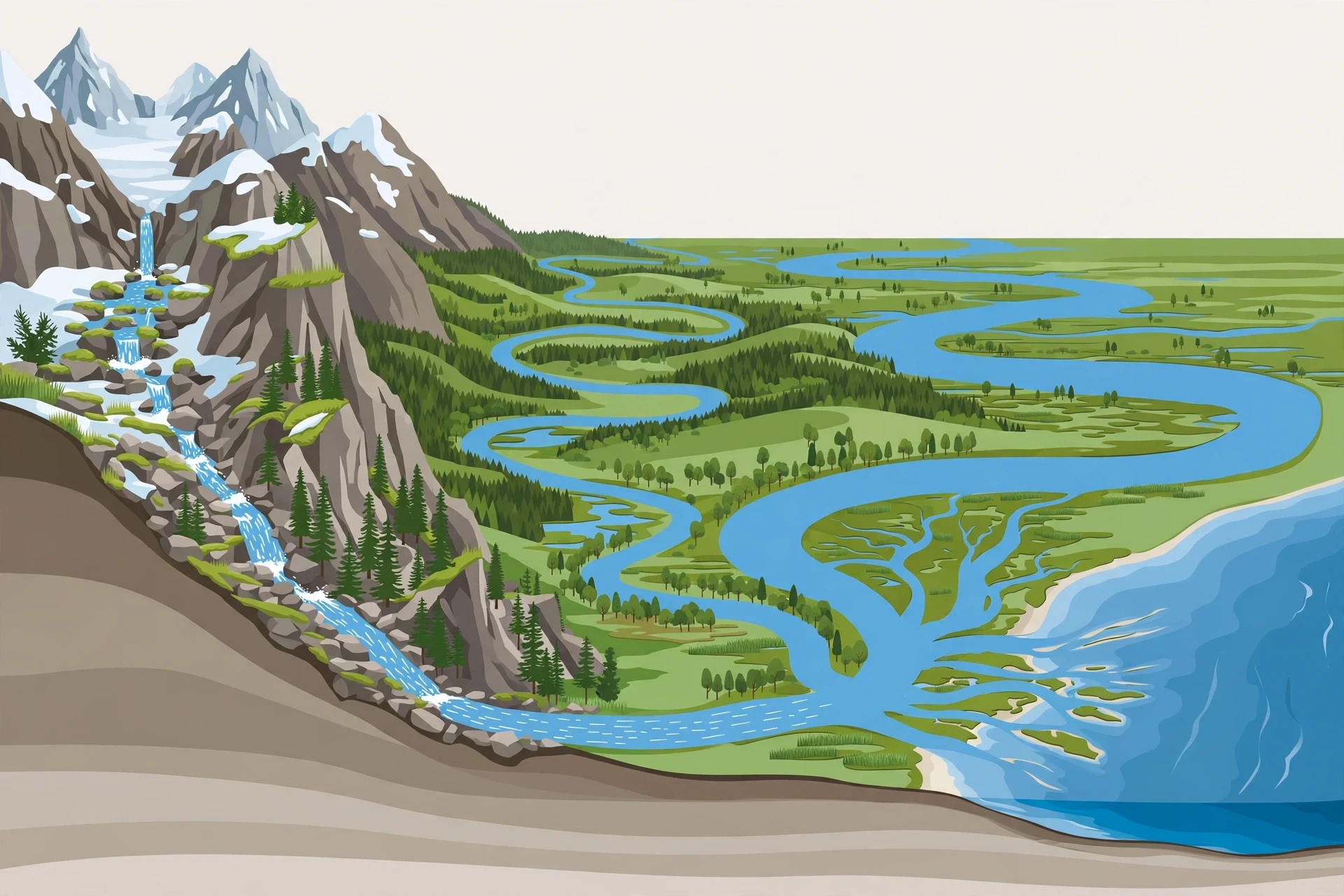
1. What a River Really Is
Ask ten people what a river is and you will get ten versions of the same picture: a ribbon of water flowing between two banks toward the sea. That picture is right, but it leaves out the most interesting part. A river is not just the water you see. It is the whole moving system — the channel, the water in it, the sediment it carries, the groundwater feeding it from below, and the land that drains into it. Hydrologists, the scientists who study water on land, call this whole system a river, not just the blue line on the map. The USGS Water Science School's guide to rivers, streams and creeks makes the same point in plain language: a river is water flowing in a channel, and that channel is shaped by the water itself.
Think of a river the way you would think of a road network rather than a single road. The water in the main channel is the motorway, but it is fed by thousands of smaller roads — brooks, streams and creeks — that gather water from every fold of the landscape. Below the surface, groundwater seeps into the channel through the bed and banks, keeping many rivers flowing long after the rain has stopped. Above the surface, rain falls directly into the channel. All of it is part of the same flow. When you stand on a bridge and watch a river pass, you are watching the combined output of an entire landscape, sometimes thousands of square kilometres of hills, forests, fields and towns, all draining through one channel.
Rivers come in almost every size. A stream you can step across and the Amazon, which at its mouth is so wide you cannot see the far bank, are the same kind of object at different scales. What changes is discharge — the volume of water passing a point each second — and the size of the drainage basin feeding it. Scientists sort rivers by these measures rather than by their names, because names are local and often misleading: one region's "river" is another region's "creek", and some "rivers" in dry country flow only after rain. The physics does not care about the name. It cares about how much water there is, how steep the slope is, and what the bed is made of.
1.1 The three ingredients: water, slope and sediment
Every river runs on three ingredients, and changing any one of them changes the river. The first is water supply. A river fed by steady rain and melting snow behaves very differently from one fed by brief desert storms. The second is slope, or gradient — how steeply the land falls. Water on a steep slope rushes; water on a gentle slope wanders. The third is sediment: the sand, gravel, silt and clay the river carries, and the rock of its bed and banks. A river flowing over soft clay will carve a different shape from one flowing over hard granite, even with the same water and the same slope.
These three ingredients trade off against each other constantly. Give a river more water and it will either flow faster, cut deeper, or spread wider — often all three. Give it more sediment than it can carry and it will drop the extra load, building bars and islands in its channel. Take sediment away, for instance below a dam, and the river will often cut downward into its bed to replace what it lost. I once watched a stream below a small weir eat away at its own banks year after year, and it took me a while to connect the two facts: the weir was trapping the sediment upstream, so the clear water coming through was hungry for material, and it took that material from the banks. Rivers are always balancing their books. Water, slope and sediment are the three columns of the ledger.
1.2 Rivers are part of the water cycle
No river is a closed system. Every river is one leg of the water cycle, the endless loop in which water evaporates from oceans and land, falls as rain and snow, flows across the surface and through the ground, and returns to the sea. Rivers are the cycle's delivery service: they collect water from the land and carry it back to the ocean, completing the loop. The USGS description of the water cycle lays out each step, and rivers sit at the centre of the story, moving water that fell on land back toward the sea at a rate that shapes climates, soils and ecosystems.
That connection matters, because it means a river's health depends on things far from its banks. Cut down the forest in a river's headwaters and the rain that once soaked into the soil now runs off in a rush, making floods sharper and dry-season flows thinner. Pave a city over the floodplain and the same rain has nowhere to go but into storm drains and straight into the channel, arriving all at once. Warm the climate and the snow that once fed a river through the whole summer may melt in a single spring surge, leaving the river low when farmers and fish need it most. To understand a river, you have to look beyond the water and see the whole landscape that feeds it.
2. Where Rivers Begin: Sources and Headwaters
Every river has a beginning, and beginnings are rarely dramatic. The source of a great river is often a spring bubbling out of a hillside, a marshy patch of ground, a melting glacier, or a small lake high in the mountains. The Nile, the Amazon, the Yangtze — all of them start as water you could cup in your hands. There is a quiet thrill in that fact. The river that will one day be kilometres wide begins as a trickle, and the trickle begins as rain or snow that fell on high ground and found a downhill path.
Headwaters are the steep, upper reaches of a river, and they set the tone for everything downstream. The slope is steep here, so the water moves fast and has enormous energy for its size. It tumbles over rocks, cuts narrow V-shaped valleys, and carries coarse sediment — gravel, pebbles, even boulders during floods. The channel is narrow and often rocky, with rapids and small waterfalls where the bed drops suddenly. If you have ever hiked beside a mountain stream and felt the spray on your face, you have felt a headwater river at work. It is loud, cold and restless, and it is doing the hardest carving of the river's whole life.
2.1 Springs, snowmelt and glaciers
Rivers get their first water from three main sources, and most rivers use a mix of all three. Springs are places where groundwater reaches the surface, often where a layer of rock that water cannot pass through forces it out of a hillside. Spring-fed streams are steady and clear, because groundwater arrives filtered through soil and rock, and its flow changes slowly with the seasons. Snowmelt feeds rivers in mountain country, arriving in a spring pulse as the winter snowpack melts — a pulse that whole farming calendars were once built around. Glaciers feed rivers too, grinding rock as they move and releasing milky, sediment-rich meltwater that looks almost white in sunlight.
I remember the first time I tasted glacier meltwater, scooped straight from a stream in the mountains. It was so cold it hurt my teeth, and it carried a faint grit of rock flour — the powdered stone the glacier had ground off the valley walls. That grit is a clue to what headwater rivers do: they are the landscape's demolition crew, breaking rock into smaller pieces and starting it on its long journey to the sea. Every grain of sand on a beach somewhere began its travels in a place like that.
2.2 Why headwaters matter out of proportion to their size
Headwaters are small, but they punch far above their weight. They supply most of a river's clean, cold, oxygen-rich water. They are home to species that live nowhere else — insects, fish and amphibians adapted to cold, fast, clear water. And they are fragile. Because a headwater stream is small, a single road, a single mine, or a single warm summer can change it completely. Damage done upstream does not stay upstream; it travels down the whole river, the way a crack in a dam travels through the whole wall. Protecting a river, in practice, usually means protecting its headwaters first.
There is also a quiet geographical fact worth knowing: headwaters define the boundaries between river systems. The line of high ground that separates one river's drainage from its neighbour's is called a watershed divide, and rain falling on one side of it ends up in a different river, and often a different sea, from rain falling a few steps away. Stand on a mountain ridge in the right place and you can be standing on the boundary between two oceans. The water at your feet has a choice to make, and gravity makes it for them, drop by drop.
3. Watersheds, Tributaries, and the River Network
If headwaters are where a river begins, the watershed is where a river gathers its strength. A watershed — also called a drainage basin or catchment — is all the land that drains into a particular river. Every drop of rain that falls inside the basin eventually finds its way, over the surface or through the ground, into that river. Every drop that falls outside it goes somewhere else. The Mississippi's watershed covers about 40 percent of the continental United States, which is why that one river carries the runoff of an area the size of a continent. The Amazon's basin is larger still, covering much of South America. Size is not everything, though: a small, steep watershed in a rainy mountain range can produce a fiercer river than a huge, flat, dry one.
Watersheds nest inside each other like bowls inside bowls. A small stream has a small watershed. That stream joins a larger one, and their watersheds combine. Keep going and you reach the basin of the great river itself. This nesting is why rivers look like branching trees when you see them on a map: the trunk is the main river, the branches are its tributaries, and the twigs are the smallest headwater streams. The pattern is not a coincidence. Water draining off any landscape naturally gathers into a branching network, because each small channel that cuts a little deeper captures more of the water around it, and the deeper it cuts, the more it captures. It is the same branching pattern you see in the veins of a leaf or the blood vessels in your hand, and for the same reason: branching is the most efficient way to collect something spread out over an area and deliver it to one place.
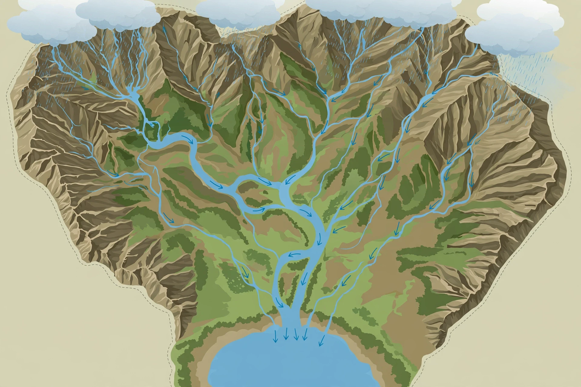
3.1 Tributaries: how small rivers build big ones
A tributary is any stream or river that flows into a larger one. The Missouri is a tributary of the Mississippi. The Ohio is another. Together, they more than double the Mississippi's flow. Tributaries matter because they are how a river grows. A river does not get its water mostly from rain falling directly into its channel; it gets it from its tributaries, which gather water from across the whole basin and deliver it, each one adding its own flow, its own sediment, and its own character to the main stem.
Tributaries also carry the history of the landscapes they drain. One tributary may run clear and cold out of forested hills; another may run brown with soil from farmland; a third may carry the mineral tang of a limestone valley. When they meet, the main river becomes a mixture of all of them — and sometimes, at the meeting point, you can see the two waters flowing side by side for a long way before they mix. The confluence of the Rio Negro and the Amazon near Manaus is famous for this: the dark, almost black water of the Negro runs alongside the pale, muddy water of the Amazon for kilometres, two rivers sharing one channel, before they finally blend.
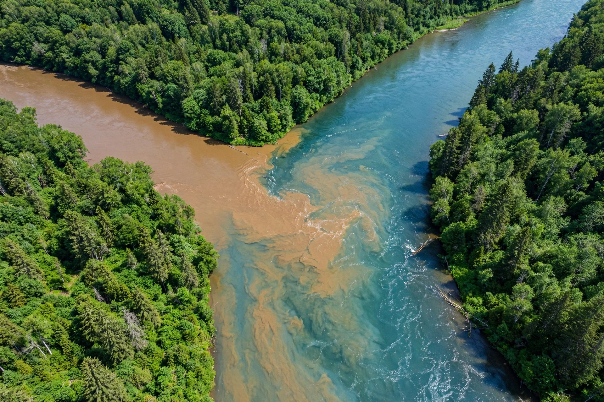
3.2 Reading a river network like a map
Once you know what a watershed is, maps start to read differently. The branching pattern of a river network tells you about the land underneath it. In flat country with soft, uniform rock, the branches spread out in a tree-like, dendritic pattern, wandering wherever the slope allows. Where the rock is folded or faulted, the rivers follow the weaknesses, turning in sharp, rectangular bends along cracks in the earth. Where a river meets a hard ridge, it may cut straight through it in a narrow gorge — a water gap — because the river was there first, cutting down as the land rose around it, patient as a saw.
You can practise this kind of reading on any map. Find the main river, trace it upstream, and watch it split into tributaries, and those into streams. Notice where the branches are dense and where they are sparse: dense branching usually means rain that runs off quickly over hard or saturated ground; sparse branching often means water sinking into porous rock instead. The map is not just showing you where the water is. It is showing you how the land works.
3.3 Groundwater: the river you cannot see
Not all of a river's water travels on the surface. A large share of it — often most of it during dry weather — arrives as groundwater, seeping into the channel from the soil and rock on either side. This is called baseflow, and it is the reason many rivers keep flowing for weeks after the last rain. The river is, in a sense, the visible tip of a much larger underground flow, the place where the water table meets the surface.
I learned this the practical way, on a field trip in my student days, when our group measured a small stream's flow in a dry spell and found it carrying far more water than the recent rain could explain. Our tutor knelt down, dug a small hole in the bank a metre from the water's edge, and watched it fill. "There is your river," she said. "Most of it is underground." That hole changed how I think about rivers. The channel is the part you can photograph, but the river's real reservoir is the ground itself — which is why pumping too much groundwater can dry up a river just as surely as a drought can.
4. How Rivers Work: Flow, Speed, and Discharge
So far we have followed water from the hills into the channel. Now comes the central question: once the water is in the channel, what decides how fast it moves, how much of it there is, and what it does to the land? This is the heart of how rivers work, and it comes down to three linked quantities — discharge, velocity and the shape of the channel — tied together by a relationship so simple it fits on one line: discharge equals velocity multiplied by the cross-sectional area of the flow. In symbols, Q = A × v. If the channel gets wider or deeper, the area grows, and the same speed carries more water. If the water speeds up, the same channel carries more water. Every flood, every drought, every change in a river's behaviour is a change in one of those three quantities, and the river adjusts the others to compensate.
Discharge is measured in cubic metres per second, and the numbers span an astonishing range. A small stream might carry less than one cubic metre per second — about a bathtub's worth, every second. The Amazon, the largest river on Earth by discharge, carries around 209,000 cubic metres per second into the Atlantic, more than the next several largest rivers combined. The Mississippi carries roughly 17,000. These are not fixed numbers. A river's discharge rises and falls with rain, snowmelt and season, sometimes by a factor of ten or more between low water and flood. Hydrologists measure it constantly, using instruments that record water level and converting that level into flow with a rating curve built from years of direct measurements. The National Park Service's pages on rivers describe how river systems are monitored and protected, and the monitoring is the unglamorous backbone of everything we know about floods, droughts and water supply.
4.1 Why water in the middle moves fastest
Stand on a bridge and drop a leaf into a river, and watch where it goes. If you drop it near the bank, it drifts slowly. Drop it in the middle and it races away. That is not an illusion. Water moves fastest in the middle of the channel and near the surface, and slowest near the bed and the banks, where friction with the rough ground drags it back. The fastest thread of current, called the thalweg, usually sits just below the surface and over the deepest part of the channel. This uneven speed is why rivers sort their sediment the way they do: the fast water in the middle can carry coarse gravel, while the slow water near the banks can only carry fine silt, which settles out as mud.
The shape of the channel matters too. A deep, narrow channel moves water efficiently, with relatively little friction for its volume. A wide, shallow channel loses more energy to friction and moves water slowly. This is one reason rivers change their shape as they go: a river that is given a steep slope and plenty of water will cut down and narrow, becoming more efficient; a river that loses slope will spread out, slow down and drop its load. The channel is not a fixed pipe. It is a shape the river builds for itself, and rebuilds after every flood.
On that same student field trip I mentioned earlier, we measured a stream's speed with the simplest instrument in hydrology: an orange. We dropped oranges at measured intervals, timed them over a marked stretch, and averaged the results. It sounds like a joke, but it is a real method — oranges float just below the surface, they are visible, and they do not blow away in the wind the way a leaf does. Our oranges told us the stream was moving at about half a metre per second in the middle and barely a crawl near the edges. That single measurement, crude as it was, explained the shape of the bed beneath us: gravel in the middle where the current was strong, sand and silt at the edges where it was weak. The river had sorted its own bed, grain by grain, according to speed.
4.2 Laminar flow, turbulent flow, and why rivers are rarely smooth
Water can flow in two ways. In laminar flow, it slides in smooth, parallel layers, like a sheet of glass. In turbulent flow, it churns and eddies, mixing in all directions. Almost every river you have ever seen is turbulent, and that turbulence is essential to how a river works. Turbulence lifts sediment off the bed and holds it in suspension; it mixes oxygen into the water, which is what fish and insects breathe; and it is what makes the surface of a river look alive, full of swirls and standing waves. A river that flowed in smooth, laminar sheets would be a very different and much poorer thing — its sediment would settle, its water would stagnate, and its life would thin out.
Turbulence also explains why rivers are so good at their work. A turbulent current does not just push sediment along the bed. It picks it up, carries it, drops it, picks it up again — a relay race that can move a grain of sand hundreds of kilometres over years. And because turbulence grows stronger with speed, a flood does far more than carry more water: it carries vastly more sediment, and much coarser sediment, than the same river on an ordinary day. A single big flood can move more rock than a decade of normal flow.
4.3 The long profile: a river's shape from source to sea
If you plot a river's height against its distance from the source, you get a curve called the long profile. Near the source it is steep, like the top of a ski jump. Farther down it flattens, and near the sea it is almost level. The shape is concave — steep at the top, gentle at the bottom — and it is no accident. The upper river has little water but a steep slope, so it cuts downward hard. The lower river has enormous water but almost no slope, so it flows gently and drops its sediment. The profile is the river's way of balancing its energy: steep where the water is small, flat where the water is big, so that the energy available for carving stays roughly even along the whole length.
Rivers work toward a smooth long profile, but they rarely reach it. Hard bands of rock create steps — rapids and waterfalls — where the river cannot cut down as fast. A waterfall is often just a hard layer of rock holding up the river's progress while the softer rock below is worn away. The river will get through eventually, cutting back the waterfall upstream, grain by grain, year by year. Niagara Falls, for instance, has been retreating upstream for thousands of years, and will keep retreating until the falls reach Lake Erie — a slow-motion event on a human timescale, but a fast one in geology. A river never forgets a step in its profile. It just works on it until it is gone.
Course | Gradient | Channel | Main work | Typical features |
|---|---|---|---|---|
Upper course | Steep | Narrow, rocky, shallow | Erosion downward | Rapids, waterfalls, V-shaped valleys |
Middle course | Moderate | Wider, deeper, smoother bed | Erosion sideways and transport | Meanders, floodplains, oxbow lakes |
Lower course | Gentle | Wide, deep, slow | Deposition | Levees, deltas, wide floodplains |
The table above is a simplification — real rivers blur the boundaries, and a single river can show upper-course features in its lower reaches where the rock is hard — but it captures the broad pattern. As a river travels, it trades gradient for volume, and its work shifts from cutting down to cutting sideways to building up.
5. Meanders: Why Rivers Wander
Look at a river on a map and you will notice something odd: rivers almost never run straight. Even across a flat plain, with no hills to dodge and no hard rock to avoid, a river will wander in great lazy S-curves called meanders. This is one of the most beautiful facts in all of physical geography, and it is also one of the most surprising: a river bends because it cannot help it. Straight channels are unstable. Given a flat plain and enough time, any river will start to meander, and once it starts, the meandering feeds on itself.
The mechanism is a loop of cause and effect. Imagine a channel that is almost, but not quite, straight — a tiny bend, no more than a ripple in the bank. Water flowing around that bend is flung toward the outside of the curve, the way you are pressed against the door of a car going around a corner. The fast water on the outside of the bend erodes the bank there, undercutting it and making the bend sharper. At the same time, the slow water on the inside of the bend drops its sediment, building a gentle slope of sand and gravel called a point bar. The bend grows sharper, the outside erodes faster, the inside builds up faster, and the curve deepens. The river is, in effect, chasing its own tail, and the loop only stops when the bend becomes so tight that the river cuts across its own neck.
A straight river is a river that has not had time to be itself yet. Give any river a flat plain and enough years, and it will write its signature across the land in loops and curves.
I have a favourite place to watch this happen: a lowland river near where I once lived, where a footpath follows the bank for several kilometres. Over the years I walked it, I could see the changes. A tree that had stood on the outer bank one spring was leaning by autumn, its roots exposed, and gone by the next year, toppled into the current. On the inner bank, a sandbar that had been ankle-deep in water was dry land by the following summer, colonised by grasses and then by saplings. The river was migrating sideways, eating one bank and building the other, and the path of the channel was visibly different from one year to the next. It was slow enough to miss if you were not looking, and fast enough to be unmistakable if you were.
5.1 Oxbow lakes: when a river short-circuits itself
When a meander loop becomes too tight, the river takes a shortcut. During a flood, water finds the narrow neck of land between two arms of the loop and cuts straight across it, abandoning the loop entirely. The abandoned loop is left behind as a curved, crescent-shaped lake — an oxbow lake — slowly silting up and turning into marsh, then meadow, then dry land. Oxbow lakes are the fossils of old river courses, and a floodplain full of them is a record of where the river has been, written in water.
This cutting-off process, called a meander cutoff, is one of the river's ways of keeping its own length in check. Left alone, meandering would make a river longer and longer, and its slope gentler and gentler, until it could barely flow. Cutoffs shorten the channel and restore the slope, and the cycle begins again. A river is always negotiating with itself: meandering lengthens it, cutoffs shorten it, and the balance between the two keeps the river's gradient in the range it needs.
5.2 Braided rivers: when there is too much sediment to carry
Not all rivers meander. Some, called braided rivers, split into many shallow channels that weave around bars of sand and gravel like strands of a plait. Braiding happens when a river carries more sediment than it can move — usually because the slope is steep, the flow varies wildly, or the banks are made of loose sand and gravel that the river can push around easily. Mountain rivers below glaciers are often braided, and so are rivers in dry country after flash floods. The channels shift with every flood, and the whole riverbed can move sideways by metres in a single event. Braided rivers are rivers in a hurry, with too much material and too little patience to settle into a single channel.
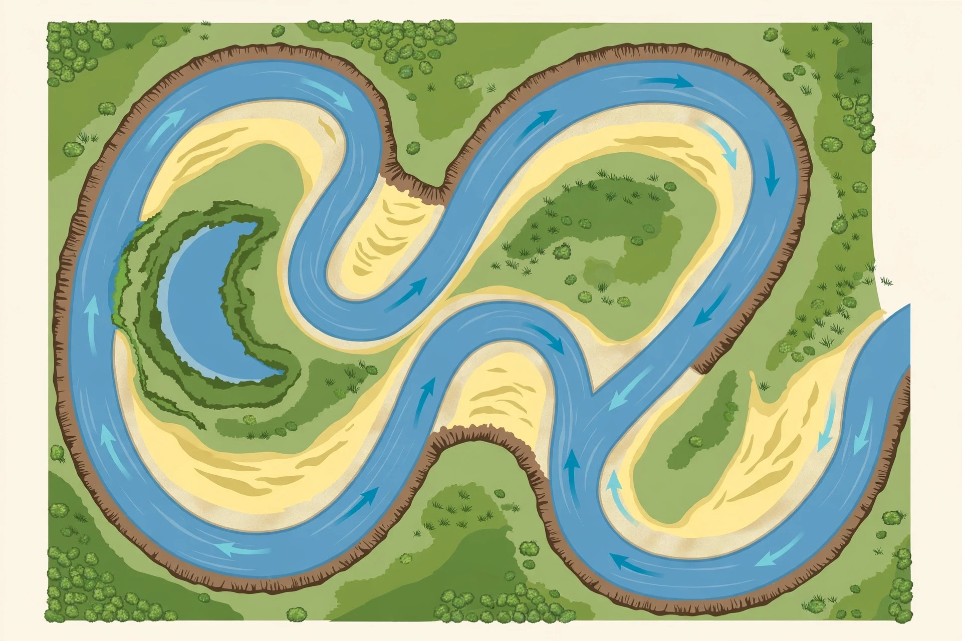
5.3 How much does a river move?
The answer depends on the river, but the scale surprises most people. A large lowland river can shift its channel sideways by several metres in a single flood, and by hundreds of metres over a human lifetime. The Mississippi has moved so much over the centuries that whole towns built on its banks have found themselves miles from the water, and the river's old courses are still visible from the air as dark, curving scars across the floodplain. This is why building close to a river is always a negotiation, and why the floodplain — the flat land beside the river — is called a floodplain: it is the land the river uses, on its own schedule, whether or not we have built on it.
6. Erosion and Deposition: Rivers as Earth's Sculptors
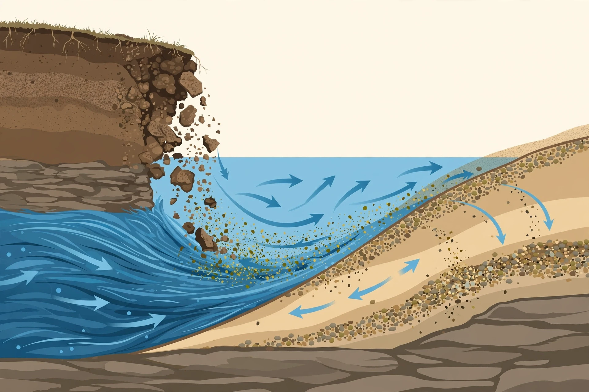
If meanders are a river's handwriting, erosion and deposition are its tools. A river sculpts the land in two ways at once: it takes material away from some places and puts it down in others. The taking away is erosion. The putting down is deposition. Together, over millions of years, they have carved canyons, built plains, filled valleys and moved entire mountains, grain by grain, to the sea.
Erosion happens in four ways, and a river uses all of them. The first is hydraulic action: the sheer force of moving water, which can prise apart cracks in rock and pluck loose boulders from the bed, especially in flood. The second is abrasion, sometimes called corrasion: the sediment the river carries acts like sandpaper, grinding the bed and banks as it is dragged along. A river carrying sand and gravel cuts far faster than clear water, which is why the muddiest rivers are often the most destructive. The third is attrition: the sediment particles themselves wear each other down as they collide, becoming smaller and rounder the farther they travel. That is why a pebble in a headwater stream is angular and rough, while a pebble near the sea is smooth and round — it has been tumbled for hundreds of kilometres. The fourth is solution: water, slightly acidic from dissolved carbon dioxide, dissolves limestone and other soluble rocks, carrying them away invisibly in solution.
A river does not need a chisel. Given enough time, moving water and the sand it carries will cut through anything — even solid rock — because the river never stops, and the rock never gets a rest.
The Grand Canyon is the most famous example of what this work adds up to. The Colorado River has cut a gorge more than a kilometre deep through rock that is, in places, nearly two billion years old. It did not do this quickly or violently. It did it the way rivers always do: a grain at a time, year after year, for millions of years, with floods doing most of the heavy lifting. Stand on the rim of the canyon and the scale is almost impossible to take in — until you remember that the river at the bottom is still doing the same work today, and that the canyon is not finished. It is a work in progress, and the river is the artist.
6.1 The load a river carries
A river's load — all the material it carries — comes in three forms. Bed load is the coarse stuff that rolls, slides and bounces along the bed: gravel, pebbles, cobbles. Suspended load is the finer material — silt and clay — held up in the water by turbulence, which is what makes a river look brown and muddy after rain. Dissolved load is the material carried invisibly in solution, mostly minerals dissolved from rock. Most of the sediment a river moves is suspended load, and most of it moves during floods. A river in flood can carry in a few days as much sediment as it carries in an ordinary year.
Here is a detail that catches many people by surprise: a river carries its load downstream, but the individual grains do not travel in one smooth trip. A grain of sand is picked up, carried a short distance, dropped, buried, dug up again by the next flood, and carried a little farther. Its journey to the sea is a series of hops spread over years, decades, or even centuries. The river is a relay, not a conveyor belt, and the sediment in the channel today is a mixture of material that arrived last week and material that has been working its way downstream since before anyone alive was born.
6.2 Where deposition happens — and what it builds
A river deposits its load whenever it slows down, and it slows down in predictable places: on the inside of meander bends, where the water spreads out and shallows, where it meets the sea, and wherever it spills over its banks in flood. Each of these places gets its own landform. Inside bends build point bars. Floods build natural levees — low ridges of silt along the banks, dropped as the floodwater spills out of the channel and suddenly slows. And where the river meets the sea, deposition builds deltas, which we will come to next.
Deposition is also why floodplains are so fertile. Every flood leaves behind a thin skin of fresh silt, rich in minerals ground off rocks far upstream. Farmers have known this for thousands of years, which is why the great early civilisations grew up on river floodplains: the river delivered fresh soil every year, free of charge. The same silt that builds farmland also builds problems when it arrives in the wrong place — silting up reservoirs, burying riverbeds, and choking harbours — but the mechanism is the same. A river builds land wherever it slows down, and the land it builds is some of the richest on Earth. That is how rivers work as builders: they borrow rock from the mountains and pay it back as farmland near the sea.
7. Deltas: Where Rivers Meet the Sea
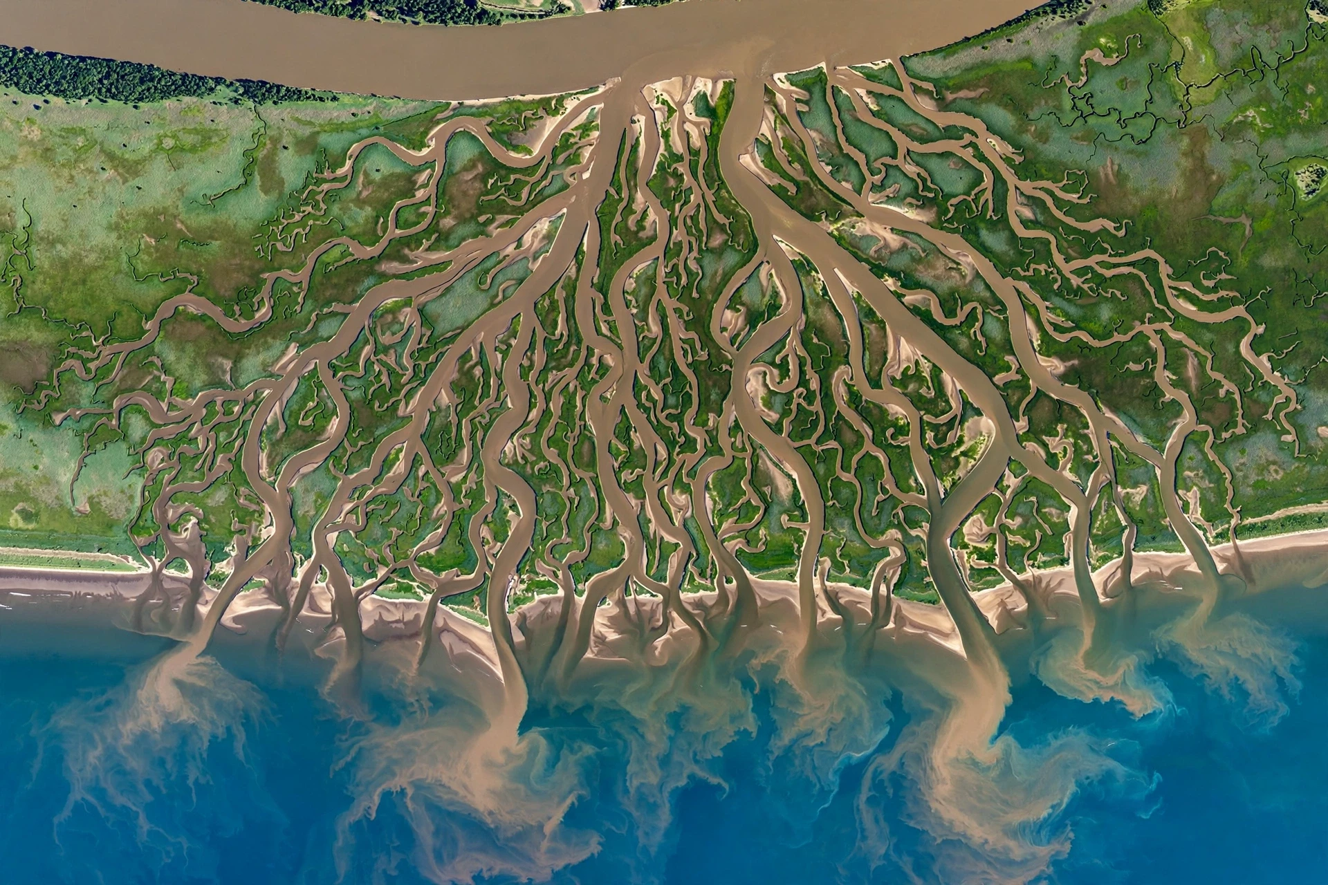
Every river's journey ends at the sea, and the ending is often spectacular. When a river reaches the ocean, its flow spreads out and slows down, and it can no longer carry its sediment. The load drops, grain by grain, and builds new land out into the sea. That new land is a delta — a fan of channels, islands and marshes that grows, shifts and rebuilds itself as the river changes course. The Nile Delta, the Mississippi Delta, the Ganges-Brahmaputra Delta: these are some of the largest and most fertile landscapes on Earth, built entirely from sediment that rivers carried from far inland and laid down at the coast.
A delta forms only when the river delivers sediment faster than the sea can carry it away. If waves and tides are strong, they sweep the sediment along the coast and no delta grows. If the sea is calm and the river is heavily laden, the delta pushes outward, sometimes by many metres a year. The shape of the delta depends on the balance: river-dominated deltas, like the Mississippi's, push long fingers of land out into the sea; wave-dominated deltas, like the Nile's, are smoothed into broad arcs by the surf; tide-dominated deltas are cut into many parallel channels by strong tidal currents. The National Geographic education resource on rivers describes deltas as one of the key landforms rivers build, and the photographs from orbit tell the story better than any words: a delta seen from space looks like a tree branching into the sea, or a hand with its fingers spread.
7.1 Life on the edge: why deltas matter
Deltas are among the most productive places on the planet. Their soils are fresh and rich, their waters are full of fish and shellfish, and their marshes shelter birds, buffer storms and trap carbon. Hundreds of millions of people live on deltas — farming rice on the Ganges-Brahmaputra, fishing the Mekong, living in cities built on the Mississippi's mud. But delta life is a bargain with the river: the same floods that bring fresh silt also threaten homes, and the same channels that bring fish can change course without warning.
Deltas are also fragile in a way that is easy to miss. A delta only keeps growing while the river keeps delivering sediment. Trap that sediment behind dams upstream, and the delta begins to sink and shrink, starved of the material that built it. Pump groundwater from beneath it, and the land subsides faster. Raise the sea level, and the water pushes farther in. Several of the world's great deltas are now shrinking rather than growing, and the people who live on them are feeling the change in salt water creeping into wells and fields, and in land that floods more often than it used to.
7.2 Rivers that never reach the sea
Not every river ends in the ocean. Some end in lakes, some spread out and soak into the desert, and some simply dry up. These are called endorheic rivers, and they drain into closed basins with no outlet to the sea. The water that reaches the end evaporates, leaving its dissolved minerals behind — which is why closed-basin lakes are often salty. The shrinking of such lakes, when rivers are diverted for irrigation before they arrive, is one of the clearest demonstrations of how completely a river and its endpoint depend on each other. A river is not just a channel of water. It is a delivery system, and when the delivery stops, the place it was delivering to changes.
Where a river does meet the ocean, the meeting is a world of its own. Fresh water and salt water mix in estuaries, creating shifting zones of brackish water where some of the richest ocean nurseries on Earth are found. Young fish shelter in the calm, nutrient-rich water, and the mudflats feed millions of migrating birds. The river does not simply end at the coast. It reaches out into the sea, carrying nutrients that feed plankton far offshore, and its sediment plume can be seen from space, spreading for hundreds of kilometres. The sea and the river are not two separate worlds. They are one connected system, and the river is the link.
River | Approx. length (km) | Approx. discharge (m³/s) | Where it ends |
|---|---|---|---|
Nile | 6,650 | 2,800 | Mediterranean Sea |
Amazon | 6,400 | 209,000 | Atlantic Ocean |
Yangtze | 6,300 | 30,000 | East China Sea |
Mississippi–Missouri | 6,275 | 17,000 | Gulf of Mexico |
Danube | 2,850 | 6,500 | Black Sea |
The figures in this table are widely quoted rounded values, and the exact length of a river depends on where you say it starts and how you measure its bends, which is why the Nile and the Amazon have traded the "longest river" title for years depending on the method used. What the table makes plain is the difference between length and power: the Amazon is not the longest river, but it carries far more water than any other, because its basin is warm, wet and enormous. Length is a matter of geography. Discharge is a matter of climate and basin size — and discharge is what does the work.
8. Floods: When Rivers Leave Their Banks
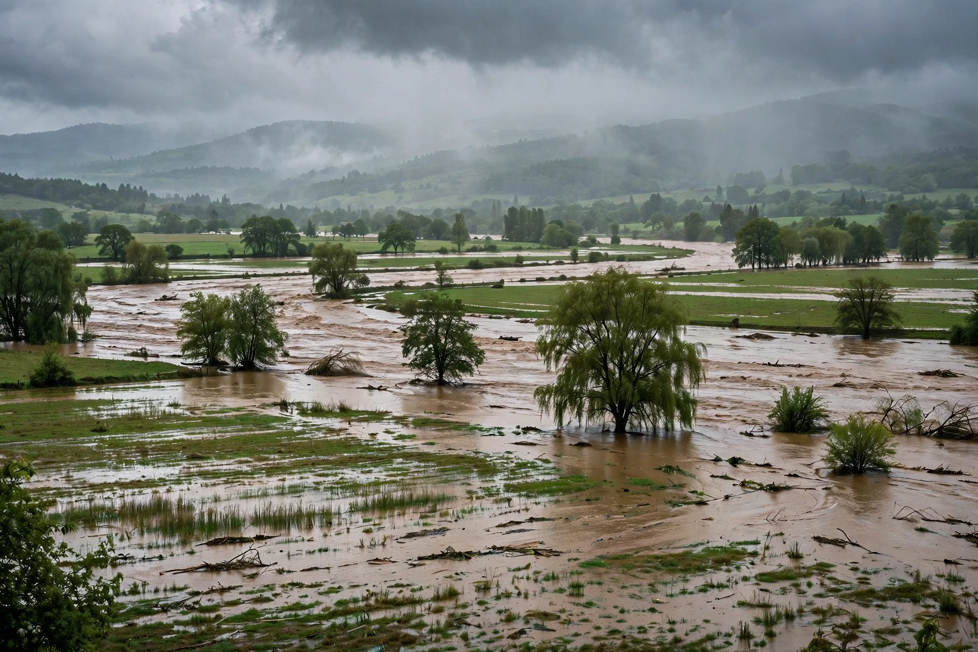
A flood is a river doing what rivers have always done: using more of its valley than usual. When discharge rises beyond what the channel can hold — after heavy rain, rapid snowmelt, or a storm surge pushing back up an estuary — the water spills over the banks and spreads across the floodplain. This is not a malfunction. It is part of how rivers work, and the floodplain exists precisely because the river floods it, leaving silt behind each time. The problem is not that rivers flood. The problem is that we have built houses, roads and cities on the land rivers use for flooding, and then acted surprised when the river came to collect.
Most people assume a flood is mainly a matter of too much rain falling in one place. What the records actually show is that the worst floods are usually a combination of causes arriving together: saturated ground that cannot absorb more rain, snow melting at the same time as rain falling, tributaries peaking at the same moment so their flood waves add up in the main river, and — in coastal rivers — a high tide or storm surge holding the river back so it cannot drain. A river flood is a system event, not a single downpour, and that is why forecasting floods is one of the hardest jobs in hydrology. The rain is only the first part of the story.
Floods come in several kinds, and telling them apart matters:
River floods build slowly over days as rain accumulates across a whole basin, and they can last for weeks on a large river.
Flash floods arrive in minutes or hours, usually in steep, small catchments or in cities, where water has nowhere to soak in.
Coastal floods happen when storm surges and high tides push seawater up rivers and over low land.
Snowmelt floods arrive in spring, when a warm spell melts a deep snowpack faster than the river can carry the water away.
Each kind needs a different warning and a different response, which is why flood forecasters watch not just the rain, but the soil, the snowpack, the river levels upstream, and the tide tables all at once.
8.1 Why floods are not all bad
It is easy to see floods only as disasters, and for the people caught in them, they are. But from the river's point of view, floods are maintenance. A flood scours the bed, moves sediment that ordinary flows cannot shift, reconnects the river to its floodplain, fills oxbow lakes and wetlands, and delivers the nutrients that floodplain forests and fisheries depend on. Many river species time their breeding to the flood season, and some floodplain trees only release their seeds when the water rises. Take the floods away entirely — by damming a river and holding back every peak — and the floodplain slowly starves: the wetlands dry out, the fish lose their breeding grounds, and the riverbed below the dam, robbed of its sediment, cuts downward instead.
The challenge of living with rivers is not to stop floods. It is to give them room. The most successful flood management in the world does not try to wall the river in everywhere; it sets aside space — floodplains, washlands, restored wetlands — where the water can go safely, and keeps people and buildings out of the places the river will need. A river that is allowed to spread out in the right place is a river that arrives at the city downstream lower and slower. Room for the river is not a concession to nature. It is engineering that works with the river instead of against it.
A floodplain is not empty land waiting to be used. It is the river's own spare room, and the river will use it on its own schedule, with or without our permission.
8.2 Reading a river in flood
If you ever watch a river rising, there are signs worth knowing. The water turns brown as it picks up sediment. Debris — branches, leaves, the occasional fence post — rides the current. The sound changes: a river in flood is louder, deeper, more continuous than a river at normal flow. And the water level can rise with frightening speed in a small catchment, far faster than most people expect. The single most important safety rule is also the simplest: never walk or drive through floodwater. It takes only a small depth of fast-moving water to knock a person over or float a car, and the water hides what is underneath — washed-out roads, open drains, debris. Floodwater is not just water. It is water carrying everything the river has picked up, moving faster than you can run.
9. Rivers in Human History
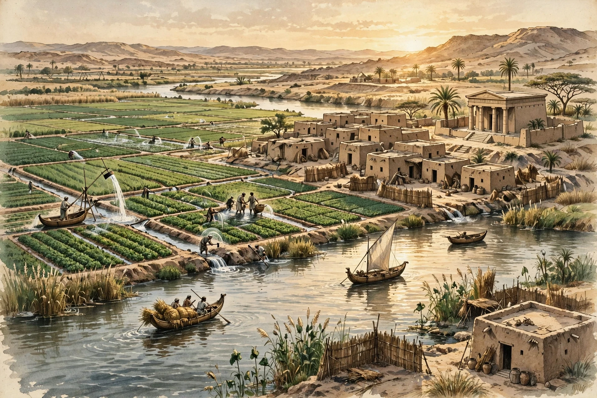
Human history is, to a surprising degree, river history. The first cities, the first farms, the first empires all grew up beside rivers, and for the same reasons: rivers gave people drinking water, fish, fertile floodplain soil, transport, and a natural defence. The Nile, the Tigris and Euphrates, the Indus, the Yellow River — each of these cradled a civilisation that learned to read the river's seasons and build its life around them. The Egyptians measured the Nile's flood each year with stone gauges called nilometers, and a good flood meant a good harvest, while a bad flood meant hunger. The river was not scenery. It was the calendar, the economy and the god, all at once.
Rivers were also the first highways. Before roads and railways, the cheapest way to move anything heavy was by water. Timber, grain, stone, coal and people all travelled by river, and towns grew where rivers could be crossed, where tributaries joined, or where the river met the sea. Many of the world's great cities — London on the Thames, Paris on the Seine, Cairo on the Nile, Shanghai on the Yangtze — sit where they do because a river put them there. Even today, with motorways and air freight, rivers carry an enormous share of bulk cargo: barges on the Mississippi, the Rhine and the Yangtze move millions of tonnes of grain, coal and containers every year, using far less energy per tonne than trucks.
9.1 Irrigation, power and the bargain we made
The bargain humans made with rivers was always two-sided. Irrigation turned dry land into farmland, but it also took water out of rivers, sometimes so much that the river never reached the sea. Dams gave us electricity and stored water for dry seasons, but they also trapped sediment, blocked fish migrations and drowned valleys. Canals joined river systems and opened trade routes, but they also carried invasive species from one basin to another. Every benefit came with a cost, and the costs were often paid downstream, years later, by people who had not shared in the benefit.
The history of river engineering is a history of learning this lesson, slowly and sometimes painfully. Early dams were built to solve one problem — floods, or water supply, or power — and the side effects were discovered later. Modern river management tries to think about the whole system at once: the fish that need to migrate, the sediment that needs to reach the delta, the floodplain that needs its floods, and the people who need water and power. It is harder, and it involves more arguments, but it works better, because a river is a system, and you cannot change one part of it without the rest noticing.
9.2 Rivers in culture and the imagination
Rivers run through our stories as deeply as they run through our landscapes. They are boundaries and meeting places, roads and obstacles, symbols of time passing and of journeys taken. The river in the story is almost always moving, and that movement is the point: a river is the one thing in the landscape that is always going somewhere, and humans have always wanted to go with it. From the first dugout canoes to the great river steamers, from the songs sung on riverbanks to the poems written about them, rivers have carried our imagination as surely as they have carried our cargo. A river is never just water. It is the oldest road we have, and we are still travelling it.
10. Rivers and the Living World
A river is not just a channel of water. It is a living corridor, and some of the richest ecosystems on Earth depend on it. The water itself holds fish, insects, molluscs and microscopic life; the banks hold reeds, willows and floodplain forests; the floodplain holds wetlands that filter water, store carbon and shelter birds. The connection runs in both directions: the land feeds the river with leaves, insects and nutrients, and the river feeds the land with water, silt and fish. Salmon carry nutrients from the ocean far upstream, and when they die after spawning, their bodies fertilise the forests along the banks — a gift from the sea, delivered by the river.
River life is organised by flow. Fast, cold, oxygen-rich headwaters suit one set of species; slow, warm, nutrient-rich lowland reaches suit another. Change the flow — dam it, warm it, pollute it — and the community changes with it, often fast. This sensitivity is what makes river life such a good indicator of environmental health: the insects in a stream tell you about the water quality of the whole catchment, because they live in the water, breathe it, and cannot leave when it turns bad. Scientists use them as living instruments, and a stream full of mayflies and stoneflies is telling you something very different from a stream where only a few hardy worms survive.
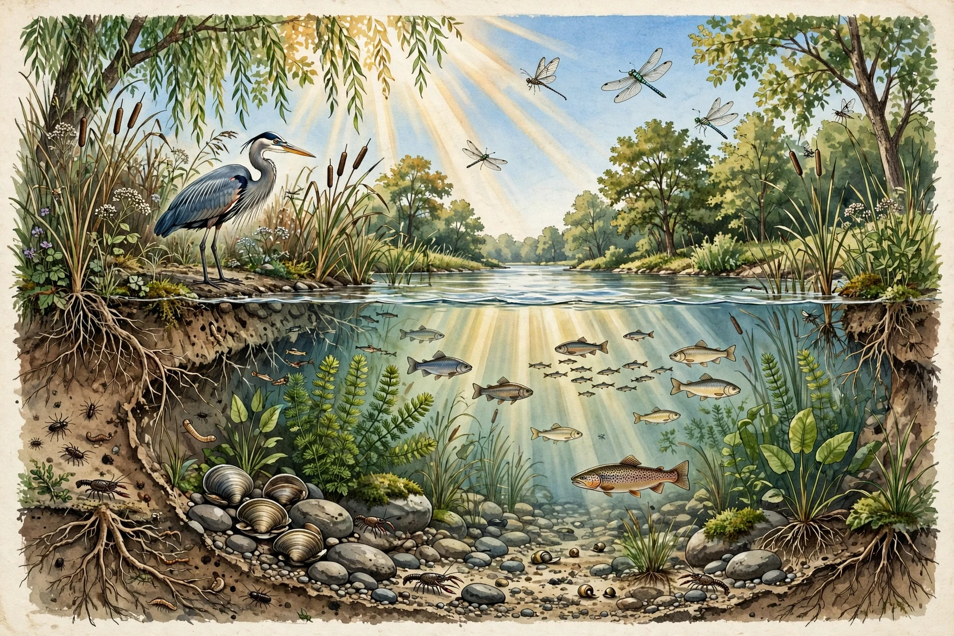
What keeps a river alive, in the end, is connection: connection to its headwaters, to its floodplain, to its tributaries, and to the sea. Break those connections — with a dam that blocks migration, a levee that cuts off the floodplain, a culvert that stops a stream — and the river's living world thins out, even if the water still looks the same. Restore them, and life often returns with startling speed. I have seen a small stream, freed from a concrete channel and given back its bends and its gravel, fill with fish and insects within a few years. Rivers want to be alive. Given half a chance, they are.
Three things matter most for keeping a river healthy:
Natural flow: the rise and fall of the seasons, including floods, not a flat, constant release from a dam.
Clean water: low in pollution and sediment from soil erosion, so light reaches the bed and oxygen stays high.
Connected habitat: open passage for fish, linked floodplains, and riverside trees that shade the water and drop in food.
None of these is complicated. All of them require us to think of the river as a whole system, not as a pipe for moving water from one place to another. That is how rivers work as living systems: flow, clean water and connection, all three together.
11. What Most People Get Wrong About Rivers
Rivers are familiar, and familiarity breeds confident mistakes. Here are the ones I hear most often, and what the evidence actually shows.
11.1 "Rivers always flow south"
This is the misconception I meet most, and it is easy to see where it comes from: several famous rivers — the Nile, the Mississippi — do flow generally southward. But rivers flow downhill, not south. The direction is set by the slope of the land, and land slopes in every direction. The Rhine flows north to the North Sea. The Ob and the Yenisei flow north to the Arctic Ocean. The Mackenzie flows north-west across Canada. In the southern hemisphere, rivers flow south, north, east and west with equal indifference. If you remember one sentence from this article, make it this one: rivers follow gravity, not the compass.
11.2 "The Nile is obviously the longest river"
Most people assume the Nile is the longest river in the world, full stop, but what we actually see in the measurements is a close contest with no clean winner. The Nile is usually quoted at about 6,650 kilometres, and the Amazon at about 6,400 — but those numbers depend on where you decide each river starts, which tributary you count as the source, and how you measure a winding channel. Different methods give different answers, and serious geographers disagree about them. The honest answer is that the Nile and the Amazon are both around six and a half thousand kilometres long, and the ranking depends on your ruler. What is not in doubt is that the Amazon carries far more water than any other river, and that is the number that matters most for what the river does.
11.3 "A river is just the water in its channel"
As we saw earlier, the water you see is only part of the river. The groundwater feeding it from below, the floodplain it uses in high water, the tributaries gathering water across the basin — all of it is the river. Managing only the visible channel is like treating only a fever and ignoring the infection. The river is the whole system, and it behaves like one.
11.4 "Floods are unnatural disasters"
Floods feel unnatural because they damage our buildings, but they are one of the most natural things a river does. A river without floods is like a forest without fire: the system evolved with it, depends on it, and suffers without it. The disaster is not the flood. The disaster is building in the flood's path and then being surprised.
11.5 "Dams only affect the river behind them"
A dam changes the river for its whole length, in both directions. Upstream, it drowns the valley and traps sediment. Downstream, it changes the flow, starves the river of sediment, blocks migrating fish, and can reshape the delta hundreds of kilometres away. A dam is not a local change. It is a change to the entire river system, and its effects are felt from the headwaters to the sea.
Frequently Asked Questions
How do rivers form?
Rivers form when rain and snow falling on high ground gather into channels and flow downhill under gravity. Small channels join into larger ones, groundwater seeps in from below, and over time the flowing water carves a permanent channel. A river needs a water supply, a slope, and a landscape that drains toward one outlet — given those three, a river will form, and it will keep shaping its own channel as it flows.
Where does river water come from?
River water comes from rain and snow falling on the river's watershed, plus groundwater seeping into the channel from the soil and rock on either side. Some rivers are fed mainly by rain, some by snowmelt, some by glaciers, and many by a mix of all three. During dry weather, most of a river's flow is groundwater — the slow, steady supply that keeps rivers running between rains. It is a quiet part of how rivers work, and an easy one to overlook.
Why do rivers meander instead of flowing straight?
Rivers meander because straight channels are unstable. Any small bend makes the water flow faster on the outside of the curve, eroding that bank, while slow water on the inside drops sediment and builds a bar. The bend grows sharper, and the process feeds on itself until the river cuts across the loop and starts again. On a flat plain, meandering is the river's natural state.
What is the difference between a river and a stream?
There is no sharp scientific boundary. In general, a stream is a smaller channel and a river is a larger one, but the words are used loosely and vary by region — what one place calls a river, another calls a creek. Hydrologists sort channels by their discharge and by their position in the network, not by their name. A stream that joins a larger channel is a tributary, whatever it is called locally.
How do rivers create deltas?
When a river reaches the sea, its flow spreads out and slows down, and it can no longer carry its sediment. The sediment drops and builds new land — a delta of channels, islands and marshes. A delta grows only when the river delivers sediment faster than waves and tides can carry it away. Trap the sediment behind dams upstream, and the delta stops growing and begins to sink.
Are floods always bad?
No. Floods damage homes and farms, and they can be deadly, but they are also essential to how rivers work. Floods move sediment, recharge wetlands, fill oxbow lakes, deliver nutrients to floodplain soils, and trigger breeding in many fish and trees. The goal of flood management is not to end floods but to give them safe room — keeping people out of the floodplain and letting the river use the land it needs.
Can a river change direction?
A river cannot flow uphill, but it can change its course dramatically. Meander cutoffs shorten the channel, floods can push a river into a new channel, and over centuries rivers can abandon one course entirely and take another — a process called avulsion. The Yellow River in China has famously changed course many times, sometimes shifting its mouth by hundreds of kilometres. A river's course is a habit, not a promise.