

The air went still first. I was standing on a hillside one summer evening, watching a cloud tower climb until its top flattened into an anvil, when the wind dropped away and the birds went quiet. The light turned a strange yellow-green, and then a jagged white fork tore the sky open. The flash came first, and a few seconds later the thunder arrived as a rolling crack I felt in my chest. That gap between light and sound, that sense of a sky suddenly holding a charge, is where the story of how lightning works begins.
Lightning is one of the most familiar sights on Earth and one of the most misunderstood. Most of us have seen it from a window, counted the seconds after a flash, or been told as children that it never strikes the same place twice. Yet the physics behind it is elegant and, once you see it, surprisingly easy to follow. A thunderstorm is a machine for separating electric charge. It lifts warm, moist air, freezes water high up, lets ice and soft hail collide millions of times, and sorts the tiny charges those collisions create until the top of the cloud and the bottom of the cloud carry opposite signs. When the difference grows too large, the air itself breaks down, and a channel of superheated plasma bridges the gap in a fraction of a second. That bridge is lightning. The sound it makes is thunder.
This article follows that chain from beginning to end. We will look inside a thunderstorm to see where the charge comes from, trace a single strike step by step from the first faint leader to the brilliant return stroke, compare the main types of lightning, explain why thunder rumbles instead of cracking once, and finish with the safety rules that matter most. Along the way, we will clear up a few ideas that sound sensible but do not survive a look at the evidence. No advanced physics is needed. If you can picture a cloud as a tall, churning column of air, a battery as a device that separates charge, and a spark as air briefly becoming a conductor, you already have the three pictures that explain most of what lightning does.
1. What a Thunderstorm Actually Is
A thunderstorm is not simply a rain cloud with extra drama. It is a specific kind of cloud, a cumulonimbus, built by strong upward motion in air that is warm and moist near the ground and much colder above. On an ordinary cloudy day, air rises gently and spreads out. On a thunderstorm day, the atmosphere is unstable: a parcel of warm air near the surface is lighter than the air around it, so it keeps rising, cooling as it goes, and condensing into cloud. The process feeds on itself. As water vapour condenses, it releases heat, which makes the parcel lighter still, which makes it rise faster. The result is a tower that can climb 10 to 15 kilometres in under an hour, punching through layers of the atmosphere until it hits a stable layer near the top and spreads sideways into the flat anvil shape that is the signature of a mature storm.
I learned to respect that speed the first time I watched a storm build from a field station during a summer field course. At midday the sky was blue with a few harmless puffs of cumulus. By mid-afternoon, one of those puffs had grown a dark base, a cauliflower top, and a shadow that raced across the ground. A colleague pointed at the anvil spreading overhead and said, simply, that we had about twenty minutes. She was right. The first rain arrived as a wall, the temperature dropped several degrees in minutes, and the first flash lit the cloud from inside before we had finished packing the instruments. That rapid growth is the first clue to lightning. A storm does not need hours to become dangerous. It needs the right ingredients — heat, moisture, and a trigger to lift the air — and then it builds its own engine.
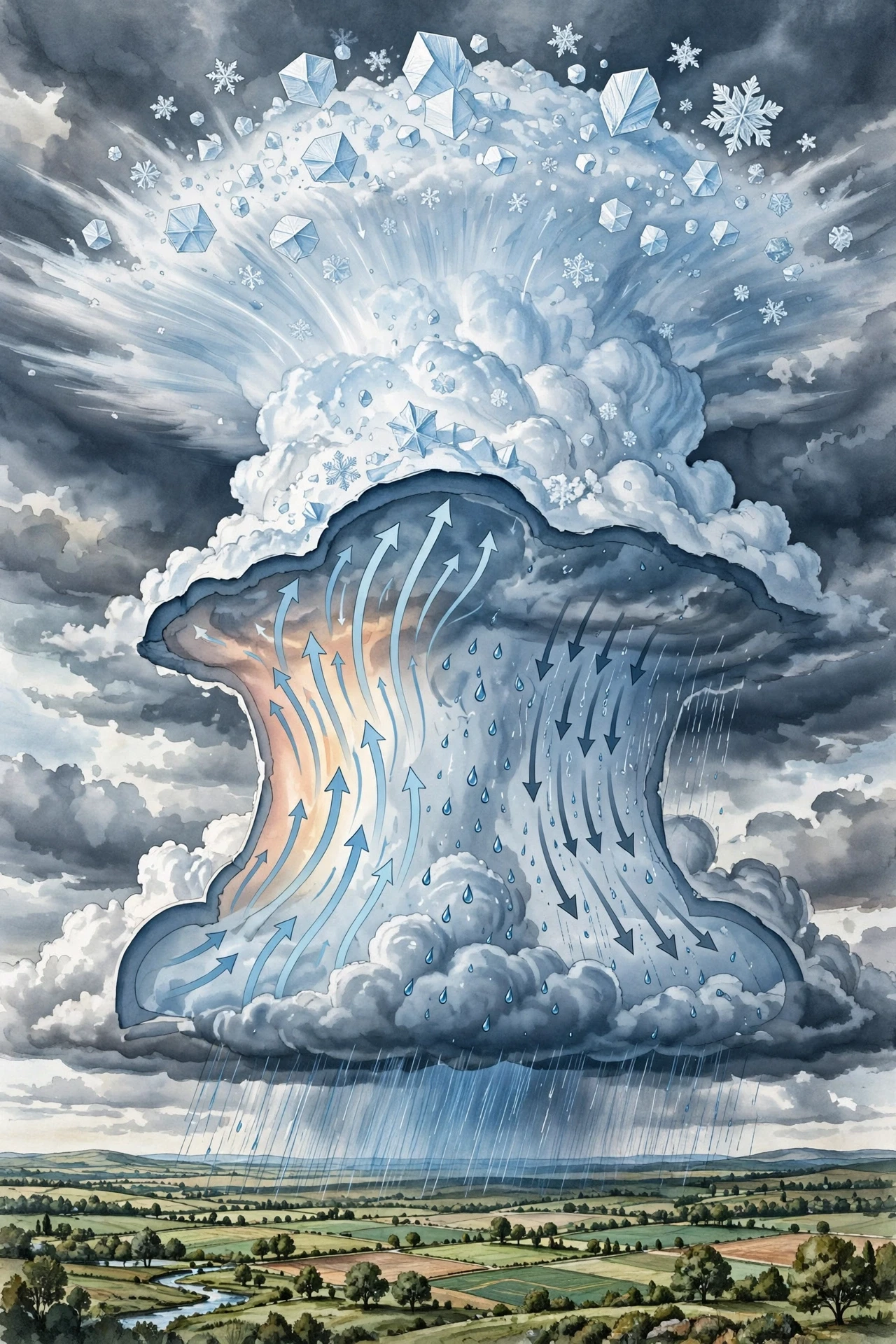
Inside a cumulonimbus, the air is not moving in one direction. Warm air rushes upward in an updraft that can exceed 100 kilometres per hour in a strong storm. Cooler air, loaded with rain, sinks in a downdraft beside it. Between them, water droplets are carried up, freeze into ice crystals, and fall back through the cloud as soft hail, called graupel. Those particles do not drift politely past each other. They collide, bounce, melt, refreeze, and collide again, thousands of times in a single cloud, and every collision is a tiny exchange of electric charge. A single collision moves almost nothing. Millions of collisions, sorted by the updrafts and downdrafts, move a great deal.
To understand thunderstorms more broadly, including how forecasters track them, see the guide to Meteorology. The same rising and sinking air that makes a storm also sets the stage for the charge separation that follows. A storm is, in that sense, two machines in one: a weather machine that moves heat and water, and an electrical machine that moves charge.
1.1 The three stages of a thunderstorm
Thunderstorms move through three stages, and lightning belongs mainly to the middle one. In the cumulus stage, the cloud is growing. Updrafts dominate, the top is still rounded, and there is little or no rain at the ground. The cloud is gathering the ingredients, but the electrical machine has not yet reached full power.
In the mature stage, updrafts and downdrafts exist side by side. Rain falls heavily, hail may form, the anvil spreads at the top, and lightning is at its most frequent. This is the stage most people picture when they think of a thunderstorm: dark base, towering cloud, rain, and repeated flashes. The mature stage is also the most dangerous, because the storm is producing lightning, strong wind, and heavy rain at the same time.
In the dissipating stage, the downdrafts take over. The updraft is cut off, the cloud loses its supply of warm, moist air, rain weakens, and lightning fades. The anvil may linger as a thin veil of ice crystals long after the rain has stopped, a quiet reminder of the energy the storm spent.
Not every thunderstorm reaches the same strength. A single-cell storm may live for half an hour and produce a handful of flashes. A multi-cell storm, a cluster of cells at different stages, can last for hours and produce lightning across a wide area. A supercell, a long-lived rotating storm, can produce severe weather including large hail and tornadoes, and its lightning patterns are more complex. The National Weather Service explains the structure and life cycle of thunderstorms in its storm guide, which is a good place to check the basics before going deeper into the electrical side (National Weather Service).
1.2 Why only some clouds make lightning
If every cloud made lightning, the sky would flash constantly. It does not, because most clouds lack the ingredients for strong charge separation. A thin layer of stratus cloud, for example, has gentle motion, small droplets, and no deep vertical development. It can drizzle for hours without a single flash. A fair-weather cumulus has an updraft, but it is shallow and short-lived, and its top stays well below freezing, so there is little ice to collide and little charge to separate.
Lightning needs depth, cold, and churn. The cloud must be tall enough that its top reaches well below freezing, so that ice crystals and graupel can form and collide. It must have strong updrafts to keep those particles suspended and cycling through the cloud. And it must have enough moisture to sustain the process. When those conditions line up, the cloud becomes an electrical generator. When they do not, you get rain without fireworks, or a cloud that grows, rains itself out, and fades without ever flashing.
That distinction matters for safety as well as for science. People sometimes assume that a storm is only dangerous when it is raining hard overhead. In reality, lightning can strike well away from the rain, from the anvil or the edge of a storm, and the first flash of a developing storm can arrive before the rain does. The cloud's electrical state, not the rainfall at your feet, decides the risk.
2. How Lightning Works: From Still Air to a Giant Spark
At its simplest, how lightning works comes down to three steps: separate charge, build up a large voltage, and let the air break down. The details are rich, but the outline is the same whether the flash goes from cloud to ground, from one part of a cloud to another, or from a cloud into the clear air above it. Something separates positive and negative charge. The separation creates an electric field. When the field grows strong enough, the air stops being an insulator and becomes, briefly, a conductor. Current rushes through that conducting channel, heating it to tens of thousands of degrees, and the channel glows white-hot. We see the glow as lightning and hear the explosive expansion of the heated air as thunder.
That outline sounds abstract until you compare it with a spark you already know. Rub a balloon on your hair on a dry winter day and it will stick to a wall. The rubbing separated a tiny amount of charge. Bring your finger close to a metal doorknob after walking across a carpet and you may feel a small shock. That shock is a miniature lightning strike: charge separated by friction, a voltage building up, and air breaking down across a gap of a few millimetres. A thunderstorm does the same thing on a scale that is hard to hold in the mind at once. The gap is kilometres, not millimetres. The voltage is hundreds of millions of volts. The current is tens of thousands of amperes. The channel is heated hotter than the surface of the Sun. Yet the physics is the same family of physics as the doorknob shock, scaled up by the sheer size and violence of a storm cloud.
The key difference is not the kind of electricity but the way the charge is separated and stored. In the balloon example, friction does the work. In a thundercloud, collisions between ice particles do the work, and the cloud's updrafts and downdrafts do the sorting. The result is a cloud that behaves like a giant battery with its terminals kilometres apart, one terminal at the top and one at the bottom, with the ground below acting as a third player in the circuit. When the insulation between those terminals fails, the stored energy is released in a flash that lasts less than a second but can contain several separate strokes.
2.1 Electricity in plain language
Electricity, at the level this article needs, is the behaviour of electric charge. Charge comes in two kinds, positive and negative. Like charges repel each other, opposite charges attract, and when charge is separated — positives gathered in one place, negatives in another — an electric field appears between them. That field is a measure of how strongly a charge placed in it would be pushed. The bigger the separation and the larger the amount of charge, the stronger the field.
Voltage is the pressure behind that push. A higher voltage means a stronger urge for charge to flow from one place to another. Current is the actual flow of charge when a path exists. Resistance is how much a material opposes that flow. Air is normally a good insulator, meaning it has very high resistance, so charge can sit separated in a cloud for minutes without flowing. But every insulator has a limit. Push the voltage high enough and the air breaks down: its molecules are torn apart into charged particles, and it becomes a plasma, a conducting gas, through which current can rush. That breakdown is the moment lightning begins.
For a fuller grounding in these ideas, the article on the Fundamentals of Electricity explains charge, voltage, current, and circuits in the same plain style used here. The cloud does not need wires. It uses the air itself as both insulator and, for a brief moment, conductor.
2.2 The cloud as a battery
Picture the thundercloud as a battery stood on end. In the classic picture, the top of the cloud carries a net positive charge, the base carries a net negative charge, and a smaller pocket of positive charge sits near the very bottom, tucked under the main negative region. That lower positive pocket matters more than its size suggests, because it helps shape the electric field between the cloud base and the ground and influences where a strike will go.
The ground below is not neutral in this picture. The negative charge at the cloud base repels negative charge in the ground beneath it and attracts positive charge upward, so the ground directly under the storm becomes positively charged. Trees, buildings, poles, and even a person standing in a field can gather that positive charge at their tips and edges. The stage is set: a negative cloud base above, a positive ground below, and kilometres of insulating air between them. The voltage between cloud and ground can reach hundreds of millions of volts. It only needs a path.
A battery analogy helps, but it has limits. A real battery stores charge chemically and releases it through a circuit you can switch on and off. A thundercloud stores charge by sorting ice particles, and it releases it when the air breaks down on its own, without a switch. The cloud is also leaky and messy: charge is constantly being moved, rain carries charge down, and new charge is being separated all the time. The storm is not a neat device. It is a churning, turbulent volume of air that happens, for a while, to behave like a very large, very unstable battery.
A thunderstorm is a battery with no switch and no wires. It charges itself by colliding ice, stores the charge in kilometres of cloud, and discharges the moment the air between its terminals can no longer hold the voltage apart.
2.3 A flash in four beats
A cloud-to-ground flash, the kind most people picture, usually happens in four beats. First, a faint, branching channel called a stepped leader works its way down from the cloud in short jumps, feeling for a path. Second, as the leader nears the ground, streamers of positive charge rise from the ground to meet it. Third, when leader and streamer connect, a powerful return stroke rushes upward along the channel, and that is the bright flash we see. Fourth, the flash may repeat: a dart leader follows the same channel down again, and another return stroke follows, so a single flash can contain several strokes in less than a second. The eye blends them into one flickering bolt, but high-speed cameras show the separate strokes clearly. The next sections take each of those beats apart.
3. Charge Separation: How a Cloud Builds a Battery
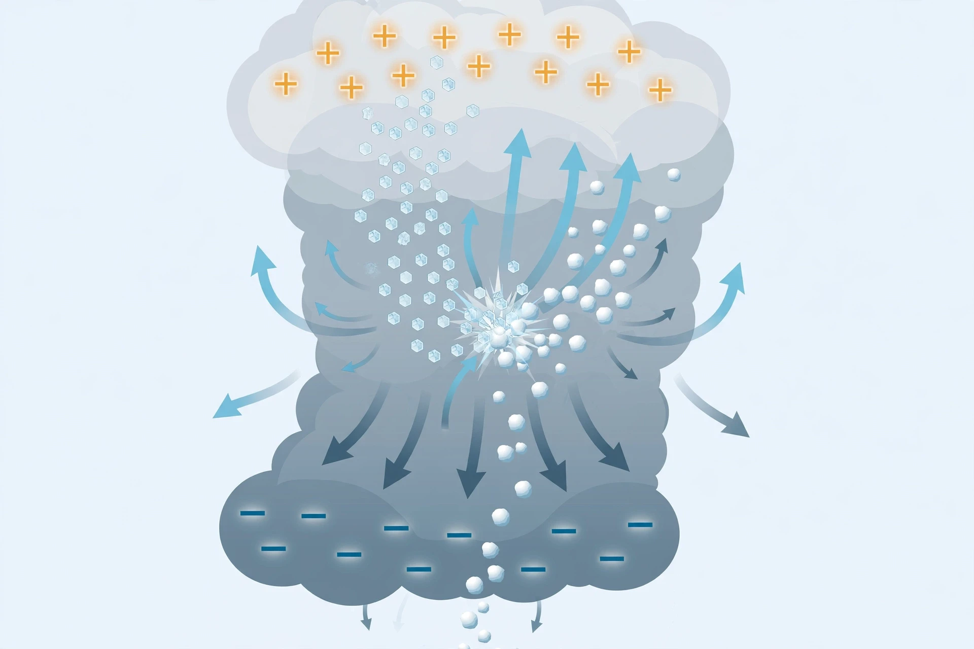
The heart of lightning is charge separation, and the heart of charge separation is a collision. Inside a thundercloud, at temperatures below freezing, two kinds of ice particle meet again and again: small, light ice crystals, and larger, heavier pellets of soft hail called graupel. Graupel forms when supercooled water droplets freeze onto an ice nucleus and grow into a soft, slushy pellet. It is heavier than an ice crystal, so it falls faster, and as it falls it sweeps through a swarm of smaller crystals rising in the updraft. The two meet. They touch, exchange a tiny amount of charge, and part.
The details of that exchange are still an active area of research, and scientists do not agree on every part of the mechanism. What is well established is the pattern that results. In the temperature range where the collisions happen most often, roughly between minus 10 and minus 20 degrees Celsius, the graupel tends to pick up negative charge and the smaller ice crystals tend to pick up positive charge. The updraft then carries the light, positively charged crystals to the top of the cloud, while the heavier, negatively charged graupel sinks toward the base. Over minutes, the top of the cloud becomes net positive and the base becomes net negative. The cloud has sorted its charge by weight, using gravity and updrafts as the sorting machine.
I find that sorting idea quietly astonishing every time I return to it. No one designed the cloud to be a battery. No one placed the charges. The sorting falls out of the physics of falling ice and rising air, repeated millions of times, until a volume of cloud several kilometres across carries a charge imbalance large enough to break down the air. It is a reminder that order can emerge from chaos without a plan, as long as the same small process repeats often enough in the same direction.
3.1 Graupel, ice crystals, and the collision that matters
Why do ice particles exchange charge at all? The honest answer is that the exact microphysics is subtle and still debated. When two ice particles collide, a tiny amount of material can transfer, or charge can move across the contact point because of differences in temperature, surface state, and growth rate. Laboratory experiments, in which researchers grow ice in cold chambers and let particles collide under controlled conditions, have shown that the sign of the charge transferred depends on temperature, on how fast the ice is growing, and on the amount of liquid water present. In the main charging zone of a thundercloud, the conditions favour negative charge on graupel and positive charge on the smaller crystals. In other temperature ranges, the sign can reverse, which helps explain why some storms have a more complicated charge structure, with extra layers of positive and negative charge stacked inside the cloud.
That complexity is worth naming, because it keeps us honest. The simple picture — positive top, negative base — is a useful first model, and it explains a great deal. Real clouds are messier. Soundings from research aircraft and balloon-borne instruments have found clouds with multiple charge layers, inverted charge structures, and pockets of charge that do not fit the textbook diagram. The simple model is the right place to start, but it is a model, not a photograph of every storm.
3.2 Updrafts as the sorting machine
Charge separation by collision would mean little without sorting. If the positive and negative particles stayed mixed, their charges would cancel and no large field would build. The updraft is what keeps them apart. It lifts the small, light, positively charged crystals to the top of the cloud, where they spread out in the anvil. Gravity pulls the heavier, negatively charged graupel down toward the base. The two populations end up kilometres apart, and the electric field between them grows.
The strength of the updraft matters. A weak updraft cannot keep the crystals aloft long enough for the sorting to build a large charge, and it cannot keep the graupel cycling through the charging zone. A strong updraft, fed by warm, moist air, can sustain the cycle for an hour or more, separating charge the whole time. That is one reason why the most electrically active storms are often the ones with the strongest updrafts, the tallest clouds, and the heaviest rain. The same engine that makes the storm tall also makes it charged.
There is a limit to how much charge a cloud can hold. As the field grows, it begins to leak: small discharges, called corona, bleed charge from sharp points, and rain carries charge to the ground. Eventually the field reaches the breakdown strength of air, and a lightning flash releases a large part of the stored charge at once. Then the process begins again. A single storm can produce hundreds or thousands of flashes over its lifetime, each one a partial discharge of a battery that is constantly recharging itself.
3.3 How much charge, how much voltage
The numbers help to give a sense of scale. A typical thundercloud may separate enough charge to produce a voltage of a hundred million volts or more between its top and base, and between its base and the ground. A single cloud-to-ground stroke may carry a peak current of 20,000 to 30,000 amperes, and particularly strong strokes can exceed 100,000 amperes. The total energy in a flash is large in human terms — enough, in principle, to power a household for weeks — but it is delivered in a fraction of a second, through a channel only a few centimetres wide. That concentration is what makes lightning so destructive. It is not only the total energy that matters, but the rate at which it is delivered and the tiny volume into which it is focused.
Those figures are approximate, and they vary widely from flash to flash. Some flashes are weak, barely enough to register on a detector. Others are exceptionally strong. The variation is part of what makes lightning hard to predict in detail, even though the general physics is well understood. A storm can be electrically active for an hour and produce a wide range of flash strengths, and no two flashes follow exactly the same path.
4. The Stepped Leader and the Return Stroke
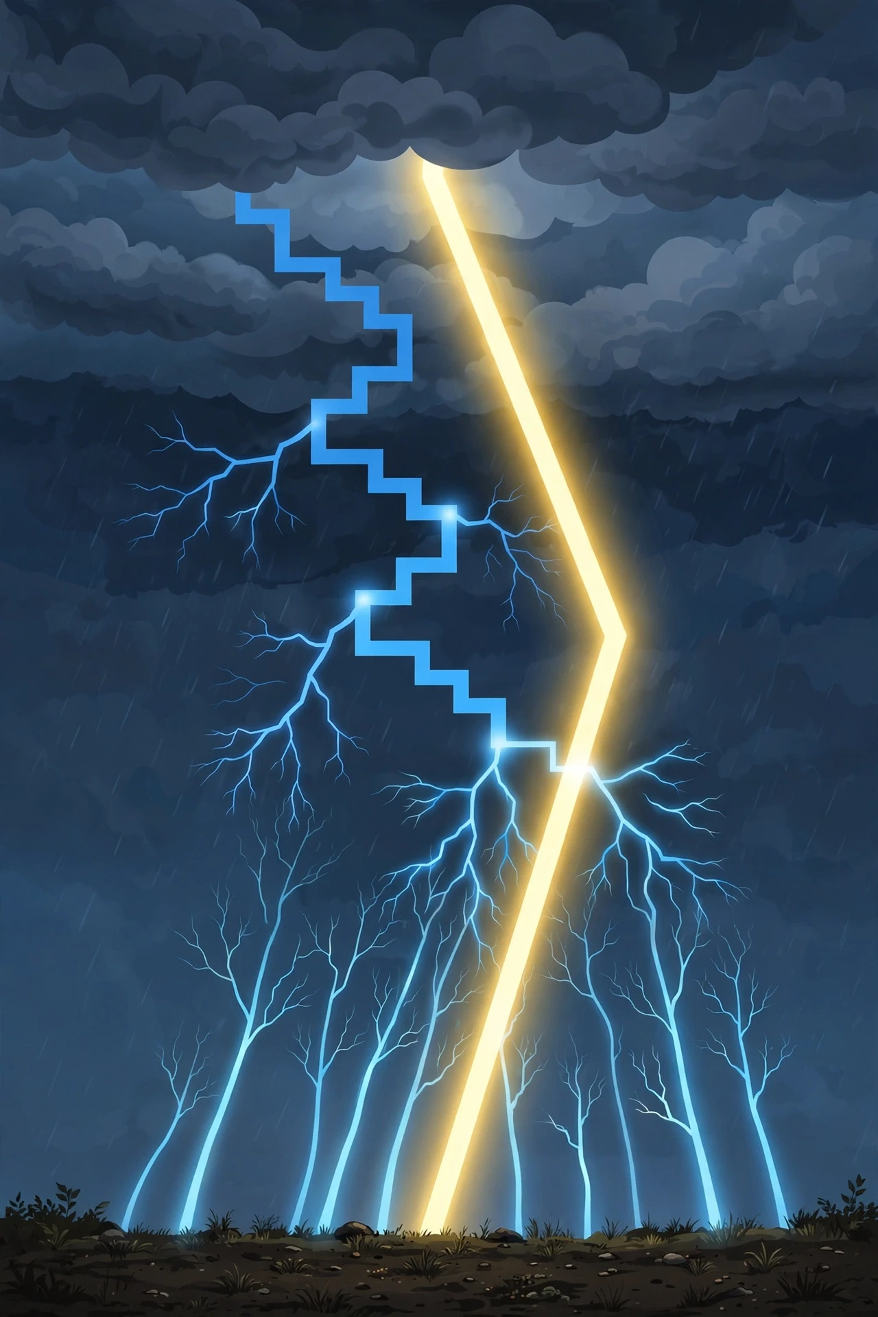
If charge separation is the charging of the battery, the stepped leader is the moment the battery finds a way to discharge. It is also the part of lightning that looks most like a living thing feeling its way forward. A stepped leader is a faint, branching channel of ionised air that starts at the cloud base and works its way toward the ground in a series of short jumps. Each jump, or step, is about 50 metres long and takes about a microsecond. Then the leader pauses for about 50 microseconds, gathers itself, and jumps again. The whole descent takes a few tens of milliseconds, and the leader branches as it goes, sending out side channels that may or may not become part of the final strike. Most of the branches die out. One path, the one that first reaches close enough to the ground, becomes the main channel.
Watching high-speed video of a stepped leader changed how I think about lightning. In ordinary video, a bolt appears all at once, a single white line. In high-speed footage, slowed down thousands of times, the leader creeps down in hesitant steps, branches flickering and fading, as if the cloud were testing the air for the easiest route. It is not a single decision. It is a search. The air is not uniform: pockets of humidity, temperature, dust, and previous ionisation all change how easily a channel can form. The leader follows the path of least resistance, and that path is jagged because the air itself is uneven.
As the leader approaches the ground, something happens below that is easy to miss. The strong electric field under the leader pulls positive charge upward from the ground. Sharp, tall objects — a tree, a flagpole, a fence post, a person standing upright — concentrate that field at their tips, and streamers of ionised air begin to rise from them. These upward streamers are fainter and shorter than the leader, but they are the ground's answer to the cloud's question. When one streamer meets the descending leader, the circuit closes.
4.1 The return stroke: the flash you actually see
The bright flash we call lightning is mostly the return stroke. The moment the leader and a streamer connect, a wave of current rushes upward from the ground to the cloud along the channel the leader created. It moves at roughly a third of the speed of light, and it heats the channel to about 30,000 Kelvin, roughly five times hotter than the surface of the Sun. The channel glows white-hot, and that glow is what the eye sees as a bolt. The return stroke lasts only a few tens of microseconds at any one point, but the whole channel lights up so fast that it appears to the eye as a single, instantaneous line from cloud to ground.
That direction surprises many people. The bolt looks as if it comes down from the cloud, and the leader does come down. But the bright light travels up. The leader is faint because it carries relatively little current. The return stroke is brilliant because it carries the main current. If you could watch a strike in slow motion, you would see a dim, branching finger creep down, a brief meeting near the ground, and then a dazzling wave racing up the same path. The eye, which cannot separate events a few milliseconds apart, merges them into one downward bolt.
The return stroke is also what does most of the damage. Its current heats the air so fast that the air expands explosively, creating thunder. Its current can splinter a tree, melt sand into glass, start a fire, and damage electronics far from the strike point. The heat is so intense that the air around the channel is briefly turned into plasma, and the light from that plasma is rich in ultraviolet, which is why lightning looks blue-white rather than yellow like a flame.
4.2 Dart leaders and multiple strokes
A single flash rarely ends with one return stroke. After the first stroke, the channel begins to cool and fade, but it remains partly ionised for a short time. If enough charge remains in the cloud, a second leader, called a dart leader, can shoot down the same channel without the hesitant steps of the first leader, because the path is already partly conducting. It moves faster and without branching, and it triggers a second return stroke. Then a third may follow, and a fourth. A typical flash contains three to four strokes, and some contain more than a dozen. The strokes are separated by tens of milliseconds, and the whole flash lasts less than a second, but the eye sees it as a flicker, a bolt that seems to pulse or shimmer before it fades.
That flicker is a useful clue. If you see a bolt that appears to flash several times in quick succession, you are probably seeing the separate strokes of a single flash, not several independent bolts. Photographers who use long exposures sometimes capture the separate strokes as slightly offset lines, because the channel can shift a little in the wind between strokes. The result is a photograph that looks like several bolts side by side, when in fact it is one flash, replayed down the same channel several times.
The dart leader also explains why lightning can seem to strike the same place more than once in a single storm. The channel is the easiest path, and the cloud will reuse it while it remains conducting. After the flash ends and the channel cools completely, the next flash will need a new leader and may take a different path, but for a fraction of a second, the same line in the sky can carry several strokes in a row.
4.3 Why lightning is jagged
Lightning is jagged because the air is not uniform and the leader is a search, not a straight line. Each step of the leader chooses the direction where the air breaks down most easily at that moment. A pocket of humid air, a wisp of ionised gas left by a previous discharge, a small change in temperature, can all tilt the choice. The result is a path that bends and branches, with kinks at every step. The main channel is the path that happened to reach the ground first, but the branches are real channels too, and they can be seen in photographs as fainter forks that stop in mid-air.
The branching also tells us something about the scale of the process. A stepped leader can branch into dozens of channels, most of which never reach the ground. Those branches are not failures. They are the leader exploring the volume of air below the cloud, testing many routes at once. The route that wins is not necessarily the shortest or the straightest. It is the one where the air gave way first. That randomness is why two strikes from the same storm can look so different, and why predicting the exact point where a strike will hit is so difficult, even when the general area is known to be at risk.
5. Types of Lightning
Not all lightning goes from cloud to ground. In fact, most lightning stays in the sky. The most common form of all is lightning that never touches the ground at all, flashing inside a cloud or between clouds, lighting the cloud from within. Cloud-to-ground lightning, the form that does most of the damage and gets most of the attention, makes up only about a fifth to a quarter of all flashes in many regions, though the fraction varies. The rest is intra-cloud, inter-cloud, and cloud-to-air lightning, each with its own pattern and its own hazards.
To see how lightning works across those different paths, the table below compares the main types. It is worth reading slowly, because the names can be confusing: "sheet lightning" is not a separate physical type, but a way of seeing intra-cloud lightning from a distance; "heat lightning" is not a separate type either, but distant lightning whose thunder is too far away to hear. The physics is the same in each case — charge separated, air broken down, current flowing — but the path, the location, and the risk are different.
Type | Path | What you see | Main risk |
|---|---|---|---|
Cloud-to-ground | Cloud base to the ground | A bright, jagged bolt reaching the ground | Direct strike, fire, injury |
Intra-cloud | Within a single cloud | The cloud lights up from inside | Low direct risk, but a sign of an active storm |
Inter-cloud | Between two clouds | A flash jumping cloud to cloud | Low direct risk, mainly an aviation concern |
Cloud-to-air | Cloud to the clear air above or beside it | A bolt into apparently clear sky | A bolt from the blue, striking far from rain |
Sheet lightning | Intra-cloud, seen from a distance | A broad, diffuse glow with no visible bolt | Same as intra-cloud; distance makes it look soft |
Ball lightning | Uncertain, reported near the ground | A glowing sphere drifting for seconds | Rare and poorly understood |
5.1 Cloud-to-ground lightning
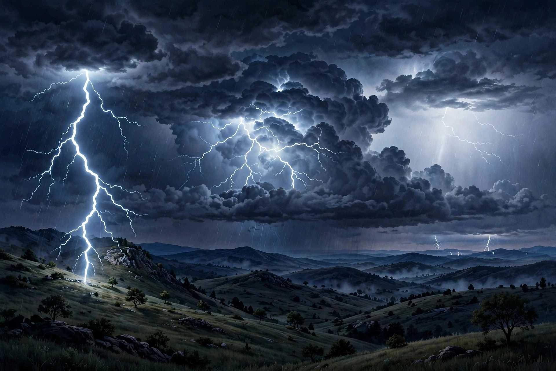
Cloud-to-ground lightning is the type most people mean when they say "lightning struck". A stepped leader descends from the cloud base, streamers rise from the ground, and a return stroke connects them. The strike point is usually a tall or pointed object, because those concentrate the electric field and are more likely to launch a streamer that meets the leader. But lightning can also strike flat ground, water, or a person in an open field. The leader does not aim at a target in the way a person aims. It follows the easiest path through the air, and the ground streamer that meets it first wins.
Cloud-to-ground flashes are further divided by polarity. Most are negative: the leader carries negative charge down from the cloud base, and the return stroke carries current upward. A smaller fraction are positive: the leader carries positive charge down, often from the upper, positively charged part of the cloud or from the anvil. Positive flashes are less common but tend to be stronger, with higher peak currents and longer durations, and they can strike farther from the main rain area. They are the source of many "bolts from the blue", flashes that seem to come from a clear sky because they originate in the anvil and travel sideways for kilometres before turning down to the ground.
The National Weather Service lightning science page explains the stepped leader, return stroke, and polarity in detail, and it is the clearest official summary of the process for a general reader (National Weather Service).
5.2 Intra-cloud and inter-cloud lightning
Intra-cloud lightning is lightning that stays inside a single cloud, flashing between regions of opposite charge within the cloud itself. Because the top of the cloud is positive and the base is negative, a discharge can bridge those regions without ever leaving the cloud. From the ground, it looks like the cloud is lighting up from inside, a soft glow that spreads through the cloud and fades, rather than a sharp bolt. If the cloud is distant, that glow can look like a broad sheet of light, which is why people call it sheet lightning. It is not a different kind of lightning. It is intra-cloud lightning seen from far away, with the cloud itself hiding the channel from view.
Inter-cloud lightning jumps between two separate clouds. It is less common than intra-cloud lightning, and it is mainly of interest to aviation, because an aircraft flying between clouds can find itself in the path. Both intra-cloud and inter-cloud lightning are signs that the storm is electrically active, even if no bolt reaches the ground. A storm that is flashing inside its clouds is still a storm to take seriously. The next flash could be the one that goes to ground, and there is no reliable way to tell from the ground which flash will be which.
I remember watching a storm at night from a rooftop, years ago, where the clouds pulsed with light for an hour without a single visible bolt reaching the ground. It was beautiful, and it was easy to feel safe, because nothing seemed to be striking anything. A meteorologist with me pointed out that the pulsing was intra-cloud lightning, and that the storm was producing hundreds of flashes, each one a sign that the charge separation was strong. The beauty was real. So was the risk. We went inside.
5.3 Sheet lightning and heat lightning
Sheet lightning and heat lightning are the same phenomenon seen from different distances. When intra-cloud lightning happens far away, the cloud hides the channel, and the observer sees only a diffuse glow, as if a sheet of light had been switched on inside the cloud. When the storm is so far away that the thunder cannot be heard — sound fades with distance much faster than light — people call it heat lightning, because it often appears on hot, humid summer nights when distant storms are active but no rain is falling locally. The name is misleading. The lightning is not caused by heat, and it is not a special type. It is ordinary lightning, too far away to hear.
The confusion is understandable. On a still summer evening, a flash on the horizon with no thunder can feel like a different phenomenon from a bolt that cracks overhead. It is not. The light travels for tens of kilometres without much loss. The sound, which spreads and weakens as it travels, is lost after about 15 to 25 kilometres, depending on the atmosphere. Beyond that distance, you see the flash but hear nothing. The storm is real, and it is distant, and the silence does not mean it is harmless to the people under it.
5.4 Ball lightning
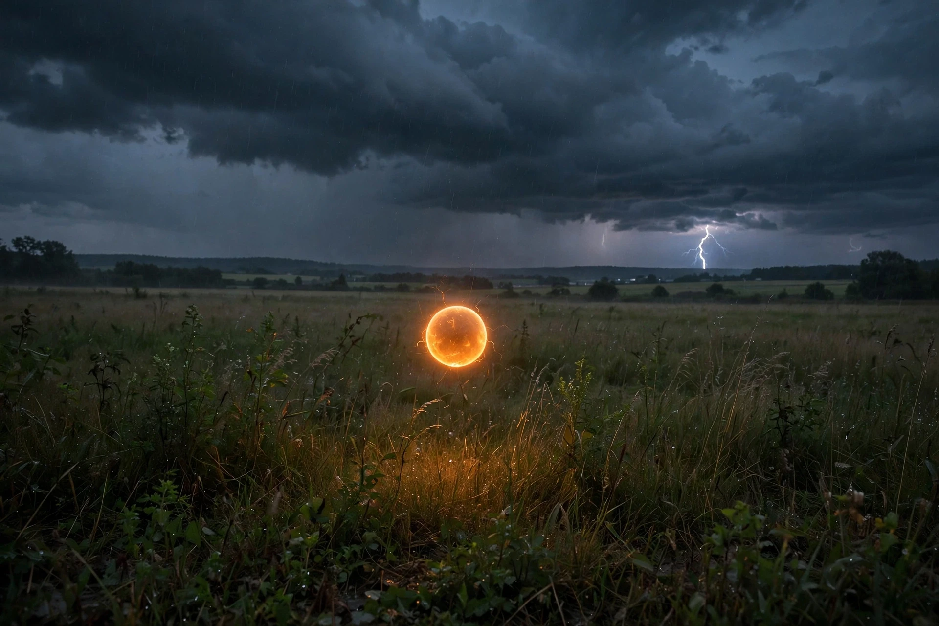
Ball lightning is the strangest and least understood form of lightning. Witnesses describe a glowing sphere, roughly the size of a grapefruit, drifting through the air for a few seconds, sometimes passing through windows or walls, and then vanishing, sometimes with a pop, sometimes silently. Reports go back centuries, and they are consistent enough in their broad outlines — a luminous ball, a few seconds of life, an association with thunderstorms — that most researchers accept that something real is being described. But no one has yet produced ball lightning reliably in a laboratory in a way that matches all the reports, and there is no agreed theory of what it is.
Several ideas have been proposed. One is that ball lightning is a pocket of plasma, a ball of ionised gas, somehow stabilised for a few seconds. Another is that it is burning silicon or other material vaporised by a strike. A third is that it is an optical effect, a kind of afterimage or hallucination triggered by a nearby strike. Each idea explains some reports and fails on others. The honest position is that ball lightning remains an open question. It is rare, it is hard to study, and the evidence is mostly eyewitness testimony, which is valuable but not the same as a controlled measurement.
That uncertainty is worth stating plainly, because it shows how science works at its edges. Most of lightning is well understood. The stepped leader, the return stroke, charge separation, and thunder all have solid explanations backed by laboratory work, high-speed cameras, and decades of measurements. Ball lightning sits outside that settled picture, a reminder that a familiar phenomenon can still hold a mystery. If you ever see something that looks like ball lightning, treat it with the same caution as any lightning: do not approach it, do not touch it, and move indoors.
6. Why Lightning Is So Hot, Bright and Powerful
Lightning is hot because it is fast and narrow, and that heat is a direct clue to how lightning works at the level of the channel itself. The return stroke drives tens of thousands of amperes through a channel only a few centimetres wide for a few tens of microseconds. All that energy goes into a tiny volume of air, and the air responds by heating to about 30,000 Kelvin. At that temperature, air is no longer a gas in the ordinary sense. It is a plasma, a soup of ions and free electrons, and it glows intensely across the visible spectrum and into the ultraviolet. The white-blue colour of lightning is the colour of that plasma, the same reason a very hot star looks blue-white and a cooler one looks red.
The brightness is part of the danger. Looking directly at a nearby strike can cause a flash burn to the eyes, similar to the burn welders protect against. The light is also a useful diagnostic. High-speed cameras and spectrographs can read the temperature and composition of the channel from its light, and researchers use those readings to test models of how the channel heats and cools. The channel cools quickly, in a few hundred microseconds, but while it is hot it expands, and that expansion is thunder.
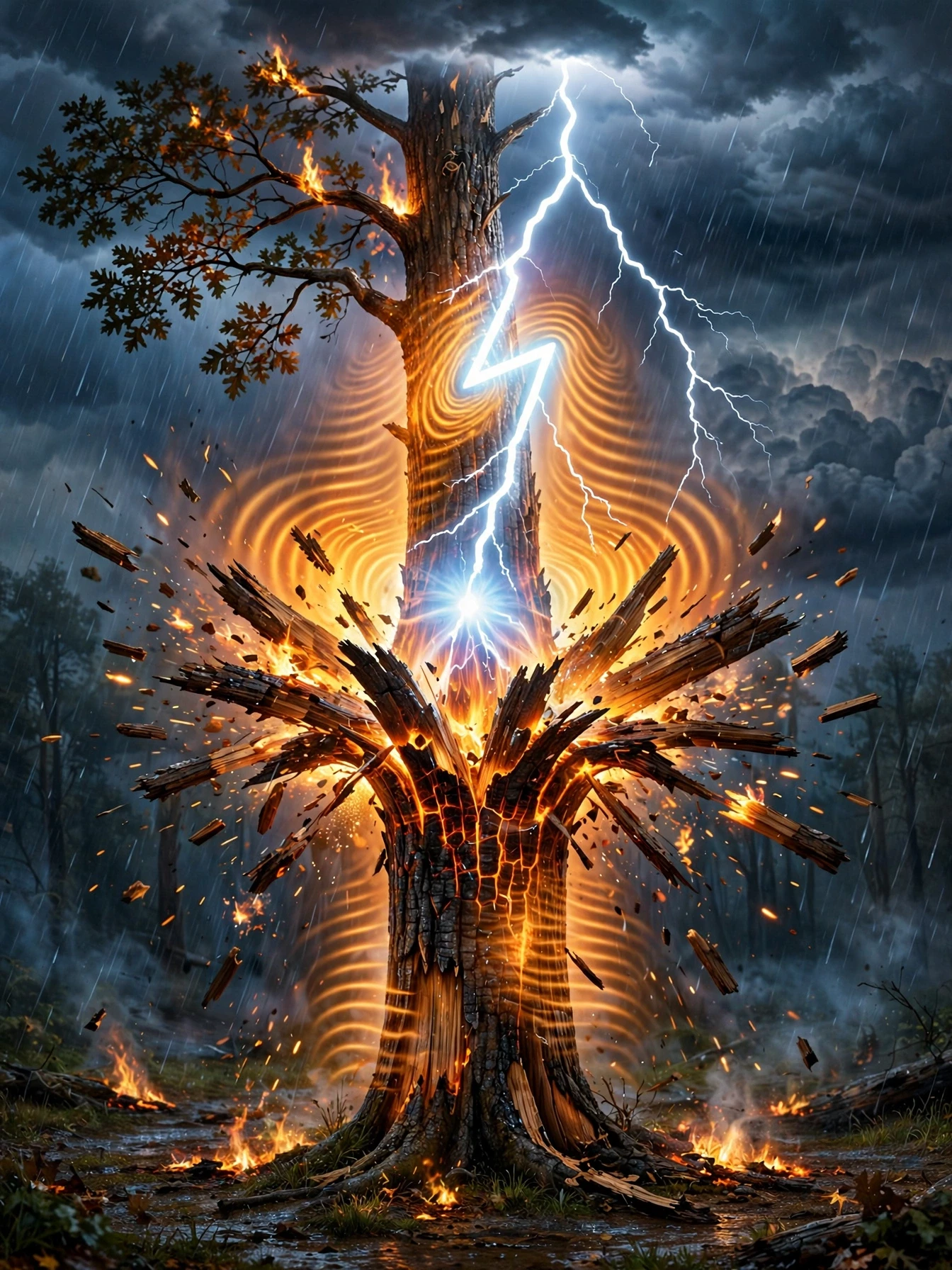
Lightning is powerful because it concentrates energy in time and space. The total energy in a flash, a few hundred million joules in a typical case, is not enormous by the standards of a storm, which contains far more energy in its wind and rain. But a flash delivers its energy in less than a second, through a channel a few centimetres wide. A tree struck by lightning does not burn slowly. The sap inside it is heated to steam in an instant, the steam expands, and the trunk can split or explode. Sand struck by lightning can fuse into a glassy tube called a fulgurite, a fossil of the strike that preserves the shape of the channel in the ground. Those effects are not the result of a huge total energy. They are the result of a large energy delivered very fast to a very small place.
The danger of lightning is not only how much energy it carries, but how fast it delivers it. A flash focuses a storm's electrical energy into a channel a few centimetres wide for less than a second, and that concentration is what splits trees, fuses sand, and stops a heart.
6.1 How lightning starts fires and damages buildings
When lightning strikes a tree, a building, or the ground, the current seeks a path to spread out, and it follows whatever conducts best. In a tree, the sap and the wet bark are the best conductors, so the current runs through them, heating the sap to steam and blowing the bark off in strips. In a building, the current may follow wiring, plumbing, or a metal roof, and the heat can ignite wood, insulation, or roofing material. In soil, the current spreads out in the ground, and the voltage falls with distance from the strike point, which is why a person standing near a strike can be injured by the voltage difference between their feet, even if the bolt does not hit them directly. That is called step voltage, and it is one of the reasons the advice is to stay away from a strike point, not just to avoid being hit.
Modern buildings are protected by lightning rods, more properly called air terminals, and a system of conductors that carry the current safely to the ground. A lightning rod does not prevent lightning. It gives the strike a preferred, low-resistance path to the ground, so the current does not have to force its way through the building. The idea goes back to Benjamin Franklin, who proposed it in the 18th century after his experiments with electricity. It remains the standard approach today, and it is one of the clearest examples of a scientific idea becoming a practical safety device. A building with a properly installed system is far safer than one without, but no system makes it safe to be outside in a storm.
6.2 Lightning and the global electric circuit
Lightning is not only a local phenomenon. It is part of a global circuit that connects thunderstorms, the ionosphere, and the ground. At any moment, about 2,000 thunderstorms are active around the world, producing on the order of 40 to 50 flashes per second globally. Those flashes carry charge upward and downward, and they help maintain a voltage difference between the ionosphere, the electrically conducting layer high above the Earth, and the ground. That voltage, about 250,000 volts in fair weather, drives a small current through the atmosphere everywhere, even on a clear day. Thunderstorms are the batteries that keep that global circuit charged.
NASA's lightning research, including space-based sensors that map flashes from orbit, has helped to measure that global flash rate and to understand how it varies with season, latitude, and climate. The Lightning Imaging Sensor, flown on satellites and on the International Space Station, detects total lightning — cloud and ground flashes together — day and night, over land and sea, giving a picture of global lightning that ground-based networks alone cannot provide (NASA Earthdata). That global view matters for climate science as well as for safety, because lightning is linked to convection, rainfall, and the production of nitrogen oxides in the atmosphere, which affect ozone and air quality.
7. What Thunder Is and Why It Sounds the Way It Does
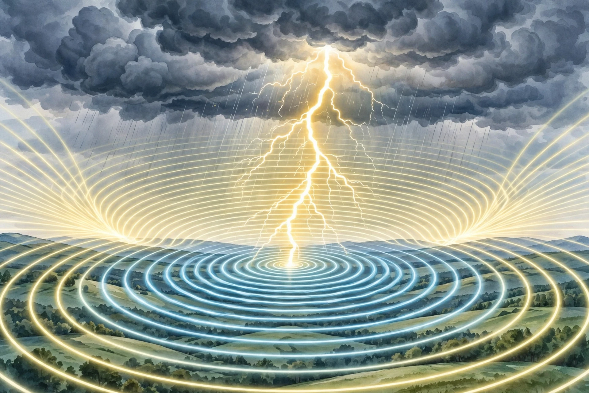
Thunder is the sound of lightning, and understanding it completes the picture of how lightning works as a whole event, flash and sound together. When the return stroke heats the channel to about 30,000 Kelvin in a few microseconds, the air in and around the channel expands faster than the speed of sound. That supersonic expansion creates a shock wave, which then slows and becomes the sound wave we hear as thunder. Close to the strike, the shock wave is still strong, and thunder sounds like a sharp crack, almost like a gunshot. Farther away, the high frequencies are absorbed by the air, the shock wave has weakened into an ordinary sound wave, and thunder sounds like a low rumble that can last for seconds.
The rumble has a simple cause. A lightning channel is not a point. It is a line kilometres long, branching and bending through the sky. Different parts of that line are at different distances from you, so the sound from the nearest part arrives first and the sound from the farthest part arrives last. The channel also has branches, each contributing its own sound, and the sound can reflect off clouds, hills, and layers of air at different temperatures. All those arrivals overlap and stretch out into a rolling sound that can last for several seconds, sometimes with a series of peaks as different parts of the channel are heard in turn. A short, straight strike overhead gives a single sharp crack. A long, branching strike several kilometres away gives a long, rolling rumble.
There is a third ingredient in the sound: the air itself. Sound travels at about 343 metres per second in warm air at sea level, slower in cold air, and its path can bend as it passes through air of different temperatures. On a stormy day, the atmosphere is layered and turbulent, and the sound of thunder can be bent, focused, or blocked in ways that make it louder in one place and almost inaudible in another a short distance away. That is why two people a few kilometres apart can have very different experiences of the same storm — one hears a deafening crash, the other hears a distant murmur — even though the lightning was the same.
7.1 Why you see lightning before you hear thunder
Light travels at about 300,000 kilometres per second. Sound travels at about 0.34 kilometres per second, roughly a million times slower. A flash 3 kilometres away reaches your eyes in about ten microseconds. Its thunder takes about nine seconds to reach your ears. That difference is the basis of the familiar counting rule, and it is also a direct demonstration of the physics: light and sound leave the same event at the same time, but they travel at vastly different speeds, so they arrive at vastly different times.
The same scattering that makes the daytime sky blue also plays a role in how we see lightning, though in a different way. The blue of the sky and the white-blue of a lightning channel both involve light interacting with air, but the mechanisms are not the same, and the comparison is a good reminder that "the sky" is not one effect but many. For the scattering story, see Why Is the Sky Blue.
7.2 Can thunder damage hearing or buildings?
Close thunder is loud enough to be startling, and a strike very close by can produce a sound level that is painful, but thunder itself rarely causes hearing damage at the distances where people normally hear it, because the sound weakens quickly with distance. The shock wave close to the channel is a different matter. Within a few metres of a strike, the pressure wave can break windows, crack plaster, and knock a person down, though those effects are caused by the strike itself and the explosive expansion of air, not by the sound as it is heard from a distance. The main risk from thunder is not the sound. It is the lightning that made it.
8. How Far Away Is That Strike? Reading Flash and Thunder
The flash-to-bang rule is simple and useful: count the seconds between the flash and the thunder, divide by five, and you get the distance in miles; divide by three and you get the distance in kilometres. A ten-second gap means the strike was about 3 kilometres away. A five-second gap means about 1.5 kilometres. If you can hear thunder at all, the storm is close enough to be a risk, because lightning can strike well away from the rain. The National Weather Service puts it directly: when thunder roars, go indoors (National Weather Service).
That rule is an estimate, not a measurement. It assumes a constant speed of sound, which is approximately true over short distances but varies with temperature. It also assumes you can identify which flash goes with which thunder, which is not always easy when a storm is producing many flashes. Still, as a practical guide, it is good enough. The key point is not the exact distance. It is the trend. If the gap is shrinking, the storm is getting closer. If the gap is growing, it is moving away. If you hear thunder, you are within range of a strike, and you should already be indoors or moving toward shelter.
A practical habit follows from that. When you first hear thunder, even faintly, treat it as the signal to go inside. Do not wait for the rain. Do not wait for the next flash. Do not finish the game, the walk, or the job. The first thunder you hear means a storm is within about 15 to 25 kilometres, and the next flash could be closer than the last. The 30-30 rule, once widely taught — seek shelter when the flash-to-bang gap is 30 seconds or less, and wait 30 minutes after the last thunder before going back outside — captures the same idea, though official guidance now stresses simply going indoors at the first thunder and waiting 30 minutes after the last.
9. Lightning, Weather and Climate: Where and When It Strikes Most
Lightning is not evenly distributed. It is most frequent in warm, moist, unstable air, which is why the tropics see far more lightning than the poles, and why summer sees far more than winter in temperate regions. Central Africa, the Amazon, and Southeast Asia are among the most lightning-active regions on Earth. In the United States, Florida is famously the most lightning-prone state, with its combination of heat, humidity, sea breezes, and afternoon thunderstorms. Mountains, coastlines, and regions where warm and cold air masses meet also see more lightning, because those are the places where air is most often lifted strongly enough to build a tall thundercloud.
Time of day matters too. Most lightning happens in the afternoon and early evening, when the ground has been heated by the Sun and the atmosphere is most unstable. Night-time lightning is less common in many regions, but it does happen, especially when a weather front or a large storm system provides the lift instead of daytime heating. Season matters in the same way: summer, with its heat and moisture, produces far more lightning than winter in most temperate places, though winter thunderstorms do occur, particularly near coasts and over warm water.
Climate change is expected to affect lightning, but the direction and size of the change are not settled. Warmer air holds more moisture, which can feed stronger convection, and some studies suggest lightning frequency could increase with warming. Others point to changes in atmospheric stability and wind patterns that could offset that increase in some regions. The honest summary is that lightning is sensitive to climate, that the details vary by region, and that researchers are still working out the net effect. What is not in doubt is that lightning will remain a major weather hazard in a warmer world, and that the safety rules will remain the same.
9.1 How lightning is detected and forecast
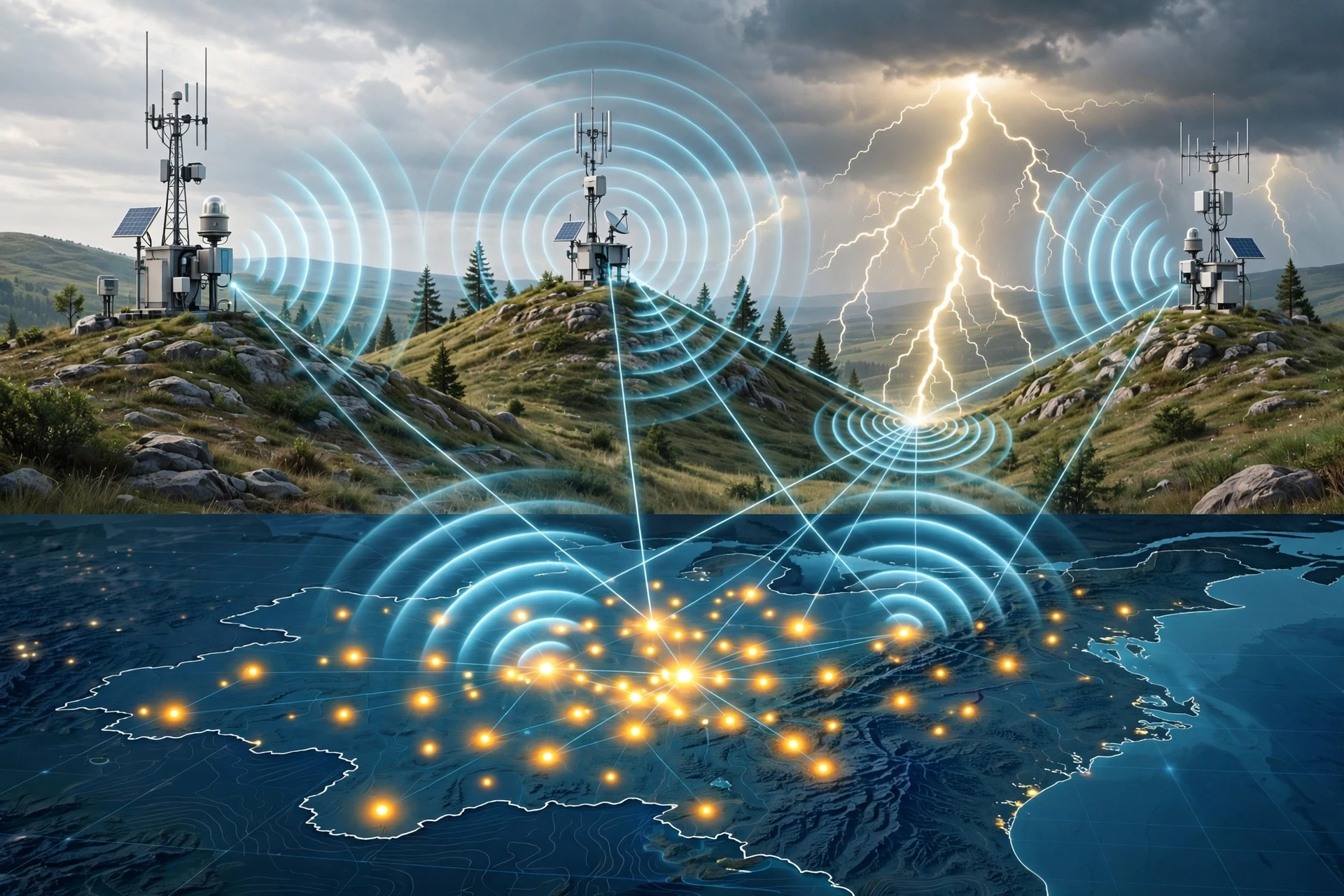
Modern lightning detection relies on the radio waves a flash produces. A lightning channel is a powerful radio transmitter, and a network of antennas can pick up those signals, time their arrival at different stations, and triangulate the location of the strike to within a few hundred metres. The U.S. National Lightning Detection Network and similar networks around the world provide real-time maps of lightning activity, which forecasters use to issue warnings, which utilities use to protect the power grid, and which researchers use to study storm behaviour.
Satellites add a global view. Space-based sensors detect the optical flash of lightning from orbit, mapping total lightning over land and sea, day and night. That view is especially valuable over oceans and remote regions, where ground-based networks are sparse. Together, ground and space sensors give a picture of lightning that was impossible a generation ago, and that picture is now part of everyday forecasting: when a forecaster says a storm is producing frequent lightning, that statement is often based on a live detection map, not only on radar.
10. Sprites, Jets and Other Lightning Above the Storm
Lightning does not stop at the top of the cloud. Above a thunderstorm, in the thin air of the upper atmosphere, a family of brief, colourful discharges can appear: sprites, blue jets, and elves. Sprites are large, reddish, jellyfish-shaped flashes that appear high above a storm, tens of kilometres up, lasting only a few milliseconds. Blue jets are narrow cones of blue light that shoot upward from the cloud top. Elves are rapidly expanding rings of light in the ionosphere, triggered by the electromagnetic pulse of a strong lightning flash below.
These phenomena were long reported by pilots and observers but were not photographed clearly until the late 20th century, and they are still hard to study because they are brief, high, and often hidden by the cloud below. They are not a danger to people on the ground. They are a reminder that the electrical activity of a storm extends far beyond the cloud itself, into the upper atmosphere, and that the sky above a thunderstorm is an active electrical environment in its own right. Researchers study them with high-speed cameras on the ground, on aircraft, and on the International Space Station, and each new observation adds a piece to a picture that is still being assembled.
11. Lightning Safety: What to Do Before, During and After a Storm
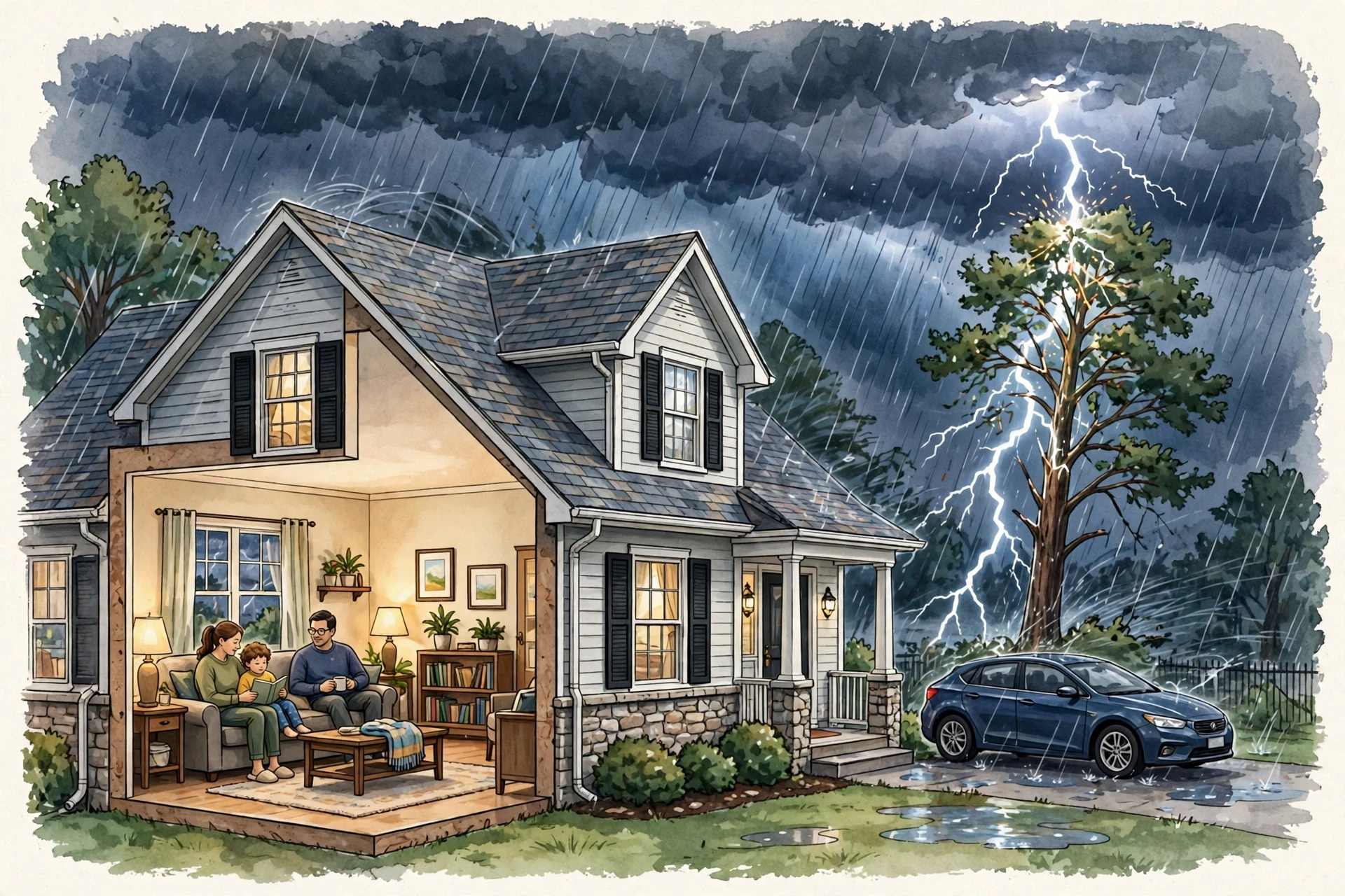
Lightning safety is simple in principle and hard in practice, and it follows directly from how lightning works: if you can hear thunder, a flash can reach you. It is hard in practice because it requires changing plans when a storm is still distant and the sky still looks inviting. The core rule is the one the National Weather Service repeats in every safety campaign: when thunder roars, go indoors. A substantial building with wiring and plumbing, or a hard-topped car with the windows closed, is a safe place. A tent, a picnic shelter, a bus stop, and a tree are not. The building or car does not need to be hit to protect you; it needs to give the current a safe path to the ground that does not go through you.
Before a storm, check the forecast, and have a plan for where you will go if a storm develops. If you are hiking, boating, swimming, or playing sport, know the nearest substantial shelter and how long it will take to reach it. If you are organising an outdoor event, assign someone to watch the weather and to make the call to pause or cancel. The decision is easier to make in advance than in the middle of a storm, when the pressure to finish the activity is strongest.
During a storm, if you are indoors, stay indoors. Avoid contact with water, plumbing, and electrical equipment, and avoid corded phones, because lightning can travel through wiring and plumbing into a building. If you are in a car, pull over safely, stay inside, and avoid touching metal parts connected to the outside. If you are caught outdoors with no safe shelter, the advice is to crouch low, minimise contact with the ground, stay away from water, tall isolated trees, metal fences, and poles, and spread out if you are in a group so that a single strike cannot injure everyone. These last-resort steps reduce risk, but they do not make being outdoors safe. The only safe action is to get to a substantial building or a hard-topped car.
After a storm, wait 30 minutes after the last thunder or lightning before going back outside. Many lightning injuries happen after the rain has stopped and the sky looks clearer, because the storm is still electrically active or a new cell is developing. The same rule applies to resuming outdoor activities, including swimming, boating, and sport. The National Weather Service lightning safety pages give the full set of recommendations, including what to do if someone is struck, and they are worth reading before the storm season starts (National Weather Service, Ready.gov).
11.1 If someone is struck by lightning
Lightning victims do not carry a charge, and it is safe to touch them. Call for emergency help immediately, and if the person is not breathing or has no pulse, start cardiopulmonary resuscitation if you are trained. Lightning can cause cardiac arrest, burns, and neurological injury, and prompt care matters. Move the person to a safer place only if it is safe to do so, and do not put yourself at risk from a continuing storm. The National Weather Service page on lightning victims explains the steps in detail and is a good page to read before you ever need it (National Weather Service).
12. Common Misconceptions About Lightning
Most people assume lightning never strikes the same place twice. What we actually see in the evidence is the opposite: lightning strikes the same place repeatedly, and tall structures are struck many times a year. The Empire State Building, for example, is struck dozens of times in a typical year, and any tall tower, mast, or tree that has been struck once is more likely, not less likely, to be struck again, because it is tall, pointed, and well connected to the ground. The saying survives because it feels like a comforting rule about randomness, but the physics points the other way: lightning follows the easiest path, and a tall object that provided that path once is likely to provide it again.
That misconception is not harmless. If you believe a place is safe because it has already been struck, you may stay near it during the next storm, when it is in fact one of the most likely places to be struck again. The same pattern applies to several other common beliefs, and they are worth clearing up one by one.
Rubber tyres protect you in a car. They do not. A car protects you because its metal body forms a shell that carries the current around you to the ground, not because of the tyres. A car with rubber tyres and no metal body would offer no such protection.
Lightning only strikes when it is raining. It does not. Lightning can strike 15 kilometres or more from the rain area, from the anvil of a storm, in apparently clear sky. The first strike of a storm can arrive before the rain.
Metal objects attract lightning. They do not attract it from a distance, but they do conduct it well, and they can concentrate the electric field at their tips. The risk is not that metal pulls lightning toward you, but that it gives the current an easy path through you if you are holding it or standing near it.
A lightning rod prevents lightning. It does not prevent it. It gives a strike a safe, preferred path to the ground. A building with a rod can still be struck; the rod simply makes the strike less destructive.
If you are indoors, you are completely safe. You are much safer indoors, but you should still avoid water, plumbing, and wired electronics during a storm, because lightning can enter a building through those paths.
Lightning is a rare cause of death, so it is not worth worrying about. Lightning is rare as a cause of death compared with many other hazards, but it is a leading cause of weather-related deaths in many countries, and most lightning injuries are preventable by going indoors at the first thunder.
The National Weather Service maintains a myths page that addresses these and other misconceptions with the same evidence-based approach, and it is a useful check against any claim that sounds too neat to be true (National Weather Service).
The most dangerous idea about lightning is not a wrong fact but a comfortable one: the idea that a storm is only dangerous when it looks dangerous. A distant flash, a clear sky, a place that has already been struck — each can feel safe, and each can be the moment the risk is highest.
Frequently Asked Questions
What causes lightning?
Lightning is caused by charge separation inside a thunderstorm. Collisions between ice crystals and graupel leave the crystals positively charged and the graupel negatively charged, and updrafts sort them so the top of the cloud becomes positive and the base becomes negative. When the electric field between those regions, or between the cloud and the ground, grows strong enough, the air breaks down and a channel of plasma carries current in a flash.
How does lightning work in simple terms?
In simple terms, how lightning works is that a thundercloud acts like a giant battery, separating charge until the voltage is high enough to break down the air. A faint stepped leader works its way down from the cloud, streamers rise from the ground to meet it, and a bright return stroke rushes up the completed channel. That return stroke is the flash you see, and the explosive heating of the air around it is the thunder you hear.
Why does thunder come after lightning?
Thunder comes after lightning because light travels far faster than sound. The flash and the thunder start at the same time, but the light reaches your eyes almost instantly while the sound takes about three seconds to travel each kilometre. Counting the seconds between flash and thunder therefore gives a rough distance to the strike.
Can lightning strike the same place twice?
Yes. Lightning strikes the same place repeatedly, especially tall, pointed structures. Tall buildings and towers are struck many times a year. A place that has been struck once is more, not less, likely to be struck again, because it offers an easy path to the ground.
Is it safe to be in a car during lightning?
A hard-topped car is a relatively safe place during a thunderstorm, because its metal body carries the current around the occupants to the ground. Stay inside with the windows closed, avoid touching metal parts, and pull over safely if you are driving. A soft-topped car, a motorcycle, or a bicycle does not offer the same protection.
What should I do if I am caught outside in a thunderstorm?
Get to a substantial building or a hard-topped car as quickly as you safely can. If no safe shelter is available, crouch low, minimise contact with the ground, avoid water, tall isolated trees, metal fences, and poles, and spread out from others in your group. These steps reduce risk but do not make being outdoors safe, so getting indoors remains the goal.
What is ball lightning?
Ball lightning is a rare, poorly understood phenomenon reported during thunderstorms, described as a glowing sphere drifting through the air for a few seconds. No laboratory has yet reproduced it in a way that matches all reports, and there is no agreed theory of what it is. It remains an open question in atmospheric science, and it should be treated with the same caution as any lightning.