

I was twelve the first time I watched a cloud being born, and the first time I asked how clouds form. It was a hot afternoon in late summer, and I had been lying on my back in a field for what felt like hours, watching small white puffs drift over the hills. One of them caught my eye because it was doing something the others were not: it was growing. Its top boiled upward in slow, rolling folds, bright white against the blue, and within twenty minutes the little puff had become a towering white castle with a flat grey base. Then, as the sun dropped, it thinned at the edges and melted away as quietly as it had arrived. I did not know it then, but I had watched the whole life cycle of a cloud — birth, growth and death — in a single afternoon.
That memory has stayed with me because it holds the central surprise of this subject. Clouds look solid. They look permanent, like objects parked in the sky. In reality a cloud is a process, not a thing. It is air in motion, made briefly visible. The water inside a cloud is always coming and going: droplets form, fall, evaporate and form again, sometimes in a matter of minutes. The shape you see is only the place where the conditions are right, right now, for water to exist as liquid or ice instead of invisible vapour.
Understanding how clouds form changes the way you look at the sky. A thin veil of high cloud stops being decoration and becomes a signal that a weather system is approaching. A flat grey sheet overhead becomes a readable statement about stable air. A towering anvil cloud becomes a warning you can act on. Sailors, farmers, pilots and mountain walkers have read these signs for centuries, long before satellites and radar. The science behind their folk wisdom is elegant, and it starts with something you cannot see at all: water vapour in the air around you.
Every breath you take contains it. On an ordinary day, somewhere between one and four percent of the air near the ground is water in its invisible gas form. You cannot see it, smell it or feel it directly, yet it is the raw material of every cloud that has ever existed. When that vapour cools enough, it condenses into billions of tiny droplets or ice crystals — and suddenly the invisible becomes visible. That is the heart of the story. Everything else — the types, the shapes, the weather they bring — follows from how the air rises, how fast it cools, and how much moisture it carries.
1. The Short Answer: How Clouds Form in Three Steps
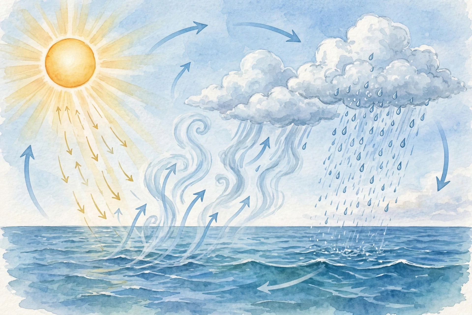
If you want the whole story in one paragraph, here it is. Clouds form when moist air rises, cools, and its invisible water vapour condenses onto microscopic particles to become visible droplets or ice crystals. Three ingredients, in that order: moisture, lift and cooling. Take away any one of them and the sky stays clear.
That is the simple version. The interesting part is how those three steps play out differently in different places, and how they produce the enormous variety of clouds above our heads — from the wispy mare's tails of a summer evening to the flat grey ceiling of a November afternoon.
Step one: the air must hold enough water vapour. Air picks up moisture from oceans, lakes, rivers, damp soil and plants. Warm air can hold far more vapour than cold air, which is why the steamiest clouds tend to form over warm seas and sun-baked land. The water cycle keeps this supply moving: evaporation lifts water into the sky, and precipitation returns it to the ground.
Step two: the air must rise. Air near the ground is warmed by the sun-heated earth, pushed up the side of a mountain, or forced upward where two air masses meet. As it rises, the pressure around it drops, so the parcel of air expands — and expanding air cools. This is the engine of cloud formation, and it is the reason clouds are born high up rather than at ground level.
Step three: the vapour must condense. As the rising air cools, it eventually reaches a temperature — the dew point — where it can no longer hold all its vapour as gas. The excess vapour needs somewhere to go, and it finds it on microscopic specks of dust, salt, smoke and pollen floating in the air. Vapour gathers on these particles and becomes droplets so small that fifty of them lined up would barely span the width of a human hair. Billions of them together scatter sunlight, and we see a cloud.
A cloud is not a thing in the sky. It is a place in the sky where the air is cold enough, wet enough and lifted enough for water to show itself.
Once you hold that idea, the rest of the science clicks into place. Different clouds are simply different answers to the same three questions: how wet was the air, how was it lifted, and how cold did it get? A gentle lift over a wide area makes a flat, layered cloud. A violent upward rush makes a towering storm cloud. Very cold air high up makes clouds of ice crystals instead of droplets. The sky is a laboratory, and every cloud is an experiment you can read.
2. The Ingredients: Water Vapour, Cooling Air and Tiny Particles
2.1 Water vapour: the invisible ingredient
The first thing to understand about how clouds form is that the main ingredient is invisible. Water vapour is water in its gas form, and it is colourless. When you see "steam" curling from a kettle, you are not seeing vapour at all — you are seeing vapour that has already cooled and condensed into tiny droplets. The true vapour, right at the spout, is transparent.
This matters because it clears up one of the oldest confusions about clouds. People sometimes imagine that clouds are made of steam or smoke. They are not. A cloud is made of liquid water droplets, ice crystals, or a mix of the two, all suspended in air. The droplets are so small and so light that they fall incredibly slowly — a typical cloud droplet sinks at roughly a centimetre per second, and the rising air inside a cloud easily holds it up. That is why clouds float. They are not light because they are made of something weightless; they float because their pieces are tiny and the air beneath them is moving.
How much vapour the air can hold depends on temperature. Warm air is like a large room: it has space for a lot of guests. Cold air is like a small room: it fills up fast. At 30°C, a cubic metre of air can hold about 30 grams of water vapour. At 0°C, it can hold only about 5 grams. This simple fact drives the whole process. When warm, moist air rises and cools, its "room" shrinks, and the extra vapour has to condense out. The temperature at which the room becomes exactly full is called the dew point, and it is one of the most useful numbers in weather science.
2.2 Cooling: why rising air gets cold
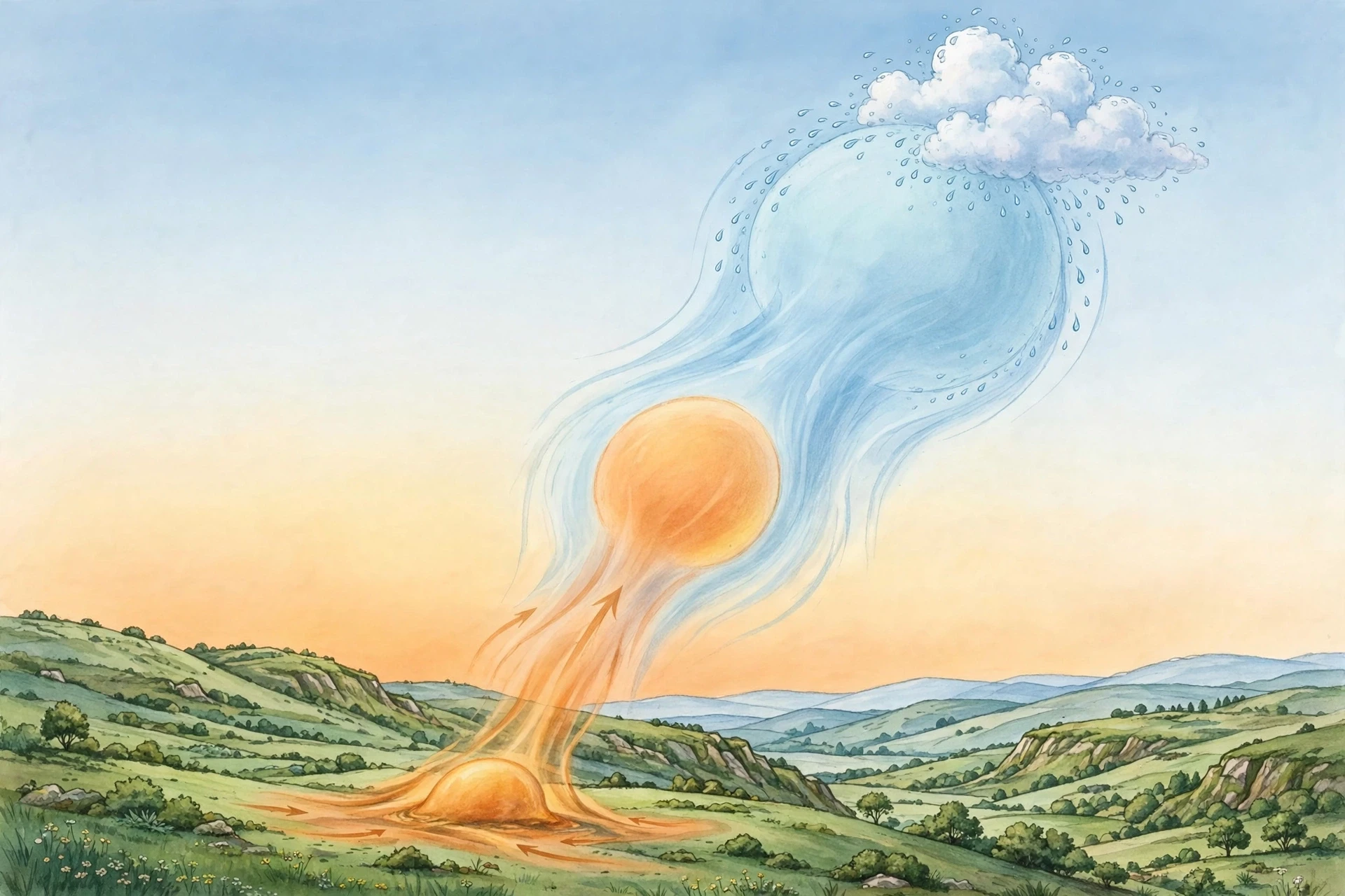
Here is the part that surprises most people when they first learn how clouds form. Air does not cool as it rises because the upper atmosphere is cold, though it is. It cools mainly because it expands. As a parcel of air climbs, the air pressure around it falls, so the parcel spreads out. Spreading out takes energy, and that energy comes from the heat of the air itself. The result is cooling without any heat being lost to the surroundings — physicists call this adiabatic cooling, from a Greek word meaning "not passing through."
I once watched a demonstration of this in a school lab that I have never forgotten. The teacher sprayed a fine mist into a clear plastic bottle, sealed it, and pumped air in until the pressure was high. Then she released the valve with a sharp hiss. In that instant, the bottle filled with a white cloud. The air inside had expanded, cooled, and its vapour had condensed — a cloud in a bottle, made in a second. It was the same physics as a mountainside, shrunk to fit on a desk.
The rate of this cooling is remarkably steady. Unsaturated air cools by about 9.8°C for every kilometre it rises. Once condensation begins, the release of latent heat — the heat stored when water evaporated — slows the cooling to roughly 5–6°C per kilometre. This is why clouds often form at a distinct height: the lifting condensation level, where rising air first reaches its dew point. Look at a field of fair-weather cumulus on a summer day and you will see it. Every cloud in the field has a flat base at almost exactly the same height. That flat base is the lifting condensation level, drawn across the sky like a ruler.
2.3 Condensation nuclei: the specks that make clouds possible
The third ingredient is the strangest. Even when air cools below its dew point, vapour does not condense easily on its own. It needs a surface to gather on. In perfectly clean air, vapour would need to cool far below the dew point before droplets could form from nothing. Our atmosphere is never that clean. It is full of microscopic particles called condensation nuclei — dust blown from deserts, salt from sea spray, smoke from fires, pollen from plants, and pollution from cities.
These specks are the seeds of every cloud. A typical cubic centimetre of air near the ground contains hundreds of them. Each one can collect vapour and grow into a droplet. Without them, there would be far fewer clouds, and the clouds that did form would behave very differently. It is a humbling thought: the white beauty overhead depends on dirt.
This also explains why clouds form more readily over land than over the open ocean, and why some of the most spectacular clouds gather downwind of dust storms and wildfires. The particles are not a contaminant of the process. They are part of it. NASA's Earth science pages describe how these tiny particles, called aerosols, shape cloud formation and influence how much sunlight clouds reflect — a link between air quality and climate that researchers are still working to measure precisely.
One more ingredient deserves a mention: time. A cloud droplet grows by gathering vapour, but vapour alone grows droplets slowly. For rain to fall, droplets must grow roughly a million times in volume, from about 10 micrometres across to about a millimetre. That growth happens when droplets collide and merge inside a cloud, or when ice crystals grow at the expense of droplets in cold clouds. The fact that most clouds never produce rain is not a failure. It is the normal outcome. Most clouds live and die as vapour made briefly visible, and their water returns to the air when they evaporate.
3. Why Air Rises: The Four Ways Clouds Are Born
If cooling is the engine of cloud formation, lifting is the ignition. Air does not rise on its own in a still atmosphere; something has to push it up. Meteorologists recognise four main lifting mechanisms, and each one changes how clouds form in a different way, producing clouds with a characteristic look. Learning to tell them apart is the first step toward reading the sky.
3.1 Convection: bubbles of warm air
On a sunny day, the sun heats the ground, and the ground heats the air touching it. That air becomes warmer — and therefore lighter — than the air around it, and it begins to rise in invisible bubbles called thermals. Glider pilots hunt for these thermals and ride them upward; birds do the same. Each thermal is a small, rising parcel, and if it climbs high enough to reach its dew point, a cumulus cloud pops into existence at its top.
This is why fair-weather cumulus clouds look like separate puffs rather than a continuous sheet. Each puff marks one thermal. They form in the late morning as the ground warms, grow through the afternoon, and fade in the evening as the heat source weakens. On a calm summer day you can watch the whole cycle, and if you pay attention you will notice that the clouds dissolve from the edges inward as their thermals run out of lift. The sky is breathing, in and out, on a daily rhythm.
I remember a long afternoon walk in the hills when the cumulus clouds above us grew taller with every hour. By mid-afternoon one of them had sprouted a hard, cauliflower top and a dark base, and my walking companion — a farmer — glanced up and said we should head back. An hour later the sky opened. He had read in that cloud what I had only admired. That is the difference between looking at clouds and understanding how clouds form: the same shape that delights a watcher warns a farmer.
3.2 Orographic lifting: air forced over mountains
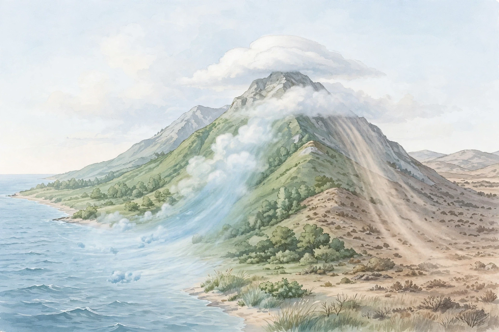
When wind meets a mountain range, it has nowhere to go but up. The air is forced to climb the slope, cooling as it rises, and clouds form over the ridge. This is orographic lifting, and it explains why mountain ranges are so often capped with cloud while the valleys below stay clear. It also explains why one side of a mountain range can be lush and green while the other is a dry desert — the rain shadow effect.
The pattern is dependable enough to plan around. Moist air climbs the windward side, condenses, and drops its rain. By the time the air crosses the peak and descends the far side, it has lost much of its moisture, and as it sinks it warms and dries further. The leeward side sits in the rain shadow. The western slopes of the mountains in the American Pacific Northwest are famously wet, while the land east of them is far drier — the same air, transformed by one climb.
Mountain clouds have their own personalities. A smooth, lens-shaped cloud hovering over a peak — a lenticular cloud — forms when moist air flows over the mountain in waves, condensing at the crest of each wave and evaporating in the troughs. The cloud looks perfectly still, even though the air is rushing through it at speed. It is a standing wave made visible, and pilots treat it with respect because the same waves that paint the cloud can shake an aircraft violently.
3.3 Frontal lifting: air masses collide
The largest clouds on Earth are born where air masses meet. A front is the boundary between a warm air mass and a cold one, and because cold air is denser, it acts like a wedge. When a cold front advances, it shoves the warm air ahead of it upward, steeply and quickly. The result is a narrow band of tall, energetic clouds — often cumulonimbus — with heavy rain, thunder and gusty wind.
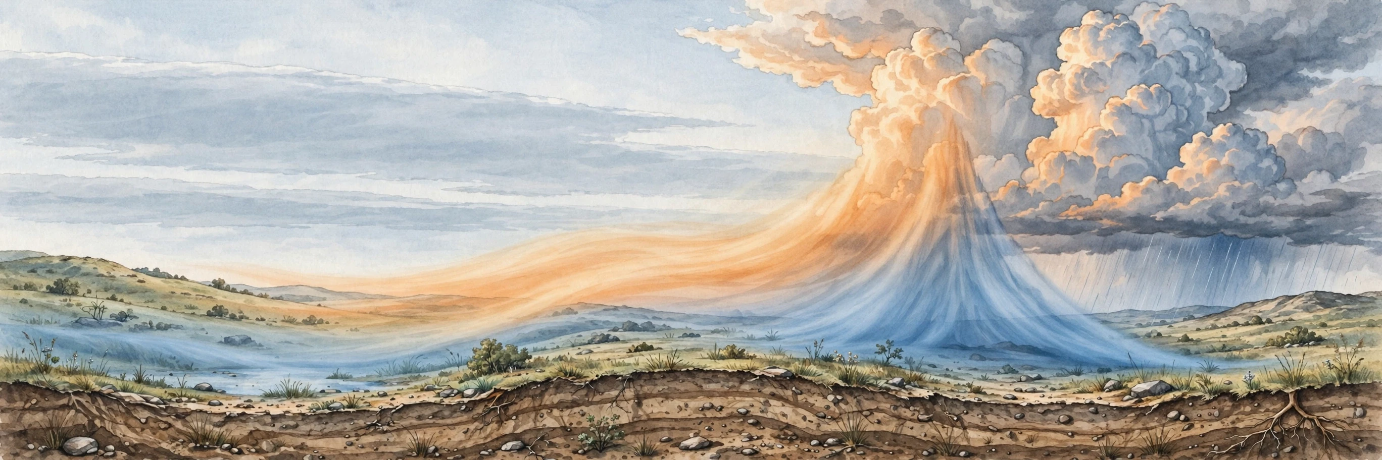
A warm front behaves differently. Warm air is lighter, so it slides gently up over the retreating cold air like a long, shallow ramp. The lifting is slow and spread over hundreds of kilometres, so the clouds it makes are broad, flat and layered: cirrus first, then altostratus, then nimbostratus, thickening and lowering as the front approaches. That sequence is one of the most reliable forecasts in meteorology. If you see high, wispy cirrus thickening into a grey sheet over the course of a day, a warm front is on its way, and rain will probably follow within a day or so.
This is the mechanism behind the great storm systems that cross continents. A single frontal system can be a thousand kilometres wide and last for days, and the clouds it paints across the sky are visible from space as great spiral arms. The National Weather Service's JetStream pages explain how these frontal clouds fit into the wider pattern of weather systems, and they are a good place to check your own sky-reading against the official picture.
3.4 Convergence: air piling up and escaping upward
The fourth mechanism is convergence — air flowing together from different directions and having nowhere to go but up. This happens along coastlines where sea breezes meet, in the centre of low-pressure systems where surface winds spiral inward, and along the equator, where the trade winds of the two hemispheres collide in the Intertropical Convergence Zone. That equatorial band is one of the cloudiest places on Earth, a near-continuous ring of towering clouds and thunderstorms that shifts north and south with the seasons.
Convergence is the quiet workhorse of cloud formation. It does not need a mountain or a strong front. It only needs wind patterns that gather air into one place. Thunderstorms along a summer sea breeze are a small, everyday example: the breeze pushes moist air inland, it meets air flowing from the other side, the two streams pile up, and a line of cumulus builds along the meeting line. Anyone who has spent a summer afternoon near a coast has watched this happen without knowing its name.
Lifting mechanism | What pushes the air up | Typical clouds | Typical weather |
|---|---|---|---|
Convection | Sun-heated ground warming the air | Cumulus, cumulonimbus | Fair weather, or afternoon showers and storms |
Orographic lifting | Wind forced up a mountain slope | Cap clouds, lenticular, stratus | Rain on windward slopes, dry rain shadow beyond |
Frontal lifting | One air mass wedging under or sliding over another | Nimbostratus, altostratus, cumulonimbus | Long spells of rain, or sharp storm bands |
Convergence | Winds flowing together and piling up | Cumulus, cumulonimbus | Showers, thunderstorms, persistent equatorial rain |
4. From Invisible Vapour to Visible Droplets: Condensation Up Close
4.1 What happens at the dew point
Cooling air reaches a tipping point. The dew point is the temperature at which the air becomes saturated — it holds exactly as much vapour as it can, and any further cooling forces the excess out as liquid. When you see dew on morning grass, you are seeing the same process at ground level: the grass cooled overnight, the air touching it reached its dew point, and vapour condensed onto the blades. A cloud is dew that happens in the sky.
The height where rising air reaches its dew point is visible in the sky every fair day. Those flat cumulus bases I mentioned earlier all sit at the same altitude because every thermal that day started with roughly the same temperature and moisture, and therefore reached its dew point at the same height. On a humid day the bases are low; on a dry day they are high. Pilots and glider pilots read that height the way a sailor reads the wind, and farmers have always known that low cloud bases mean damp air and a good chance of rain.
4.2 Droplets, ice crystals and the freezing level
Not all clouds are made of liquid water. Above the freezing level — the altitude where the temperature drops below 0°C — cloud particles can be ice crystals, and in very cold clouds they always are. High clouds, which live above about 6,000 metres in temperate regions, are made almost entirely of ice. That is why cirrus clouds look wispy and fibrous: ice crystals fall slowly and are stretched into streaks by the wind.
In the middle of the atmosphere, many clouds are mixed: droplets near the bottom, ice crystals near the top. This mixture matters because it is how most rain begins outside the tropics. Ice crystals grow by stealing vapour from nearby droplets — cold ice has a lower vapour pressure than liquid water at the same temperature, so vapour migrates toward the ice. The crystals grow heavy, fall, melt on the way down, and arrive as rain. This is the Bergeron process, named after the Swedish meteorologist Tor Bergeron, and it is the quiet machinery behind a huge share of the world's rainfall. When you stand in a gentle, steady rain, there is a good chance that every drop began its life as an ice crystal several kilometres overhead.
4.3 Why cloud droplets are so small — and why that matters
A cloud droplet is about 10 micrometres across — a hundredth of a millimetre. A raindrop is about a millimetre across. The difference sounds small, but volume grows with the cube of diameter, so a raindrop holds roughly a million times the water of a cloud droplet. Growing a droplet that much takes time and collisions: droplets must bump into each other and merge, thousands of times, inside a cloud that is churning with up-and-down currents.
Most clouds never manage it. Their droplets stay small, and when the cloud evaporates, the water returns to the air as vapour. Only clouds with strong updrafts and plenty of moisture — deep cumulus and cumulonimbus — give droplets the time and the collisions they need to grow into rain. This is why a sky can be full of clouds all day and never produce a drop of rain, and why a single dark tower on the horizon can soak a field while the town a few kilometres away stays dry.

There is a second way droplets grow, and it involves the nuclei themselves. Some particles — sea salt, for example — attract water strongly and can start collecting vapour even before the air is fully saturated. Others are poor nuclei and stay dry. The mix of particles in the air shapes the number and size of the droplets in a cloud, and that in turn shapes how bright the cloud looks and how likely it is to rain. It is one of the reasons clouds over the ocean, where salt nuclei are plentiful, tend to have fewer, larger droplets than clouds over land, where dust provides many more, smaller ones.
The smallest things in the sky do the largest work. A speck of salt too small to see can seed a cloud that shades a valley, and a valley's weather can turn on dust blown from a desert a thousand kilometres away.
5. The Ten Main Cloud Types, Explained
5.1 How clouds are classified
In 1802, a young English meteorologist named Luke Howard stood before the Askesian Society in London and proposed a simple idea: clouds could be classified, like plants and animals, into a few basic forms with Latin names. He suggested three: cirrus (a hair or filament), cumulus (a heap), and stratus (a layer). Everything else, he argued, was a combination or a modification of those three. The idea caught on so fast that it became the foundation of the system still used today. The World Meteorological Organization's International Cloud Atlas now recognises ten main genera, built from Howard's three roots plus the prefixes alto- (middle) and nimbo- (rain-bearing). It is one of the oldest classification systems in science that still works exactly as its inventor intended.
Clouds are sorted in two ways at once: by shape and by height. Shape gives you the family — heap-like cumulus, layered stratus, wispy cirrus. Height gives you the level — high, middle or low. Put them together and you get the ten genera, and the system works because it captures how clouds form differently at different heights and in different kinds of rising air. High clouds live roughly above 6,000 metres in temperate regions; middle clouds between about 2,000 and 6,000 metres; low clouds below about 2,000 metres. The heights shift with latitude — what counts as high in the tropics is different from what counts as high near the poles — but the pattern holds everywhere.
5.2 High clouds: cirrus, cirrostratus, cirrocumulus
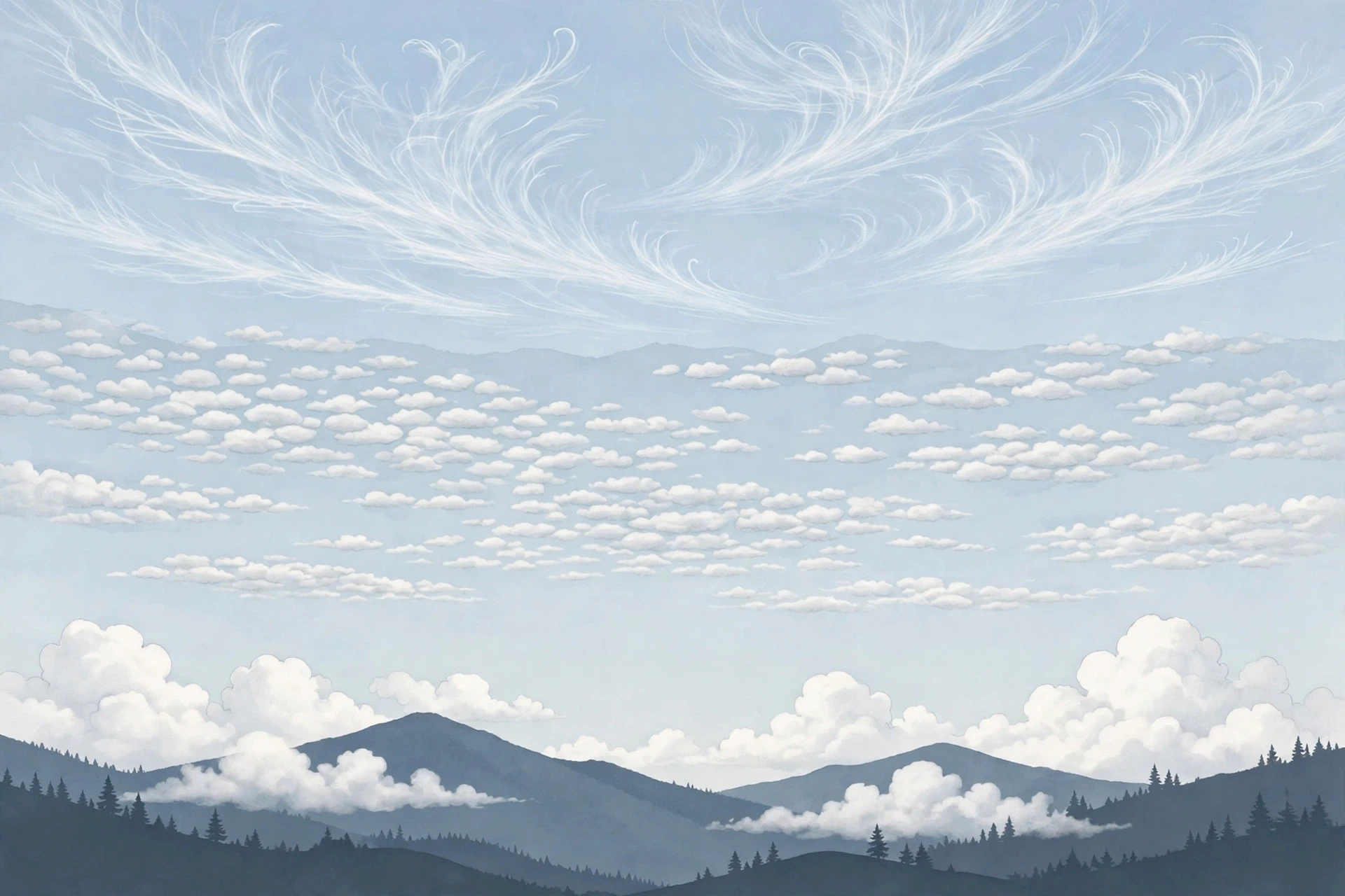
High clouds are the thinnest and the coldest. They form where temperatures are well below freezing, so they are made of ice crystals, and they are so thin that the sun and moon shine straight through them. They often look like brushstrokes or feathers, and they move fast — the winds at their altitude can exceed 150 kilometres per hour.
Cirrus is the classic wispy cloud: delicate, feathery streaks, often curved into hooks or commas. Cirrus forms when moist air rises very high, or when the top of a thunderstorm spreads out and its ice crystals are carried downwind. Because cirrus usually arrives ahead of a weather system, a sky filling with cirrus is a traditional sign of change within a day or two. The old saying "mare's tails and mackerel scales make lofty ships carry low sails" pairs cirrus with cirrocumulus as a storm warning — and the saying holds up surprisingly well.
Cirrostratus is a thin, milky veil that covers the whole sky. It is easy to miss on a bright day because it only slightly dims the sun, but it gives itself away at night or in strong sunlight by painting a halo around the sun or moon. That halo is made by ice crystals bending light, and it is one of the most beautiful optical effects in the sky. A halo is a good reason to check the forecast: cirrostratus that thickens and lowers over hours usually means a warm front is approaching and rain is on the way.
Cirrocumulus is the rarest of the three: small, white, rippled patches, sometimes arranged in neat rows like fish scales. It forms when a thin layer of air high up becomes unstable and breaks into small ripples. It usually lasts only a short time before evaporating or merging into cirrostratus. If you see it, enjoy it — many keen sky-watchers go years between sightings.
5.3 Middle clouds: altocumulus, altostratus
Middle clouds sit in the cold-but-not-freezing zone, and they are often a mix of droplets and ice crystals. They are the clouds of change: they appear when the atmosphere is unsettled, and they often signal that the weather is about to shift.
Altocumulus appears as a layer of grey-white rolls, patches or ripples, often with a pattern like a tiled roof. It forms when a layer of moist air in the middle of the atmosphere is lifted gently — by a weak front, by waves in the air, or by convection that runs out of energy halfway up. Altocumulus that appears on a warm, humid morning is a classic thunderstorm warning: it shows that the middle atmosphere is moist and unstable, and the afternoon sun may finish the job that the morning started. Farmers and sailors have long treated a "mackerel sky" as a sign of wind and rain to come.
Altostratus is a smooth, grey-blue sheet that covers the sky and dims the sun to a vague bright patch, like looking at the sun through frosted glass. It is thicker than cirrostratus and it sits lower, and it usually means a broad area of air is rising slowly — the leading edge of a warm front. When altostratus thickens and darkens over hours, rain is usually not far behind. Unlike the dramatic clouds of summer storms, altostratus does its work quietly, and that is exactly what makes it a useful sign: a grey sheet overhead is the sky telling you that a large weather system is moving in, and you have time to prepare.
5.4 Low clouds: stratus, stratocumulus, nimbostratus
Low clouds live close to the ground, and they are the ones that most shape our daily experience of weather. They are usually made of water droplets, and they are often thick enough to block the sun completely.
Stratus is a flat, featureless grey sheet — the cloud of a dull, overcast day. It forms when a broad layer of air near the ground cools to its dew point, often on a calm night when the ground radiates heat away and chills the air above it, or when moist air drifts over a cold surface. Stratus is the cloud of sea fog that rolls inland, of the grey ceiling that settles over a city in winter, and of the low cloud that hugs hilltops. It rarely brings more than drizzle, but it can linger for days, and its flat base is often only a few hundred metres above the ground. If you have ever climbed a hill and walked into cloud, you have walked into stratus — or into fog, which is the same thing at ground level.
Stratocumulus is stratus that has broken into rolls and lumps: a low, lumpy layer, grey and white in patches, often covering the sky after a front has passed. It forms when a stratus layer is stirred by weak convection from below, or when a cumulus field spreads out as the day's heating fades. Stratocumulus is one of the most common clouds on Earth — satellites show vast sheets of it over the cool oceans off the western coasts of continents — and it matters enormously for climate, because its bright top reflects a great deal of sunlight back to space.
Nimbostratus is the rain cloud: a thick, dark, shapeless layer that covers the sky and produces steady, long-lasting rain or snow. The name says it plainly — nimbus means rain. Nimbostratus forms along warm fronts, where air rises slowly over a huge area for hours at a time. It has no distinct features because it is simply too thick and too uniform; the sun disappears entirely, the light goes flat and grey, and the rain sets in. If stratus is a grey ceiling, nimbostratus is a grey ceiling with the taps on.
5.5 Clouds with vertical growth: cumulus and cumulonimbus
The last two genera are the ones that grow upward rather than spreading sideways, and they are the most dramatic clouds in the sky.
Cumulus is the cloud everyone pictures when they hear the word "cloud": a bright white heap with a flat base and a rounded, cauliflower top. Cumulus is the visible top of a thermal, and its life is the life of that rising bubble. A small cumulus on a fair day — cumulus humilis, the "humble" cumulus — is a sign of fine weather. It forms, grows a little, and dissolves as its thermal fades. But if the air is moist and unstable, cumulus can keep growing, its top boiling upward in tower after tower, until it becomes something else entirely.
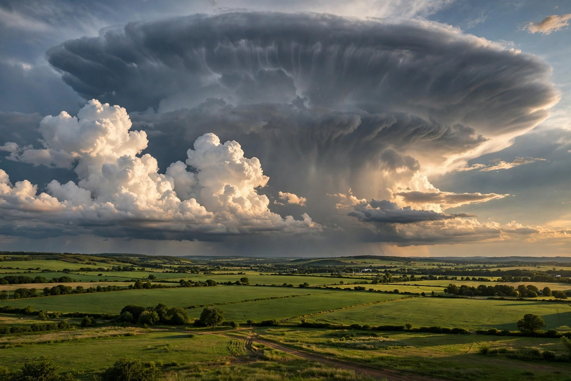
Cumulonimbus is that something else: the thunderstorm cloud, the tallest and most powerful cloud on Earth. It can tower 12 to 15 kilometres high, punching through the top of the troposphere and spreading into the flat anvil shape that marks its ceiling. Inside it, updrafts and downdrafts race at tens of metres per second, water and ice are hurled up and down, and collisions between ice particles build up the electrical charges that become lightning. A single cumulonimbus can produce torrential rain, hail, violent wind gusts and tornadoes. It is also, strangely, one of the most beautiful things in the sky — a white mountain with a dark heart, lit from within by lightning at night.
Cloud genus | Height level | What it looks like | What it usually means |
|---|---|---|---|
Cirrus | High | Thin, wispy, feathery streaks | Fair weather now; change may be coming |
Cirrostratus | High | Milky veil; halo around sun or moon | A front is approaching; rain within a day |
Cirrocumulus | High | Small white ripples, like fish scales | Unstable air high up; often short-lived |
Altocumulus | Middle | Grey-white rolls or patches | Unsettled air; storms possible later |
Altostratus | Middle | Smooth grey sheet; sun dimly visible | Broad lifting; rain likely as it thickens |
Stratus | Low | Flat, featureless grey layer | Overcast; drizzle or fog possible |
Stratocumulus | Low | Low lumpy rolls, grey and white | Often follows a front; usually dry |
Nimbostratus | Low | Thick, dark, shapeless rain layer | Steady, long-lasting rain or snow |
Cumulus | Low, growing upward | Bright heaps with flat bases | Fair weather if small; watch if growing |
Cumulonimbus | Low to very high | Towering cloud with an anvil top | Thunderstorms, heavy rain, hail, lightning |
6. Reading the Sky: What Clouds Tell You About the Weather
6.1 The sequence that warns of rain
The most useful forecast you can make with your eyes alone is the warm-front sequence. It plays out over roughly a day, and it works because the clouds of an approaching front arrive in height order — highest first, lowest last. If you know the order, you can read the timetable.
It starts with cirrus: thin, high streaks appearing in a blue sky, often from one direction. Over several hours the cirrus thickens and merges into cirrostratus, and the sun takes on a milky look, perhaps with a halo. Then the veil lowers and thickens into altostratus, the sun fades to a dim patch, and the sky turns uniformly grey. Finally the base drops further, the cloud becomes nimbostratus, and steady rain begins. The whole sequence is the cross-section of a warm front, sliding over your head like a wedge.
Cold fronts announce themselves differently: a line of towering cumulus on the horizon, growing fast, with a dark base and a sharp, hard edge. The warning time is shorter — hours rather than a day — and the weather is sharper too: heavy showers, thunder, a sudden gust of cold wind as the front passes, then a clearing sky. Learning to tell these two sequences apart is the single most practical skill in sky-reading, and it is the reason farmers and sailors trusted clouds long before they trusted forecasts.
6.2 Why forecasters still look up
Modern forecasting runs on satellites, radar and computer models, and it is far more accurate than sky-reading ever was. So why do forecasters still look at the sky? Because the sky shows what the models miss. A model works on a grid, and the grid is coarse — a thunderstorm is often smaller than one grid square. A forecaster watching the sky can see a cumulus tower growing in real time and issue a warning minutes before the radar catches it. That practice has a name — nowcasting — and it is one of the reasons severe-weather warnings have become so much faster in the last few decades.
There is a second reason, and it is about trust. A forecast that says "40% chance of rain" is hard to act on. A sky that shows towering cumulus with dark bases is easy to act on. The best forecasters combine the two: the model gives the big picture, and the sky gives the local detail. If you learn to read clouds, you are not replacing the forecast. You are adding a layer of information that no model can provide for your exact spot, at your exact moment.
For a deeper grounding in the science behind weather forecasts, the Meteorology guide on this site explains how observations, models and forecasts fit together.
6.3 Clouds you should never ignore
Most clouds are harmless. A few demand respect. A cumulonimbus with a hard, cauliflower top and a dark, ragged base is producing strong updrafts and may already be producing lightning — lightning can strike several kilometres from the rain, under a sky that looks clear overhead. A rotating wall cloud beneath a thunderstorm is a sign that a tornado may be forming. A fast-moving, dark shelf cloud — an arcus — marks the gust front of a storm, and strong winds follow within minutes.
The rule is simple and worth teaching to children: if the cloud is growing tall and dark, get indoors. The science behind the rule is the physics of this article. Tall, dark clouds are tall because the updrafts are strong, and dark because they are thick enough to block the sun. Strong updrafts plus thick cloud equals a storm with energy to spare. You do not need to know the numbers to respect the signal.
7. Why Clouds Look White, Grey, Pink and Gold
7.1 White by scattering, grey by shadow
A cloud looks white because its droplets scatter sunlight in all directions, and they scatter all colours roughly equally. Sunlight enters the cloud, bounces from droplet to droplet, and comes back out as white light. The thicker the cloud, the more scattering happens — and the more light gets absorbed or scattered away before it can reach your eye from the far side. That is why the tops of clouds are bright white while their bases look grey: you are seeing the sunlit side and the shadowed side of the same object.
The grey of a storm cloud's base is not dirt or smoke. It is shadow, pure and simple. A cumulonimbus can be ten kilometres thick. Almost no direct sunlight reaches its base, so the base looks dark. The same cloud photographed from above, by a satellite or an aircraft, is dazzling white. The colour of a cloud tells you as much about where you are standing as about the cloud itself.
This scattering is also the reason clouds look white while the sky looks blue — and the two effects are linked. The sky is blue because air molecules scatter short blue wavelengths more than long red ones. Cloud droplets are much larger than air molecules, so they scatter all wavelengths equally, and the result is white. The same physics explains both colours, and it is the reason a cloudy day feels so different from a clear one: the sky's blue filter has been replaced by a white diffuser. Our guide to Why Is the Sky Blue explains the scattering story in full.
7.2 The colours of sunrise and sunset
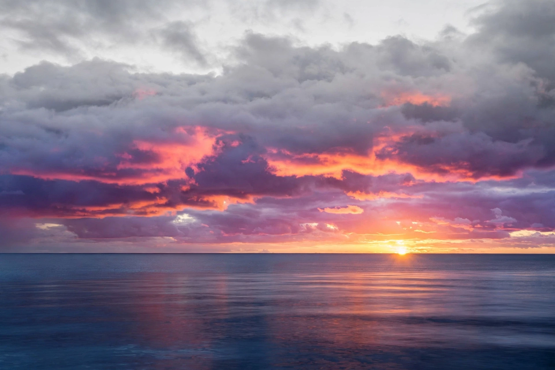
Sunset turns clouds pink, orange and gold because the sunlight reaching them has travelled a long way through the atmosphere. Near sunset, the sun's rays pass through far more air than they do at midday, and the blue light is scattered away long before it arrives. What is left is the red and orange end of the spectrum, and the clouds catch it and glow. A cloud that was white at noon becomes a sheet of fire at dusk, not because the cloud has changed, but because the light has.
The most vivid sunsets often come after a storm has cleared the air, or when high clouds are present to catch the low sun. The famous red skies that sailors took as a forecast — "red sky at night, shepherd's delight" — work because a red sunset usually means the western sky is clear of cloud while high clouds catch the light, a pattern that often goes with high pressure and fair weather approaching from the west. The saying is not magic. It is optics plus geography, learned by people who watched the sky every day.
7.3 Unusual colours and what causes them
Most cloud colours are white, grey or sunset shades, but a few rare effects are worth knowing. Iridescent clouds — sometimes called rainbow clouds — show patches of pastel colour near the sun, caused by diffraction as sunlight bends around tiny, uniform droplets. They are most often seen in altocumulus or cirrocumulus, and they last only minutes. Noctilucent clouds are the rarest of all: electric-blue, wispy clouds that glow after sunset in high summer, made of ice crystals forming around meteor dust at the edge of space, some 80 kilometres up — far above ordinary weather. If you see them, you are looking at the highest clouds that exist.
Green-tinted thunderstorm clouds are the subject of more argument. The green colour is real, and it is usually seen in very deep thunderstorms, but researchers still debate the exact cause — the leading explanation is that the light is scattered by a deep column of water and ice, with the blue of the storm's shadow mixing with the yellow of the low sun. What is not in doubt is that green skies often go with the most severe storms, and that is another reason to take them seriously.
8. Clouds and Climate: Earth's Thermostat
8.1 Cooling shade and warming blanket
Clouds are the largest uncertainty in climate science, and the reason is a tug-of-war. A cloud does two opposite things at once. Its bright top reflects sunlight back to space, which cools the Earth — the albedo effect. Its base absorbs heat rising from the ground and sends some of it back down, which warms the Earth — the greenhouse effect. Which effect wins depends on the type of cloud, its height, and the time of day.
Low, thick clouds like stratocumulus are net coolers: their bright tops reflect a great deal of sunlight, and because they are low and warm, their greenhouse effect is small. High, thin cirrus is a net warmer: it is nearly transparent to incoming sunlight, so it reflects little, but its cold ice crystals are good at trapping outgoing heat. The balance between these effects is delicate, and small shifts in cloud cover or cloud type can push the climate in either direction. NASA's climate pages explain that clouds currently cool the Earth overall, but how that balance will shift as the planet warms is one of the most active questions in climate research.
8.2 How warming may change the clouds
As the atmosphere warms, it can hold more water vapour — about 7% more for every degree Celsius of warming. That extra moisture has consequences. Warmer air means more energy for storms, and there is evidence that the heaviest rainfall events are already becoming heavier. At the same time, changes in circulation may shift where clouds form, and some regions may see fewer low clouds, which would reduce the cooling shade and amplify the warming further.
This is not a settled story, and honest science says so. Cloud feedback is the area where climate models disagree most, and researchers are careful about the limits of what they know. What is settled is the physics of how clouds form — the rising, cooling and condensing you have read about in this article — and that physics is the foundation every model builds on. The uncertainty is not about whether clouds matter. It is about exactly how much, and in which direction, in a warming world.
8.3 The clouds of other worlds
Earth is not the only planet with clouds. Venus is wrapped in clouds of sulphuric acid so thick that its surface has never been seen in visible light. Mars has thin, wispy water-ice clouds, and on cold mornings its great volcanoes wear caps of cloud like snow. Titan, the largest moon of Saturn, has clouds of methane that rain liquid methane onto its surface. Jupiter's bands are clouds of ammonia, and its Great Red Spot is a storm larger than the Earth that has raged for centuries. Everywhere we look, the same ingredients — a gas that can condense, a way to lift it, and something to cool it — produce clouds. The details differ. The recipe does not. The next time you look up at a summer cumulus, remember that you are watching the same process that paints the bands of Jupiter and veils the surface of Venus.
9. Common Misconceptions About Clouds
9.1 "Clouds are made of steam"
Most people assume a cloud is made of steam, and I have to disagree with that idea directly, because it gets the physics backwards. Steam is invisible water vapour, and a cloud is the opposite of vapour: it is water that has stopped being vapour and become liquid or ice. When you see the white plume above a kettle, the white part is not steam — it is a tiny cloud, vapour that has already cooled and condensed. The real steam is the clear gap right at the spout. A cloud is visible precisely because its water is no longer a gas.
9.2 "Clouds are weightless"
A cloud looks light, but it is astonishingly heavy. A fair-weather cumulus the size of a small town can hold hundreds of tonnes of water. The reason it stays up is not that it is weightless, but that its water is spread across billions of droplets so tiny that they fall slower than the air around them rises. The cloud is a crowd, not a solid object: each droplet is falling, slowly, all the time, and the cloud persists only because new droplets keep forming as fast as old ones evaporate. A cloud is less like a balloon and more like a fountain — the shape stays, but the water is always changing.
9.3 "Clouds only form when it is about to rain"
Most clouds never produce rain. They form, drift, and evaporate, returning their water to the air. Rain needs droplets to grow a million times in volume, and that requires deep clouds with strong updrafts. A sky full of small cumulus on a summer afternoon is a sign of fair weather, not of coming rain. The confusion comes from the fact that the clouds that do bring rain are the most memorable ones, so we remember the rainy clouds and forget the hundreds of harmless ones in between.
9.4 "You can tell the weather from one cloud alone"
A single cloud is a snapshot, and a snapshot can mislead. A lone cirrus streak might be the first sign of a front — or it might be the fading remnant of a distant thunderstorm, with no weather behind it at all. What matters is the pattern over time: are the clouds thickening, lowering, and spreading, or thinning and breaking up? Sky-reading is about sequences, not single frames. Watch the sky for an hour, and it will tell you far more than a single glance ever could.
9.5 "Contrails are a type of cloud"
Contrails — the white lines left by high-flying aircraft — are not a natural cloud type, but they are real clouds in the physical sense. Hot, moist exhaust mixes with the very cold air at cruising altitude, the vapour condenses and freezes, and a line of ice crystals forms. In humid air a contrail can spread and linger for hours, merging into cirrus. They are a reminder that the atmosphere does not care where the moisture or the lift comes from. Give cold air enough vapour and a nucleus, and a cloud will form — whether the trigger is a mountain, a front, or a jet engine.
10. How to Watch Clouds Like a Scientist
You do not need instruments to study clouds. You need time, a notebook, and the habit of looking up. Start with the ten genera in section 5 and try to identify one cloud a day. Note the time, the cloud type, the wind direction, and what the weather did in the next few hours. Within a month you will have a personal record of how clouds behave in your own sky, and patterns will emerge that no book can give you — the way the cumulus builds over the hills to your west, or how the cirrus always thickens before a change.
A few practical tips make the habit easier. Look at the sky at the same times each day — morning, midday and late afternoon — because clouds change through the day. Watch the bases of cumulus clouds: if they are all at the same height, the air is well mixed; if the bases rise through the afternoon, the air is drying out. Watch for the warm-front sequence in section 6, and test it against the forecast. And photograph the clouds you cannot name. The International Cloud Atlas is the official reference, and comparing your photos with its images is one of the fastest ways to learn.

The habit pays off in unexpected ways. I have kept a cloud notebook on and off for years, and the entries that taught me most were the ones where I was wrong — the afternoon I was certain a storm was coming and the clouds dissolved instead, or the morning the sky looked harmless and rain arrived by lunch. Being wrong is the point. Every wrong guess sharpens the next one, and that is how science works at every scale, from a notebook on a hill to a climate model on a supercomputer.
Look up often. The sky is the one laboratory that is always open, and its experiments are free.
Conclusion
Clouds form when moist air rises, cools and condenses — three steps, endlessly repeated, producing everything from a wisp of cirrus to a thunderstorm that shakes the ground. That is how clouds form, and the simplicity of the recipe is what makes the variety of the results so remarkable. The water in a cloud is always moving: vapour becomes droplet, droplet becomes rain or evaporates back to vapour, and the shape you see is only the place where the conditions are right, right now. That is the whole secret, and it is enough to change the way you look at the sky.
The next time you see a cloud being born over a hill, or a veil of cirrus thickening ahead of a front, you will know what you are watching: air rising, cooling to its dew point, and painting itself white with droplets too small to see alone. The sky has been running this experiment for billions of years. All it asks of you is that you look up.
Frequently Asked Questions
How do clouds form in simple terms?
Clouds form when moist air rises, cools and its water vapour condenses onto tiny dust or salt particles, becoming visible droplets or ice crystals. That is how clouds form in one sentence: the three ingredients are moisture, lift and cooling.
What are the three main ingredients needed for a cloud to form?
The three ingredients are water vapour, a lifting mechanism and cooling. Water vapour supplies the raw material; lifting — by convection, mountains, fronts or converging winds — pushes moist air upward; and cooling, caused by expansion as the air rises, forces the vapour to condense. Remove any one of the three and no cloud appears.
Why do clouds have flat bottoms?
Cumulus clouds have flat bases because the base marks the lifting condensation level — the height where rising air first cools to its dew point. Every thermal that day starts with similar temperature and moisture, so each one reaches its dew point at the same altitude, and every cloud base lines up at that height. On humid days the bases are low; on dry days they are high.
How do clouds stay in the sky if they are made of water?
Cloud droplets are so small — about 10 micrometres across — that they fall at roughly a centimetre per second, slower than the rising air inside a cloud. The updrafts hold them up, and new droplets keep forming as fast as old ones evaporate or fall out. A cloud is not a solid object floating; it is a process, with water constantly entering and leaving.
What is the difference between cumulus and cumulonimbus clouds?
Cumulus clouds are fair-weather heaps with flat bases and rounded tops, formed by gentle rising thermals. Cumulonimbus clouds are cumulus clouds that kept growing: their updrafts are so strong that they tower up to 15 kilometres high, develop an anvil top, and produce thunderstorms, heavy rain, hail and lightning. Small cumulus means fair weather; a growing tower with a dark base means a storm is building.
Can clouds form without mountains or fronts?
Yes. Convection alone — sun-heated ground warming the air until it rises in thermals — makes clouds over flat land and open sea every day. Convergence, where winds flow together and pile up, also makes clouds without any mountain or front. Mountains and fronts are two of the four lifting mechanisms, not the only ones.
Do clouds affect the climate?
Yes, in both directions at once. Clouds cool the Earth by reflecting sunlight back to space, and they warm it by trapping heat rising from the surface. Low, thick clouds are net coolers; high, thin cirrus is a net warmer. Overall, clouds currently cool the planet, but how that balance shifts as the climate warms is one of the most actively researched questions in climate science.